
|
|
 |
 |
 |
 |
 |
 |
 |
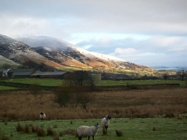
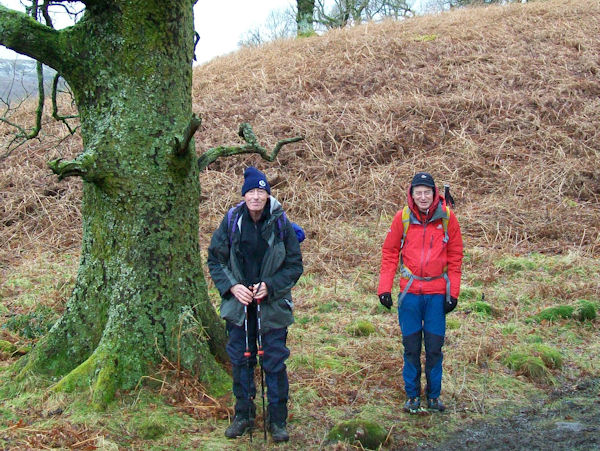
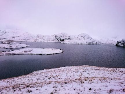
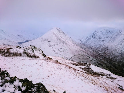
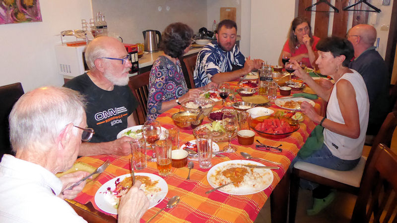
We had a convivial gathering of members and friends in the days between Christmas and New Year. As usual, people arrived and left on different days but for a time there were some 9 or 10 people in the hut, with Mike and Marian also popping in occasionally. It rained a fair amount while we were there, but on some other days it was clearer and enabled people to get onto the higher fells.
Howard and Richard did a local walk towards Brotherswater one day before the rest of us arrived, then Andy and friends from Nottinghamshire were there for a couple of days, as were Don and I.
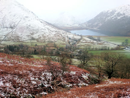
On the Saturday Richard, Don and I went over some lower hills in St John’s in the Vale, which is a good option for a wet and windy day as it is low but has interesting views and makes a good circuit.
We parked at the north end of Low Rigg, went over both this top and also High Rigg, including numerous intermediate summits, and returned by a path on the East side. In this area the wind was not overly strong, and the rain only intermittent. At times we saw several groups of local people walking and Landrovers parked on the road, then later saw a pack of hounds out on the fell.
Andy and company went up to Angle Tarn in rain and wind and descended via Hayeswater. We heard later that 12 year old Ruby was one of the strongest walkers in the group!
The next day Don and I investigated part of the newly marked ‘Ullswater Way’ along the West side of the lake. In the main, this links together existing paths with regular waymark posts. The southern section includes a long established path close to the lake and continues with a newly created section beyond Glenridding to Aira Force. It then goes over Gowbarrow, following at some distance away from the lake, to below Little Mell Fell.
We began just south of this point, taking another footpath to join the main route, as we had already explored the earlier sections on various occasions. Once we had found our way through the campsite (with some difficulty) and through a wet field, we were on the waymarked path through Bennethead and Wray to Waterfoot Farm. After this there was a new section of path to Pooley Bridge. Although direction finding was easy, due to the markers, most of the path was extremely muddy, with some sections going up and down very slippery fields. The few people that we met along the way also commented on the mud and one person was covered in it, having slid down a particularly muddy field. Since it was still raining when we reached Pooley Bridge, we took advantage of the very good bus shelter in the centre to have our sandwiches and watch the activities of the town. As often happens, the ferries were cancelled due to high winds. We returned on a path closer to the lake, below several hotels and activity centres, which was less muddy but not continuous as you have to walk along short stretches of road. It made an interesting day out without going too far or too high.
Most of the others did indoor activities that day, except Howard who went up to Red tarn and back via Glenridding and Patterdale. John Kentish of AC and his friend Diana arrived before we left, and went out with Marian and Mike the next day.
Overall, the meet was relaxed, friendly and everyone enjoyed themselves, making a good opportunity for a break from the Christmas and New Year festivities.
Present: Richard Hampshire, Howard Telford, Andy Burton, Claire, Ruby, Jane, Jos, Don Hodge, Judy Renshaw. (Also John Kentish (AC) and Diana, Mike and Marian)
Report by Judy Renshaw
Eight participants gathered on the Friday evening at the Highland Hotel in Strathpeffer. Saturday morning dawned with the appearance of promising weather so we were all anxious to “head for the hills” soon after breakfast.
On the Saturday, Margaret and Jim drove west to Glen Carron and climbed Moruisg (928m) in fair weather, until reaching the summit ridge where they encountered very strong winds making walking difficult. Rain on the descent ensured they arrived back at the car in a rather damp state. They had a good day nonetheless.
Marj, John, Jay and Peter climbed a Graham, Carn na Coinnic (673m), by a good estate road
from Bridgend in Strathconon that was followed up to around 600m then a traverse up boggy
ground to the summit. Descent was by the same route. The weather was warm and windy,
but manageable except near summit where the wind was cold and strong but the group
found shelter just below the summit for lunch.
They then drove to the end of the public road and walked along the glen westwards and
back for a mile or so.
Roger and I climbed a Corbett, An Sidhean (814m), from the Monar dam in upper Glen Strathfarrar. This hill is situated in very remote country north of Loch Monar and the summit area does have that feeling of remoteness. Our route was along Loch Monar’s north shore past Monar Lodge. Very wet underfoot and windy on the summit.
This area is the location for Iain Thomson’s book, “Isolation Shepherd”. He moved to Strathmore on Loch Monar in the 1950s with his young family and the book is a moving and interesting account of the shepherd’s life. Well worth reading. Alas, his home was submerged under the waters of Loch Monar when it was later dammed for a hydro scheme.
On the Sunday Margaret, Jim, Jay and Peter had a pleasant drive up Strathconon to just
short of Inverchoran Farm, where they left the car. The party climbed another Graham,
Beinn Mheadhoin (663m), by a stalker’s path and very old cairns all the way to the summit,
again in fair weather and with extensive views from the summit. A strong buffeting wind soon
brought in heavy rain clouds and a hurried descent. Again, they had a very wet interlude
necessitating the donning of over-trousers after they were already wet, this was a more
prolonged episode of wind and rain. Wet and soggy, they drove back down the glen taking a
detour over the dam on a small side road to Contin.
Then a walk around upper Strathpeffer to admire the architecture of the Victorian villas,
before supper.
Marj and John opted for a “low level” excursion on the Sunday, they took a lovely, windy walk on Dornoch beach.
Roger and I climbed another Corbett, Little Wyvis (764m), on the Sunday. The weather would best be described as “gloomy” with the top shrouded in cloud and a very strong, cold wind which hastened our descent from the summit cairn. Very wet underfoot.
An excellent weekend where the walking, the accommodation and the company was most agreeable despite the mixed weather.
Present: Peter Farrington, Marj and John Foster, Roger James, Margaret and Jim Strachan, Jay Turner, Philip Hands
Report by Philip Hands
I can’t believe that it’s a year already since our last visit to the Brecon Beacons, but there we were to enjoy them again. The meet was held once again at the New Inn at Bwlch which is a Bunkhouse with ensuite pub!
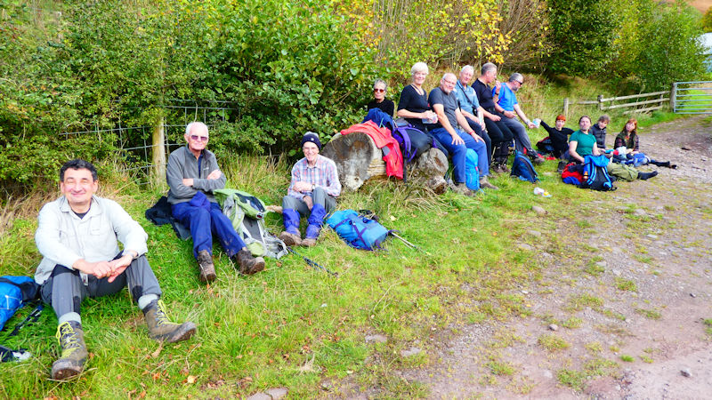
As if by magic the Friday afternoon walk participants all arrived at the Bunkhouse within five minutes of one another. Amazing considering they were coming from Devon, Hampshire, Wiltshire and Nottinghamshire. Once we had deposited our bags in the rooms we set off on what is fast becoming a Friday afternoon fixture walk. This walk leaves Bwlch via a path past the old church, now someone’s home, to reach the ridge which passes to the east of Llangors Lake. The weather was kind with sun and clouds allowing us to view the north edge of the Brecon Beacons winding its way to the west and the Black Mountains to the east. The ridge is approximately 5km in length from Bwlch to the pass at the far end. We stopped for lunch at the small pond just off the summit of Mynydd Llangorse.
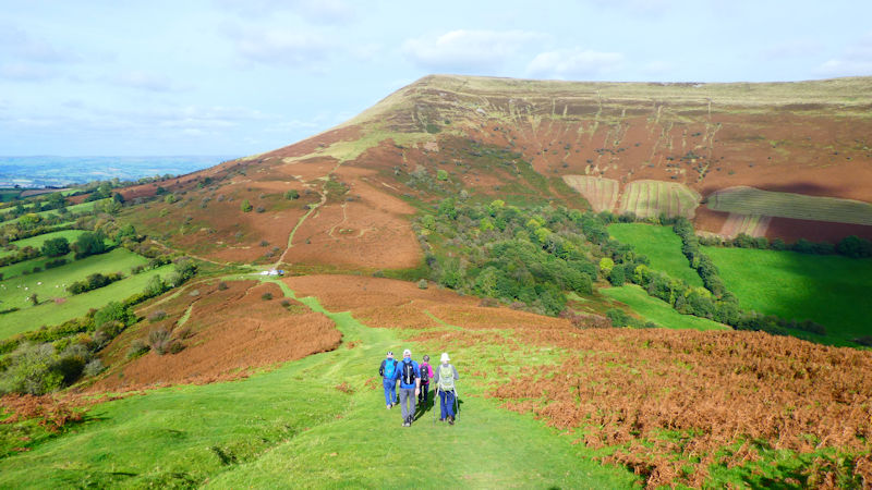
There are splendid views across to southern Herefordshire countryside. At the pass at the far end of the ridge we took the rather muddy bridleway south along the bottom of eastern slope of the ridge until we could regain the ridge via a steep path. We retraced our steps back to the Bunkhouse for the evening meal and some refreshments with the remaining weekend participants.
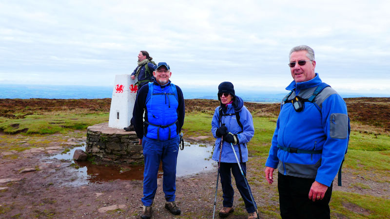
On Saturday we decided to try a different approach to ascending the major Beacons peaks. We drove to the car park at the northern end of the Celn Cwm Llwch ridge, just south of Brecon.
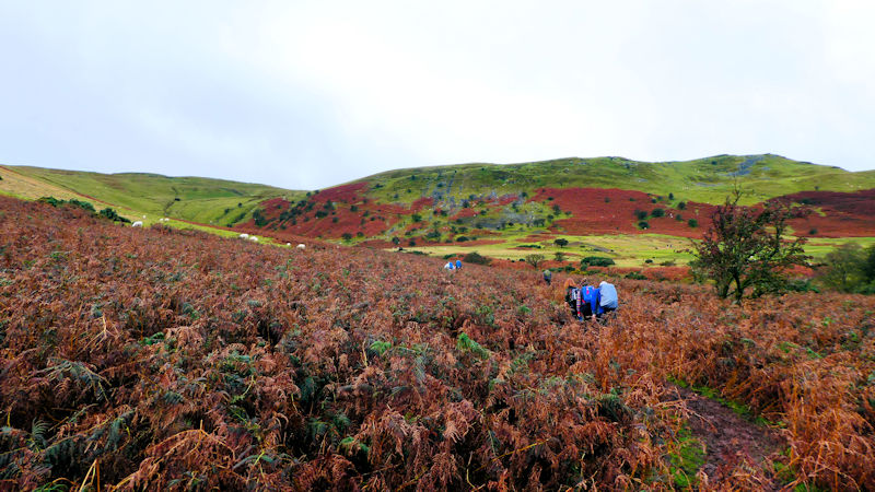
After a dodgy start (my fault) we made our way onto the ridge and followed it to the top of Pen y Fan. Once again the weather had been reasonably kind with an overcast day but still giving cloud free summits. The view from the top of this very popular mountain is amazing in all directions. However, you have to share it with around 50 or so like minded individuals.
We followed the normal Brecon Beacons horseshoe path to the summit of Cribyn. At the summit the team split with the majority following the horseshoe path to Fan y Big and three intrepid adventurers (gluttons for punishment) who went down the Bryn Teg ridge for a while before cutting down to the old roman road to follow it back to the pass between Cribyn and Fan y Big. The group rejoined on the summit of Fan y Big and then descended the Cefn Cyff ridge to its northern end.
Unfortunately the group split by accident taking two routes back to the car park. One via the roads with occasional footpaths and the others via a longer path which followed the tips of the northern ridges. The later route involved a very dodgy “ford” crossing. Once reunited at the car park we returned to the Bunkhouse for some much needed sustenance.
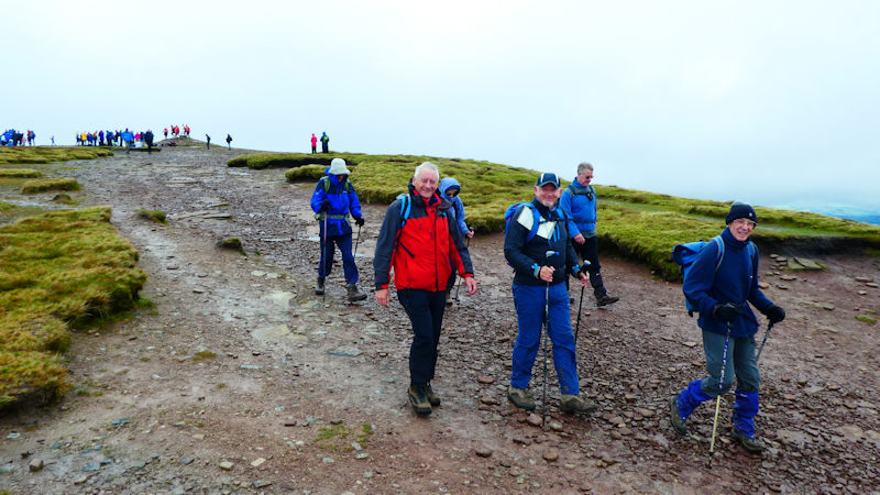
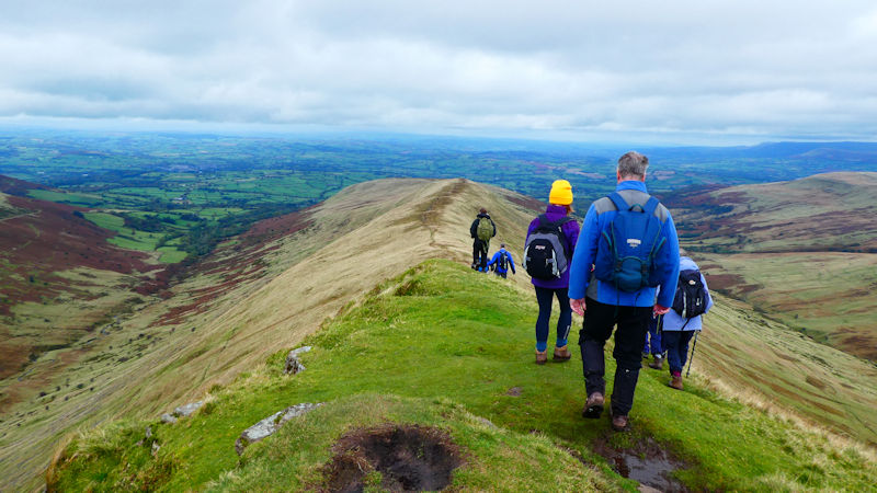
On Sunday we left the Bunkhouse to travel to Gospel Pass for a walk involving Offas Dyke. Amazingly we managed to get all our cars parked in the small upper car park and set off towards Hay Bluff.
At the summit we headed south east along the Offas Dyke path. After approximately 4.5km we reached the pile of stones and headed west on the path to the bottom of the valley containing Llanthony Priory.
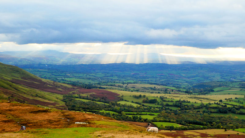
Lunch was taken in the valley and then we followed the path up to the western ridge at Blacksmiths Stones. The well trodden path north east passes Twyn Talycefn and allows views of the Grwyne Fawr reservoir. Once we reached the northern edge of the Black Mountains we made our way to the summit of Twmpa (Lord Herefords Knob). On arrival at the summit we were met by the most spectacular view of the suns rays shining through the clouds which had drawn quite a crowd.
We made our way back to the car park at Gospel Pass for our fond farewells after an extremely busy weekend which had culminated in quite a late finish. I would like to thank all of the meet participants and thank them for their enjoyable company. I’m already looking forward to our next Brecon Beacons meet but how do I manage to top those walks?
Present: Paul Stock, Andy Burton, Steve Caulton, Mike Goodyer, Belinda and James Baldwin, Heather Eddowes, Mary Eddowes, Myles O'Reilly, Jonny Dixon, Daniel Albert, Rachel Howlett, Dave Matthews, Nanette Archer
Report by Paul Stock
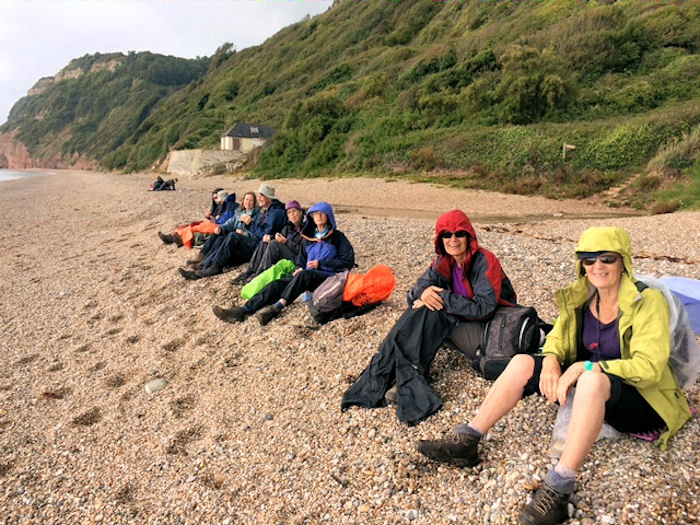
It was decided that we would not do too much travelling to reach the starts of the two walks. On Saturday we took the picturesque bus ride from Beer to Sidmouth. This is no ordinary bus ride as it goes via Branscombe, which involves narrow lanes with about 6 inches space between the bus and hedges. This problem is compounded by bends and steep hills so not much fun for approaching vehicles but entertaining to us passengers admiring the driver’s negotiating skills.
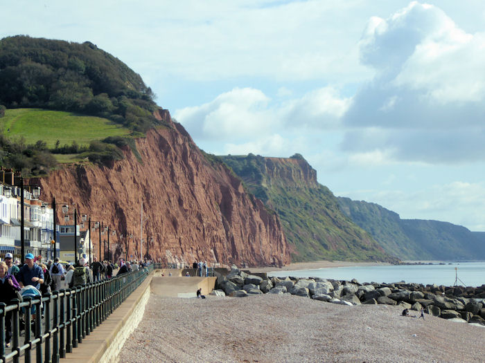
We took the coastal path back to Beer a distance of 9 miles so not far but described in the guide as severe then strenuous as there are high cliffs intersected by deep narrow valleys. In all we climbed 925 metres so quite like a mountain day. Unlike a mountain day we enjoyed our sandwiches on the beach.
On Sunday we drove westwards to Bowd north of Sidmouth for a shorter walk up to Harpford Common enabling those with time to make the journey on. There were many fine views of coast and countryside. Hedges and pasture were still in their summer glory so we were surrounded by splendid greenness as well as blackberries to keep our energy up.
We had clearness on both days. On Saturday we did have to don waterproofs for a little while but the rain was nothing like that forecasted. It had been yet another good ABM Meet.
Present: Antonia Barlen, John Dempster, Heather Eddowes, David, Margaret Moore, Max and Vivien Peacock, Dinah Nichols, James and Belinda Baldwin
Report by Belinda Baldwin
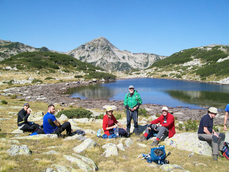
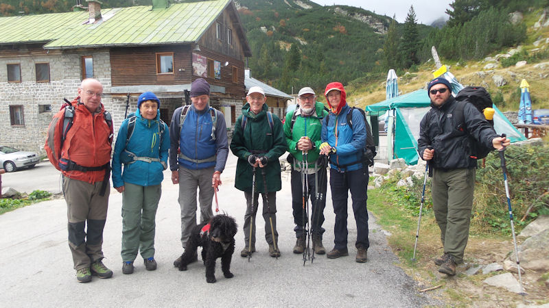
I had previously visited the Pirin mountains with a friend who has an apartment in Bansko, the main town, and had met Liz Alderson who has recently set up a new company for trekking and other activities, Pirin Adventures. It seemed like an ideal opportunity for ABMSAC members to experience these mountains with people who know them, who could provide support, logistics and accommodation.
Marian and Mike spent a couple of days in Sofia, the capital, to recover from the early morning flight and look around, before most of us went out to Bulgaria. Liz met us at Sofia airport, picked up Marian and Mike then took us to Bansko where we stayed in comfortable rooms in apartments adjacent to hers. Some people had a look around town that afternoon (and managed to find a suitable bar) while the rest of us settled in, had tea and cake and went over the itinerary for the week. We were provided with excellent dinners every night, a more than adequate breakfast and food to pack up for lunch every day, as well as tea and cake in the afternoons.
Every day but one was sunny and warm, so most people wore shorts much of the time. The first day turned out to be the longest, as we went quite slowly with many stops and it all took longer than anticipated. We started at the Vihren hut at the top of a long mountain road. There were many people and cars, as it was a Sunday, but they gradually dispersed as we went further away from the road. A good path took us up into a valley with several beautiful lakes, then up to a col. Liz and her dog, Charlie, came with us part of the way before turning back but the two people working with her, Niki and Hristo, came with us all the way.
The next day was an easier walk so we managed to be better organised, with an informal split into a faster and a slower group, with Niki and Hristo taking turns to join each group. We started lower down near the west side of Bansko at Predel, where Liz dropped us off, then she took one car round and walked across with Charlie to collect the other one later. We went up through forest for a few hours, had several rest stops in sunny places and found masses of raspberries near a river. Ed managed to get a photo of an eagle in flight, which had been circling above. We came to a col with views and descended to a valley then over a saddle to the Yavarov hut, where we all tried the local Bulgarian tea. Liz had driven up a long track and took most people down in the car. Ed, Niki, Hristo and I did a rapid descent on a forest path for 45 minutes to collect the second car and managed to arrive back at base just before the others.
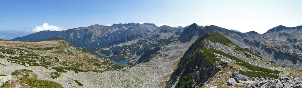
We had intended to do a challenging route the next day along the Concheto ridge from Yavarov, but the weather prevented us from achieving this. The forecast was for very strong wind and low cloud but it kept changing so we headed up to the Vihren hut to attempt it from the other end. The cloud was very low, obscuring the ridge and all the main peaks and the wind strong. This was the only day we needed warm clothes and waterproofs. Ed and I set off with Niki and Charlie the dog (but Charlie was determined to go back from the start so Niki had to go down to return him to Liz). As it turned out, he had made the right decision, since we only managed to get as far as the saddle, where the wind was blowing us over and gusting even more strongly, with horizontal rain in our faces making it hard to see. We went up the first part then turned back, meeting the others somewhere below the saddle. The only other group we had met attempting to go up had also turned back. Lower down it was pleasant enough to stop for lunch in a sheltered place, before meeting up with Marian who had done some sketching from a viewpoint nearby. Back in Bansko it was still warm and sunny so a relaxing afternoon was had by all, reading, sketching and drying clothes in the sun.
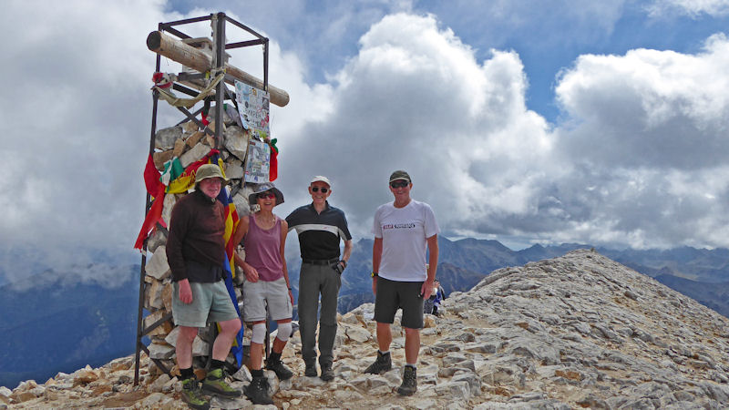
The following day was intended to be a rest day but, since we had rested a fair amount already and had failed to do Vihren, the highest peak (2914m), four of us felt like having a go at it. Liz very kindly lent us her second car and Ed volunteered to drive it up the mountain road, so we set off at our usual early time. Since it was a weekday there were no crowds at the hut this time. We went up the path that was already familiar, now with sunshine and views, and made good time to the summit, 15 minutes less than the guide time, including several rests. We descended part way and found a good sheltered spot for lunch near the saddle. We then explored the next minor peak, Hvoynati (2635m), and its ridge before returning down the main path. Marian and Mike had taken the cable car and walked from there to a hut at Bandaritsa for lunch. That evening we ate at a very nice restaurant in town, where we had some typical Bulgarian dishes, plenty of salads and side dishes, wine and beer for an absurdly cheap price.
For the last two days we did an excursion to a more remote area of the Pirin and stayed overnight in the Tevno Esero Hut. We set off once again from the Vihren hut, with Liz and Charlie accompanying us as far as the main ridge above the lakes. The weather was great, sunshine and a little cloud. We took a path past the ‘frog lake’ and a long lake, and stopped for an early lunch before ascending a couple of boulder fields to the ridge.
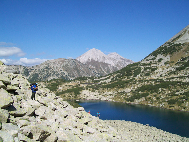
The hut is in a spectacular position among the high mountains, on the edge of a small lake. What it lacks in facilities it makes up for in the setting, so people took plenty of photos, including some of the stars at night. There were a couple of other groups at the hut but it was not full. Dinner in the hut was adequate but unexciting.
The morning temperature was not far above freezing so a cold wash was somewhat bracing. After a fairly early start and breakfast of sort-of fried dough breads with honey, a Bulgarian hut speciality (I opted to eat supplies I had brought with me instead), we set off up to a ridge on the other side. There were some boulder fields to cross but shorter than yesterday’s. We passed more lakes and through valleys, below the peak of Bezbog to the lake and hut of the same name, in time for lunch.
After a rest, it was a leisurely walk down through forest to a lower hut, where Liz and Charlie were waiting for us. That evening we had a very jovial dinner, with excellent food as usual, and said our goodbyes to Hristo, Niki and Liz, who had organised such a great week for us.
We gave them some bottles of vodka as a thank you and hope we may meet again some time.
Present: Mike Parsons, Marian Parsons, Ed Bramley, David Seddon, Myles O’Reilly, Judy Renshaw
Support provided by Liz Alderson and Pirin Adventures, with assistance from Niki and Hristo. Hristo also provides accommodation in the Rhodope mountains (see website for ‘visitRhodopes’).
Five of us made it to the hut for this week. Max arrived on the Monday and stayed most of the week, Heather, Dave and I were there from Wednesday to Friday and Howard joined us on the Thursday and stayed a few days. We had a very enjoyable time in excellent company and managed some very good days out in the hills. The weather was a mix of very good and partly wet days, better than might have been expected on the basis of this month so far, and almost always better than the forecast.
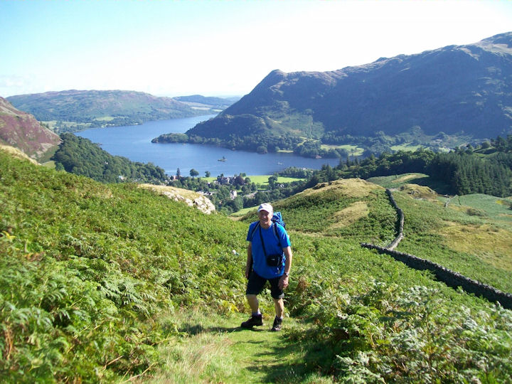
We woke on Thursday to bright sunshine and clear hills so Helvellyn had to be visited (Dave’s first time there!). We took the ridge route by Birkhouse Moor, which has some of my favourite views over Ullswater, up to Swirral Edge and were on top for an early lunch in the shelter. The crowds were amassing on Striding Edge, so we were glad not to be among them or queueing for the ‘bad step’.
The next morning was not nearly as good, with steady rain for some hours in the morning, so many changes of plan were made. After much discussion, Heather and Dave took the steamer to Howtown and walked back along the lake, Max took the bus to Pooley Bridge to walk back along the new lakeside path on the West side and Howard went to do one of more obscure Wainwright tops near Bassenthwaite. I put off the decision for a while by visiting the local art exhibition in Glenridding in which many of Marian’s paintings were on display; it was well worth a visit. Then I went over most of the various tops on Place Fell having gone up via the Hare Shaw path. The weather improved from about midday onwards, making it an enjoyable walk with pretty good views.
The evenings were almost busy as the days, with some work in the hut, including making decisions about the pictures on the walls. After a pub meal on Wednesday we played a new card game of Heather’s (a kind of complicated version of Snap) which was challenging and fun. The next evening saw us all sorting through all of the reading material on the bookshelves, sifting and deciding what to keep.
Present: Heather Eddowes, Dave Matthews, Max Peacock, Howard Templeton, Judy Renshaw
Report by Judy Renshaw
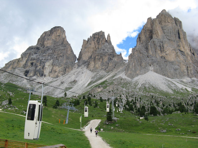
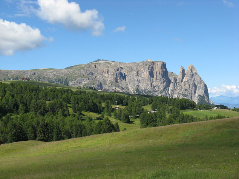
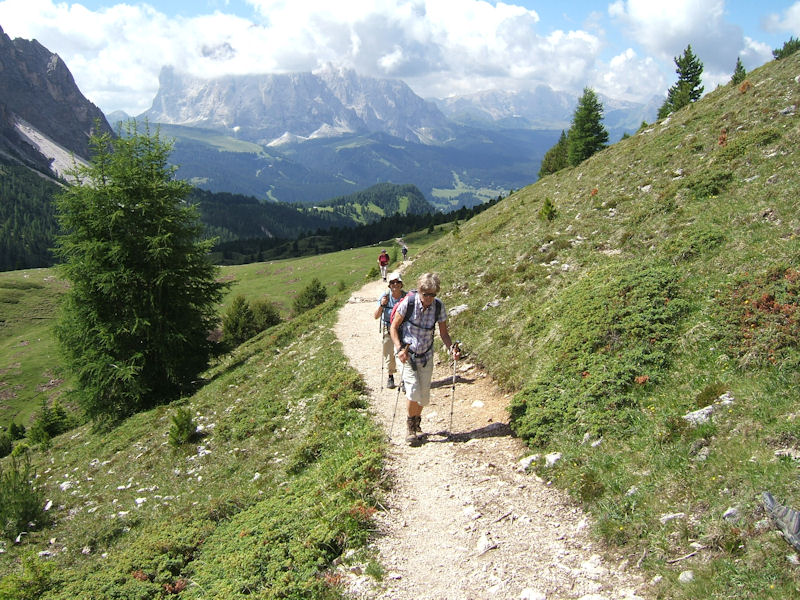
This year’s hotel meet based in Selva Gardena was attended by 34 members, the most on any hotel summer meet since the club’s centenary in 2009. Fortunately the sunshine stayed with us the whole week, and this, combined with the beautiful setting, variety of walks, and excellent hotel, made the meet a great success. Despite the attraction of Ötzi the Iceman being in the museum at nearby Bolzano, very few of us managed a visit, although some did go there in the days before or after the meet.
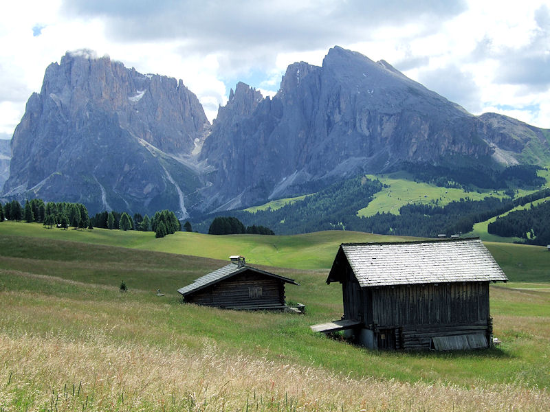
The Val Gardena is a stunningly beautiful part of the Dolomites, with the rocky spire of Sasso Lungo towering over Selva, the highest village in the valley. Santa Cristina and Ortisei are slightly lower, and the three villages are linked by frequent buses, with lifts rising to above 2000m. With hardly any of the group still under 70, this meant that even those who no longer wanted to walk uphill, or who had difficulty with the downhill, could walk at a high altitude and enjoy the lovely views. The Cicerone and Kompass guide books, together with Doris at the hotel, gave us plenty of ideas of where to go, and with walks for all abilities we were spoilt for choice.
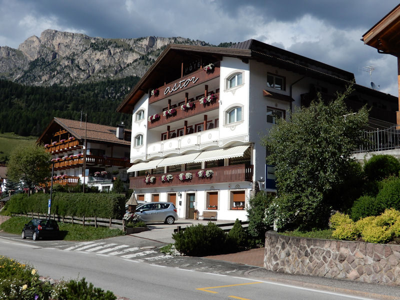
The Hotel Astor proved a great find, in a central yet quiet location close to the bus stop, lifts and shops. It was a small family-run hotel, and apart from one other couple, we had it to ourselves. But despite its size, all the rooms were large, with lovely views onto the mountains, and the dining-room was airy and spacious. Doris and her parents were excellent hosts, and Doris was a fount of knowledge on the mountain trails, having run them since she was a teenager. Even 12-year old Lucas helped at the reception, and played the accordion for us on our last evening. The dining-room was run with impeccable efficiency by the friendly Romanian waiter Riki, who had been coming over to work at the hotel for several years, and we started every day with a copious breakfast, including eggs and bacon for those who wanted. Dinner was a 5-course marathon with lots of choice, culminating in a special Tyrolean meal on our last evening.
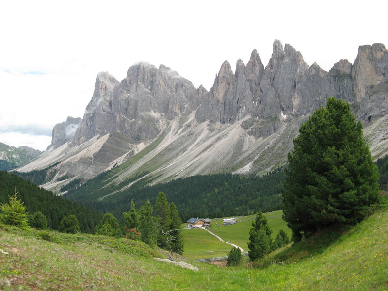
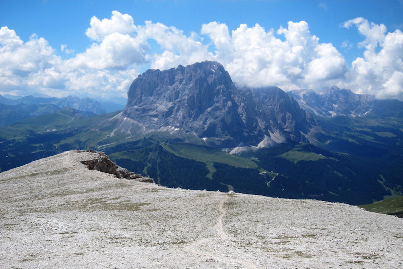
The Val Gardena was originally part of the Austrian South Tyrol, but was ceded to Italy in 1919 after the First World War. Although Italian is now the first language, German is still widely spoken, as is Ladin, a Latin based language similar to Romansch. This took a while to get used to as the road signs were in three languages, whereas the Tabacco maps used the Italian names, and the Kompass the German. Thus the Val Gardena is also known as Grödental, Selva as Wolkenstein and Ortisei as St Ulrich. But I found the names of the mountains and huts more difficult, as when I had previously visited the valley on Alasdair’s two Dolomites treks, we consistently used the German names. The two nearest and most dramatic mountains were then the Langkoffel and Plattkofel, although now the Italian names are more commonly used and they are referred to as Sasso Lungo and Sasso Piatto, while the Geisler are now known as the Odle. I never did quite come to terms with the names of the huts!
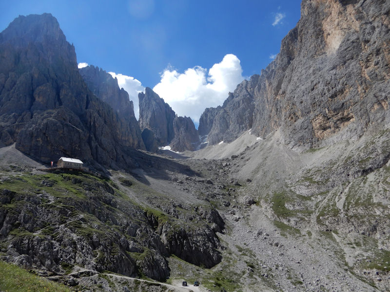
We were warned that it might rain on the afternoon of our first day, and so decided on a fairly short walk, in order to get acquainted with the area and to get acclimatised. Thus a group of 25 of us set off on the bus to Ortisei and the chair lifts up to Mont de Sëura. From there it was a fairly flat walk along to the Comici hut, with lovely views of Sassolungo towering above us and the peaks of the Odle on the opposite side of the valley. Some stopped for refreshments at the hut, but most of us continued to the Sella pass, arriving there at noon, before the rain set in. On seeing a strange-looking lift going up from there, several of us decided to take it. The cabins were small and pale yellow, only big enough for two when standing, and our arms were grabbed by two men who ran alongside to help each of us in. The lift moved very slowly up the steep rock face before ejecting us into a hail-storm at Forcella Sassolungo and the Toni Demetz hut at the top.
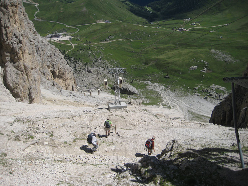
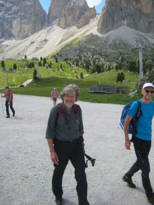
On a later date, Niels Doble and four others decided to walk up the stony slopes from the Rifugio Vicenza to Forcella Sassolungo, and then down the steep descent on other side, below the ‘coffins’. Both the ascent and descent were steep and stony, over rubble and scree, and Geoff and Pauline Causey elected to avoid the knee-jarring descent by taking the lift down to the Sella pass, arriving in time to have the excitement of bumping into Reinhold Messner, who lives in the area.
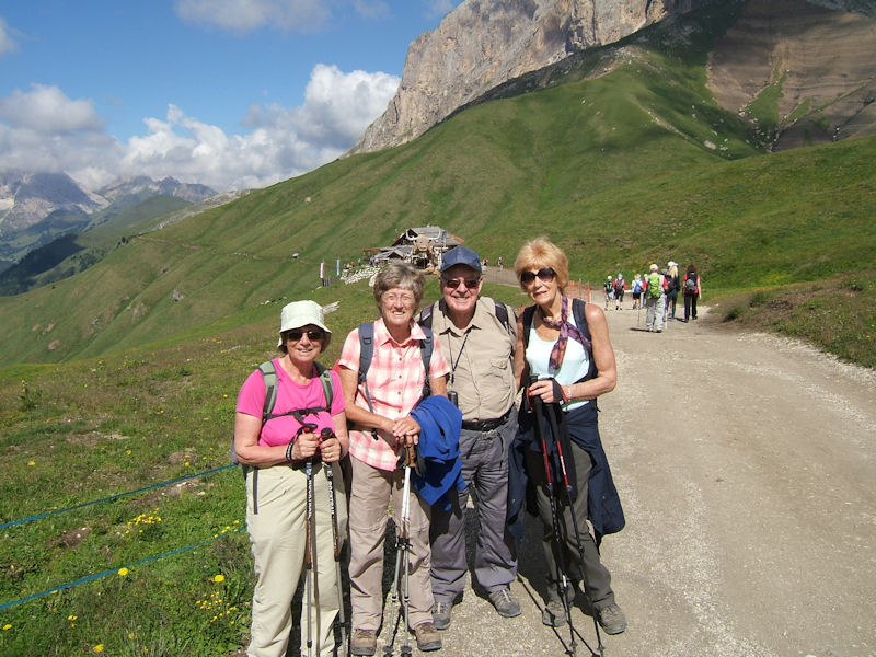
The weather was more settled on the second day, and we were almost as large a group who set off for the new funicular railway above Ortisei. We were speedily transported 800m up to 2107m, from where we set off westwards, past the Rasciesa hut, towards the small chapel and cross at Rasciesa di Fuori. From here the views were magnificent, looking northwards towards the Ortler, Cevedale and Adamello-Presanella, and south across to the Sciliar massif above Alpe di Siusi, Sassolungo and Sasso Piatto, with the Sella group to the east. From the cross a lovely balcony path, with the same glorious views, wound back to the east, but higher up, towards the Brogles pass and down to the Brogles hut for lunch.
By the third day members had found their own walking pace, as well as working out the bus and lift systems, so from then on we set out in smaller groups. Many walks could be made from Selva itself, and there were lovely walks linking the three villages. One giving the best views was the high path between Santa Cristina and Ortisei, up to the crucifix on the plateau of Sëura-Sas-Alm. On the way up we found both wine-red martagon and delicate white St Bernard lilies, and a small clump of fragrant, ground-hugging daphne cneorum. Just below the high point was a café, even recommended by Tripadvisor, in an idyllic setting, an ideal lunch spot with delicious apfel strudel and glorious views across to the towering Sassolungo and Sciliar massif. The descent to Ortisei led past St Jakob’s church, the oldest in the valley, with lovely 12th century frescoes.
Several of us had been on Alasdair’s hut-to-hut treks in the valley, and for us it was a chance to re-visit places we had been to before. One of my best memories of the 2001 trek was walking on the beautiful Alpe di Siusi, the largest cultivated mountain pasture in Central Europe, and on different days several of us caught the chair lift from Ortisei up to the plateau. The complete circuit of 22 kms all round it was made by eight of us, a long though glorious day across grassy meadows, with lovely views and flowers all the way. We started by walking south towards the Sciliar massif and Kompatsch, where we had started the 2001 trek, and then turned east to skirt the northern slopes of Sasso Piatto, finally turning north towards the peaks of the Odle at the Zallinger hut, unfortunately not an option for a beer stop as it was being renovated. We arrived at Monte Pana just in time catch the last chair-lift of the day, and four of the group treated themselves to a taxi back to our hotel.
Another walk which followed part of our 2001 route was the Friedrich August Weg, created in 1911 to connect the Sella pass to the Alpe di Siusi. The path was named after the last king of Saxony, a renowned mountaineer who was a frequent visitor to the Dolomites before World War I, and there is a large wooden statue of him outside the hut bearing his name at the start of the walk. The path is very popular as it gives spectacular views of the huge rocky spires of Sasso Piatto as it skirts below them to reach the Sasso Piatto hut, a good lunch stop. After this the path turns northwards, with wonderful views towards the Alpe di Siusi. The whole tour continues back round to the Sella pass, but most of us cut it short, by-passing the Vicenza hut and returning to Santa Cristina on the Mont de Sëura lift, after a glorious day out.
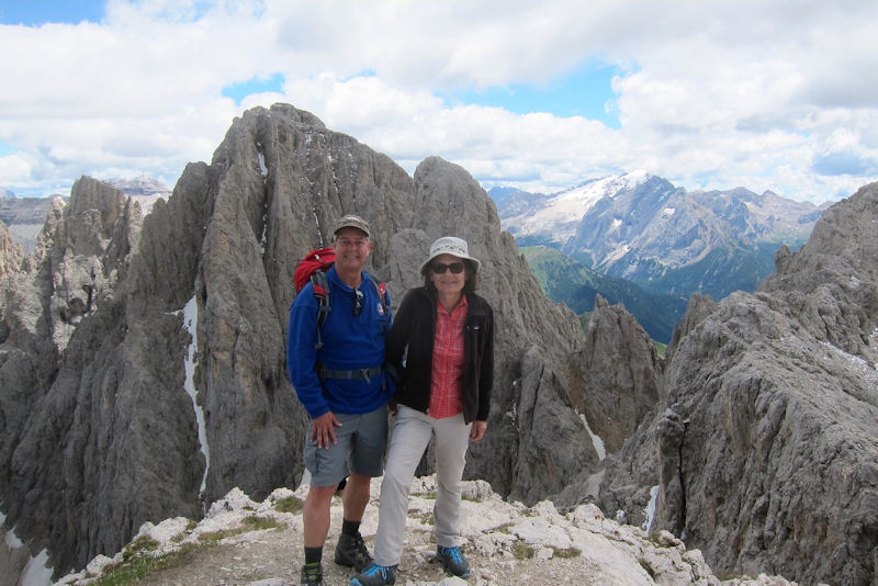
Bill and Rosie took the same route along the Friedrich August Weg as the rest of us, but in addition climbed the peak of Sasso Piatto, at 22954m the highest point reached on the meet. They described it as a steep and unrelenting climb of about 660 meters from the hut, up the south-west ridge, the only real difficulty being loose rock on the trail, which required a slow and careful descent. Views from the summit were spectacular, especially of Sassolungo to the northeast and of Alpe di Suisi to the west.
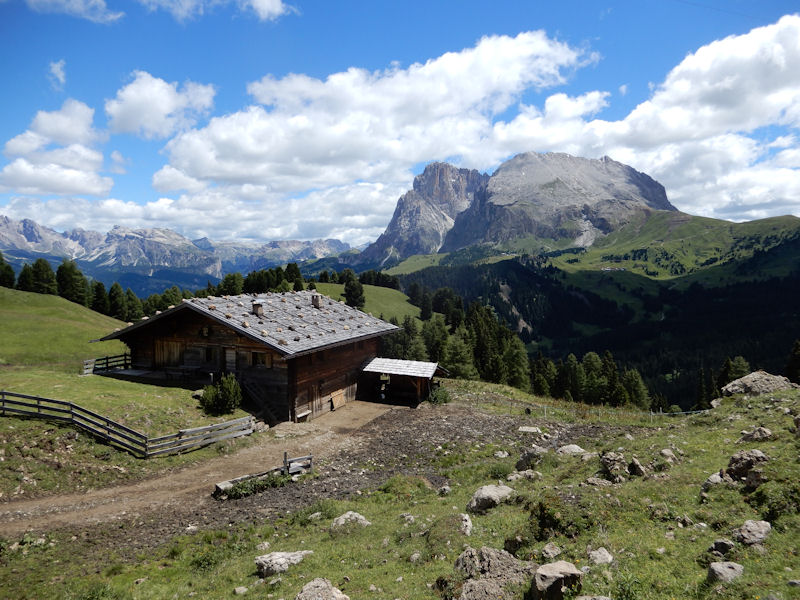
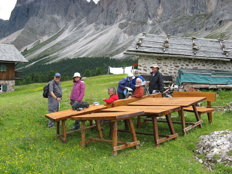
The Dolomites are well known for the number of mountain huts which provide frequent refreshment stops on all the walks, and those of us on the 2001 trek will never forget Terry Shaw, on his first ABMSAC meet, stopping at every one he passed for a beer! This time we made somewhat less frequent refreshment stops at the huts we passed, but they also provided a destination for some of our walks. Several of us were keen to visit the Firenze hut, originally known as the Regensburger hut, built in 1888 and the oldest in the valley. This was due north of Selva, about 500m up an easy track winding above the village, although most of us walked down to it from the top of the Col Raiser lift.
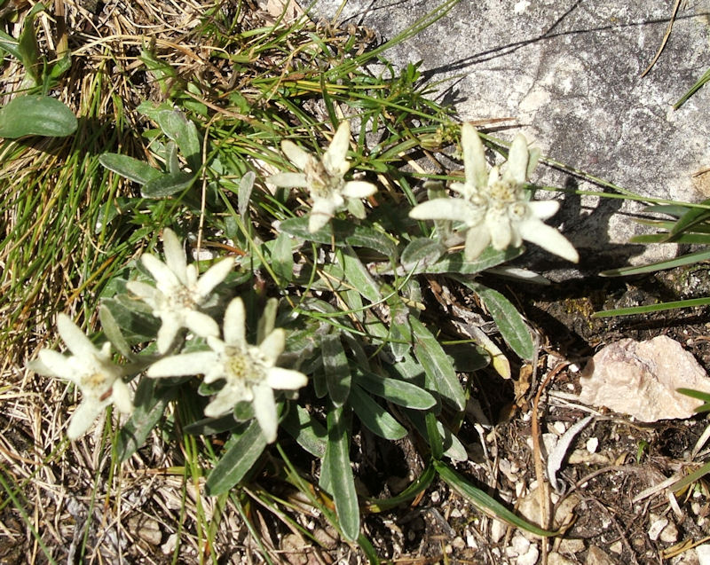
Another hut, also due north of Selva in the Puez-Odle nature park, was the higher Stevia hut, discovered by James and Belinda Baldwin early in the week. They walked up to it from the valley, but others later in the week accessed it from the top of the Col Raiser lift. All who went there commented on its lovely location, looking straight down into the beautiful Val Lunga. Bill and Rosie took a much longer route from Col Raiser to reach the hut, turning east to climb their second peak of the week, the Col da la Piëres, 2,747m, col being the Ladin word for hill. They reported that although there was a good path to the summit, the final approach was steep and airy, with fixed cables along the most exposed stretches. The flat summit commanded a stunning 360° panorama, and from there a grassy ridge with abundant edelweiss led down to the Stevia hut.
The whole of the Val Gardena was a flower-lovers paradise, the most frequently found being black vanilla and fragrant orchids, globe flowers, mountain avens, alpine asters, small blue bladder gentians and tiny pink alpine gysophila clinging to the rocks. One of the valleys with the greatest variety of flowers was the Val Chedul, also in the Puez-Odle park east of Selva. Some of us accessed the valley from the top of the Dantercëpies lift from Selva, while others reversed this route and walked up, taking the lift down. From the top of the lift the path contoured past Jimmy’s hut, visited by most of our group at one time or another, and then wound up a steep and stony scree slope, secured with wooden steps, to reach the Forcella Cir.
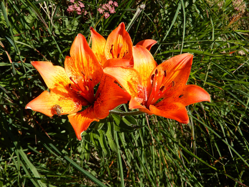
On the final day of the meet Jay Turner led a fitter group on a long but exciting walk from the Gardena pass into the upper Val de Merscia. They started across flowery meadows, past lovely orange lilies, to the Forcelles hut for their first coffee of the day, and then cut off on a narrow path into the Stella Alpina valley and up stony slopes past the dried up lake bed of Lech Ciampëi to the Forcella di Ciampëi, the narrow separation between the Val de Merscia and Val Lunga. The stony path into the Val Lunga looked most uninviting, so they decided instead to cross the plateau to the Forcella Crespëina with its large crucifix, and to return via the Forcella Cir at the top of the Val Chedul. From there they took the same route they had taken on a previous day to Jimmy’s and the Dantercëpies lift back to Selva - a long but rewarding day.
The nearest walk from the hotel was into the Val Lunga, and most of us walked at least part of the way up this lovely valley. One day we took the higher path from Selva, the ‘via crucis’, which contoured past 15 beautifully carved stations of the cross to the chapel. Half way along was Wolkenstein castle, now in ruins, which had once guarded the valley. Orange lilies grew here too, and it was here that Geoff and Janet Bone found the floral highlight of the week, the rare devil’s claw growing high on the cliff at the side of the castle. Geoff went back a few times to photograph its development, and by the end of our stay seven more of us had been to look at it, finding several more plants in flower as the week went on.
Another flower-studded walk was Farrer’s Bindelweg, starting at the Pordoi pass. Elizabeth Wells had taken the bus here earlier in the week, having visited in past years, and after the meet had ended, a small group of those who stayed on caught the bus here too. While John Dempster and Dinah, together with Geoff and Janet, took a lift up towards Piz Boč, which John and Dinah had climbed in 2006 from the Pisciadü hut, Alan and I turned south towards the Col de Cuch and then east along the Vičl dal Pan, the old ‘bread’ route used by grain smugglers in the Middle Ages to avoid taxes of the Venetian Republic. This was the Bindelweg, and Farrer had written of the extraordinary variety of flowers here in his 1913 book on the Dolomites. We discovered many of those he spoke of, including Monte Baldo’s anemone and Moretti’s bellflower, rare even in the Dolomites. We were no longer in the Val Gardena but on the other side of the Sella group, and as we walked along we had glorious views of the snow-covered Marmolada, the highest peak in the Dolomites.
It was good to have with us again the long-standing members of the club who had not been on the summer meet for a few years, and to see much everyone enjoyed their week’s stay in this beautiful valley. As we drove away, many of us were already planning to return in the not so distant future.
Participants: Pamela Harris & Alan Norton, James & Belinda Baldwin, Geoff & Janet Bone, Ian Brebner & Morag MacDonald, Derek Buckley & Ann Alari, Geoff & Pauline Causey, John Dempster & Dinah Nichols, Niels & Guni Doble, Richard & Katherine Heery, Sylvia Mercer, Roger Newson & Sheila Coates, Rick & Carol Saynor, Jim & Margaret Strachan, Barbara Swindin, Jay Turner, Elizabeth Wells, Bill & Rosie Westermeyer, Brian & Ursula Woodhouse, Dick & Karen Yorke.
Report by Pamela Harris
Meet photos“What do you mean, the Café’s shut?” came the plaintive voice of Andy, out of the mist. It was the Friday morning, so the early contingent had ventured out onto Snowdon, in those conditions that prevent you seeing anything, but manages to drip down everywhere. “It’s shut – Come and have a look for yourself if you don’t believe me” my reply echoed out of the gloom. Sure enough, on a Friday in June, the Snowdon summit café was shut, and our dreams of large warm pasties inside an equally warm building had disappeared faster than the summit views. So we sat there in the café doorway, a series of wet and bedraggled gargoyles, eating the meagre fare we had brought with us. Even the summit birds were wishing they were elsewhere, and only made half-hearted attempts to persuade our food away from us.
Our routes were simple and tried and tested. Up from the cottage on the start of the Rhyd Ddu path, and then straight on at the path junction, to Bwlch Cwm Llan. Sharp left and upwards onto Allt Maenderyn, before ascending to Bwlch main and Snowdon summit itself. And a descent following the Rhyd Ddu path in its entirety back to the cottage. Only from passing the first of the old slate quarries onwards, the view became restricted to those few feet around us, with all the colours muted. Still, we were all out, and giving the body an airing. Tomorrow would be another day.
And to prove that even Welsh weather cannot be miserable all the time, Saturday did at least lift the cloud base to a reasonable level, so we could enjoy some views before we were back to the grey shrouds again. Following Friday’s route to start, we reached Bwlch Cwm Llan again, and this time turned right, to head up the less frequented peak of Yr Aran. Taking a set of bearings down, and several altercations with clumps of gorse and heather later, we joined the lower level path on the south of the mountain, in Afon y Cwm. Following the track round, we passed into the grounds of Craflwyn hall, complete with its carving of a dragon in the grounds. From there, the route headed unerringly into Beddgelert and the ice cream shop, even despite the unseasonal temperatures.
For those who didn’t want the luxury of a train ride, the walk back through the forest is becoming a familiar track, and we all made good time back to the cottage, just right for our communal evening meal.
Sunday was another dank affair, which didn’t inspire most people for a day of derring do, but Don and Judy, not to be put off, made a foray onto Anglesey, and part of the coast path round from the Menai bridge. Others found low level walks around from Beddgelert that both led around the hillsides and took them nearer the various eateries. For those like Marcus and Michele who played the waiting game well, Monday started to show promise again, and they were rewarded with an ascent of the north ridge of Tryfan and Bristly ridge. All in all, not bad for a weekend of very varied weather.
Participants: Daniel Albert, Ed Bramley, Andy Burton, Steve Caulton, Heather Eddowes, Mike Goodyer, Don Hodge, Tony Howard, Mike O’Dwyer, Marian Parsons, Mike Parsons, Michele Pulford, Maggie O’Dwyer, Mike O’Dwyer, Judy Renshaw, Howard Telford, Marcus Tierney and Richard Winter.
Report by Ed Bramley
The meet was based in two locations, with four nights at the Sligachan bunkhouse on the Isle of Skye and two at Kintail, in the SYHA at Ratagan. We had a mix of weather, gradually improving throughout the week and were able to achieve something every day. Several of us flew to Inverness and hired cars, which made the journey much quicker and less tiring than driving all the way from the south. In both sites there were bar meals available nearby.
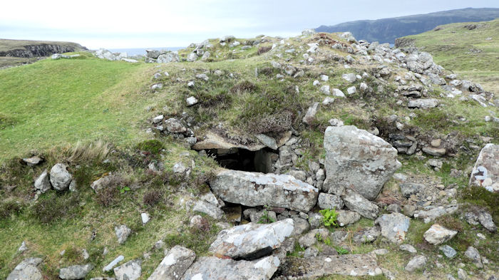
The initial weather problem was very strong wind of up to 55mph, making it difficult, if not unsafe, to go up high onto ridges. The first day was forecast for rain as well as strong wind so most of us did a coastal walk on the peninsula from Glen Brittle. We investigated the remains of a fairly extensive Iron Age settlement, and burial chamber and were able to enjoy good views of the wildlife, including seals, gannets, oystercatchers, cormorants, lapwings and orchids. Ed managed to take good photos of some of them. Don explored other areas of the island, such as the Quiraing in the north and, on other days, the coral beaches north of Dunvegan.
Tuesday morning saw horizontal waves of rain and continuing strong wind, keeping us indoors until almost midday. The Red Cuillin range looked a better option than others, being lower. Max and I ran out of patience first, so we set off in rain, up the Drum na Ruaige ridge to the tops of Beinn Dearg Mheadhonach (651m) and Beinn Dearg Mhor (731m). The wind was so strong that I was often unable to walk or stay upright, it felt like trying to walk upstream in a raging river, with gusts pushing you over now and again. We managed the two lower tops but had to leave Glamaig for another day. The rain and cloud did stop later, so we had lovely views to the mainland and other islands. Ed, Andy, Mike and Howard went along Coire na Sgairde and up to the Beaiach na Sgairde between the same tops, so also had good views in the afternoon.
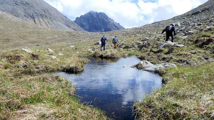
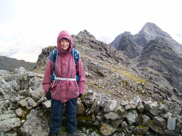
The Wednesday forecast was better so Max and I attempted a route on the Black Cuillin ridge, hoping for the clearing of summits that had been forecast. We set off from Glen Brittle SYHA towards the ridge, initially on a good path into the coire then on steep scree towards An Dorus gap. The cloud never lifted in our area, so we were unable to find the direct way across to Sgurr Mhadaidh, so we attempted the gully on wet, slippy rock and eventually found a way around on the south side towards Sgurr a Ghreadaich (973m). Since the visibility was very limited, we opted not to go back to Mhaidadh but to continue south over two tops to Sgurr na Banachdich (965m), from where there was a good descent route. Route finding was not easy, despite it being a ridge, and we had to backtrack several times to find a reasonable way along, as some serious scrambling was involved and no one else was up there that day. It was inevitably slow going, but the way off Banachdich was easy and we were soon down into sunshine, with the welcome sight of green grass and lambs. The others went to the Quiraing and around to the Flora Macdonald monument on the NW coast and enjoyed a sunny but windy day.
Thursday saw altogether better weather so most of us did a pleasant, non-technical route up Bruach na Frithe (958m) in good conditions. We heard the first (for me) cuckoos of the year in the valley on the approach. Rain showers lasted on and off for a couple of hours but once we were up to the ridge it all cleared to give us great views. Several other groups were up there, including people from America and Australia. We descended into Coire a Bhasteir, down some scree and over boilerplate slabs, with a section of interesting route finding, back to the car, then drove to the SYHA at Ratagan on the mainland.
On the last full day most of us did the Forcan Ridge and The Saddle at Kintail. Since Max and I had done this last year, he opted not to join us but did a route towards the falls of Glomach. Don went up towards the Bealach an Sgairne and met up with Max later (at the ice cream shop!). The rest of us took a very good path around Meallan Odhar to a col, after a minor difficulty on starting on the right route, then up the rocky ridge. The day was warm and sunny, with nice dry rock, so most of us enjoyed the scramble sections up the ridge and on to the top of the Saddle. We briefly saw a bird that was identified as a Ring Ouzel, quite rare so we were very pleased to see that. Lunch on top followed by a leisurely descent made for a pleasant afternoon and enabled us to get back for tea and cake. We all enjoyed dinner at the Kintail Lodge hotel as a good finish to an excellent week.
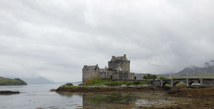
Some people had to leave early in the morning to drive back while others, including Don and I, took our time, visited Eilean Donan Castle then drove to the airport and were home by early evening. We had always done the long journey by car in the past, but the option of a flight and hire car is certainly less taxing.
Present: Andy Burton, Don Hodge, Ed Bramley, Howard Telford, Judy Renshaw, Max Peacock, Mike Goodyer
Report by Judy Renshaw Meet photosFourteen attendees again this year, many regulars and some first timers, and three day visitors.
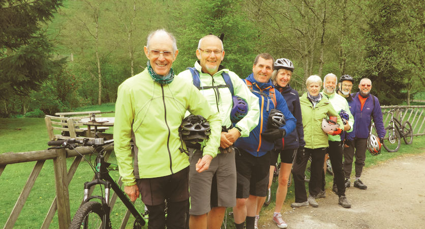
Friday afternoon saw the organiser rock up at the Royal Oak mid afternoon, but due to an accident on the M5 the other couple of early birds failed to land until the evening. So a short cycle ride along the High Peak Trail in a loop through the farmland onto the Tissington Trail, provided a close up encounter with two lapwings walking away from their nest site in the fallow field to my right. A downhill stretch into Biggin to avail myself of the facilities at the pub and campsite, and then a little pull back up onto the trail to finish the last 5 miles on the 1 in 100 railway gradient, essentially flat to you proper cyclists out there, saw me back in time to assume the position as the attendees started to arrive.
Friday evening saw most of us gather at the Royal Oak in time for a beer and the dash to the ever welcoming fish and chip shop at Longnor.
The view of the upper Dove valley as you negotiate the first hairpin bend down towards Crowdecote must be one of the finest unspoilt views in Derbyshire and neighbouring Staffordshire.
You should read nothing into the fact that one of the bridges over the River Dove in this area is called Glutton Bridge.
A cheeky pint in the Packhorse on our way back allowed me to speak to Mick the licensee, and book us in for dinner on Sunday night, as the organiser had run out of time to bring all the foodstuff required for a BBQ on the Sunday evening.
Saturday saw Michele Pulford and Marcus Tierney join us for breakfast and beef up the Manifold Way cycle group numbers.
Ed Bramley and Howard Telford set off for a day's climbing at Froggatt edge, and decided to make sure the day was full of exercise, by parking at Grindleford cafe, and then walking in. There was method in the madness, as will be revealed. The rock was clean and dry and soon the old classic Heather Wall was being enjoyed, with it's simple, well fitting jams, and a spacious balcony just below the top, to belay out of the wind.
Other routes, including Terrace Crack and Sunset Crack (both now HS 4b) soon followed in leads from Ed, but with a cautious top rope on Sunset Slab ( now HVS 4b) it still remains effectively runner less, despite all the advances in friends. More routes followed in a great day of climbing, but with The crux on Trapeze Direct (VS 4c) still having the last laugh, as Ed tried unsuccessfully to negotiate the bulge and pull over. Probably should have gone up left to start, not right.
Now the sense in parking next the café came into play as the pair made it down for a late afternoon tea and cake, before returning to the VS of eating, back at the Royal.
We were also joined early Saturday evening by Mike O’Dwyer as part of his post heart op recovery plan, which as I write this report culminated in him completing his first Brutal 10 race. Your Mum and Dad didn’t raise no quitter, that’s for sure. Thanks for making the effort to attend mate.
All rounded off with a late feast in the Oak Room, once Mary had been collected from Buxton railway station by Rachel and Karen, maintaining another fine ABM tradition of never being late for dinner, well almost.
Sunday 30th April we were joined at breakfast by Steve Caulton, and after a short drive to ‘The Street’ car park at the northwest corner of Errwood Reservoir, we commenced a 9 mile long, varied ridge walk from the wild open moorland of Shining Tor (559 metres), 1833 feet in real money, and 50 metres higher than Shutlingsloe to the south, to the edge of Windgather Rocks, where we tarried a while for lunch, followed by the descent and return into the famed Goyt Valley.
Fourteen of us enjoyed dinner at the Packhorse Arms at Crowdecote, another great pub sat almost on the Staffordshire/Derbyshire border, but one bridge downriver from the gluttonous one.
Bank Holiday Monday saw most attendees pack up and go home. Just the Class of 66, Tony Howard and Paul Stock braved the initial light shower on our way over to Grindleford Station where free parking on a Bank Holiday Monday was still to be had. This allowed us to enjoy a 7 mile walk, past the Old Mill and ancient Catholic Chapel in the conservation area of Upper Padley across the railway line that links Sheffield and Manchester (New Mills) down to the River Derwent, continuing through the mix of large deciduous woodland interspersed with river-banked grassy meadows full of flowering wild garlic and bluebells, and the occasional clumps of marsh marigolds.
With a Grindleford Café chip buttie and mug of tea to finish, the 2017 Derbyshire Meet came to a close in good time, to allow all the remaining attendees to escape the Peak ahead of most of the Bank Holiday traffic.
Thanks to all the attendees and day visitors without whom there would be no Meet at all!