


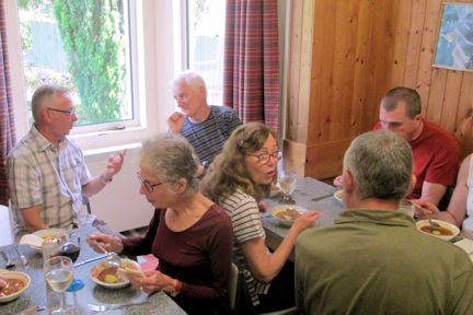
Fourteen participants gathered on the Friday evening at the Caledonian Hotel Fort William.
The weather forecast was not particularly good for the weekend. Saturday morning dawned dull and cool but dry.

Jim and Margaret Strachan, John Dempster and I drove down Glen Nevis and climbed the Munro, Stob Ban in the Mamores, from there, retracing our steps back to the car.
John and Marj Foster took a scenic drive around Ardgour, Graham and Allison Daniels opted for a walk into upper Glen Nevis as far as Steall Bridge. John Gregson also took a low level walk in Glen Nevis whilst Peter Farrington did a low level walk in Glen Etive.
Roger James and Shirley Mackay took it easy in the hotel watching the Rugby International and the Brexit vote on television!
Sunday dawned sunny but windy and cooler with a light dusting of snow on the high tops.

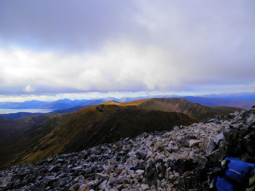
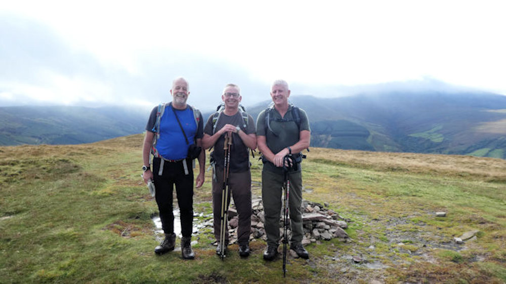
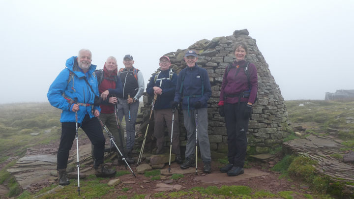
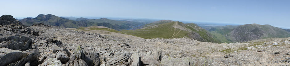
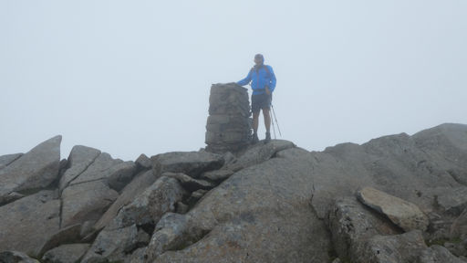
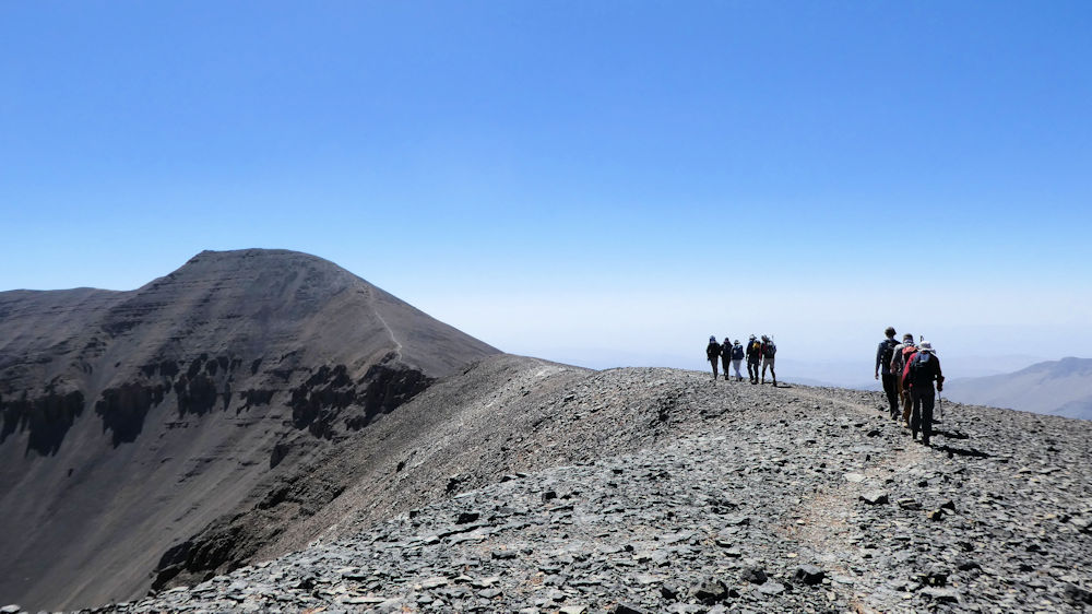
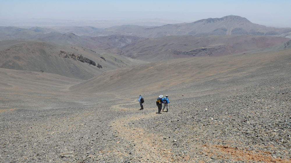
Jim and Margaret Strachan, John Dempster, Peter Farrington and I set off to climb the Corbett, Meall Lighiche from Glen Coe. I parted company with the group at the foot of the hill to climb solo. The summit views were superb and on the descent I rejoined the group for the walk back to the start and a pint in the Clachaig Inn.

Roger James and Shirley Mackay drove to Ardnamurchan and climbed Ben Hiant, described by the SMC as a “superb viewpoint” despite its modest height.

Graham and Allison Daniels and John Gregson opted for a walk in Glen Etive.Unfortunately, we had another casualty in Graham Daniels who fell just before setting off on their walk. Fortunately, a paramedic was camping nearby who was able to administer first aid before Graham went to the hospital in Fort William for treatment.

I hope all our casualties are recovered, including Marj Foster who had undergone a hip operation just before our meet!
Apologies if this report is more akin to a medical bulletin than a meet report!
Attendeees: John Dempster, Graham and Allison Daniels, Peter Farrington, Marj and John Foster, John Gregson, Roger James, Shirley Mackay, Margaret and Jim Strachan, Hugh and Susan
Chapman’s son and grandson, Alex and Richard and myself. (Alex and Richard took Hugh and Susan’s place as unfortunately, they had to return home early as Hugh was feeling unwell)
Photos by Jim Strachan.
Report by: Philip Hands
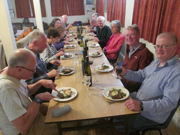
The euphemistically called Presidents Meet has turned into a gastronomic tour de force with Andy Hayes preparing yet another banquet on Saturday evening, the highlight of which was the chocolate coated strawberries on top of poached pears, thanks Andy.
The meet started on Thursday with a stalwart party arriving early to warm up the George Starkey Hut and bag a few hills. The remainder of us arrived on Friday with one latecomer on Saturday in time for dinner. Many routes were attempted in fairly indifferent weather.
Friday was bright and sunny, but with a cold breeze. The early birds of Ed, Andy, Mike and Paul travelled round to Threkeld and parked at the old station. After some interesting navigation to actually get on the fell the team headed across the boggy ground to Great Dodd, for a lunch stop and then onto Stybarrow Dodd by way of Watson's Dodd.

From Stybarrow the team continued along the ridge to Raise and then back to Glenridding via the zigzags and then to the hut. Fish n chips awaited at the White Lion. A great day across the unfrequented Dodds.
The weather on Saturday was mixed and yesterdays team ,accompanied by Judy, set off for Pooley Bridge via the south side of Ullswater.

The tops were shrouded in low cloud and rain never looked far away.

We continued along the path, stopping for refreshments at the cafe in Howtown, with lovely views down to the lake.

By the time we reached "The Cockpit" stone circle the rain had settled in and we had all put our overtrousers on - yes even Mike! We pulled into town and had over an hour wait for the next boat. Andy whistled up a local taxi and we were all back at the hut in time for tea and cake - and to help in the meal prepartions.
Saturday Evening Dinner, menu designed and cooked by Andy H, ably assisted by several volunteers, was a great treat.
 Tucking into the meal
|  Pudding now arrived
|
|
 Starter
|  Main course
|  Pudding
|  Cheese course
|
|
|
Many thanks to Don for the culinary pictures.
The Committee met on Sunday morning and concentrated on hut upgrade proposals with the views being fed back to the George Starkey Hut company directors.
After an energetic meeting we were ready for some fresh air. So it was a quick dash up to Lanty's Tarn and along the watercourse to the Greenside Mines in poor weather. Once back at the hut we had afternoon tea and headed off home.
Belinda and James had the pleasure of visiting Mary Boulter and her daughter on Sunday afternoon before returning to Devon. Mary passes on her best wishes to club members.
Attendees: James and Belinda Baldwin, Ed Bramley, Andy Burton, Mike Goodyer, Andy Hayes, Don Hodge, Ian Mateer, Dick Murton, Judy Renshaw, Paul Stock and for Saturday evening, Ann Jago, Mike and Marian Parsons.
Report by James Baldwin, with additional reporting from Mike Goodyer and Don Hodge.
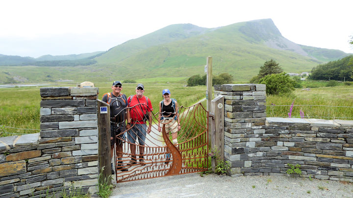
This year we broke from our traditional Friday afternoon walk and decided to attempt a crossing of the River Usk and onwards to the summit of Tor y Foel. However, after walking over Buckland Hill we dropped down to a foot bridge clearly marked on the map only to find that it was impassable due to being situated on private property and protected by a coded gate. So we adjusted our route accordingly and set off for the 13th century bridge across the river at Llangynidr. Once across that bridge we took the waymarked path alongside the river bank. This path was quite challenging as the rain which had fallen heavily for the previous week meant the river level was very high and in places had flooded the path. After about 1 km along the path it was completely blocked by a fence. So once again we had to alter our route to reach the base of Tor y Foel. Eventually we reached the summit of Tan y Foel which gave some fantastic views over Talybont reservoir and the higher range beyond.
All of the weekend participants had arrived in time for the Friday evening meal which was up to the usual New Inn high standards. Plans were made for Saturday during the evening. The weather forecast was improving at every inspection. On Saturday morning we had a brief visit from Wendell Jones and his wife who were staying locally. They also agreed to meet us for the Saturday evening meal.
Three teams set off on Saturday morning with different objectives in mind.
 The bridge over the Usk The bridge over the Usk |  Steve getting in the mood for the canal towpath Steve getting in the mood for the canal towpath |
Steve Caulton and Andy Burton set off to complete a walk to the top of Tor y Foel via the Usk Valley path, Brecon Beacons Way and a bit of canal towpath. I believe that it may have been punctuated with a pub lunch and afternoon tea.
The rest of the group set off on two variations of the same walk around the skyline of the Talybont reservoir. One involved a shorter linear walk (9km) involving the use of two cars and the rest of the team completed a longer (21km) whole circumnavigation. The race was on for the teams to complete their walks before the rain which was due in around 5pm.
The longer walk team just made it as the heavens opened. The morning views were slightly spoiled with low cloud but after lunch it cleared away to give quite extensive views across the ranges.

The evening meal was a very convivial affair with Wendell’s visit.
On Sunday we decided to walk up a very sunny Sugar Loaf as it enabled everyone to take routes of varying lengths according to the time required to depart for home. We gathered at a car park above Abergavenny and set of as one group to the summit via a long ridge.

At the summit we all said our goodbyes and went our separate ways back to the cars and onwards to end a very successful meet. A select group continued around to Ysgyrd Fawr before returning to Abergavenny for afternoon tea.
 Who are you looking at? The team on Ysgyrd Fawr Who are you looking at? The team on Ysgyrd Fawr |  Sugar Loaf from Ysgyrd Fawr Sugar Loaf from Ysgyrd Fawr |
Attendees: Andy Burton, Steve Carlton, Mike Goodyer, Heather Eddowes, Myles O’Reilly, Rick Snell, Alison Henry, James and Belinda Baldwin, Dave Clear, Dave Blackett and Paul Stock.
Report by Paul Stock
This was our final and fifteenth Beer Meet. This year we were blessed with continual sunshine unlike the inaugural one, when the Saturday was a washout and we managed the shortest route to Branscombe for a pub lunch sitting in soggy clothes. We did the walk along cliffs, when it brightened up a bit.

This year we set off along those cliffs with the sea looking Mediterranean at a leisurely pace and stopped by the Branscombe beach for coffee and cake.

A decision was made that we would walk just beyond the village to the Fountain Head before turning back to follow inland footpaths back to Beer.

It was warm enough to tempt some ladies into the sea as that is what the seaside is for. I was glad not to join them.
We dined at The Smuggler’s Kitchen, where we were joined by Debbie and Michael Owen, who were on a meet at Saas Fee in 1988 with their baby son. They live further west in Devon. James has been working with Michael on the Dartmoor Way, a new route around Dartmoor. John, who was on the Sunday of the first meet and has been at many more said some very kind words to us. It has been a great pleasure. There have been many laughs and no tears that we are aware of. We have always looked forward to being able to hold a meet for a climbing club without a mountain in sight.

On Sunday we walked from base again to Colyton over undulating landscape. There two decided that a tram ride was a good way to get back to Seaton, whilst the rest us wandered back beside the Axe. The tram riders were given a tour of the works on their return. Ice creams were consumed on the Esplanade and Sheila was tempted back into the sea. This year’s outings were a far cry from when we would walk briskly over Dartmoor or eight miles over cliffs and returning on foot inland.
Antonia, Penny and Sheila were present at for the whole of the first meet. John and Dinah plus Dick and Lin have become regulars. We have seen many come and sadly go. We are looking forward to Paul Stock’s meet further east but still in the south away from any mountains with zero responsibility.
Participants: Penny Austen, Antonia Barlen, Andy Burton, Sheila Coates, John Dempster, Heather Eddowes, Mike Goodyer, Sylvia Mercer, Dick and Lin Murton, Dinah Nicholls, James and Belinda Baldwin.
Report by Belinda Baldwin
This was the first meet to be held in Klosters since 1989 and, with such a wealth of walking trails amidst beautiful mountain scenery, it was difficult to understand why the club had not returned in the intervening years. Six of this year’s group had attended the earlier meet during which John D, Jim and Margaret had climbed the Piz Buin, and Heather and Sheila the Silvrettahorn, but age had taken its toll, and thirty years on no one even attempted these giants.
Since 2019 was the 110th anniversary of the club, it was decided that the customary seven night stay should be extended to ten, to accommodate a celebratory dinner on the last Saturday. Most welcomed the additional days, and the meet attracted a grand total of 41. Klosters had experienced temperatures of over 30°C in the week prior to our visit, and we were somewhat relieved when it cooled down after our first two days, and even welcomed the occasional shower. We were all out walking every day, mostly in sunshine, returning with wet boots after walking through snow patches rather than with wet rain-jackets.
 Landquart river, by Alan Norton | The 4* Hotel Piz Buin proved an exceptional find, in a central yet quiet location by the Landquart river, which was torrential with snow melt when we arrived. There was a bus stop outside the door, and the train station, Gotschna lift and shops were just a short walk up the road. Monsieur Huber and his team went out of their way to make our stay a success, and nothing was too much trouble for them. The rooms were large, well-appointed suites, and the complimentary mini-bar was re-stocked every day: a pleasant surprise. The balconies overlooking the mountains and river were a welcome place to relax at the end of a day’s walk, as was the swimming pool and fitness centre, both much appreciated. We started each day with a copious buffet breakfast featuring such delicacies as smoked salmon and eggs cooked to order, and the evening meals were equally delicious and beautifully presented. |
The Klosters and Davos tourist offices work together, and the guest card included free use of buses, trains and lifts in both resorts, though we quickly decided that the smaller Klosters was much more attractive than the larger, glitzy Davos. As the first morning dawned bright and sunny, most of us headed for the nearby cable-car heading to Gotschnaboden and Gotschnagrat at 2285m, but an unpleasant surprise awaited us, for the lift was more than half filled with mountain bikes and their owners.

Fortunately these headed off directly downhill from the top station, leaving us to wander along the aptly named Panoramaweg in peace. As we neared the Parsenn hut there were spectacular views across to the peaks of the Silvretta Alps in Austria and down onto the waters of the Davosersee below.

The flowers were equally spectacular, with the alpine favourites of blue trumpet gentians, red alpenrose and white edelweiss, as well as several varieties of primulas and other gentians, including a tiny white snow gentian. Those who took a later lift turned off at the middle station of the cable railway and took it up to its highest point at the Weissflüjoch to enjoy the views before returning down to Davos-Dorf and taking the train back to Klosters. After a brief picnic lunch, the rest of us continued along to the Strela pass where there was a welcome café, and then steeply down to Schatzalp which boasted an immense hotel, formerly a sanatorium, and two alpine gardens. Most visited the gardens later in the week, where we were delighted to find a Tibetan slipper orchid in full bloom. One day Alan and I took the funicular up to Schatzalp and continued southwards along the contouring trail to Stafelalp, through meadows full of flowers and grazing cows, from where we dropped down to Frauenkirch and the bus back to Davos.
The other lift starting at Klosters went up to Madrisa, and Bill, Rosie and Don took this on their first day to ascend the steep rocky slopes of Calanda to the Rätschenhorn, 2703m, returning via the Rätschenjoch on gentler slopes.

Jim and Margaret repeated this route later in the week, but most of us found easier and equally scenic trails to explore there. The lift was a gondola which thankfully was too small for the ubiquitous bicycles, and we enjoyed being free of their annoying presence both in the cabin and on the trails. On taking the lift a few days later, a group of us headed eastwards towards Schlappinerjoch on the Austrian border. The slopes here were red with alpenrose, and the views of the Silvretta Alps were glorious. But before long it began to cloud over, and we reached the col in thick mist as a helicopter with equipment for the small building nearby landed near us. Fortunately the cloud lifted as we got lower, and as we passed the signpost leading down to Schlappin, we decided to take that route rather than retracing our steps to the gondola. It was a delightful path winding down through flowery slopes to the small lake below. A café awaited us on its shores, and here we chose the luxury of a taxi back to Klosters to avoid a further 500m descent. James and Belinda, however, were made of stronger stuff for they walked all the way back to the hotel.
Two walks using minibus transport on private roads had been included in the meet planning, in the hope that the majority of the group would join in. These proved a great success, though the crossing of the Jöriflüelafurgga from the Flüela pass road to the Berghaus Vereina had to be postponed for a day due to the closure of the Vereina road for the annual ‘alpage’, when cows from as far away as Basel were to be trucked up for their summer vacation.
Reports indicated that so far this season no one had made the crossing, and all anyone seemed to know was that there would be snow on the higher north-facing slopes. So it was with some trepidation that a diminished group of eleven set off from Wägerhüs on the Flüela side, with another group of twenty opting to go directly to Vereina, hoping to meet up at the Jöriseen lakes for a picnic lunch.

Despite having to negotiate snow on the rocks and a loose protective cable, the first team of Don, Jim and John F. raced down past the lakes long before we had a chance to get anywhere near them. The others made a more leisurely descent, stopping at the still frozen lakes to admire the magical sight of myriad soldanellas pushing up where the snow had just melted.

Although not all of us reached the lakes – partly due to the circuitous route we took after missing a crucial signpost – we were content just to enjoy being in this wonderfully unspoilt valley, enjoying the flowers and the views, free of all bikers.
The other walk we made using minibus transport was also beyond Monbiel, this time to Alp Sardasca, into another lovely unspoilt valley. We were a group of 15, and most of us walked from here up to the Silvretta hut, although Mike and Marian elected to climb to the Seetal hut and lake instead. Our path led alongside a stream and then steeply upwards, through slopes of alpenrose and other flowers, over narrow bridges across streams.

After a fork leading right towards the easier drovers’ path, we could see the hut above us and zigzagged up the final slope to reach it, guarded by a seemingly tame marmot. Once there we continued higher up onto the glacier trail, which gave spectacular views of the Silvrettahorn ahead. We took the same route down, and while waiting for the return minibus, it was a pleasure to relax at the delightful self-service café at Alp Sardasca, with cold beers and soft drinks on offer in the trough of the outside fountain, comparing injuries incurred on the descent. We all agreed that it had been another splendid day.
There were other lifts to explore too, and later in the week we took the cable car to the Jakobshorn, again accompanied by mountain bikers. Fortunately they avoided the dramatic ridge walk up to the Jatzhorn, enjoyed by many of our group on different occasions, with spectacular views and flowers. Unfortunately, the steep path taken by some of us down to Sertig Dörfli was too narrow to be enjoyable, with groups of bikers continuously hurtling down behind us.

Another ridge walk, saved for our last day, was the Rinerhorn circuit from the lift above Davos-Glaris further down the valley. It was another sunny day, and a group of nine of us set out to do the circuit in different directions, even managing to meet up on the summit for our picnic. We saw no other walkers all day apart from a couple with two dogs, and this time there were no bikers to spoil our enjoyment. We were not far from the Jatzhorn, and Margaret looked across in eager anticipation, hoping to see Jim who had gone up there on a second occasion, this time with John F.
With so many free transport options, most of us with cars were happy to leave them in the hotel car park for the duration of the meet, although on occasions some did use them to go further afield. Bill, Rosie, Don and Caroline set off one day in search of a 3000m peak, driving over the Flüela pass to the base of the Flüela Schwarzhorn. Only Bill and Don made it to the summit at 3146m, though Rosie and Caroline reached the ridge at 2880m. It was a steep ascent, but in a wild and beautiful valley, and they reported that the views from the summit were well worth the effort. John and Dinah set off later in the week to attempt the same peak, but in less clement weather, and after driving into the mist, decided that lunch in Italy was a better option. Caroline and Don were the only ones to drive up the Dischma valley to Dürrboden, from where they climbed up through the snow to the Chamanna da Grialetsch, which Caroline had last visited with her family as a teenager. Mark set off in his car one day to take Geoff on a tour of the passes, thus living up to his record of arriving late for at least one dinner – his excuse was that the Umbrail pass was unexpectedly closed, necessitating a very long detour back.

We all found plenty to do on less energetic days too, with shorter walks from Klosters up to unspoilt alpine meadows, along the river to Monbiel suspension bridge, or around Davos lake. Some went to the lovely painted houses at Serneus, the Kirchner Museum at Davos, the heritage museum in an old wooden house in Klosters, and the churches at Klosters and Davos, both of which boasted stained glass windows designed by the Swiss artist Augusto Giacometti, older cousin of the world famous Alberto. The most popular option for a less strenuous day was to take the historic Rhaetian train from Davos to Filisur, with its original wooden seats and open carriages.

Those who did this came back with tales of the impressive Wiesner viaduct, 210m long and towering 88m above the gorge, with various nearby viewpoints to access, as well as the gorge itself to walk through, which Dick and Lin did.

The climax of the meet was the dinner on the last Saturday to celebrate the 110th anniversary of the club, which provided a fitting end to a memorable meet. Everyone at the hotel went out of their way to make this a special occasion, helping us decorate the dining room with Swiss and cantonal flags to add to the union jack bunting that Heather had brought over, and designing a special menu card with photos of the ABM logo and banner, and the Britannia hut. We were served drinks and nibbles beforehand, followed by a delicious four-course meal where the chef excelled himself.
 Christiane with the ABMSAC shirt, by Rosie Westermeyer Christiane with the ABMSAC shirt, by Rosie Westermeyer | It was an honour to have Christiane and Bernard Ody of the Geneva section as our guests, and Christiane spoke after the meal about the importance of the club’s link with the Britannia hut since its foundation more than a century ago, showing photos of past celebrations and present improvements. We were reminded by James of the 110 years of the club’s history and by Pamela of past alpine meets, and we all agreed that, although our club has diminished in size, time has if anything increased our enjoyment of the mountain environment |
Participants: Pamela Harris & Alan Norton, James & Belinda Baldwin, Geoff & Janet Bone, Derek Buckley & Ann Alari, Geoff & Pauline Causey, Mark Davison, John Dempster & Dinah Nichols, Niels & Guni Doble, Heather Eddowes & Dave Matthews, Marj & John Foster, Mike & Anne Goodyer, Don Hardy, Richard & Katherine Heery, Sylvia Mercer, Dick Murton & Lin Warriss, Roger Newson & Sheila Coates, Mike & Marian Parsons, Rick & Carol Saynor, Jim & Margaret Strachan, Caroline Thonger, Elizabeth Wells, Bill & Rosie Westermeyer, Dick & Karen Yorke.
Report by Pamela Harris
Photos of the Celebratory dinner
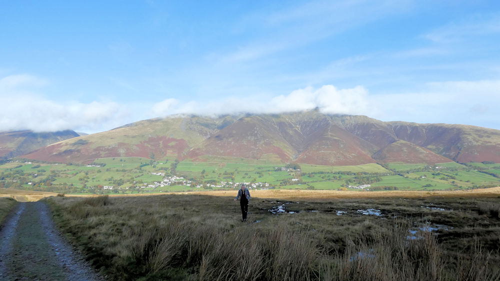
With a number of recent meets having been blessed with good weather, the question was whether it would hold for our annual return to Rhyd Ddu for our North Wales meet. For an early arrival contingent, Thursday afternoon was set fair, and so they made most of the good weather and headed up to Snowdon summit to take in the views, returning via the Snowdon Ranger path to make a circuit of the outing.
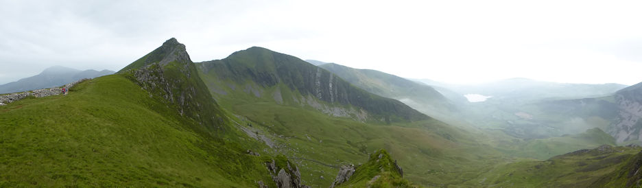
By Friday morning, more of us had arrived, with a variety of aims in mind. The challenge was to avoid the masses on top of Snowdon, so a variety of routes were devised. One group headed out to Llanberis via the pass at Foel Goch to Llanberis, then returning via the halfway house near Clogwyn. Another chose the climbing option, including Central Route on Carnedd Y Filiast. We decided to head for the Glyders, parking near the PYG hotel.
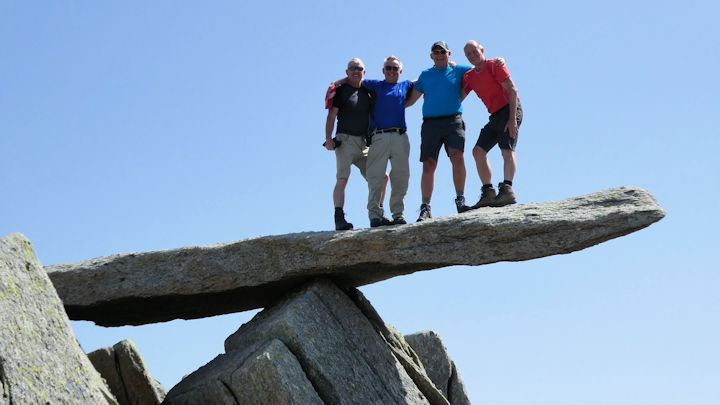
We followed the miners track onto Glyder Fach, and posed for the obligatory picture atop the Cantilever stone.
Already the day was warm, and we were drinking our way through lots of water. Past the Castle of the Winds and onto Glyder Fawr for some lunch, before making the decision to descend the Devils Kitchen and into Ogwen Valley.
By this time, we have all got through our first filling of our water supplies, so it was with some relief we descended to the café at Ogwen Cottage, to refill and also to enjoy a cooling ice cream. By now it was well into the afternoon, and it made a long pull back to the col next to Tryfan, before returning to the car at the PYG. A hot and exhausting day.
On the Saturday, the weather was kinder for us, with low clouds rolling round the Nantle ridge.
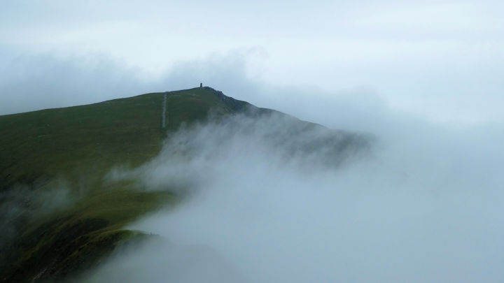
Whilst we hadn’t planned it that way, it seemed that most of us ended up at the monument for an early lunch, admiring the clouds rolling in from the sea, a complete change from the day before. Whilst some opted for a fuller day, pressing on to Craig Cwm Silyn, we opted for the gentle return down one of the ridges, connecting onto the forest tracks from Beddgelert.
In the evening, we did our usual Tardis approach to Tan yr Wyddfa, managing to seat 18 of us around the table, including those stopping at the nearby pub, and in their camper van. Given our recent Moroccan trek, the Moroccan theme was continued for part of the communal meal, with Harira soups for starters, followed by lamb tagine. The usual assortment of puddings including apple pie and trifle rounded off the refreshments.
Sunday saw a range of options for routes, including Moel Siabod, and Sentries ridge, as well as a more leisurely walk to Beddglert and the Aber Glaslyn gorge, before the obligatory ice cream and short train ride back.
 Paul on a cloudy M. Siabod, photo by Mike Goodyer |  The Train, photo by Ed Bramley |
With a few people stopping on longer at the pub, opportunities to get out continued to abound, with Moel Siabod being visited again on the Monday, along with Mynydd Mawr, whilst on the Tuesday there was still time left for climbing on Idwal slabs, including Faith.
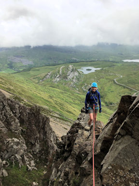 Michelle on Sentries Ridge. | 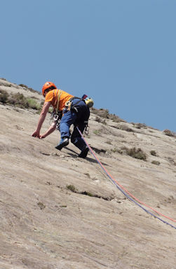 Marcus on Faith. |
We had hoped for good weather, and more than our fair share of it, even if the clouds did roll in for a while on the one day.
Participants: Belinda Baldwin, James Baldwin, David Blackett, Ed Bramley, Andy Burton, Steve Caulton, David Clear, Mike Goodyer, Don Hodge, Tony Howard, Ian Mateer, Margaret O’Dwyer, Mike O’Dwyer, Michele Pulford, Judy Renshaw, Paul Stock, Howard Telford & Annette, Marcus Tierney
Report by Ed Bramley
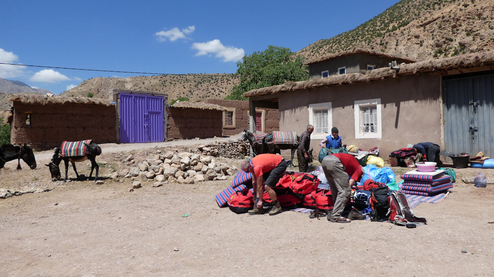
Meet photosWe’ve been travelling to the start of our trek for over four hours now, and the road is indicative of our progress. At first, it was wide, tarmac surfaced, with a white line. As we turned off, it narrowed noticeably, and the white line disappeared. Now, as we near Agouti, even the tarmac has gone, and our driver cautiously skirts the potholes. Then we are there, on the edge of the Ait Bouguemez valley, otherwise known throughout Morocco as the Happy Valley, a point emphasised further by our guide, Rachid, who comes from these parts. In Agouti we meet up with our muleteers and the process of loading commences.
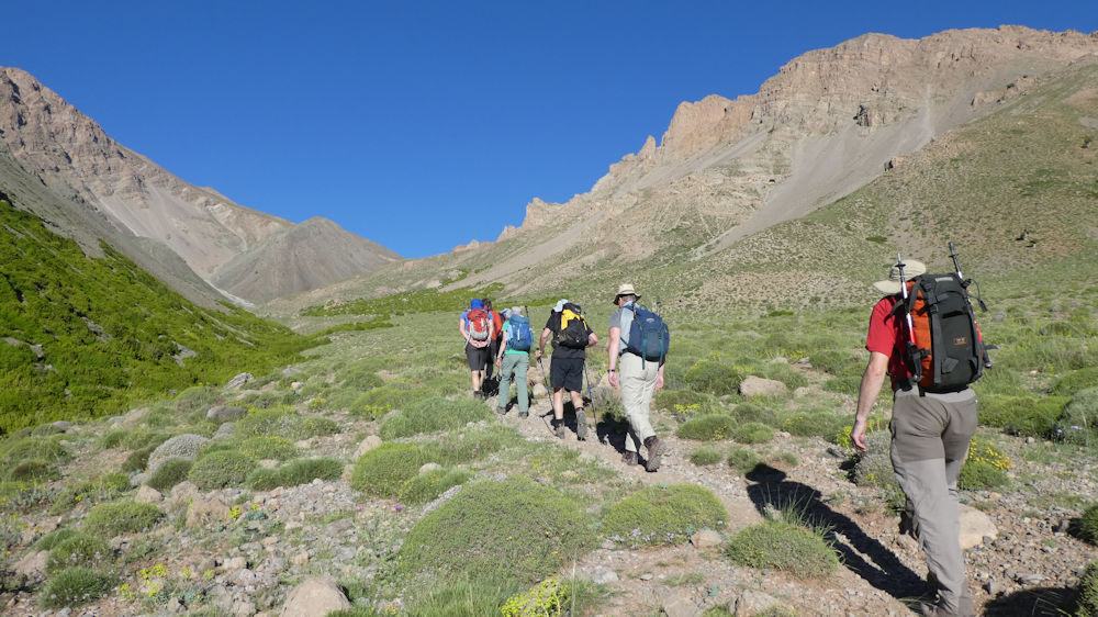
For us, we can now start to stretch our legs and feel how well, or otherwise, we move. This first afternoon is a gradual introduction to the scenery, altitude and heat. The track is wide and distinct, and takes us slowly upward through farmland, to our first evening’s camp at Arous. We follow the river upstream through fertile farmlands and the occasional profusion of wild flowers, including orchids. At our camp, as the sun sinks and the shadows lengthen on the close of the first day, we’re aware both of the tranquillity of our surroundings, and the contrasting night time temperatures.

We rise at just after seven, with the sun touching the tops of the nearby peaks, and within half an hour the campsite is warming in the morning light.

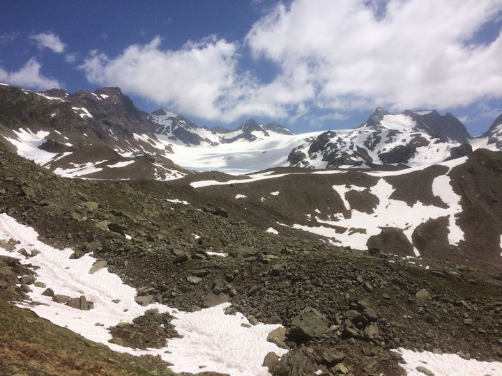
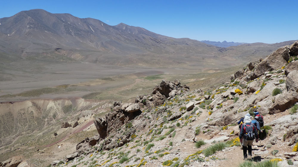
Upwards we go, increasingly slowly, to the second pass, Aghouixni Est (3,400m), which offers a grandstand view of the whole of the M’Goun range.

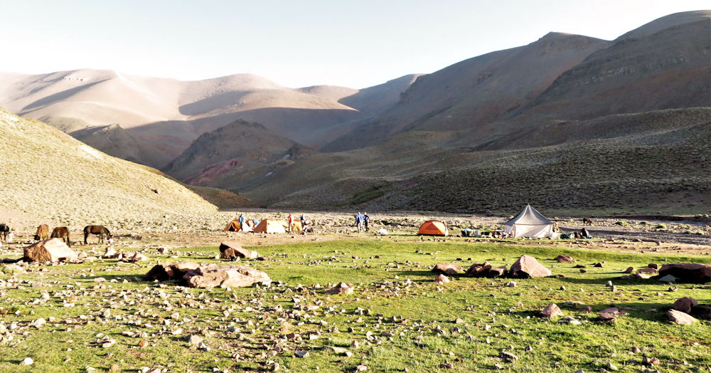
To keep us fuelled, Rachid produces a container of trail mix, and those of us who have been before know the delight that is coming. A mix of brittle coated nuts, peanuts, mini breadsticks and dates provide just the right boost. A steady descent takes us to our overnight camp on the beautiful high plateau of Tilibiyt N'Tarkeddit which overlooks the Tessaout Valley. On the way down, we pass a nomadic Berber tented encampment used by the herdsmen.
Our campsite on the plateau is on a lush green area, and our mules and those of several other parties are frolicking around, the occasional cloud of dust rising up as one of the mules rolls over and takes a dry bath.

It feels timeless here, and many of us enjoy the afternoon taking in the remoteness and beauty of the plateau and the surrounding mountains. That enjoyment is tempered by the knowledge that it’s a pre-dawn start tomorrow, and the effects of altitude are tapping away at everyone, which makes for a restless night for many of us.

Tuesday is Big Day in all senses of the word, and we’re up just after 4am, so we can be off soon after 5. We fumble around the camp in the torchlight, trying to take on board some breakfast before we set off. It’s easy rolling countryside at first, and the first alpenglow is not long in lighting up the nearby peaks. Along the way, we encounter a group of wild camels, probably owned by one of the local herdsmen. As our route swings into a side valley, we lose the sun, and the drop in temperature is marked, with hands cold to the point of hot aches, despite wearing gloves. The scenery has changed as well. No longer the clumps of pincushion flowers, we’re now in scree central, although it is still remarkably stable underfoot. Slowly, as we climb higher, the sun is on us again, and the body immediately feels the welcoming warmth.
We are now at the start of a series of broad ridges that sweep round the skyline for nearly a mile, rising slowly but surely to the summit of M’Goun (4,068m), the third highest peak in the Atlas Mountains. We’re at over 3,800m now, and all feeling the effects of altitude. Small ascents that would be straightforward in the Lake District now require major focus. The ridge itself is great, with one section looking like it’s been paved, the rock formation is so regular. More effort, just to climb those final few feet, despite the heaving lungs and the constant headache.

The view from the summit is incredible, like nothing we’ve seen before. Great tilted rock strata interspersed with whole valleys of scree, and ridge line after ridge line of mountains, receding into the distance. Great weather to have been on the ridge, as it can be “fun” in windy weather. We’ve just had a few zephyrs on the summit, exchanging the warm still air for something altogether cooler.
Down now, and our route off is initially down a steep scree slope, which means we can lose altitude quickly, before a much longer descent to our overnight camp.
As we reach the valley proper again, we pick up the signs of habitation, from the shepherd on the hillside, to the cave dwellings in the valley. And it’s pancakes and honey for late afternoon tea. Just the thing to help revive tired limbs.
Our overnight camp was in a sheltered valley, and to keep us company, we had a cacophony of frogs who wanted to serenade one another at random times throughout the night. Ah, the sounds of the country. Up at our normal 7am time this morning, but with a long distance day in front of us. Our route takes us out of one valley system, through landscapes that looked like pit slag heaps, before reaching the start of the cultivated part of the valley. On the hillsides roundabout is wormwood, with its distinctive smell, and also some patches of sage. Rachid expertly navigates us round different sets of field systems and water channels, before resting under a walnut grove for our lunch.
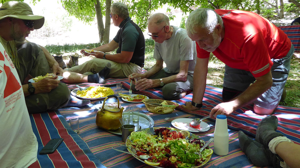
As we sit in the cool shade, we tuck slowly into helpings of salad and pasta, and we marvel at the skill of Ali our cook, who had produced all of this, and carried there on two of the mules. We are now in the start of a cultivated area, and pass round several more water channels after lunch. Again, there is a profusion of smells, from juniper wood, to the many roses that are growing in this, the rose valley. At one point we cross a small waterfall, which brings out the playful in all of us, and a welcome cooling as well. Further down the valley there is serious construction underway as a new road is being built between the Rose Valley and the markets in the Ait Bouguemez valley. We see several strange sights on the way, including a pick-up full of mules, part of another trek returning home.

Today has been a long day, over 16 miles, and we are relieved when we reach our overnight camp at Tiguitine (2,700m), on the edge of a set of gorges. Hot too, with top temperatures not far short of 40 Celsius. Late afternoon mint tea and doughnut type samosas with honey further help to restore the aching limbs and combat our dehydration.
We start our last day descending the first of two gorges, the Amsekar gorge. Big towering sandstone walls and, at one point, a concrete ramp which the mules skitter down. Emerging out of the first gorge, we are immediately into cultivated land, and the meadows we pass through are loud with the sound of bees. By the river, the local ladies are doing the village washing, a scene that is repeated several times throughout the day. We pass into a second, larger Petites Gorges du Mgoun, which has many oleander plants blossoming.

Fish swim in parts of the river and frogs plop into the water as we pass, whilst swallows and other birds provide the flypast to our nature extravaganza. We are treated to another open air feast for our lunch, before we head out into the sun again, and the last part of the walk. In the villages we pass through, we see several examples of Kasbahs; Ancient fortified grain stores, akin to our Pele towers.

To give us a last piece of excitement, at one point our trail follows a water channel, and we promenade along its outer edge, perched some feet above the main river. A short distance further on we reach the village of Boutaghar, our final destination and our gite, where we can enjoy a warm shower and chill out on the terrace whilst we reflect on another great trek.

Participants: Ed Bramley, Simon Bramley, Andy Burton, Steve Caulton, Mike Goodyer, Mike O’Dwyer, Myles O'Rielly, Judy Renshaw and Rick Snell
Report by Ed Bramley
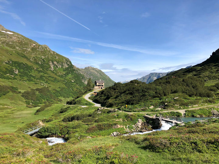
Meet photosThis year’s May meet in Scotland was based in a bunkhouse with a difference, the sleeping car at the Glenfinnan Station Museum. This is a converted railway carriage in which the dining area and the bunks are original train fittings. It was well equipped and comfortable for the five of us who stayed most of the week but would have been a bit too cosy if another two or three had attended. Karen Dickinson and Rachel Howlett had to change their plans at the last minute but did turn up for the last night, so were able to get at least a taste of it. The rest of us arrived on Sunday afternoon, Steve and Andy having driven from Nottingham and Mansfield, Max and Judy from Inverness airport and David had been staying in the area for a week or so beforehand. The nearest pub/hotel was very close and provided excellent food and a friendly, relaxed atmosphere so this became our dining place almost every evening.

Steve Caulton and I signed up for Judy’s 2019 Glenfinnan Meet because it was an area we wished to return to after spending a foul weather day in March on one of John Dempster’s Meets at Fassfern House, driving around this area of Scotland, so inextricably linked with Bonnie Prince Charlie, and some of our more recent military history. After a steady and enjoyable 9 hour drive up from Nottinghamshire, we arrived at Glenfinnan Station in time to introduce ourselves to the lady manning the station/tourist office and find a bunk in our own railway carriage for the week.
Everyone made themselves comfortable, plans were made for the next day, and that evening’s meal, which was taken at the Prince House Hotel, about 250 yards walk away. A post dinner walk to the nearest viewpoint above the Station afforded Steve and me some great views of Loch Shiel and the surrounding hills in the gloaming.The first day saw very low cloud, although not much rain, so we all decided to begin by exploring the local area and to head up Glenfinnan. From the bunkhouse we took the scenic path towards the monument and visitor centre, with Dave pushing his mountain bike, initially above the 21-arched Glenfinnan Viaduct.
