


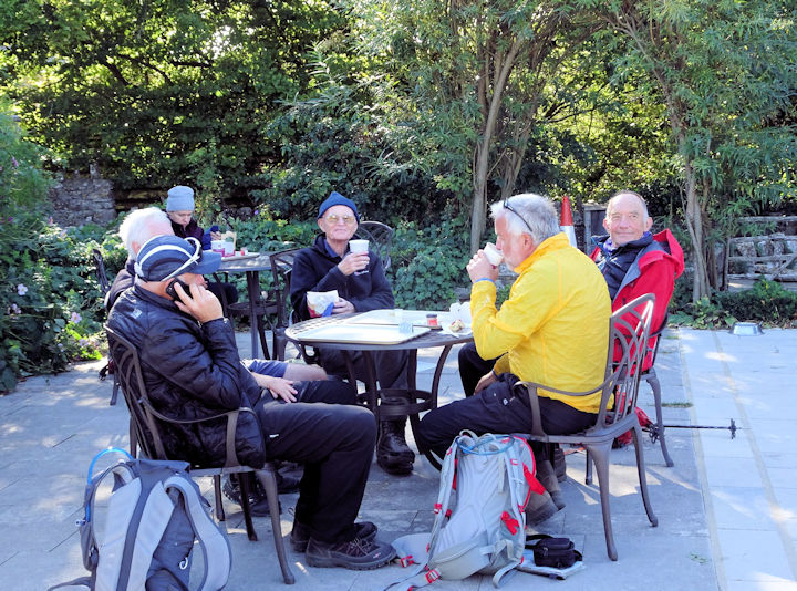
Those of us who live in Switzerland are doubly fortunate, for not only do we live in a beautiful country but also we are free to travel to enjoy it, with none of the restrictions of neighbouring European countries now in lockdown. Mindful that this might change and Switzerland itself join the lockdown any time, Alan and I decided in late October to spend a few days in Zermatt while we could still get there.
I have visited Zermatt many times since coming to work in Switzerland more than fifty years ago, but I still feel the same thrill when the train from Täsch pulls into the station and I see the Matterhorn rising above the roofs of the buildings. Over the years Zermatt has changed exponentially, with the building of more and more hotels and cable-car installations, and an influx of tourists from all over the world. However, on this occasion it was quieter than I have ever seen, with no flag-waving groups hurrying for the Gornergrat railway, the only tourists being from Switzerland itself.
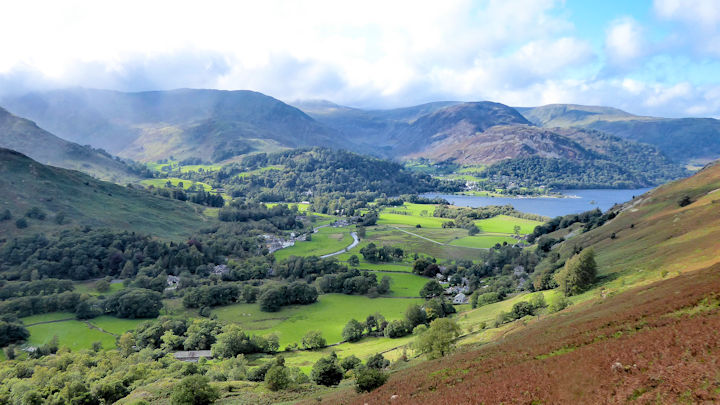
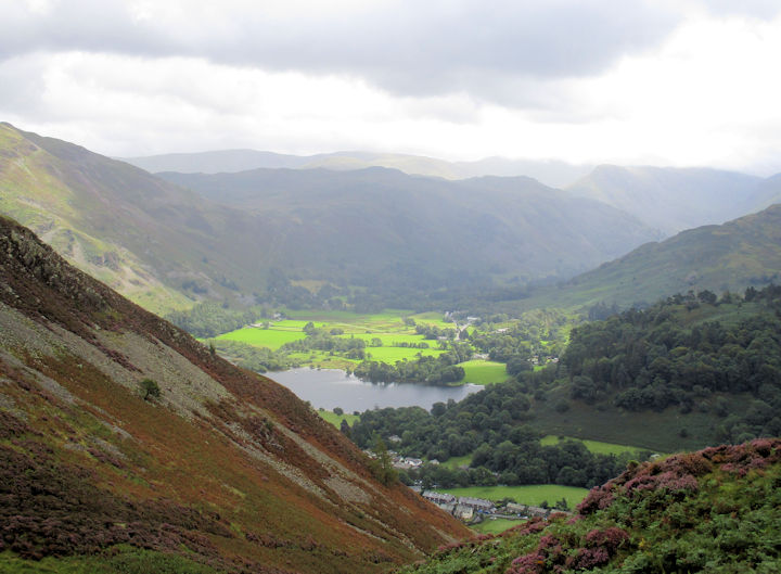
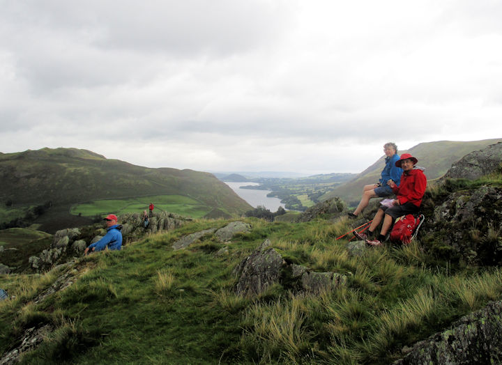
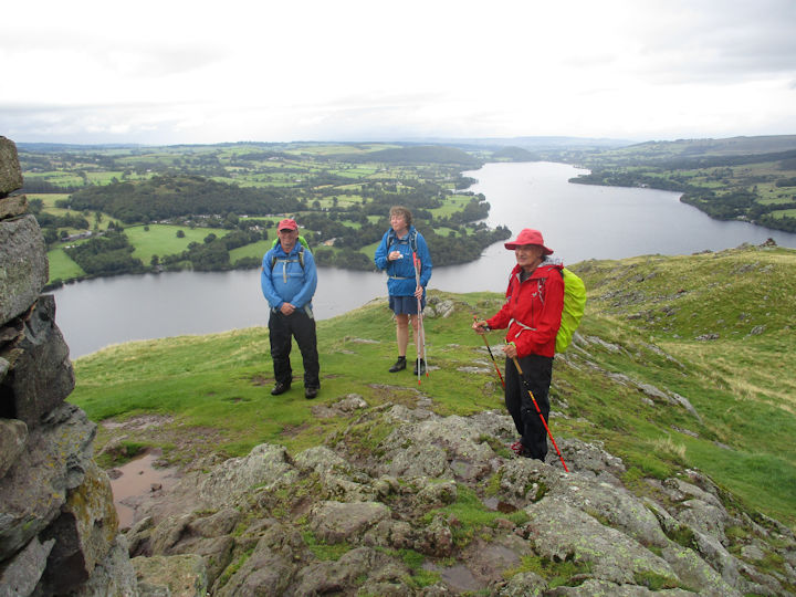
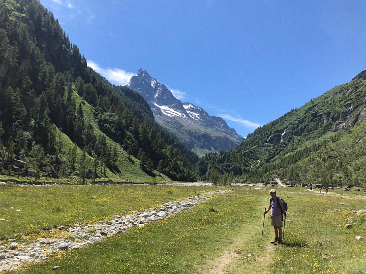
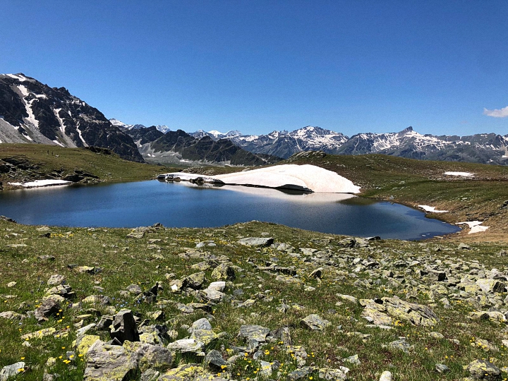
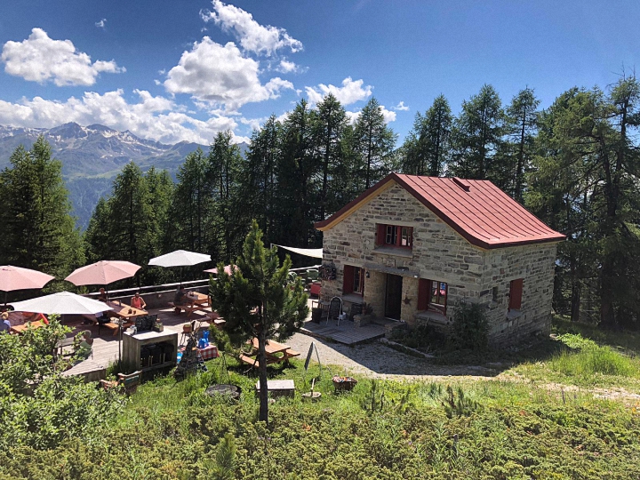
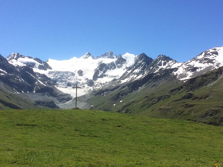
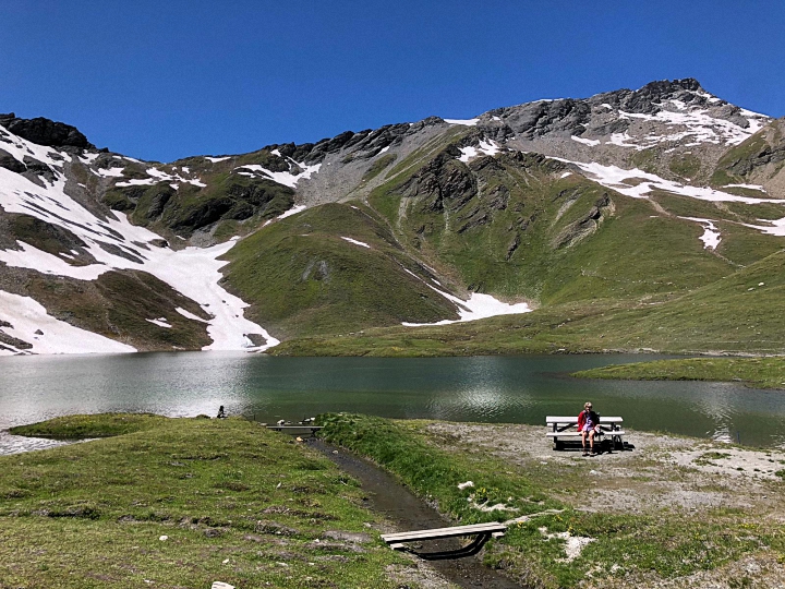
It had been very cold the previous week, with snow even as low as the village, but our arrival coincided with blue skies and brilliant sunshine. Since the higher trails were covered in snow, we opted for lower-level walks, the first starting from the funicular at Sunnegga. From there we set out on the “Lakes Trail”, winding gently uphill towards Fluhalp. I had come here on my very first trip to Zermatt in the early months of 1965, and this was where, also for the first time, I had strapped sealskins to the base of my skis to trudge up through deep powder snow, rewarded by an exhilarating descent into Zermatt itself, with magnificent views of the Matterhorn all day. The views were equally splendid on this occasion, perhaps even more so with the autumn colours of the larch trees shining in the sunshine. We reached the snow-line at the small frozen lake of Grindjisee, so turned downhill to the lake of Moosjesee, with the Matterhorn a perfect back-drop. The trail became easier as we got lower, and after a welcome drink at one of the cafés still open at Findeln, we made our way back into the town.
As we did so, memories of earlier visits came to mind, for it was from Zermatt that I had climbed my first 4000 metre peak, the Breithorn. Now it is an easy climb of two hours from the top of the Kleine Matterhorn cable-car, but we made the ascent in 1969, before this lift was built, making it considerably more challenging. And it was from Zermatt that I had made my own attempt on the Matterhorn almost half a lifetime ago. Like most Zermatt guides, mine had been born in the village and had climbed it many times himself, so knew the route well. We roped up at the Hörnli Hut, setting out when it was still dark, and at the start I had no problem following him up the steep rocks. But as we approached the Solvay hut high on the ridge, dawn began to break and it became light. I made the mistake of looking down, and there was Zermatt thousands of metres directly below. I froze, and although the guide managed to persuade me to continue for a short time, we both had to admit that I was not going to get to the top. Now I am content with just looking at this majestic peak, and with less energetic but equally enjoyable exploits.
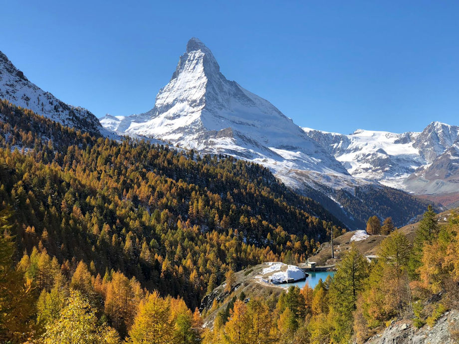
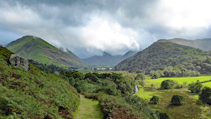
One of these was on our recent visit when we discovered the “Kulturweg”, or Culture Trail, leading from Zermatt to the hamlet of Zmutt, 300 metres above. It is an easy trail of about four kilometres, with lovely views of the Matterhorn all the way along, and a welcoming restaurant on arrival, with a terrace in the sunshine for my favourite Valaisian lunch of rösti mit spiegelei. Previously called the “Panoramaweg”, in July 2019 the trail was re-named and equipped with 14 information boards to show what life was like for farming communities in bygone days. The trail starts just above the church, where it turns off the main street past some of the oldest buildings in Zermatt, dating back to the 1800s. These are large wooden store-houses, known as “raccards”, perched on small mushroom-shaped pillars of stone to keep out rats and mice. From there it climbs up more steeply to reach the small settlement of Herbrigg, where we found an information board pointing to the oldest barn in Europe, built in 1261.
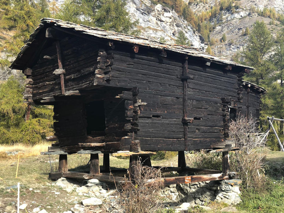
A higher trail branched off from here toward Hubel, but the “Kulturweg” flattened out to contour along the hillside through the trees, the information boards full of interest. They pointed to a centuries old apple tree, which bore fruit at the unusually high altitude of 1750m; a lynx trap dating from 1720; and a circular stone cattle pen. The trail itself had been surfaced with stone slabs centuries ago and was lined by low walls. At the entrance to Zmutt there were more wooden hay barns and old houses, one of which had been built in 1551 and belonged to the Inderbinen family, so the information boards told us. In the early years of the twentieth century, the Inderbinens, together with their nine children, spent every summer and autumn up here looking after their sheep and cows, planting vegetables and collecting wood.
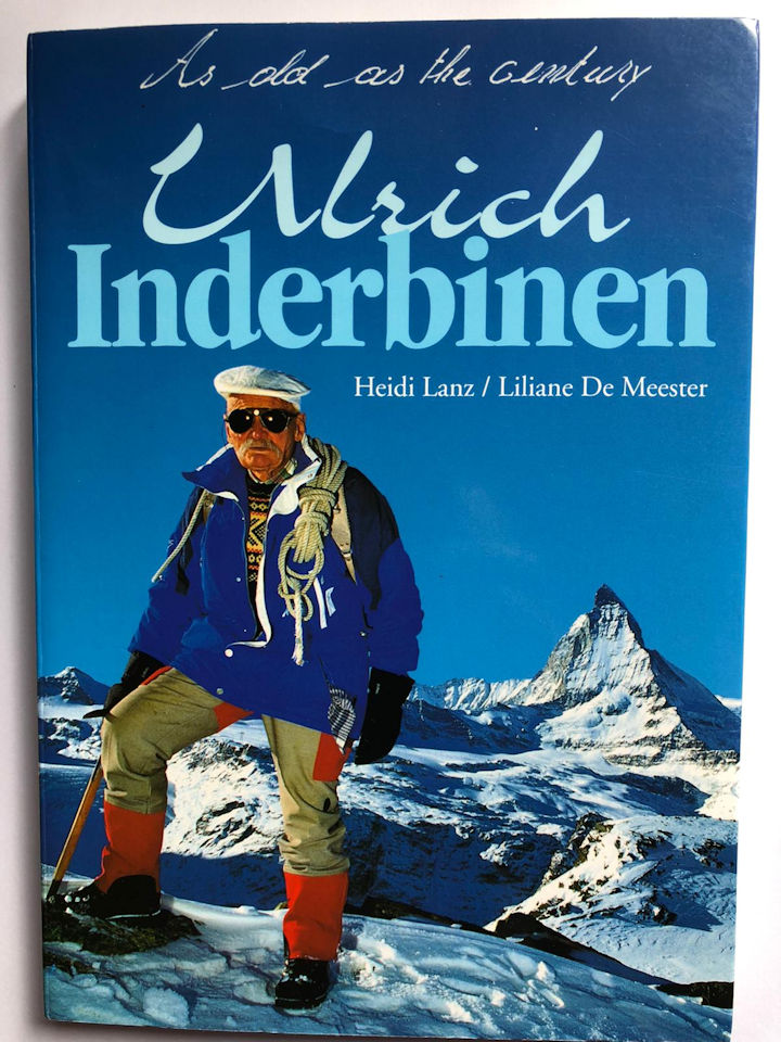
“As old as the century”
|
| Ulrich, the second son of this family, grew up to become the most famous guide in Zermatt, where he was affectionately known as the “King of the Alps”. Born in December 1900, he lived until 2004, dying peacefully at the age of 103 in the house he had built himself for his young family. The story of his life, told in the 1996 biography “As old as the century”, makes fascinating reading, for it is also the story of Zermatt’s evolution from a small isolated village, cut off for months every winter, to one of the world’s top resorts all year round. The first mountain he climbed was the Matterhorn, and this was not until he was 20 when he decided to train as a guide and needed proof of his ability. He went on to climb it at least 370 times and became a well-loved figure in Zermatt, never changing his simple habits, and never owning a car, a bicycle or a telephone. At the age of 95 he was still an active guide and still winning ski races, for he was the only competitor in his age category, as he himself pointed out! The last time Ulrich climbed the Matterhorn was in 1990, a few months before his 90th birthday. This was on 14th July, as part of the 125th anniversary celebrations of the first ascent in 1865. He reached the summit only four hours after leaving the Hörnli Hut, and was the centre of attention on his return to Schwarzsee. And this is when I saw him, for Alpine Club members had been invited to join in the celebrations at the small chapel there.
|
|
|
And it was there too that I was able to talk to one of my childhood heroes, John Hunt of Everest fame. After the celebratory lunch, I noticed that Lord Hunt had been standing by himself for some time. I walked over to him and told him how I still remembered being taken to see the 1953 Everest film when in Primary School, and had always wanted to meet him. Ever gallant, Lord Hunt replied that I looked much too young to remember that far back! As we chatted, I told him how I believed it was this film that had influenced me to climb mountains myself, and to see Everest, a dream which I finally realised on a trek to Base Camp in 1972. I tentatively asked for his autograph, and he signed my copy of “The Alpine Flowers of Britain and Europe”. His inscription, “For Pamela, John Hunt”, has made this one of my most treasured possessions, and accompanies me on all my mountain walks.
Report by Pamela Harris
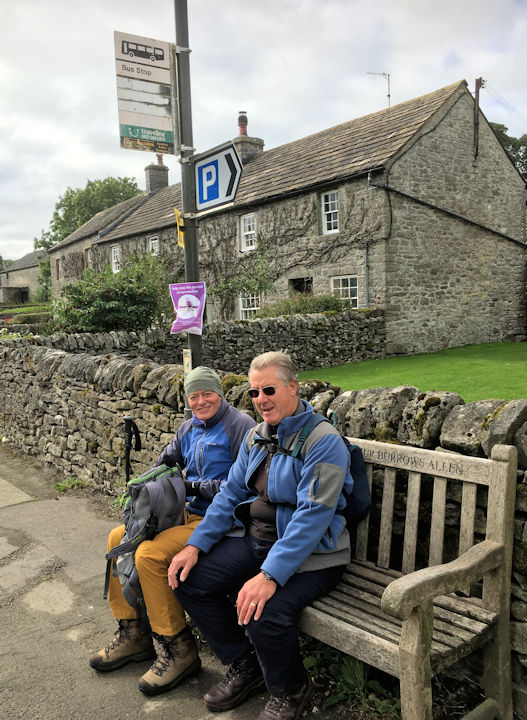
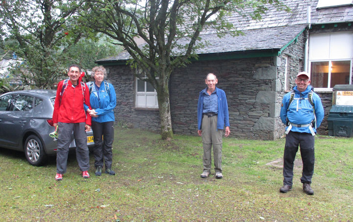
Peak District Walk - 26 SeptemberThis walk, which could also be titled ‘What a difference three months make’, was planned for a group of 6 in accordance with the prevailing Covid-19 rules for meeting and eating together, but in the end only three made it.
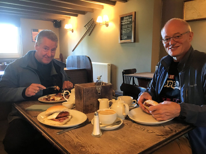
Preparing for the walk, photo by Andy Burton
|
| Ed, Steve and I met at the Royal Oak at Hurdlow and began the day with a hearty breakfast. Ed and I had pre-walked most of the route one Monday in early July, but Saturday’s in the Peak this year can be even more challenging than normal. We started walking from the pub, through its busy campsite onto and along the last mile or so of the High Peak Trail, turning sharp right up across the fields towards the former Bull int’ Thorn Hotel on the A515 ridge road that runs from Ashbourne to Buxton. This property has been turned into a large café facility with a re-developed campsite at the rear, offering camping pods with hook-up, and new toilet and shower facilities built with Covid-19 issues in mind.
|
|
|
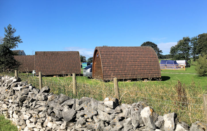
Camping pods, photo by Andy Burton
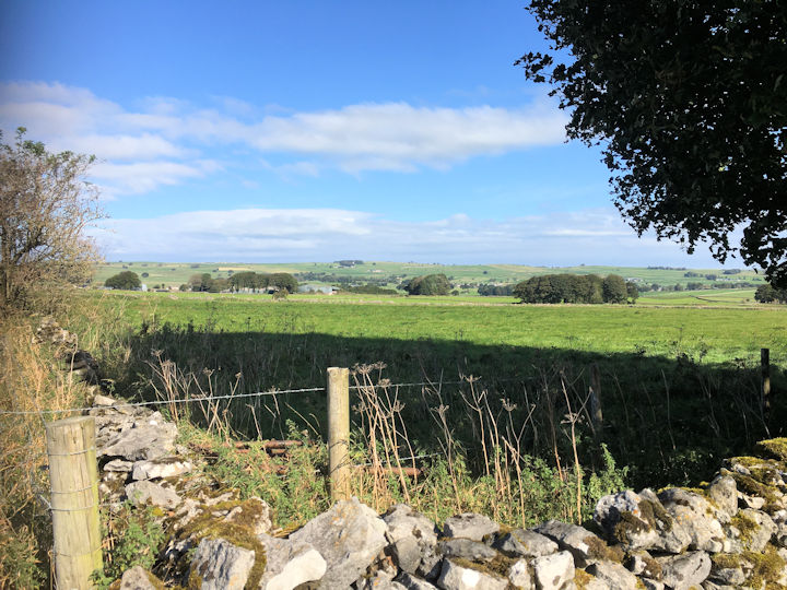
View from Bull int Thorn campsite boundary, photo by Andy Burton
|
|
|
Turning left to the right of the Bull we walked alongside the campsite as the view opened out over towards Flagg and Monyash, which was heaving with motorcyclists, cyclists and other visitors all queuing outside Smithy’s café.
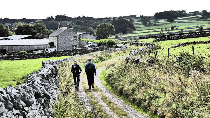
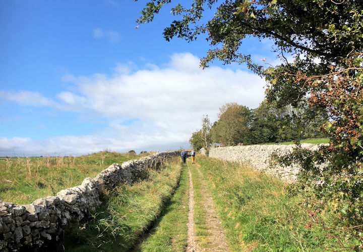
We quickly took our leave making our way onto Blackwell Lane towards Flagg joining the Limestone Way for a short while.
Steve and Ed on a bench in Monyash, photo by Andy Burton
|
| At Flagg we struck across the fields to Town Head, up onto Flagg Lane again looking back across this wide bowl of a valley at the view. A right along Pillwell Lane and then left onto the footpath through an old mining rake led us down into the trees that shelter the natural spring that has supplied water for the village of Chelmorton for centuries. Known locally as Illy-Willy Water for reasons that even our retired waste water expert did not wish to dwell on, this quickly leads to the first row of houses, and the tucked away Church Inn. Here we managed a relaxing pint, before continuing through the village and across the road up over a small ridge shown as Nether Low on the map, among patches of woodland and fields of cattle, dropping down into a dry valley across fields where all the hay had been cut since Ed and I last walked through.
|
|
|
The Limestone Way with high wall to the right, photo by Andy Burton
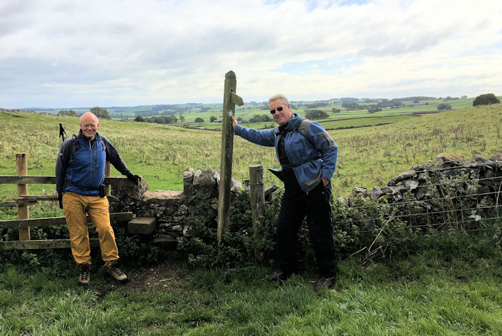
Ed and Steve above Flagg with views back over Monyash, photo by Andy Burton
|
|
|
Passing over Sterndale Moor and crossing the A515 into fields that border Hindlow Quarry, we learnt a valuable lesson, that little calves in 3 months grow into big boisterous and curious bullocks with strong gang-like behaviours.
Steve, always the wise one! shouted Ed and I as we found ourselves confronted by said animals, clearly indicating his intentions, as he was already back at the stile and making his way onto the road.
Ed and I looked around and saw a gate nearby that would allow us to escape onto the roadside as well. This we did, and with careful field and fence management we avoided any further stand-offs, with the remaining herds of young cattle, as we passed by the quarry lands, alongside the mineral line, and out onto the little lane that now separates the working railway from its former continuation, now the High Peak Trail.
By now the weather had changed enough to make the small divert up through the Pomeroy farm campsite to sample their home-made ice creams, of little interest, and we hot-footed it back to the Royal, only to find it packed and unable to bring our table reservation forward (by nearly two hours).
Only thing to do, go home.
Steve Caulton’s thoughts on the day - Thanks again for a great day.Thoroughly enjoyed it as usual. Glad you both got something out of the walk. A new part of Derbyshire for me. I wasn't aware you'd taken me to the highest village in the County and therefore the highest pub. And all very interesting too. Not every day a sceptic like me is confronted with proof that too much red meat can be bad for you. Apparently it can go directly to your heart, but I didn't think it meant possibly straight through your ribs.
I was relieved when you both sensibly abandoned that path in favour of getting out of that field before you became 'walker trampled' headline number three this month.
Present: Ed Bramley, Steve Caulton and Andy Burton
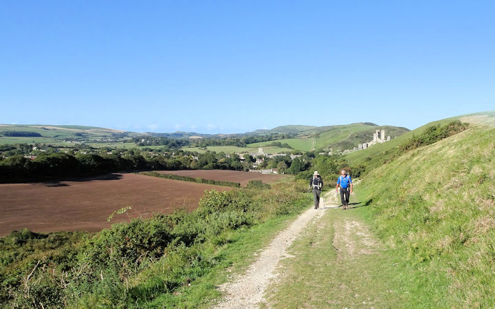
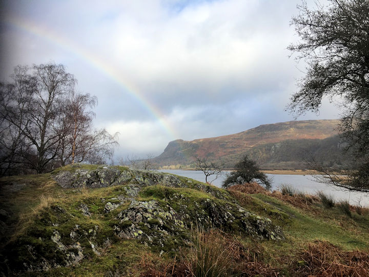
Report by Andy Burton A very early start to drive down to Corfe Castle enabled most of the meet participants to arrive in the busy car park at Corfe Castle before 9am on a beautifully sunny and cloud free morning. Judy and Don had camped overnight at a nearby campsite and Rick had bivvied overnight at St Albans Head after a days climbing on the Sea cliffs the day before. It was good to see this meet being so well supported with 10 members attending. After a quick assembly we set off on separate walks. Don had opted for a trek along the Purbeck ridge west towards Knowle Hill and then looping back to Corfe Castle connecting paths across the fields. The rest of us set off east through the village and past Corfe Castle towards the Poole Bay coastline.
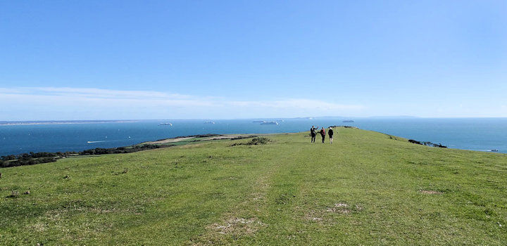
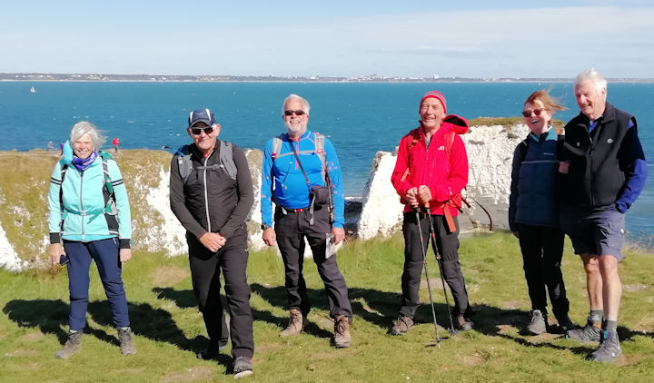
After passing the long barrow on Ailwood Down we continued along Kingswood Down to the final peak on that ridge at the Giants Grave. As the morning progressed we passed many others enjoying the sunshine either trail running, mountain biking or walking. The wind was picking up as we dropped down to meet the road between Studland Bay and Swanage. After crossing the road we made our way along the signposted route towards Old Harry’s Rocks. After a few hundred meters we turned to make a steep ascent of Ballard Down to the Obelisk on top of the ridge. This was an opportunity for a group photo stop. We continued on the Purbeck Way along Ballard Down and Studland Hill until the whole vista of Poole Bay and the Needles on the Isle of Wight opened up. It was strange to see approximately 7 or 8 cruise liners at anchor in the bay, presumably due to the current lull in business due to the Covid-19 epidemic. At the junction of paths returning to the Studland Bay road and onwards to Old Harry’s Rocks James made his way back towards Corfe Castle. The wind was now quite brisk and we stopped briefly for coffee on the cliff top at Ballard Point.
Rounded it off with an impromptu tea and a beer to dull the aching legs.
Wondered why I felt lightheaded afterwards. I can blame either the altitude or the Pedigree bitter.
I'm pleased I took heed of medical advice to avoid too much at any one time.
The only time I can truly say that part of the route was Bullocks and not offend anybody!
Hope I see you both sooner rather than later.
Southern Day Meet, Corfe Castle - 26 September
 On the way up. Photo by Julie Freemantle
We passed Challow Farm and made our way on a gently rising path to the top of the ridge. The visibility was superb with views deep into the Dorset countryside and out across Poole harbour as well as the start of the Jurassic coastline in the opposite direction. We were now on the Purbeck Way which is right on the crest of the ridge crossing Rollington Hill and Brenscombe Hill. We had broken down into smaller walking groups catching up after such a long break from club meets.
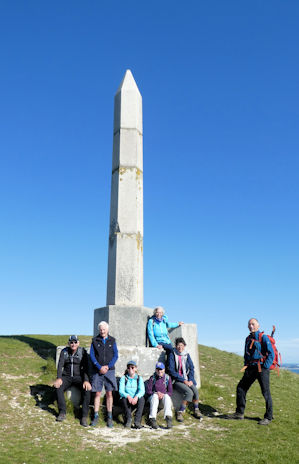 Team at Obelisk. Photo by Mike Goodyer
 Cruise liners in the bay. Photo by Julie Freemantle
Windy spot! Photo by Margaret Moore
|
We made a swift visit to Old Nicks Ground to see Old Harry’s Rocks, the natural arch and pinnacles of white chalk. The visibility was outstanding. After taking a few photos we returned to the top of Ballard Cliff for a lunch stop out of the wind. |
|
|
|
After lunch we made our way back Corfe Castle along the path on the leeward side of the ridge. The group split with some deciding to return along the ridge top in reverse of our morning walk whilst the rest stayed on the lower path.
The group reassembled in Corfe Castle to enjoy some refreshments at the National Trust cafe underneath the shadow of Corfe Castle. We made contact with the Northern Day meet who were still out on the hills in Derbyshire.
Tea time and Paul making contact with the Derbyshire walk. Photo by Julie Freemantle
| 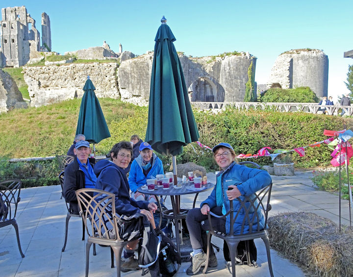
Tea time with Corfe Catle backdrop. Photo by Julie Freemantle
|
|
|
It was a lovely walk with great company. 22.8km (14 miles) and 737m (2417 ft) ascent and descent.
Present: James Baldwin, Don Hodge, Judy Renshaw, Mike O’Dwyer, Margaret O’Dwyer, Margaret Moore, Julie Fremantle, Rick Snell, Mike Goodyer and Paul Stock
Report by Paul Stock
With the Daves booking a weekend at the hut, I arranged to meet up with them for a socially distanced day out on the hills, with local knowledge of the paths provided by Mike Parsons. The previous day had been raining in the Lakes, and the last of it was just clearing off as we headed across the bridge towards Side Farm, all of us pleased we were out for a walk. As we headed out in the direction of Hartsop, the trees around Goldrill Beck were as resplendent as ever, the twists of the bark and the mosses on the trunks shown off to great effect.
Once over the footbridge crossing Angletarn Beck, Mike’s local knowledge started to kick in. “There’s a little track up through the woodland on the left – avoids the trade route up to Angle tarn” – Sure enough, there was a feint path linking up to the higher track leading towards Hayeswater – Why had we not been on this before, with great views straight into Threshthwaite Glen. Whilst it had stopped raining, the clouds boiling over the edge of High Street and the strengthening winds gave us a good indication that it was no longer a summers day.
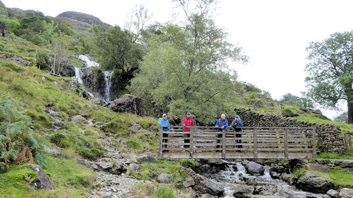
Team on the footbridge
| 
Boiling clouds!
|
|
|
Another of Mike’s local knowledge tracks saw us making a rising traverse on another old horse trod on the flank of Brock Crags, rising up beside Calfgate Gill, to eventually join the ‘trade route’. Immediately it was clear that the wind was going to have a major influence on the day, pushing us bodily around on the track. It didn’t take long to reach the conclusion that our original route would have all the feeling of being tumbled around in a washing machine for the day, and wanting to enjoy the walk, rather than just get round, we hastily revised our plans.
Picking up the path around the north side of Rest Dodd, we then swung round to meet the peat covered shoulder of The Nab, with its many shallow groughs dissecting our path, and being vaguely reminiscent of being on Kinder. Before descending to the plateau we were lucky enough to see a herd of deer crossing the path in front of us. The path marked down the east side of The Nab initially takes a little finding, but once on, we had another old horse trod heading down into the valley, only made more difficult by the proliferous bracken further downhill.
Looking down to Patterdale
| 
looking towards Brotherswater
|
|
|
Passing near the red bungalow at the head of Martindale valley, we contoured round to Dalehead, and a good track up to Bedafell Knott. Straightforward, apart from the few hundred yards around Dalehead, where the path on the map was rather clearer than the actual track on the ground. Before long we were back at Boardale Hause and I was contemplating the usual descent back to the hut – but our local variations were not yet finished! One last horse trod connected with the Brothers Water path up to the Hause, providing a wide track and great views back up the valley. A last variation saw us on the river bank track, right the way back to our starting bridge. Back at the hut, a helping of tea and biscuits provided the perfect end to the day, before the journey home.
Present: Ed Bramley, Dave Blackett, Dave Clear and Mike Parsons.
Report by Ed Bramley
Don and I were lucky to be among the first people to use the hut after full lockdown in March. Since it was available only to single households, no one else could stay over. The weekend we had booked (22/23 August) turned out to be wet and windy, with the aftermath of storms Ellen and Francis. However it was wonderful to be there, really good to see the village, hear the church clock chiming the hours and to make brief (socially distanced) visits to Marian and Mike next door. We had brought vast quantities of food with us, including many vegetables from the garden, so there was no need to eat out, even though most of the pubs were serving meals.
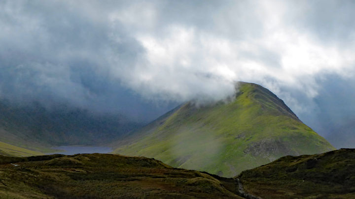
On Saturday, the windier day, I took a lift with Don to Aira Force and walked along just below the ridge to Glencoyne, which was reasonably sheltered, then attempted to go up towards Greenside but was turned back by fierce wind and rain. So instead I went over Sheffield Pike and found a path I had never noticed before from the col below Glenridding Dodd, over a couple of minor tops with cairns and down to Seldom Seen. From there I went back along the lakeside path encountering a few groups of people along the way. The rest of the walk had been very quiet.
On Sunday we were able to have a (more or less) real meet, with two groups out walking the hills. David, Daniel and Nicola joined me, going up to Boredale Hause and along the ridge of Beda Fell in intermittent rain, although it did allow us a couple of good snack stops and brief moments of sunshine. We then went up Hallin Fell, from where we had a good view of Ullswater and could watch the sailing boats and the steamers. We came back along Boredale and over the Hause, a route I have almost never taken before and which was pleasantly quiet (except for meeting two people whom Nicola and Daniel knew from Kendal, who used to live in the valley).
 Beda Fell Ridge
|  On Hallin Fell
|
|
|
Meanwhile, Don and Marian did a local walk, initially to view the reinforcement work that had been undertaken to support the road and buildings in lower Grisedale. Then they went to see the short climbing crags below Birks and some old shielings (former huts) and charcoal burning sites in Glenamara Park.
Back at the hut, everyone was able to stop for tea and biscuits, in a suitably airy and distanced way, before setting off to their various homes, a good way to finish an enjoyable day. Don and I left on Monday, having cleaned up the hut with extra care, and called in on Heather Eddowes and Dave Matthews on our way back, in their lovely garden at Knutsford.
It was a treat to have enjoyed the company so many ABM members over the weekend.
Present: Daniel and Nicola Albert, David Clear, Don Hodge, Judy Renshaw, Marian and Mike Parsons.
Report by Judy Renshaw
When a new virus from China reached Western Europe early this year, everyone thought it would be quickly contained and would not affect the summer’s Alpine hotel meet at St Luc in the Val d’Anniviers. But as country after country entered lockdown and borders closed, by May it became clear that the meet would have to be cancelled.
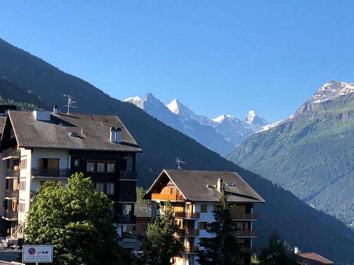
However, by late June Switzerland had gradually begun to recover, with hotels, restaurants and mountain lifts opening, and so Alan and I decided to go to St Luc on a “mini-meet” of our own, knowing that those from the UK would be unable to join us. The forecast was set for sunshine every day, so we phoned the Hotel Beausite, where our original reservation had been for a group of 26, and booked for just the two of us.
The Val d’Anniviers is described by Kev Reynolds in the Cicerone Guide to Walking in the Valais as having “some of the loveliest mountain scenery imaginable”. At its head are the alpine giants of the Matterhorn, Ober Gabelhorn, Weisshorn and Zinal Rothorn, and it was these that we looked out towards from the balcony of our hotel room and from the breakfast room. We were impressed by the precautions against Covid-19 taken by the Salamin family, with hand sanitiser at the entrance, restaurant tables reorganised for social distancing, and the waitresses wearing face shields. We had understood from the media that this year the Swiss were mostly taking holidays in their own country, although after the first Saturday evening there were few others staying in the hotel while we were there.
There are a wide selection of walking trails in the valley for at Vissoie it divides into three branches, south-east leading up to St Luc and the highest village of Chandolin; due south to Zinal; and south-west to Grimentz and Moiry. I had many memories of previous climbs in the valley for I had visited frequently since first coming to work in Switzerland in the 1960s, and in 2007 on Alasdair’s Valais Trek we had crossed the high passes linking the four villages. The weather had not been nearly so kind to us on that occasion, and on several days we had thick cloud, rain and even snow to contend with; only the three stalwarts of Lin and Dick Murton and Dick Yorke had walked every day of the trek, the rest of us getting round by public transport or hitching a lift in Karen’s “yakmobile”.
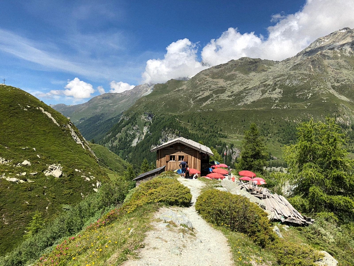
Since we would be there for four days, we planned a walk from each of the centres, beginning with the walk from Zinal up to the Cabane du Petit Mountet. We left the car where the pastures begin at the end of the village and walked along a flat path through meadows of black cows grazing amidst colourful flowers. The view in front was dominated by the twin peaks of Besso, at 3668m the first big mountain I had climbed more than 50 years ago, setting foot on its summit the same day that Neil Armstrong had set foot on the moon. On reaching the stream the path began to wind steeply uphill through trees, the rockier parts protected by chains, crossing small streams and waterfalls. As we turned a corner we finally came out into an open valley, with alpenrose at the side of the path and views of the Weisshorn above the cirque of Ar Pitetta to our left. We could now see the hut with its terrace of brightly coloured umbrellas perched at the top of the moraine above us, just a short haul before we could relax with a welcome drink.
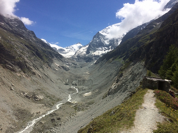
Here the glacier was rubble-strewn and dirty, but there was a glorious view of the glistening white peaks above it. I had first visited the hut when it was on the route to the much higher Cabane du Grand Mountet, one of the most beautifully situated huts in the Swiss Alps, directly opposite the north face of the Ober Gabelhorn. But this path up the western side of the glacier is no longer in use as glacial recession and crumbling moraine has made it too dangerous, and now the safer route to take is on the opposite bank along the flanks of Besso, on a path constructed some years ago by the Swiss army.
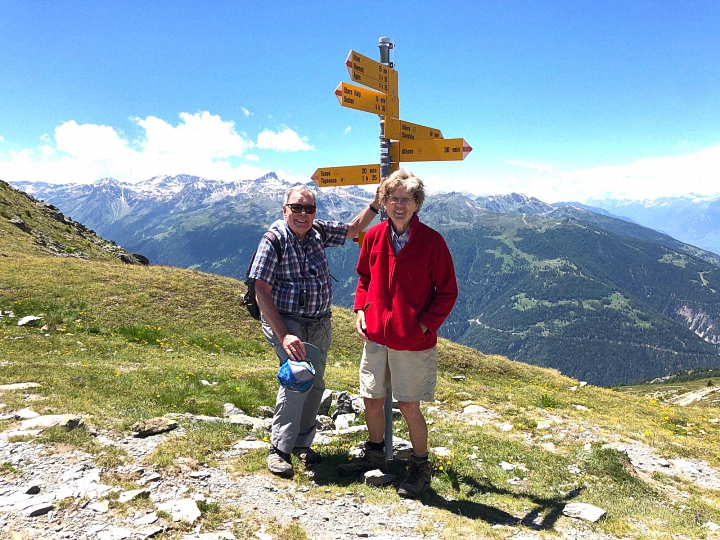
The following day we woke early to glorious sunshine again and took the 9 o’clock funicular to Tignousa, an easy way to gain 500m height. Our objective was the Sentier des Lacs, the Lakes Trail, a 14km circuit below the 3000m Bella Tola, which I had climbed on more than one occasion, the last time being with my local SAC group led by club members Niels and Guni Doble. We set out along the Planets Trail, a scale model of the solar system with sculptures of each of the planets, quickly passing the six closest together: Sun, Mercury, Venus, Earth, Mars and Jupiter. The path led towards the large square building of the Victorian Hotel Weisshorn on the ridge high above us, and is part of the route taken by the annual Sierre-Zinal mountain race. This is a gruelling 31km run, with 2200m height gain and 1100m loss, which Alan had completed 17 times. Sadly, Covid-19 meant that this year’s race has been cancelled - although Alan didn’t think he could still match his best time of just five hours!
After passing the models of Saturn and Uranus further along, we turned off the main track to take a narrow path to the left, which led uphill through slopes of tiny black vanilla orchids, bright blue trumpet gentians and delicate yellow pulsatilla anemones, with pink moss campion clinging to the rocks higher up. After a large patch of marshy ground we reached the first lake at Plan Torgnon and then continued steeply uphill to the beautiful Lac de l’Armina, a lovely peaceful spot for our picnic lunch. Facing us in the distance were the peaks of the Val d’Hérens: Mont Collon, Mont Blanc de Cheilon and the Pigne d’Arolla, the latter climbed by me forty years ago when I had skied the challenging Haute Route from Chamonix to Zermatt, one of my most rewarding mountaineering experiences.
After lunch there was an undulating, rocky scramble to reach our final lake, the Lac de Bella Tola, 500m below the summit of the mountain. Although the views were still glorious, the slopes were now scarred by ski-lifts and avalanche barriers, and we hurried downhill to the Cabane de Bella Tola for a quick drink before returning on the funicular for a delicious Swiss fondue back at the hotel.
On our third day we drove up to Chandolin, the highest village in the valley and one time home of the intrepid Swiss explorer Ella Maillart, where a small museum is a testament to her action-packed life. After taking the chairlift to Tsapé, we started on a circular walk which undulated past small lakes between the Schwarzhorn and the Illhorn. The path was flat as far as the Lac Noir, but then became a steep and rocky scramble down towards the Illsee 200m below. We were soon overtaken by a group of youngsters racing downhill, carrying what looked like fishing nets. We assumed these were for use in the lake, but when they stopped above it, we discovered they were a group of French botanists – and we never did find out what the nets were for! It was indeed a wonderful spot for botanising, the ground covered with a spectacular display of alpine flowers: gentians, alpenrose, pulsatilla anemones, white Paradise lilies and several different kinds of orchids in addition to the ubiquitous black vanilla.
After the lake the path climbed steeply uphill to reach the only patch of snow we crossed on any of our walks, just below the Pas de l’Illsee. And it was here too that we met the only foreign tourists we encountered, a group of Belgians who commented that for them Switzerland was not far away, a mere 800km drive! We were now at the northern end of the Val d’Anniviers, and the view from here looked across the Rhône Valley to the peaks of the Bernese Oberland.
The signpost at the col stated that the summit of the Illhorn was just 30 minutes higher, but we were not tempted, preferring a gentle stroll downhill for a drink at the Cabane Illhorn before returning to our car at Chandolin.
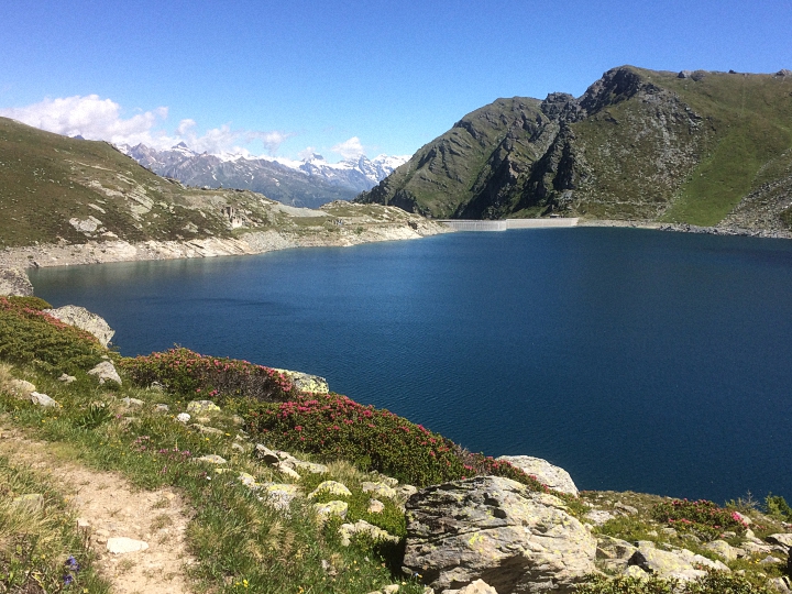
On our final day we drove down through Vissoie to the lovely village of Grimentz, with its window-boxes of colourful geraniums, and then up a long winding road to the high dam at Moiry and the lake beyond.
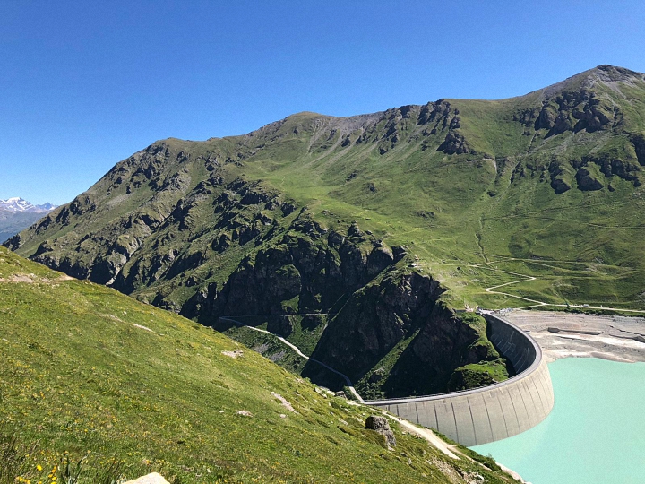 The high Moiry dam
| 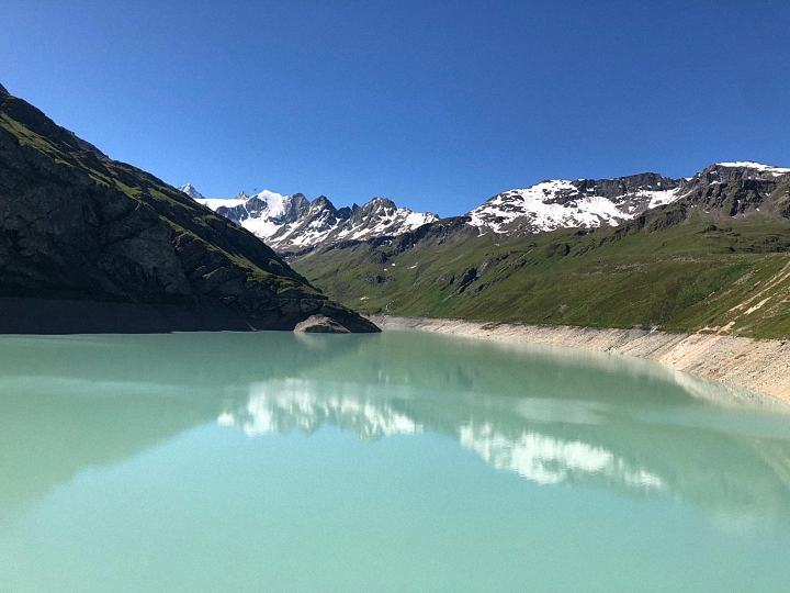 Reflections in the Lac du Moiry
|
|
|
Rising above it were the Pigne de la Lé and Grand Cornier - which I had attempted nearly 50 years ago, resulting in frost-bitten finger tips. We had no such grandiose projects in mind on this occasion, our objective being the Lac des Autannes below the Col de Torrent, which we had crossed on our 2007 Valais Trek en route from Evolčne in the Val d’Hérens to the dortoir at the Moiry dam. The slopes were covered with large yellow bellflowers and tiny green frog orchids, both rare but growing in profusion here, amongst many other flowers.
 Flowery meadows above the dam
| We soon reached the Alpage de Torrent, where cows grazed contentedly near a small farm, and continued up to the Lac des Autannes, at 2686m the highest point we reached on this year’s meet. It was a lovely spot, with the snow-covered peaks of the Dent Blanche, Grand Cornier, Ober Gabelhorn and Zinal Rothorn rising above the Moiry glacier at the end of the valley. We could just make out walkers on the top of the col above us, but instead of continuing upwards, we returned back down to Moiry to begin our drive home.
|
|
|
 Dent Blanche, Grand Cornier and Pigne de la Lé from the Alpage de Torrent
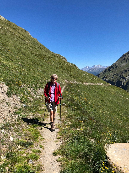
|  Socially isolating at the Lac de Torrent
|
|
|
We had had a truly wonderful four days, with glorious weather every day and spectacular views and flowers, our only regret being that the rest of the group could not be with us.
Report by Pamela Harris and photos by Pamela Harris and Alan Norton.
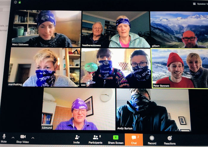
Thirteen folks attended this years rather unusual new members meet in an online zoom video chat room.
 ABM buff club
| Sadly due to COVID-19, the original meet at the George Starkey hut in Patterdale had to be cancelled. And so from self-isolation lock down folks in Nottingham, Derbyshire, Cheshire, Glasgow, Bristol, London, Bath and Northumberland, logged on at 4pm 28th March for a chat, a brew and some cake. As members logged on, it was a joy to see each other and have a light moment in an otherwise overwhelming week. It was of course disappointing not to be out on the fells together, but great to connect with familiar faces and also welcome new faces to the group. Welcome to Gilbert and Charlie! We’ll see you at a meet in the future no doubt.
|
|
A few highlights…
Andy Burton joined us in appropriate high altitude mountain wear, as unfortunately his heating and gas had given up the go at home. But he assured us he was doing ok and would be getting the Primus stove out later to cook his dinner. A true mountaineer! Next he’ll be abseiling out of his window for his daily exercise…
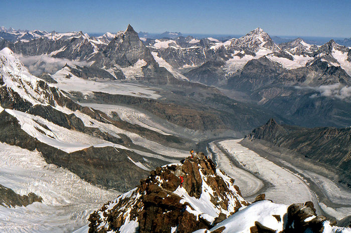 Ed’s Gorner glacier photograph from the top of the Dufourspitze (Monte Rosa) 1976, ascent with Mike Goodyer
| Ed Bramley gave a mini-quiz by zooming in on old photos and challenging us to guess the locations. A hard feat as the photos were rather small and not always in shot, but very amusing! A photograph of Ed working on the Gorner glacier, Switzerland in 1975, was a particular favourite (see photo on the right!). 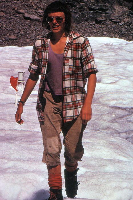 Ed looking fabulous, but where are his colourful trademark trousers??
|
|
Gilbert Roberts, a potential new club member, had everyone perusing his fabulous photo of the Alphubel, whilst Heather Eddowes shared a lovely painting of well loved ‘Place Fell and Ullswater’ from her home in Knutsford.
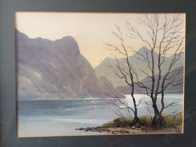 Looking South, Ullswater
| 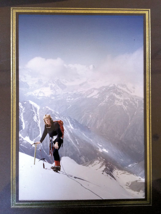 And bonus points to anyone who can tell Heather Eddowes where she was in this photograph (taken in 1983) She has forgotten!
|
|
Rachel and Karen in Glasgow drank late afternoon raison cocktails, very strange combination, but in these strange times, why not try something new and unexpected?
Mary led a short online ceilidh (skipping up and down her houseboat, twirling the computer round for a virtual ‘spin your partner’ effect), whilst Pete Bennett travelled (via video backgrounds) to snowy Norway, a muddy Glastonbury field, unknown mountain ranges and finally landed in front a roaring fire much to everyone’s amusement.
He told of plans to learn to unicycle during lock down, good luck Pete!
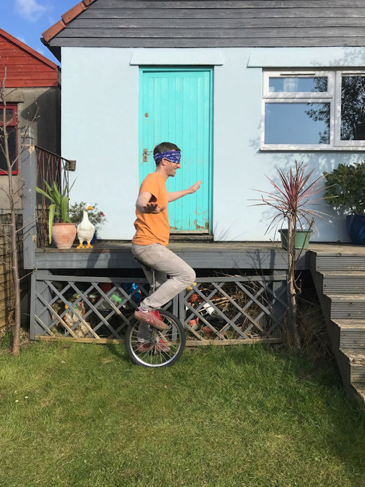
| “inbetween staging roller discos in the garage, mowing a golf green into the lawn and attempting to create a skate ramp from leftover wood, Pete likes to find creative ways that his ABMSAC buff can make everyday activities more challenging”
|
|
Great to see everyone, thanks for lifting spirits and sharing a brew. Looking forward to seeing you out on the hills sometime soon.
Stay safe people.
And sending good wishes to all ABM members far and wide.
Report by Mary Eddowes
Attendees: Martha King, Celine Ganyon, Rachel Howlett, Karen Dickinson, Pete Bennett, Carrie Brassley, Ed Bramley, Andy Burton, Heather Eddowes, Dave Matthews, Mary Eddowes, Gilbert Roberts, Charlie Rawson
The Annual Dinner and AGM weekend meet 2020 was attended by 49 members who enjoyed a great weekend despite the terrible weather!
The Friday arrivee’s were able to get out on a walk despite the poor weather forecast. A low level walk was chosen with various café’s, pubs and hotels to stop in at the beginning, middle, and end.
Two cars left Patterdale after breakfast with six walkers, all suitably prepared with packed lunch, hot drinks, and full foul weather gear.
The group comprised of Ed and Mike, Michele and Marcus, Dave Blackett (who had driven down from Sunderland that morning to join the group), and Andy.
After a slight detour which allowed the rain to ease, they parked up in Portinscale, and set off walking along the Cumbria Way, initially through open woodland with glimpses of Derwentwater through the trees.
At least two of the group saw a red squirrel, and others a woodpecker, high up in one of the trees. The woodland also has a couple of unusual pieces of permanent artwork dotted about.
At the end of the lake they walked as far as we could before the very swollen River Derwent blocked the way. It was then across the marshland fields feeling very grateful for the new plastic raised walkways, joining the road, where a very full Eller Beck flowed into the valley bottom.
 Group on trip around Derwentwater
|  Rain stopping over Derwentwater
|
|
Lunch was taken under some trees where they enjoyed views of the falls in spate through the cleft in the hills, behind the Lodore Hotel, where its new extension sat in beautifully landscaped grounds
After lunch the group resumed walking alongside the lake at Strutts Wood, below Ashness Bridge all the way into Keswick crossing back over the Derwent via the Portinscale footbridge which brought them quickly back to where the cars were parked.
A great day out sharing stories and memories of many different visits to this area, with everyone having plenty to contribute.
Definitely pinched one against the forecast!
One of Saturday’s walk was led by Marian, who talked Rick and Alison, James and Belinda, Margaret Moore, Anne Jago and Andy into walking in the rain, by making the mid-point the Brotherswater Inn, and assuring that there would be little or no road walking.
They set off over the Goldrill Beck, up through Side Farm, and along the footpath that takes you past Rooking and Crookabeck, crossing back over the Goldrill past Beckstones Farm, then climbing a stile to walk alongside the beck on a permitted path leading to the A592, where we crossed over and walked another permitted path through Low Wood, to Cow Bridge, with Marian pointing out the best areas for spring flowers, and red squirrel.
At one point they stopped, and Marian pointed out the steep permitted path going up through the trees and out of sight, that leads to Hartsop above How and Hart Crag.
The group then popped out onto the wide path just after the little car park, close to where Andy drowned his VW Sharan one year, and walked alongside Brotherswater looking across the wind-swept water at the steep ramp of Hartsop Dodd.
At Hartsop Hall they turned left, back across the fields through the Sykeside campsite to the Brotherswater Inn at Kirkstonefoot.
With the aid of a large log burner fire, a glass or two of mulled wine and a bite to eat, and with no one being in a hurry to go back out in the rain, the facilities were enjoyed and everyone dried out a bit, whilst looking out of the large picture windows to where Dove Crag could just about be seen.
Return was back along the other side of Brotherswater, crossing over the road to enter Hartsop village by the new footbridge over the Pasture Bec and up and over the concrete road under Calf Close, crossing the Angle Tarn Beck via one of the two new bridges to rejoin the way we had come back to the George Starkey Hut.
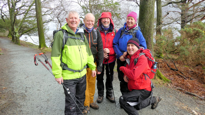
 Ed and Myles after lunch
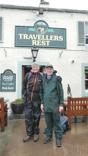
| Another group, Ed, Myles, Judy, Dave and Mike G, set off bit later when the rain eased off a bit, towards the Greenside Mines via Lantys Tarn and the high level path. Some of the group hadn't been to the Tarn before and wewre surprised at the location. Unfortunately the fine view over Ullswater had vanished in the low cloud. On arriving at the mines Dave and Judy decided that the rain wasn't bad enough at this low level and decided to head for Sticks Path (they got wet for thier troubles!). Ed, Myles and Mike decided to call into the Travellers Rest for a liquid lunch and dry off a little. A portion of chips appeared and was soon eaten. Both groups arrived back at the hut at similar times and copiuos ammounts of tea, cake and crumpets were devoured. Then it was a quick dash into the showers, change and head off to the AGM and dinner.
|
|
There were a few other highlights from the weekend for those who decided to not brave the terrible weather – swimming in the pool at the Glenridding Hotel, plenty of energetic table tennis competitions at the hotel and cream teas at the Lodore Hotel. After the weekend there was one unfortunate incident with poor Michele breaking a bone in her foot on the descent from Hart Crag.
On the evening of the 1st February the ABMSAC AGM was held followed by the AGM of the George Starkey Hut Ltd. Once these had finished it was on to the annual dinner.
 Guest speaker with James
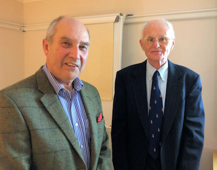
| This year it was held at the Glenridding Hotel and was attended by 49 people including some guests for the evening Tony Westcott, Chairman of the GSHL and his wife and Tom Curtis a director of the Alpine Club. The hotel served a splendid 4 course dinner which included choices from a good selection of dishes including Thai Fishcakes, Parsnip soup, baked pork tenderloin, pan fired seabass, chocolate lava cake and the groups most popular choice of dessert – sticky toffee pud! The formal parts of the evening were expertly managed as ever by President, James Baldwin. After dinner we moved to a separate room to hear the talk from our guest speaker for the evening, David Johnson. David is a former army officer who has had 30 years experience of leading or taking part in expeditions to the Arctic regions. He gave an absolutely fascinating talk with accompanying slide show outlining some of his Polar experiences including a 1999 trip when he and Glenn Morris became the first Britons to cross the Greenland ice-cap by Nansen's original route of 1888.
|
|
Back to Report Archive
