


We met at Cromford on a disappointingly grey and damp morning which prompted some of the party to fortify themselves with an early breakfast in the familiar Tor Cafe. Suitably replete we joined the rest of the party close to the famous 18th Century Cromford Mill, now a UNESCO World Heritage Site.
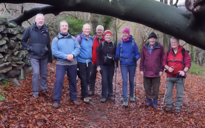
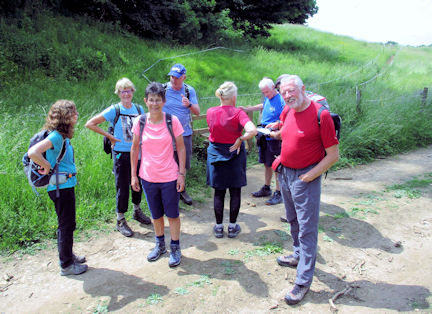
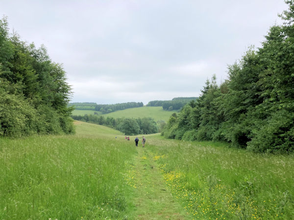
The group at the start
| 
Cromford Canal and Wharf
| |
The industrialist Richard Arkwright built it, taking advantage of the abundant rivers and streams thereabouts to power his patented water powered spinning frame. Now owned by The Arkwright Society it's a popular day out. Well worth a visit to see how it all worked, have a coffee and a wander across the road to look at the start of the Cromford Canal with its original wharf and Georgian warehouse.
A nice easy start along the bank of the Derwent River led us past the climbing venue of 'Willersley Castle Rocks'. This north facing limestone crag sees little sunshine and it shows. Andy Burton scaled these slippery heights in his youth and it remains a popular destination still for aspiring rope danglers. Cromford Village was next. A picturesque market place of varied architecture was the beginning of the uphill walk with Black Rocks as our target. As old as the Doomsday Book, most of the 'new' village was built courtesy of old Mr Arkwright who needed to house his growing army of mill workers. North Street has virtually unaltered examples of three storey terraced housing, far superior to those provided later by other entrepreneurs for their employees. Knitting frameworks lined the top floors worked by dad whilst mum and the kids went down the road for a twelve hour turn in the mill.
Some of these have been beautifully restored inside and are self catering short stay accommodation. Very cosy and ideal for anyone visiting the area for the first time looking for something different.
The huge mill pond in the village used to supply old Arkwright's water wheels down at Cromford Mill. A lovely place when the sun is shining and a pint outside The Boat Inn overlooking the water is to be recommended.

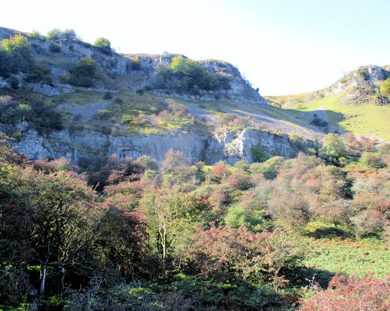
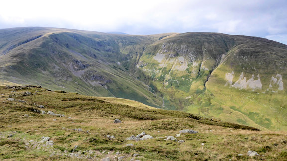
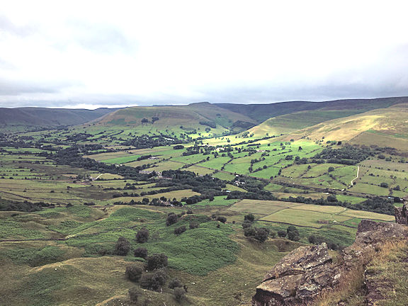
Murky Black Rocks
| Turning up Bedehouse Lane we took the steep path passing houses, old cottages and through woodland to Black Rock and The High Peak Trail.
The weather was still against us and the usually magnificent view from top of the Rocks was lost somewhere in the heavy mist shrouding the whole valley. A disappointment for me not being able to share such a panorama with those visiting for the first time.
Note from Ed Bramley- It’s where I first did any climbing as such, aged 9, when the High Peak railway still ran alongside, and many an epic tussle with the gritstone since then, some of them in big alpine boots!
| |

Engine House at top of incline
|
| Undaunted we took The High Peak Trail eastwards towards the Cromford Canal. This is the footbed of the 19th century Cromford and High Peak Railway. No mean feat of engineering today but this was built by big lads with shovels and wheelbarrows and no hard hats, paid in shillings and beer. Our route is more or less level to start with, and then down the Sheep Pasture incline, which the wagons used to be hauled up, including round a bend at half way. At the base of the incline, where the track passes under the A6, is a catch pit, to stop runaway wagons, which could reach speeds of 120mph. Waggons were pulled up the inclines by steam winding engines and lots of chains. The remains of the winding houses are still in situ.
| 
Catch pit at bottom of sheep pasture incline
| |
The long descent found us at High Peak Junction on the bank of the canal. These old railway buildings provide a shop and facilities during the summer season but still have tables aplenty for winter walkers and here we had lunch in relative comfort.
The Cromford Canal once stretched 15 miles from those wharf buildings, mentioned earlier, to The Erewash Canal. Our old pal Mr Arkwright unsurprisingly had some say in its making as he wanted to shift his cloth from his mill in the direction of civilisation.
To keep it topped up the nearby Leawood Pump House still houses a working beam engine. This huge pump draws water from the River Derwent below and delivers four tons of it into the canal at each stroke. At seven strokes a minute it's no wonder restrictions were once put upon how much water it could access every day.

Leewood Pump House
|
| It sits at one end of the Derwent Aqueduct which spans the river and at the other stands the much locally loved Aqueduct Cottage. For many years just a roofless shell, lost amongst the trees and ivy reclaiming its crumbling walls both inside and out, volunteers have restored the roof and patiently wait for the walls to dry out before plastering and pointing can be done.
| 
Talk at Aqueduct Cottage
| |
It took some doing arranging with 'Ron', the project manager, to have his lads working on site at the precise moment we happened along. Still, busy though he was he was more than happy to share with us what has been achieved thus far and the aims of all their unpaid efforts.
The walk continued along the now sadly reed strewn canal before leaving it at one of the short tunnels on the route. The twitchers amongst us were taken with Moorhens and Dabchicks darting amongst the vegetation floating along the far bank.

Heather in particular had binoculars trained on a bird hiding motionless in the greenery and her fixation piqued the curiosity of us all. Somewhat embarrassing then to admit we had all been staring at an oak leaf!. Apparently the Dabchick's neck turns brown in winter just so it can be mistaken for a leaf but then nature is wonderful isn't it. | 
entering tunnel on the canal
| |
After that it was a steady walk through the deer park of Lea Hurst, the childhood home of Florence Nightingale and later her summer holiday home. It has an impressive aspect overlooking the Derwent Valley and hills beyond and is now a private residence where you can stay in comfort if you can afford it.
We descended to the roadway and a short walk took us over the centuries old Cromford Bridge and back to the start of the walk.
A well deserved cuppa and cake was subsequently enjoyed in Arkwright's Cafe which is in the confines of Cromford Mill. Very enjoyable it was too.
Not a long trek. About 8 miles but varied in scenery and a chance to look at some of Derbyshire's industrial past.
Lovely company again made for a great day!
Report by Steve Caulton with additions from Ed Bramley
Only four participants braved the cool and cloudy weather to enjoy our day walking around Hinhead Common and the Devils Punchbowl. We started our walk from the National Trust car park in Hindhead at 0930.
The start of the walk saw us mingling with many local dog walkers initially descending into Hindhead Common and into the forested hills which are a common feature in Surrey. We managed occasional glimpses of the surrounding countryside whilst following the leafy paths. The last part of Hindhead Common was a climb to the top of Gibbert Hill. There are spectacular views in most directions and an information board describing its gory past. The last hanging at this point involved three sailors accused of murdering a local man whilst returning to their ship in Portsmouth.
After our coffee break we walked on to the ridge on the side of the Devils Punchbowl which is a lovely geological feature. Whilst walking on the old Portsmouth to London road (A3 before the new tunnel) we stumbled across an old directions stone which stated that Hyde Park Corner was 39 miles away. We stopped for lunch by a babbling stream with water meadows. The route took us through some leafy hamlets and across a heather moorland until we came to the 2.5 mile gradual ascent back up to the car park along the opposite ridge of the Punchbowl. On arrival our 14 mile route was completed and we celebrated with a National Trust cream tea.
Thanks to Mike Goodyer, Judy Renshaw and Mitch Sneddon for the great company.
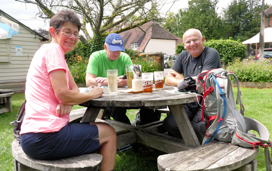
Report by Paul Stock Maps of the walks are available. The morning started cold and crisp, with many of our 10 having availed ourselves of a little pre-walk sustenance at the Aisseford tea room. Our route started over the old sheepwash bridge at Ashford in the Water – pose for obligatory photo – before heading out to the A6 and the track that runs alongside the river Wye.
After the initial tussle with that main artery over to Manchester, we quickly leave it for quieter tracks, passing beside magpie sough, which in olden times used to drain the land served by the Magpie lead mine at Sheldon, and also pass a water mill that featured in ‘Robin Hood, Prince of Thieves’. To get round some of the riverside bluffs, our path is a rising track through woodland, and we are rewarded with the last of the autumn colours as we make our way up the Wye valley. Eventually our track descends and after a coffee and loo stop (very thoughtful), we recross the A6 and continue on upstream, where the scenery is now mixed grassland and open woodland. At one point, we pass a herd of cattle in the trees and by the path but, in contrast to some herds we’ve encountered, these are very docile.
Shortly before the iconic Monsal Head viaduct, we arrive at a weir across the river, with a pair of swans adding their tranquillity to the scene. Ignoring the published route, we cross the river at the small bridge and take the steady rising ascent, directly to our lunch stop. It’s great when local knowledge of one of the party makes life so much easier.
We are all bold and sit outside in the increasing wind and cold for our lunch, just so that we can admire that view, but then succumb to the joys of Hobb’s tearoom for a cuppa (and perhaps a little more), before descending to the viaduct and the Monsal Head trail.
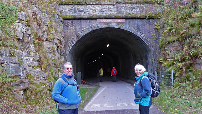
We go through the Headstone tunnel, these days with a tarmac base and full lighting, and continue on through the Derbyshire countryside. Strange to think of this as this being at one time Midland railways link between London and Manchester, with the northern leg of HS2, and NPR having been cancelled the day before! On the old trackbed we pass Thornbridge Halt, which was the one time station for Thornbridge Hall – part of the bargaining done to allow the original route of the line.
After some distance, our route then goes cross country along a bridleway and track, before descending to the western outskirts of Bakewell. After initially following the A6 out of the town, and past a newly built supermarket, we then end up on a track that cuts round the back of many houses, before rejoining the river, and a simple path back to our start.
Attendees: Ed Bramley, Steve Caulton, Heather Eddowes & Dave Matthews, Pete & Jane Hammond, Tony Howard and partner (Roma), Dick and Lin Murton
Report by Ed Bramley
This was another one of my walks into pre-history in the Wiltshire countryside. Despite injury and illness cutting our numbers four intrepid walkers arrived promptly at the NT Uffington White Horse car park (actually in Oxfordshire).
It was an overcast morning and a bit chilly, but fortunately little or no wind. This meant brisk walking and short breaks were in order.
Our first ancient site was visible from the car park - the 5500 year old white horse. We walked up to the horse, passing Dragon Hill. Although there were open views across the countryside the white horse isn't totally visible from the ground - only from the air!
The Iron Age hill fort just behind the white horse is a huge double ditch and earthwork complex - very similar to Barberry Castle a few miles down the Ridgeway. We headed off down the Lambourne Way, expecting the path to be very muddy but the walking was fine. After a short coffee break an hour or so into the walk we headed off downhill, crossing arable fields and along farm tracks and then skirting around Ashdown House and forest. On the way we passed stone circles and burial mounds. In what seemed no time at all we arrived at the Bronze Age Ridgeway track. In recent years this ancient track has suffered erosion by overuse from SUVs churning up the surface for their 'fun'. The introduction of 'tank trap' blocks at strategic points along the way has helped the situation. Our part of the Ridgeway was in good order. We saw several cycle groups and a few horse riders on the Ridgeway. As we were approaching a path crossroads we felt it was arounf lunchtime - and were pleasantly surprised to see a 'pop up' mobile cafe in a farmyard. We all enjoyed a hot drink (and more for some) and a sit down!
After our comfortable lunchtime stop it was but a short walk to Wayland Smithy, a Bronze Age burial mound. This is a huge structure and is totally enclosed by beech and oak trees - it has a special atmosphere. We all took a moment to take in this place before completing the last mile back to the car park.
An easy walk through interesting countryside - 13 miles and 900'of ascent.
Thanks to Judy, Margaret and Paul for their company. Paul and I rounded the day off with a pint and a warm by an open fire at the White Horse at nearby Woolstone.
Attendees: Mike Goodyer, Paul Stock, Margaret Moore and Judy Renshaw
Report by Mike Goodyer Maps of the walks are available. The first day of the 2021 President’s Meet dawned unexpectedly fair and so afforded the opportunity for arriving members to grab a little extra time on the hills, some with a quick sprint up Place Fell, others enjoying the reverse vista of the Helvellyn range from above Pooley Bridge.
The moody, low moorland at the northern end of Ullswater looks, at first glance, like an empty, featureless place, but closer inspection reveals a landscape dotted with Bronze Age mysteries. Many of the depressions are shake holes, naturally formed by the interaction of water and the underlying limestone. The most impressive of these remains is the Cockpit Stone Circle, estimated to be between 3500 and 5000 years old. Like other stone circles in Cumbria, such as Castlerigg and Long Meg and Her Daughters, it remains an enigma. Whatever its ancient origin, it presents a beautiful view across Ullswater towards Glenridding and Patterdale, the usual starting point for club activities in these hills. Saturday saw three groups of varying ambition leave the hut in reasonable weather, with low cloud and a gathering south westerly making for lively sailing conditions on the Ullswater steamer.
The wind forecast also revised the main group’s proposed route up Nethermost Pike to the plateau, heading instead straight for Grisdale Tarn (very gusty), over Dollywaggon to a considerable gale on Helvellyn and down via Sticks Pass. On the way down from Sticks they passed a wet DofE group on day one of their Silver expedition, what a weekend to have chosen. After a nifty 5 hours they were back for tea in the hut by 3pm.
Aira Force was another choice on the day, where fallen trees and branches have caused havoc in the lower falls, then on to the bracing summit of Gowbarrow Fell. The car park at the entrance to the falls was also a staging post for three members who chose the undulations of the Ullswater Way, again from Pooley Bridge, through lush farmland, bracken coated hillsides and glimpses of the lake, to the gusty promontory of Skelly Neb where even the sturdy tourist boats were turning back for shelter.
The President’s dinner was a delicious menu of avocado bruschetta (on secret recipe toast), red pepper soup, chicken on celeriac mash with gorgonzola sauce and veg, bread and butter pudding and an array of petits fours, provided in fine style by Andy and a team of happy helpers in the Starkey kitchen.
The President’s dinner was a delicious menu of avocado bruschetta (on secret recipe toast), red pepper soup, chicken on celeriac mash with gorgonzola sauce and veg, bread and butter pudding and an array of petits fours, provided in fine style by Andy and a team of happy helpers in the Starkey kitchen.
All this in the excellent company of Daniel Albert, the ABM Covid advisor. It is reassuring to know that the observance of unlocking rules and hut safety have been considered by the club and balanced with common sense to ensure our continued freedom to roam in high places.
Sunday morning was atrocious but, undeterred, there were two low level excursions to blow the cobwebs away and some Christmas stocking fillers were tracked down in the Glenridding Craft Market by the less adventurous contingent.
Mike and Paul ventured out up the steep path towards St Sunday Crag and shortly after the first gate broke off the path to climb a faint trod upto the Birks.
It may be too soon to say, but 2022 is looking good – or better at least!
Finally the President would like to give a big thank you to Andy Hayes and Ian Mateer and the cooking team for another great meal in good company.
Maps of the walks are available.
Attendees: Andy Burton, Heather Eddowes, Julie Jones, Andy Hayes, Ian Mateer, Mike Goodyer, Don Hodge, Judy Renshaw, Paul Stock, Daniel Albert, Mike and Marian Parsons.
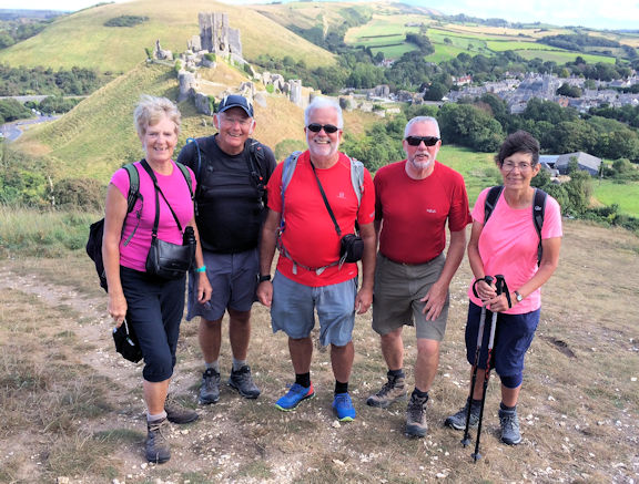
Report by Julie Jones (with additions from Andy B and Mike G) It was a good feeling on the Friday to pull into the car park of the New Inn at Bwlch for another meet in the Brecon Beacons. Neil, the owner, had used the Covid lockdowns to modify the bunkhouse with a new kitchen and less bunk rooms. The pub has also had a makeover. As we were later to find out the beer and food were up to the usual standard. So, in my opinion, a general improvement. In the afternoon five of us walked up the Beacons Way along the ridge to top of Mynydd Troed, over looking Llangors Lake to get an appetite for dinner. The sun broke through the clouds in the late afternoon and we could see the top of Pen y Fan was just in cloud.
In the evening seven of us enjoyed a good meal and the comforts of the bunkhouse, while four others were enscounced in a cottage near Brecon.
On the Saturday the cloud was low, but undeterred we had the Brecons Horseshoe complete. The group of four spent the day on Fan Fawr, with glimpses through the cloud (On Friday they were on Pan y Fan).
The bunkhouse crew all sent off from the Storey Arms in the gloom and headed up the well laid path up to Corn Du. Despite the weather the top two car parks were full by 9:30am, a busy weekend. On the way we were passed by what seemed most of Army heading down to the lorries waiting at Storey Arms (- end of a route march?). We reached the top in cloud, along with many other walkers.
It was an atmospheric day with glimpses of the mountains of the horseshoe throughout the morning. After decending from Pen y Fan Andy and Steve broke away from the ascent of Cribyn to follow the Taff Trail/Beacons Way back to the bunkhouse via the Talybont Reservoir and the canal - total of 16 miles ( A project of Steves - Good effort! See below for a personal account.). The rest of us continued up Cribyn and the cloud lifted and we had better view. After a lunch down near the dismantled Neuadd Reservoir we headed up to the Graig Fan Ddu ridge back towards Corn Du and down the path to return to the busy car parks.
A clear and cold morning greeted us on Sunday. The weather improved as the morning went with a warm sun and little wind.
Nine of us drove down to Crickhowell and had a pleasnat walk from the town to the Llangatwg escarpment and disused quarries.
We then followed the old tramway round to the old quarries/nature reserve, taking in the views and spotting ravens. After lunch we returned, via a gentle descent through a series of fields, to the canal and old lime kilns. We leisurely walked along the canal before turning off to get back to Crickhowell.
A great weekend with good food and company. We were all sorry that Paul, the meet organiser, couldn't make the weekend. We're already looking forward to returning next year. With apologies to HG Wells -
And so it was that Andy and I took up Mike's kind offer of a lift to The Storey Arms where
the whole meet gathered for the walk up Pen-y Fan. A steep ascent for dodgy knees but
the only one of the day for Andy and myself.
Our route called for no more climbing as time was of the essence.
On the descent to the base of Cribyn, the grey mist lifted to show our footpath Southeast along The Beacons Way National footpath. That magnificent trek snaking its 99 mile way from Abergavenny through The Beacons and the Black Mountains to its finish at Llangadog. At the bottom of the mountain we said our farewells to the intrepid climbers and with a wave worthy of Mallory and Irving we struck out along the stony path heading for the slopes of Fan-y-Big. There it seemed as if half a dozen coach trips had decided to go up at the same time and it was no disappointment to save that undertaking for another time.
No mist now and a clear view ahead as we took a flat and straight path South towards Torpantau and the Taf Fechan Forest.
We passed the now waterless Upper Neuadd Reservoir with only a seeming trickle of the Blaen Taf Fechan itself meandering through. The austere looking Victorian dam has given Welsh Water some headaches for many years. Leaking and cracking badly it's a work in progress but worth the effort. Concerns over climate change have reprieved this grand old lady as a valuable future asset against the increased water demands of the good people of Merthyr Tydfil. This current moonscape lies between steep escarpments of mountainous moorland and years hence will see this catchment return the reservoir to a rippling, reflective expanse of clear water, once more mirroring the attributes of Pen-y-Fan, Cribyn and Corn Du.
We were soon amongst the trees of the Taf Fechan Forest and glimpsing white columns of smoke as we walked along an obvious man made embankment from long ago .Accompanying unmistakable sounds of a steam whistle excited the schoolboy in us and we discovered the Torpantau terminus of The Brecon Mountain Railway. Running northwards from Pant above Merthyr Tydfil, this ten mile return ride skirts the Pentwyn and Pontsticill Reservoirs through a green and pleasant landscape. Now a narrow guage railway it was, until the 1960's,a grown up's size. Wonderful little old engines that look like they should be wound up make this a tourist treat. The ride has gone on the to do list.
Around the corner was the metalled Forestry roadway Eastwards which would take us all the way to the Talybont Reservoir. Time had come for some well deserved lunch and we tucked into our respective tuck boxes, looked at our map and decided it would do us no harm to bolster ourselves with a tot or two of Glayva. For medicinal purposes only of course and we were on holiday after all.
Nearby was the Caerfanell River and its tributary the Nant Bwrefwr. Beginning high up on the plateau East of Fany-y-Big she flows down the valley through wooded hillsides a full ten miles to comprise the Talybont Reservoir and swell the waters of the River Usk .A two mile stretch of these waters holds twenty waterfalls of a most picturesque aspect and from our lunchtime viewpoint we could see the one nearest. A popular visitor attraction with ample car parks to make them worth the drive to see.
Fortified by Scotland's finest we set off at a good pace, aware we still had half the walk to do. An easy surface made for good speed along the tree lined track for around four miles with snatched glimpses of the impressive Talybont Reservoir spurring us on. Before we blindly carried on downwards to the waters edge Andy fortunately spotted the waymark we needed to ascend to higher ground and the route to Bwlch-y-Waun farm. From this path we were afforded the most spectacular views of the Reservoir as it stretched full length towards its dammed extremity and the pretty village of Talybont-on -Usk. The tree spotted valley slopes carpeted with multi shaded grasses and wild foliage were perfectly reflected in the still surface waters and the sky and clouds mirrored in sharp detail.
We left this glassy fascination at the foot of the familiar Tor-y-Foel and took the muddy footpath through farm buildings that can only be described as a model of shambolic neglect and with an impressive collection of motoring paraphernalia and ancient Austin's I haven't seen since the first series of 'All Creatures Great and Small'.
Who said farmers are the custodians of the countryside?
Well beyond this scrap and rubbish the path continued along natural terrain and through more pleasing countryside, passing isolated ancient barns and patches of woodland. The nostalgic smell of woodsmoke greeted us as we passed through the busy little farm at Llwyn-y-eos with its excitable dogs and vast array of complicated looking machinery.
After that it was a stroll across the fields and meadows with curious faced, chubby bodied sheep watching our every move.
I like sheep. They don't try to tread on you like cows.
And then we were at the lock gates on The Monmouthshire and Brecon Canal where we crossed over onto the north side towpath and headed for the unpronounceable village of Llangynidr. It's always a pleasure to walk alongside a canal and we thoroughly enjoyed the boats with their quirky paintwork and eccentric decorations. One had a full sized wooden lady sitting on the pointy end quite proudly, considering whoever created her had carved her with no clothes.
As we neared the bridge over the waterway, by the side of the Coach and Horses pub, I was taken with a craving for a cold Guiness. Understandable under the circumstances but the voice of commonsense in the form of the club President wrestled me back from temptation and we pressed on.
Llangynidr is a quaint little place with the very nice Walnut Tree Cafe down by the waterside. Well worth knowing and which we have used before. The road to Bwlch crosses an impressive, narrow, 18th Century stone bridge with five arches. Built for horse and cart its single file traffic only with refuge points for walkers caught halfway across. It spans the fast flowing River Usk and is as scenic a location as you would find anywhere.
It's a long pull up from the bridge to The New Inn and wanting to finish in time for dinner we upped the pace. Now the prospect of a mug of hot sweet tea was all the carrot we needed.
My dodgy knee had done me proud thus far but I confessed to Andy that my legs felt like jelly.
An unsympathetic "What flavour?" was not the reply I expected but he had long finished his Haribo's and I think he was hallucinating a little. Where the road met the A40 we turned up the driveway of Cornerways House and the permitted path took up sharply uphill through old gates and lush grass to Darren Road. This was a sting in the tail but with no more to come this last half mile was spent green eyed at the new builds and improvements done since last we passed.
All in all a great day. 17 miles of grand and dramatic landscapes, fresh air and greenery, watery splendour and great company. An ambition fulfilled for us both and a walk likely to be repeated another year, knees and Haribo supplies permitting!.
Maps of the walks are available.
Report by Mike Goodyer (and Steve).
Attendees: Ed Bramley, Andy Burton, Steve Caulton, Mike Goodyer, Judy Renshaw, Rick Snell, Alison Henry, Michele Pulsford, Marcus Tierney, Mike and Margaret O'Dwyer. After locating the entrance to the hostel from the Swanage one way system the weekend kicked of on Friday afternoon for most of the meet attendees with a walk along the Swanage promenade and up and over Ballard Down to reach the headland with Old Harry’s Rocks.
The return trip involved a walk along the sandy beach back into Swanage town centre.
Saturdays weather was definitely not as forecasted and began quite dull with low cloud. We set off from the hostel and headed through via Peverell Point to Durleston Park. The Durleston castle and it’s Globe were very quiet and we enjoyed the rising path to Durleston Head.
Our hostel host had advised us to take the upper path along the coast to Dancing Ledge. On arrival at Dancing Ledge we split into two teams one returning to Swanage via the Priests Way from and the other pushing on further along the coastal path to Seacombe cliff and Winspit then turning inland to Worth Maltravers.
Sunday’s walk started from the National Trust Car Park at Corfe Castle. We set off through the town of Corfe Castle and onto Corfe Common which is a natural heathland. We followed the footpath through fields and woods to the west of Kingston. Here we took the road to the car park at Polar Wood and then the footpath to Swyre Head.
As the weather was much better than forecasted the views were spectacular right down to Durdle Door and beyond in the West and the Isle of Wight in the east.
I would like to thank all the attendees for their participation in what is an unusual venue for an ABMSAC meet however, I make no apologies for its inclusion in our meets calendar as the Isle of Purbeck has many attractive features for our club from walking and mountain biking to challenging sea cliff climbing.
Maps of the walks are available.
Report by Paul Stock.
Attendees: James and Belinda Baldwin, Andy Burton, Heather Eddowes, Mike Goodyer, Julie Freemantle, Judy Renshaw, Don Hodge, Margaret Moore and Paul Stock.
At last a meet at the hut, my first for 21 months. It was very nice to be there after such a long break. We arrived on Sunday evening in the sunshine and quickly settled in with a very nice chilli con carne made by Mike Goodyer and a couple of glasses of red wine.
On Monday morning we arranged to meet the non hut dwelling meet attendees at the Glenridding pier to catch the earliest ferry to Aira Force. The skies were cloudy with occasional peaks of sunshine.
We set off along the new Ullswater circular path towards Swinburn’s Park passing the memorial seat above Yew Crag.
Close to the shooting lodge we turned west and headed to the summit of Gowbarrow for our first coffee stop. The views from here are truly spectacular and with the visibility towards the Helvellyn range shrouded in spectral cloud Catstye Cam stood out really well. After Coffee we make our way down a rather well trodden path to Dockray. In fact, so well trodden that a team from 'Fix the Fells' were hard at work trying to repair it. We had lunch and some refreshments at the pub in Dockray.
After lunch we took the path over Watermillock Common to the mouth of the Glencoyne valley. We traversed around the head of the valley to Nick Head. The path was an absolute treat and gave us some great views. From here we passed over Sheffield Pike, Heron Pike and Glenridding Dodd and down into Glenridding to follow the roadside path back to the hut. The evening was spent contemplating our next folly whilst devouring a home made Spaghetti Bolognese (thanks Paul, Editor) with a few glasses of red wine.
On Tuesday morning we set off from the hut for a short drive to Troutbeck to begin our ascent of the western side of the Kentmere horseshoe walk. We followed the old cart track up to Garburn Pass. At Garburn Pass we took the Kentmere Horseshoe path over Yoke, Illbell, Frostwick and on to Thornthwaite Crag.
On Wednesday we opted for another assisted start and purloined a lift from Andy Burton to Bridgend. From here we took the path along the Hartsop above How ridge to the summit of Hart Crag. On arrival at the summit we were afforded some tremendous views across the Lakes in all directions. We followed the path to Fairfield via Link Hause and Scrubby Crag. We took lunch at one of the shelters on the top of Fairfield in the warm sunshine.
After lunch we descended to Deepdale Hause via Cofa Pike and onwards to the summit of St Sunday Crag. We diverted from the usual descent from St Sunday Crag to take in Gavel Pike. From the bottom of the engineered path from the Birks we turned South East and followed the path to the rear of the Patterdale Hotel. As it had been a warm day we felt the need for some refreshments in the beer garden of the White Lion. On return to the hut we were rewarded with a splendid pasta dish from Ed Bramley washed down with a couple of wines, of course.
On Thursday, as the weather forecast not being as kind as the previous days and the need for an early departure for home for Mike Goodyer and I, we opted for a swift walk over Lantys Tarn and followed the water course path to Greenside mines and back to the hut. An old favourite when the weather isn’t too good.
On the second day Mike O'Dwyer, Michele and I walked up Grizedale splitting up at the junction for Mike to head up to the top of St Sundays Crag. Michele and I continued to climb Pinnacle Ridge. I believe Mike continued on his own to Fairfield and onwards to Red Screes before descending back to the valley.
On the third day Andy, Lynne, Gail, Mike, Michele, Karen, Margeret and I walked up to Brothers Water and back.
Although we couldn’t enjoy the trip to the Picos Mountains as was in the original 2021 meets calendar the Lake District didn’t disappoint us. Many thanks to all who turned up and enjoyed a few days of fun in the sun and mountains. Maps of the walks are available.
Report by Paul Stock. Attendees:Andy Burton, Ed Bramley, Mike Goodyer, Marcus Tierney, Michelle Pulford, Mike and Margaret O'Dywer, Karen, Paul Stock, Gail and Lynne Burton(visitors).
Mary, Nan and prospective new member Laurel arrived in the hut on Thursday evening to the warm treat of an Andy Burton ‘El President Pasta bake’ and a lovely bottle of red. It was the perfect way to begin the first new members meet since spring 2019. A trip to the fells was certainly a long time coming for the majority of us.
With the usual evening poring over maps and route planning chat, it was agreed that the next day the four of us would walk from the hut up to Angle Tarn via the Hause at Boredale, with a view to going for a swim in the tarn should the conditions suit. Friday morning brought a slight inversion with patches of pale blue sky down alongside the Goldrill Beck. With the promise of an improving forecast later on in the day we set off up to the tarn, which greeted us with a cool moody raiment that couldn’t quite tempt anyone for a swim.
Continuing on up through the Knott and turning left at the Straits of Riggindale onto the Roman Road (High Street) we took the path off right up to Kidsty Pike at 780 metres. Here we had lunch overlooking Riggindale which cleared so we could see both the herd of around 60 red deer grazing on the slopes directly below us and out to Haweswater and the path over Gatescarth Pass towards Longsleddale. It was a pleasure to sit amongst the moss and lichen covered rocks, and drink in the views all around us, almost witnessing them anew. Reluctantly we left our lofty craggy perch and retraced our steps back to Angle Tarn where Mary, Nan and Lauren tarried at the water's edge as a group of wild campers started to pitch up nearby.
We returned back to the Hut and Patterdale just in time to get into the White Lion and secure a couple of tables with Heather leading the way. The rest of the party, still travelling along the Friday motorways of Britain, were hungrily anticipating the infamous fish and chips, curly cumberland and local ale awaiting in the cosy pub.
The group steadily grew to a total of 13. Meals and drinks of choice were provided for everyone, not always a given in the post Covid-19 era of pubs doing their best with either limited or no staff from time to time. It felt quite surreal to be altogether in the physical after so long apart and having mostly only seen each other on screens for 18 months.
Friday night was a hearty homecoming to the Patterdale regulars and a warm welcome to faces new the area and the club.
On the rainy Saturday morning two separate groups emerged from the hut bunks, one going with Mike Parsons up St. Sunday Crag to look for the Brothers Parting Stone situated en route.
The other staying beneath the low cloud and drizzle, heading for the Glenridding pier to catch the 9.45am ferry to Howtown.
This group took their time time to walk back along the lakeside path, through Sandwick and under Place Fell, stopping to read stone carved poetry, eat soggy picnics and delicious ice cream, and then finally have a swim and lakeside beach snooze with the swans near Silver crag.
The group higher up enjoyed discovering Mike’s off piste paths, bog navigation and then fantastic views of the valley once the clouds parted.
The traditional Saturday evening butternut squash curry was prepared by Mary and friends and enjoyed by all. After dinner Mike Parsons gave an interesting talk on how to choose your clothing for a day out on the fells, answering questions and explaining the different properties of traditional and modern day materials used in outdoor gear.
Then for some board games fun and cosy chat before a not too late night to bed for all.
On Sunday morning, most people made their way up to Kirkstone Pass for a short excursion up to Stoney Cove Pike along St. Ravens Edge. Worth it for the views out along Windermere to the coast at Barrow and beyond, as well as the views back into the mountains where everyone had been enjoying themselves during the previous couple of days. Tired legs and energised souls made their way home after this much needed time in the Ullswater valley.
There were four expressions of interest in joining the ABMSAC from attendees, plus two post pandemic membership renewals; the icing on the cake of another excellent New Members Meet in 2021.
Welcome back everyone! Thanks to Heather, Daniel, Mike and Marian for your help and support in making it such an enjoyable weekend.
We’re really looking forward to the new ‘Refresh/Improve Your Skills Meet’ 8-10 April 2022 which will replace the ‘New Members Meet’ and focus on training and developing skills for all members, new and existing.
Meet attendees: Andy Burton, Nanette Archer, Laurell Turner, Mary Eddowes, Simon Palmer, John Aouad, Heather Eddowes, Daniel Albert, Karen Dickinson, Rachel Howlett, Martha King, Paul Clarke, Mike Parsons, Marian Parsons.
Report written by Andy Burton and Mary Eddowes We were very fortunate to have dry calm weather which helped us do outdoor jobs as well as indoor ones.
Marian (the Hut Warden) had prepared lists of tasks, of which many were of a routine annual deep cleaning variety. Much dusting, cleaning, scrubbing and tidying was attacked with vigour, including the dreaded cupboards which had acquired a layer of dirty mould on the walls. Tony attacked the job with his usual enthusiasm, while Suzanne polished the cobwebby window frames outside until the spiders positively glowed. She did much the same with the hearth, but no spiders benefited.
Paint was applied to the bare areas on the mens' dormitory ceiling and the washroom ceiling where repairs had recently been made.
Marta had a particular flair for wielding the paint brush liberally wherever there was a scar or a mucky bit of wall, and Graham and Sharon scoured out the drying room to a sparkling finish. Paul and Judy sorted out the kitchen and gave it a good spring-clean, and Mike Dunn cleaned, scrubbed and polished the dormitories and washrooms, after clearing out the gutters.
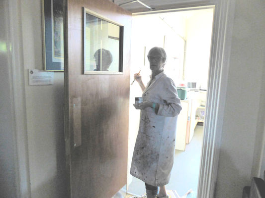
Heather gave the new kitchen fire door multiple coats of varnish, as the bare wood was actually quite nice and paint would have added unwanted thickness anyway. The front door had to have some filler and paint too, as it was scarred and weathered with layers of paint lifting here and there.
Don, our hut maintenance guru of long standing, was more or less everywhere at once, beginning with pruning the trees round the car park, and moving in to address all sorts of fiddly maintenance jobs and problem areas that only he understands how to fix!
Everyone did more tasks than I can put their names to, since I seem to have lost the tick list, but we finished with a nice sociable meal on Saturday night, and by then everything had been ticked off.
Many thanks to these kind folk who turned up to help make the Hut so much nicer for everyone.
Attendees: Don Hodge, Judy Renshaw, Paul Hudson, Mike Dunn, Marta Mills (prospective new member), Heather Eddowes, Tony Westcott, Suzanne Strawther, Graham Uney, Sharon Kennedy, Mike Parsons, Marian Parsons.
Report by Marian Parsons.
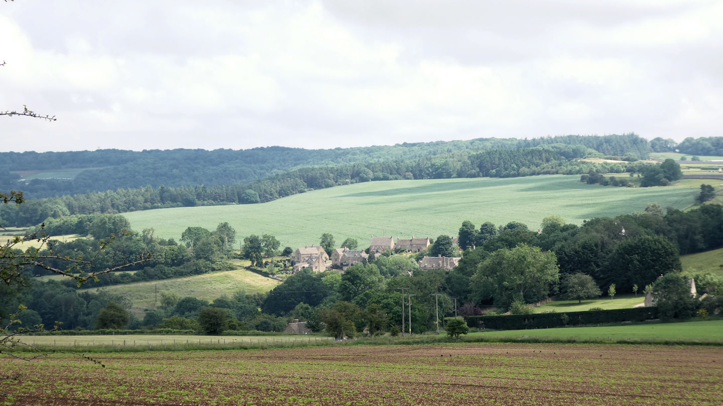
We all met at the renovated and extended yet still free (but donations appreciated) Coldwell End car park, on the western outskirts of Youlgreave.
We set off down to the River Bradford before continuing along this lovely river valley to a point where we joined the Limestone Way briefly before striking uphill towards Harthill Moor Farm with its neighbouring Castle Ring.
Harthill Moor is a rich prehistoric landscape with several protected Scheduled Ancient Monuments. Crossing the road, after helping an elderly man from the farm start his lawnmower brought the Nine Stones Close Bronze Age stone circle and separate standing stone into view.
Here we walked between the ancient stones and the much older parent rocks of Robin Hood’s Stride (also called Mock Beggar Hall?), very busy with boulderers and their mats. At the side of the woods containing the Hermit’s cave we caught glimpses of the much larger Cratcliffe Tor, which provides more challenging rock climbing with over 200 graded routes.
On reaching the road we did a little zigzag to gain a path on the other side that took us up and round Rocking Stone Farm and alongside Birchover Wood to cross the road again and drop down to the ancient stone paths that lead to and from Winster. Here we had lunch at the newly completed play area/fitness park tucked away below the village, before wending our way through the village past the church and through at the side of the cemetery to re-join the Limestone Way, before turning left into Elton to avoid the normally very boggy path round the back of Elton.
Here we again negotiated a little zigzag in the village back street to find the actual footpaths out of the village. Expansive views opened out towards Gratton Moor and Middleton as we crested the hill and walked down to the road. Then back up Cliff Road to the site of the spring water troughs at the edge of the former Bury Cliffe quarry that up until 1940 provided fresh water for the village of Elton.
Here some exploring was done as we made our way across the in parts marshy landscape to Rock Farm with its stand of large old Scots pine trees towering above. With a bend in the road having pushed the recent heavy rains across the footpath causing some alternative diversions to be used, we eventually ended up back on the banks of the River Bradford where we made our way up the gently shelving footpath through the trees back up to the road close to where we had parked the cars.
Todays 10-mile stride in perfect walking weather was enjoyed by seven members.
Atendees: Andy Burton, Martin Whitaker, Pat Cocks, Dick Murton, Lyn Warriss, Michele Pulford and Marcus Tierney.
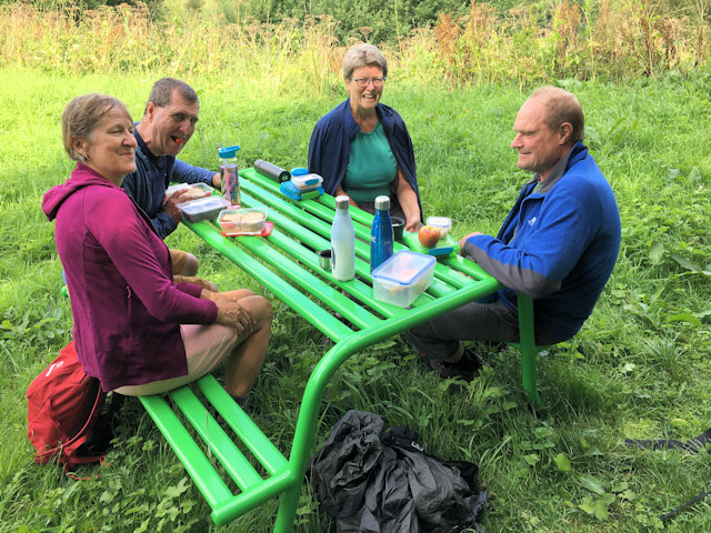
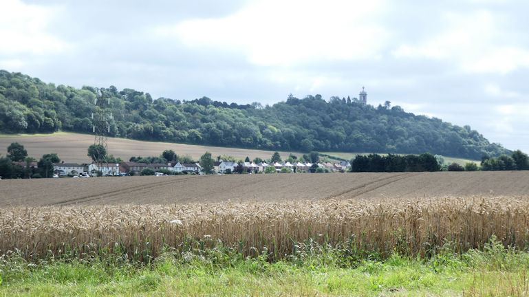
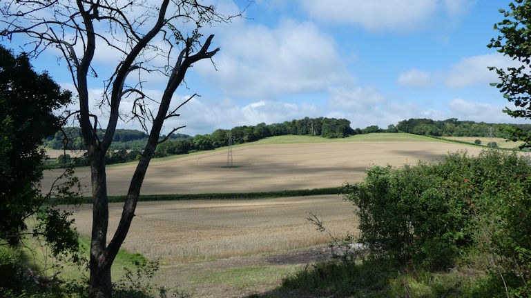
Report by Andy Burton. Five club members met for the August walk, after two had had to drop out at the last minute due to family commitments. We were lucky to have the best day of the week for weather, with no rain and enough warmth and sunshine for shorts. We met at Wheeler End Common, just west of High Wycombe, and set off after being asked to move our cars away from the common but nearer to the pub (which turned out to be an advantage at the end!).
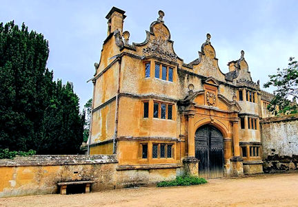
We went a short way down the road then across fields, over two ridges to the villages of Bradenham and Naphill. From there the numerous paths though woods required some assisted navigation with GPS as well as map and compass (much harder to navigate in Southern woodlands than in the mountains!) and into the grounds of Hughenden Manor. This was the home of Benjamin Disraeli, Prime Minister to Queen Victoria.
We continued via a viewpoint with a monument to Isaac D'Israeli, Benjamin’s father, then through woods and around the edges of High Wycombe to West Wycombe.
At this point one of the party stopped at the Hellfire Caves café to rest a problematic knee while the others ascended the hill to the mausoleum and returned over a few more hills to Wheeler End Common.
After some car shuffling most of us were able to stop briefly for refreshments at the Chequers pub. The total distance had been approximately 15 miles (24 Km) with 575m ascent, an enjoyable day out, in good company as usual.
Attendees: Margaret Moore, Mike Goodyer, Mike O’Dwyer, Mitch Sneddon, Judy Renshaw.
Report by Judy Renshaw Tuesday at 10am saw twelve members park up at the Mam Tor Nick National Trust car park.
After introducing three new faces to the usual suspects, we all set off up Mam Tor just as the mizzling cloud that had shrouded the higher hilltops started to clear.
By the time we had reached the top of the Shivering Mountain we were afforded clearing views into both the Edale and Hope valleys.
The Peak Cavern opening, which is the largest cave entrance in Britain, with the ruin of the 11th Century Peveril Castle sat above it was clear to see as we walked along the ridge. This castle featured in Sir Walter Scott's longest novel, Peveril of the Peak.
From Hollins Cross up onto Back Tor great progress had been made in repairing the path since most of us had walked that way last. By the time we got to Lose Hill and then down into Hope, Martin and Pat had taken an alternative path across the fields to Castleton, whilst the rest of us lunched in the grounds of Hope parish church in the sun.
Taking the bridge over the Peakshole Water, named because it runs from below Mam Tor and through the caverns until it joins with the River Noe just below Hope, we continued across the fields in front of the cement works (Home of the Edale Mountain Rescue Team) and into Castleton making our way through the side streets to the old village square and into the well-hidden Cave Dale. Here we walked underneath Peveril Castle with a clear view of the garderobe in the south-east face of the keep, (think toilet suspended over a long drop) and carried on up past the air vents from the Peak cavern with their mechanical sounding cool draft into the narrows before turning sharp right and traversing up out onto the grassy moorland above the castle itself.
Here Ian set off in search of the entrance to Titan whilst Marcus regaled us with the story of the finding of this massive underground limestone cave formation.
Passing alongside and through a series of the old lead mining rakes we ended up walking on the little road past Rowter Farm and across the fields inhabited by a mix of sheep flocks and smaller herds of cattle in front of Mam Tor back to the car park.
Attendees were: - Martin Whitaker, Pat Cocks, Pete Hammond, Dick Murton, Lyn Warriss, Heather Eddowes, Dave Matthews, Steve Caulton, Andy Burton, Ian Mateer, Michele Pulford and the walk organiser Marcus Tierney.
The Southern Walk started at East Meon, Hampshire and made its way up a steep path to the summit of Salt Hill to join the South Downs Way.
We then followed the South Downs Way towards Winchester, via Winchester Hill Fort and Beacon Hill. On arrival at Winchester Hill Fort we visited the pop up coffee wagon for refreshments.
Between the Hill Fort and Beacon Hill we stopped for a lunchtime beer at the Shoe Inn.
Lunch was taken on top of Beacon Hill with great views towards the Solent and the Isle of Wight.
After lunch we went down the opposite side of Beacon Hill to Warnford. Past the watercress beds which it is famous for and through a few undulating fields to West Meon.
From here we headed east through more arable fields, wooded hillsides and some more fields to return to East Meon. A total 17.5 miles and 2400feet of ascent. Not too shabby!
Attendees were: - Mike Goodyer, Margaret Moore, Mitch Sneddon and the walk organiser Paul Stock
This new addition to the meet calendar was designed as two one day meets over weekend. We had a total of 16 members and guests attend over the two days.the weather was kind to us and the promised rain held off during the walks, although it rained very soon after finishing Sundays walk.
Stanton and Snowshill round - Saturday Several of the group had not met up with each other since the Annual Dinner early in 2020. In addition it was an opportunity for new member Mitch and his partner to meet a few more members. The Cotswolds was a new area for several in the group and todays walk would show off the pretty villages that the area is famous for.
We set off through the village of Stanton and quickly joined the Cotswold Way heading towards Stanway. The rich colour of the stone was a feature of Stanway.
The Snowshill Arms was very welcoming with a lovely sunny beer garden and a range of Donnington Ales!
Suitably refreshed we left the village and headed onto the Winchcombe Way through woods and then towards Laverton - with a quick look on the map to make sure we took the right path. We were shortly back at Stanton. Afternoon refreshments were taken at the Mount Inn (up a steep hill) on the outskirts of the village, before everyone went their separte ways. Several members were coming along for the Sunday walk as well. Todays walk was around 8.5 miles with 1200ft of ascent. Seven Springs round - Sunday The walk today set off along the Cotswold Way around the escarpment above Cheltenham to Leckhampton Hill. The views were extensive, but slightly misty from the escarpment. A coffee stop was taken at the viewpoint on Leckhampton Hill.
After a short break we continued along the escarpment, taking in the views and enjoying the profusion of wild flowers including orchids. We dropped off the path slightly to see the Devils Chimney - a classic viewpoint of the Cotswold Way.
We arrived at Crickley Hill Country Park for lunch. Some people took advantage of the cafe and toilets. After a restful break we continued along the Cotswold Way. We had a good view across the valley of the downhill mountain bike centre on the side of Birdlip.
The next part of the walk was the most excitng - crossing the road at the Air Balloon roundabout! A kindly motorist stopped and let us all cross. After another short dash across the next road we were all safely on the Gloucestershire Way. Once we were on the Gloucestershire Way we were walking along fields and green lanes on the short walk back to Seven Springs.
We were all safely back at Seven Springs by late afternoon and the forecasted rain didn't appear.
Report by Mike Goodyer, photos from Mike, Mitch, Martha, Judy and Andy. This year’s Peak meet was preceded by an additional layer of Covid-19 admin in line with the BMC guidelines, which was ably monitored by our newest Committee member Daniel Albert in his volunteer role.
Camping became the only real option. Two walks directly from the campsite along less popular footpaths were planned. A 3-metre square gazebo was purchased and a couple of camping gaz stoves were dusted off in order to allow those travelling light to have somewhere to sit outside and cook without having to schlep it all with them, and be socially distanced as is the current norm.
Thanks to Mike Goodyer for bringing half the stuff up from Wiltshire, and helping me set it all up on Friday afternoon before everyone else arrived, and taking it all down again on the Sunday too.
Mike and I even managed a great little cycle ride along the trail into Hartington village and then back up the upper Dove valley past the Pilsbury motte and bailey castle site, where we paused to admire the view. We then had a brief look to see if the Packhorse at Crowdecote was still going, which it was but not open at that time.We continued to Aldery Cliff, the BMC owned crag in the road gap before wending our way over the hill and back down to the Royal Oak at Hurdlow.
We were in time to meet everyone else and after an aperitif we all enjoyed an outdoor fish and chip supper together.
Saturday’s walk started from the tents along the High Peak trail to its northern end and skirted round the edge of the massive limestone quarry at Hindlow, across a series of hay fields in various stages of being cut, dried and harvested.
As we approached High Wheeldon, 422 m. we dropped down into the village of Earl Sterndale. Here we found the quaint old Quiet Woman pub closed until further notice. We mused on the loss to the community as we made our way around the building back onto the footpath that leads down to the road and across and up onto Parkhouse Hill.
Here at the farm situated at the foot of the hill the farmers had corralled all the sheep ready for shearing, complete with all their lambs in tow. The combined bleating and baahing remained the dominant sound until we had climbed well up above and away from the shearing pens.
We climbed steeply up to the top of Parkhouse, 360 m, the first of two reef knolls which are believed to have existed during the Carboniferous period when the Peak District was covered by a tropical sea. (I usually rely on Ed to refresh our knowledge of things geological, but because he was not able to be with us, I have had to look it up).
With all-round blue-sky views we continued onto Chrome Hill, 425m, where comestibles were consumed whilst enjoying the views both through a large part of the White Peak and across to the more brooding Staffordshire moorland.
We then walked around Hollins Hill into the inner valley where the infant River Dove comes from its source nearby at Dove Head under Axe Edge with great views across vibrant wildflower meadows to the southwestern flanks of the two former atolls we had climbed earlier. Continuing back out onto the same fields with their sheep now all feeding quietly with their lambs, but all the ewes looking very shorn.
The way back was punctuated by one slight route change to visit the homemade ice cream shop within the Pomeroy farm and campsite. Sunday morning the forecast rain came early, and was heavier than we had hoped for, but with Steve Caulton arriving for breakfast and saying it wasn’t raining at Mansfield, a later break in the weather seemed likely.
By 11am the decision to strike camp was made. With everything safely packed/squeezed into our cars, we set off up the trail and headed off east up to the Bull int’ Thorn, where a late morning coffee and cake was enjoyed, before walking down into Monyash, making our way through the grounds of the church situated at the back of the sizeable village pond, past Fern Dale, heading for the Neolithic henge monument at Arbor Low with its companion Barrow at Gib Hill.
This atmospheric location with its fallen stone circle and surrounding earthworks, currently swathed in a carpet of buttercups and other wildflowers, with a resident pair of curlews that called us in on our approach, was our late lunch stop. The extensive views under a still quite lowering sky were enjoyed quietly by each person in their own way as befits such an ancient site. As we began walking back to the trail near Parsley Hay the sun properly broke though again, allowing everyone to arrive back fairly dried out, and ready for their different commutes home.
Steve and I saw everyone away and sat and had a cuppa in the early evening sunshine reflecting on how great it was to be able to do this sort of thing again in the hills, and how much we enjoyed everyone’s company.
Thanks to everyone who attended, and to Josh, Marshall and the team at the Royal Oak, for making it all work, flexing with all the changes thrown at them, for our umpteenth annual visit to this lovely little place.
Report by Andy Burton, photos from Mike, Mary, Martha and Andy. We met at Grindleford station café and ordered pints of tea, and the mind went back to half a century ago when, as a teenager undertaking my DofE and was climbing on the edges most weekends, I had first visited this iconic place. Back then, there was a booking hall window where you ordered your meal, and the proprietors were the elderly man who once operated the signal box, and his wife. And a large breakfast with a pint of tea was only 50p.
But enough of these reminiscences. Our walk starts with a climb, up and onto the level of the edges that dominate the landscape, with a good track running south for four miles, right the way to our lunch stop.
Once onto the edges, we stop by the first boulder and several of us indulge in climbing about on it, and also sampling the view northwards up the Derwent valley, looking towards the double peak summit that is Win Hill. The weather is surprisingly mild after the cold turns we have experienced in recent weeks and we make the most of it. Before we reach Froggatt edge, we spot a small herd of deer on the moor just behind the edge. There are a few people out climbing on the edge, but Valkyrie pinnacle is not on anybody’s list when we arrive.
The massif of Curbar edge is the next block of gritstone we pass by, its many routes hidden from view as we pass above the crag. Soon we have arrived at Curbar gap, and I’m reminiscing to another of the group about a detective book I’ve just read that is centred on this whole area.
Already in the distance we can see the Eagle stone sitting atop Baslow edge, and it’s not long before we have arrived there. Another memory of soloing up this 20 foot high boulder (not to mention reversing the route for the descent) in my younger days, but definitely not today. In days gone by, it was a test young men to climb the boulder to prove their fitness for marriage! Almost immediately, we arrive at our lunch stop, the Wellington monument, which overlooks Baslow and the Chatsworth estate, although a selective lopping of some of the birch scrub would reveal both the monument and the vista even better.
After our lunch stop, the path makes a slow descending traverse to Curbar and Calver and behind and to the side of us, we can see an ominous wall of grey over the Chatsworth estate. Despite a few spots, the body of the shower passes over Stoney Middleton, the dark grey curtain accompanied by several cracks of thunder. PHOTO 5 Our path then resorts to road for a short while, descending to Calver and the river Derwent, where Marcus is lucky enough to spot a kingfisher.
As we head up the track to Calver Mill, the rain returns with a vengeance, and it’s quickly waterproofs on for everybody. The old mill once featured in the 1970’s TV series about Colditz, and a little further upstream we come across the mill weir itself. A massive reverse S shape, which is over 11 ft high.
Crossing the bridge at Froggatt, we initially have more field walking before reaching the woodlands around Froggatt, with their twisting laid paths. Couple with the open woodland, it’s a joy to walk on and we are shielded from the worst of the rain. By the time we get to the last bridge, at Grindleford, the rain is starting to ease and we are just left with a climb back up the road to the café, which we make in good time for last orders.
When you look round at the smiling faces and listen to the banter, you wouldn’t think we’d spent the last hour or so in a downpour!
Attendees: Ed Bramley, Andy Burton, Steve Caulton, Heather Eddowes, Dave Matthews, Ian Mateer, Dick Murton, Lyn Wariss, Michele Pulford and Marcus Tierney.
The Southern group met up for their May walk at Alderbury near Salisbury, the home village of Julie Freemantle who was the leading the walk for the day.
We had a good turn out with Mike Goodyer, Margaret Moore, Mike O’Dwyer, Judy Renshaw, Paul Stock and Paul’s friend and prospective new member Mitch Sneddon.
The walk took us out of the village (past Julie’s new house!), across Witherington Down and up to Pepperbox Hill (avoiding getting run over whilst crossing the very busy A36). Pepperbox Hill is topped by an early example of a brick folly. Thought to have been built by Giles Eyre of Brickworth House, it may have served as a viewpoint for ladies following the hunt, a haunt for highwaymen and a lookout post for the home guard.
We took advantage of the great views down to Salisbury and had a coffee break keeping a wary eye on the small herd of cows that was grazing around the Pepperbox.
From there it was a walk along the ridge, which unfortunately was spoiled by the piles of rubbish that had been fly-tipped at regular intervals.
We then took a path south off the ridge into the small village of Whiteparish, through some woods where we saw the first of many carpets of bluebells.
From Whiteparish we headed through farm land, past horses, a fat pig in a sty and some very friendly donkeys, back across the A36, past a quarry and onto Moor and Titchborne Farm. After crossing one field Mike took a detour into the adjacent field and proceeded to be followed by a very large herd of cows who were far too lively for the rest of us so we kept our distance! Mike definitely has new career as a ‘cow whisperer’!
We stopped for lunch amongst the bluebells at Hanghill Copse and then made our way west to Barford Down where we got more great views of Salisbury and surrounding areas.
From there we made our way down to Barford Park, which Paul was very familiar with as he has been fishing on the River Avon there on quite a few occasions.
For our naval companions today (Paul and Mitch) we then called into Standlynch Chapel which is the private Chapel of Trafalgar House, a Grade 1 listed house which was gifted to the heirs of Admiral Lord Nelson to commemorate the Battle of Trafalgar.
We then walked through Trafalgar Park, getting a glimpse of Trafalgar House and then from there it was back down the dismantled railway track to Alderbury. We heard a cuckoo much to Judy’s delight and saw a very pretty brightly coloured bird which none of us could identify - subsequent interrogations by Mike of his bird book suggest that is was a Goldcrest.
A quick pit stop at the Green Dragon Pub for beer, tea and cake which was cut short after the rain which we had managed to avoid all day came pouring down!
A lovely walk with plenty of views and wildlife 16.5 miles in length with an ascent of 1400 metres.
Report by Julie Freemantle As I crested Curbar gap, the view into the Derwent valley opened up beneath me. A cool, crisp morning, with good visibility and the prospect of a fine day. But I think we’d have been out, even if it was raining. Just good to be out and about again and the prospect of meeting up with a few friends. The Insomnia café at Calver cross roads was our meeting point and watering hole to get us started, before heading out towards Stoney Middleton.
This adit, which was first driven in the 1800s, was finally closed in 1998 and was used to access fluorspar under Great Longstone, specifically Deep Rake, and there is evidence of where the original mine connected to those later opencast workings.
We take a quick breather at Black Harry Gate, before turning south onto Longstone Edge itself. A retrospect of the route reveals the massive settling ponds on top of the moor, complete with marquee – apparently something to do with the filming of the next “Mission Impossible” film – well, we’ll have to wait and see what that all about.
At the edge we descend towards Great Longstone, but not before we take in the views and the wildlife; a kite overhead, and the possibility of buzzards in the distance, just feeling a great morning. Further on, we take a lunch break in a secluded dale, before recommencing our travels.
Heading north west, we follow the lines of other old mineral rakes in the area back towards Calver. The terrain is easy travelling, and lots of old industrial features to spot – we even come across a still open part of the rake in one patch of the undergrowth. Past a set of holiday cottages, with signs of life re-emerging from them. Over a mile of old rakes and quarries, the sheer scale of the mineral extraction behind the screen of trees is staggering, particularly when you think this is only the minerals, and not the limestone as well.
A last pull up sees the vista of Calver and the Derwent valley open up again in front of us, Curbar and Froggatt edges standing out on the ridge line. Soon we are making the final descent down the back lanes into the village, where we each seek out our sustenance of choice, whether that is an afternoon tea, or an outside beer, now that lockdown easing has moved one stage on.
As Andy said when planning the walk – I was looking for a gentle walk that wasn’t going to be as popular as others in the area. I think you got it spot on for our first lockdown foray.
Report by Ed Bramley
On the Monday morning, the day before our walk in the Oxfordshire countryside we received this scene from our walk organiser, Margaret. Luckily all had cleared by the Tuesday morning and we had a glorious day of sunshine!
Six of us parked up at the Combe Community Hub and Margaret walked across the fields to join us in the sunshine. We set off on our 14.5 mile walk in two groups, with the ladies in front.
We walked across fields and through woods, following the Evenlode Valley, skirting East End to arrive at our morning coffee stop - North Leigh Roman Villa. There were extensive ruins, unfortunately the mosaic floor was not readily visible as the ‘shed’ housing it was shut.
We passed to the west of Stonesfield to the King’s Wood, where we stopped for a quiet lunch in the shade, the bluebells were just starting to emerge.
In this area there is the Wychwood and the Oxfordshire Ways and we walked on parts of both ways to bring us to the Great Park of Blenheim.
We entered a park over a large ladder stile. The path then followed Akeman Street until we met the tree lined boulevard from Ditchley Gate. We followed this across the Park to the lake, passing the Column of Victory on the way.
The Great Park was the first time that we had seen any numbers of folks out, but it still wasn’t busy. We stopped for the obligatory photos of the Palace, the Grand Bridge and the Harry Potter tree and then followed the lake side and up through the woods.
After passing Park Farm by a circuitous footpath we arrived back in Combe at the Reading Room and Coffee Shop for afternoon tea. We were thoroughly spoilt at the end with tea and cakes, kindly made by Margaret.
Report by Mike Goodyer
Back to Report Archive
 walking through the woodland
 views out of the woods
 Paul and Judy on Gibbet Hill
 Monument on Gibbet Hill
 Info on the Turnpike
 Milestone on the old A3
 gang of 3 in the woods
 Looking across the Devils Puchbowl, old A3 visible
 Heather moor
North and South Day Walks - November
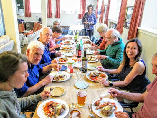
 All present and correct
 enjoying a break
 swans above the weir

Monsal Head Viaduct
 jam or cream first?
 entering the tunnel

White Horse with Dragon Hill to the left of the road
 At the Uffington Iron Age hill fort
 On the Ridgeway
 The 'pop up' cafe

Wayland Smithy Bronze Age burial mound
Presidents Meet, George Starkey Hut - October

Place Fell on Friday afternoon
 Julie near the stone circle
 Stormy time on the lake
 Heather and Julie with the local wildlife
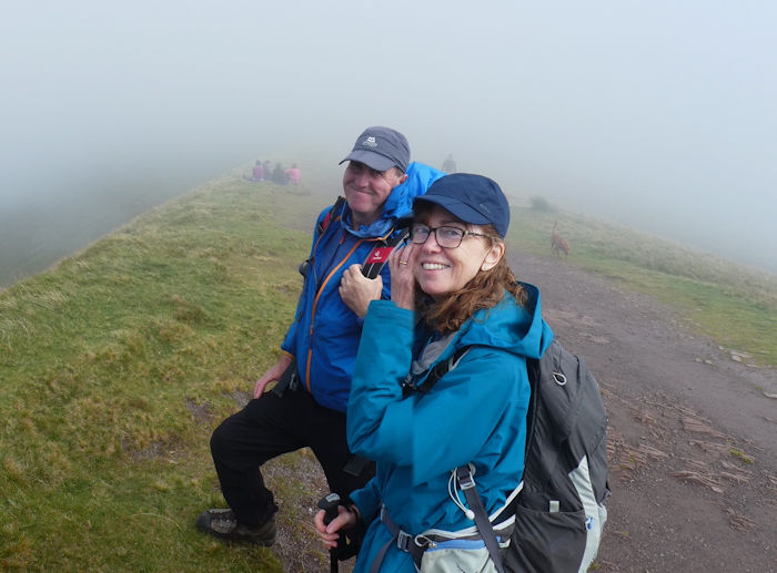
 Gusty weather and misty tops
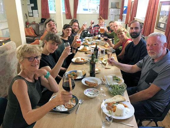
 Start of the dinner


 Paul on Arnison Crag
They traversed the hill and picked up a series of paths to return along the ridge to Arnison Crag and then steeply back down to Patterdale.
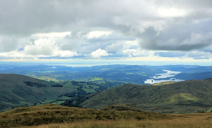
Along the ridge the sun briefly came out!
Brecons Meet - October

On Mynydd Troed
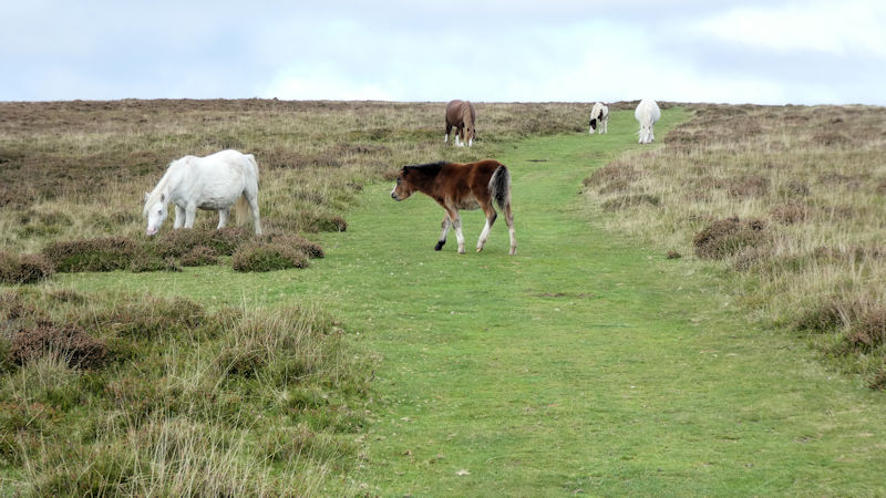 Brecon ponies
 Llangors Lake
 Marcus and Margaret enjoying the view
 Brocken spectre
 cloud clearing off the peaks on Friday
 Storey Arms middle car park in the gloom
 Bunkhouse crew atop of Corn Du
We returned back to the bunkhouse for refreshment and met up with Marcus, Michele, Mike and Margaret.
A good day followed by an excellent dinner.
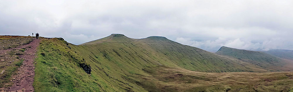
Horseshoe -Corn Du, Pen y Fan and Cribyn
Leaving the village of Llangatwg we walked along the old tramway of the quarry, which was well marked. A short but very steep pull up the side of a forest led us to the upper tramway - here there were extensive views of the Usk Valley and the Sugarloaf above Abergevanny. We could also look across to Pen Cerrig calch, which we had walked over on a previous visit.
 View across the Usk Valley
 Upper tramway
 the Llangatwy escarpment
The weekend was rounded off by a late afternoon call into a sunny cafe in the town.
 Lime kilns at the canal
 Tea time!
'The Pen- y -Fan to Bwlch alternative walk' - by Steve Caulton
"No one would have believed, in the early hours of that Saturday morning that minds, far less intelligent than those of their fellow companions, planned a walk from the pinnacle of Pen-y-Fan back to the comforts of Bwlch. Across the gulf of open countryside they regarded the adventure with envious eyes and slowly and surely they drew their plans against getting back and looking done in".
 Steve with the Brecons behind
 Talybont Reservoir
 Locks at the canal
We finished to find the gang taking in the sun and beer, relaxed and fragrant with Andy and myself less so and more like two old goats that hadn't even been rained on for about six months.
We declined Ed's offer of a beer and rewarded ourselves with that mug of tea.
Swanage Meet - September
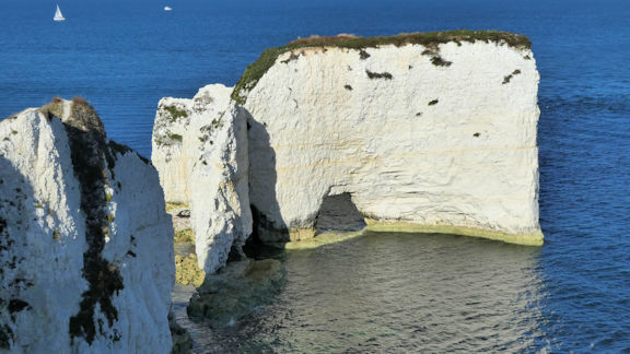 Old Harry's Rocks
This was a particularly spectacular view as the visibility was crystal clear which allowed views as far as St Catherine’s Point on the Isle of Wight.
After a quick wash and brush up we enjoyed a fish and chip supper at an outside restaurant overlooking the small harbour.
 Across to Swanage
 Team at Peverell Point
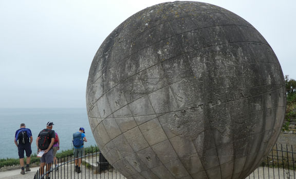 Globe at Durleston Park
 Near Dancing Ledge
Refreshments were taken at the Square and Compass pub. The return walk to Swanage was through some typical Dorset farmland on the Priests Way. The weather improved during the afternoon to give some better views on the approach to Swanage.
The Saturday evening meal was a variety of take aways eaten in the hostel kitchen.
 Corfe Castle at the start
 View from Swyre Head
 Towards Kimmeridge
 Corfe Castle from Ridgeway Hill
After a short coffee break we continued on the ridge path to just above the village of Kimmeridge. We stopped for lunch and then crossed the valley fields between the coastal ridge and Ridgeway Hill. Another tremendous view greeted us as we reached the summit of Ridgeway Hill. We followed the ridge eastwards and all the way back to Corfe Castle for afternoon tea before departure.
Lake District (Picos Replacement) Meet, George Starkey Hut - September
 Aira Force ferry
 Team on Ullswater Way
 View point on Ullswater Way
 Gowbarrow coffee break
 Upper Glencoyne path
 Looking down at Upper Glencyne from Sheffield Pike
 Troutbeck, ready for the off!
 looking towards the Beacon
 On the ridge walking to Ill Bell
 The Beacon
At the Beacon we stopped for lunch as it was the only place we could feel a slight breeze to ease the blazing sun and prevent us from being fly ridden. After that quick pit stop we descended to Thornthwaite Mouth and followed the stream down to Park Head Fell. From here we took a very faint path to meet the Roman Road descending from between Thornthwaite Crag and Frostwick. We followed this all the way back to Troutbeck. The heat in that valley was incredible and certainly made us very thirsty as we stopped for some refreshments at the Mortal Man on our return to the hut.
Tuesday evening we settled in for a lasagne made by the club President.
 Walking down the valley
 Looking along the ridge towards Fairfield
 Paul and Mike on ridge towrds St Sunday Crag
 Ullswater view
 The team
 Michelle on Pinnacle Ridge
Additional notes from Marcus
After completing Pinnacle Ridge we continued to Grizedale Tarn and onwards up Dollywaggon Pike then Helvellyn. We then descended Striding Edge and returned to Grizedale. A hot day out!
Andy and the others caught the boat to Howtown and walked back along the lake shore to Patterdale.
Disappointingly the Brothers Water Inn was closed on this day.
 Marcus on St Sunday Crag
New members Meet, 19th-22nd Aug
Early Friday morning
 A moody Angle Tarn
 Enjoying the view at lunchtime
 Brotherswater with Kirkstone Pass behind, and the re-meandering of Goldrill Beck project in the foreground below.
 Three 'lions'
 Group outside the Hut
 On the ferry to Howtown
 a beach snooze
 one of the carved stones
 Lakeside beach
 Dinner at the Hut
 Stoney Cove Pike top cairn.
Looking out along Windermere and across Morecambe Bay.
George Starkey Hut maintenance meet - August
 Hard at work
 Cleaning up
 Dinner time
North/South Day Walk - August
 Clapper bridge across the River Bradford
 Andy, Pat and Lyn near Harthill Moor Farm
 Pausing for breath......
 Lunch time!
 Leaving Elton
 Local wildlife
 Information board!
 Water troughs
 Youlgreave coming into view
 Taking the right path along the river back to the village
 Mausoleum from on the way to Bradenham
 Hearnton Woods on the way to Bradenham
 Lunchtime log
There we had a lunch stop with good views and a special log seat large enough to take everyone.
 Hughenden valley

Group at monument, looking towards the Manor House
 Hughenden Manor
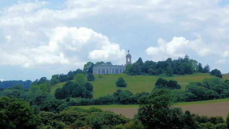 Mausoleum at West Wycombe
North/South Day Walk - July
Tuesday 13th July 2021 - Mam Tor, Derbyshire
 Heather and Steve work out where they are!
 On the ridge
 Ian following his dog
 Looking for Hollins Cross
 There it is
 After lunch
 Mam Tor area
Report by Andy Burton
Tuesday 13th July 2021 - East Meon Round, Hampshire

The group just below Salt Hill

Winchester Hill Fort
Refreshments!

Beacon Hill

Walking towards West Meon
Report by Paul Stock

Saturdays group ready for the off from Stanton
 on the way to Stanway
We passed perhaps the only thatched cricket pavilion as we entered the village.
 Stanway cricket pavilion
 Gatehouse to Stanway Manor
We walked through the village and set off up the only real hill of the day.
At the top of the hill we have wide ranging views across to Broadway tower. A gentle descent took us to the beautiful village of Snowshill and lunch.
 Stanway church
Snowshill appears in the valley
 Enjoying a lunchtime break
 Snowshill Arms
 Which way now?
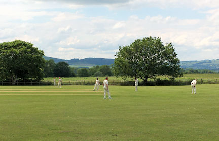 Afternoon cricket at Stanton
 Stanton and market cross

Sundays group ready for the off from Seven Springs
 View from the escarpment
 coffee break
 Devils Chimney
 Orchid
 lunch time
 Downhill mountain bike centre near Birdlip
 which path to follow?
 Walking along the Gloucestershire Way.
Although a couple of members doubted they would go the full distance everybody finished in good spirits. The walk was around 9.5 miles and 900ft of ascent.
Several people drifted off to the pub for refreshments before returning home.
Attendees: Andy Burton, Paul Stock, Mike and Margaret O'Dwyer, Mitch Sneddon plus Sue, Judy Renshaw plus Jeanie, Mike Goodyer, Heather Eddowes, Margaret Moore, Barbara Swindin, and Martha King plus Paul, Carrie, Becca.
 camp!
camp!
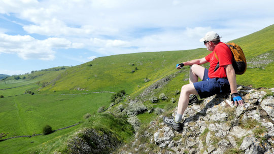 Rest at Pilsbury castle
 the view towards Hurdlow
 Aperitif time
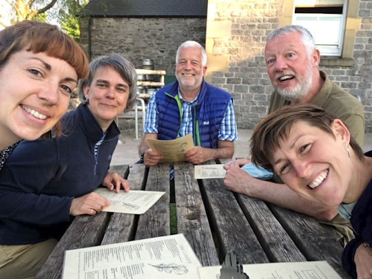 Looking forward to dinner!
 Leaving Earl Sterndale
 Looking down at the farm
 Looking back at Parkhouse
 Lunch atop Chrome Hill
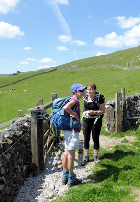 Judy and Jane
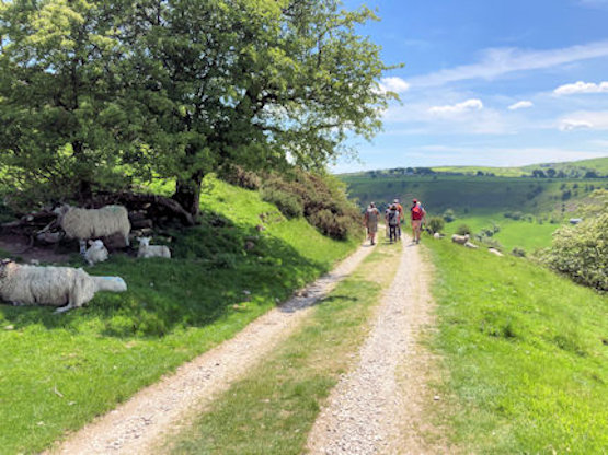 Walking around Hollins Hill
 Chrome Hill from the valley

Dinner was enjoyed by all those camping, in the Oak Room, and the evening finished with us all sat around the glowing embers of a firepit chatting under the stars until the pleasure of sleeping under canvas once again called time.
 Lunchtime
 Admiring the earthworks
 Arbor Low and meadow
Attendees: Judy Renshaw, Mike Goodyer, Mary Eddowes, Celine Gagnon, Martha King, Jane Poole, Andy Burton (Meet organiser)
Saturday visitors: Michele Pulford, Mike and Margaret O’Dwyer
Sunday visitor: Steve Caulton
North/South Day Walk - May
Walking along the Derbyshire edges – a trip down memory lane

Ready for the off
 Ian and Ed discussing the merits of 'elephants backsides' at the base of the viewing rock
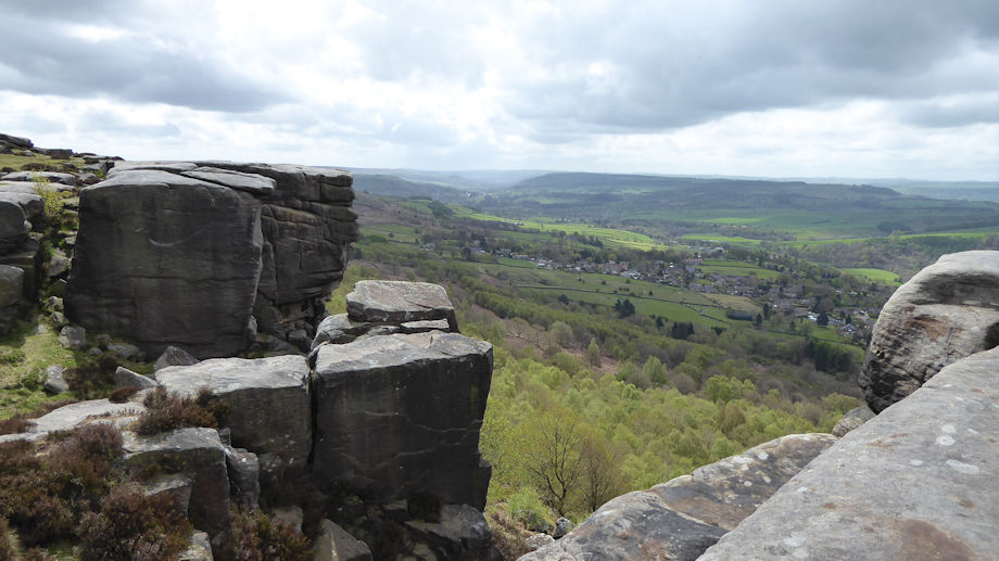
Looking south from Curbar Edge

Here comes the rain
 Froggatt Bridge
Report by Ed Bramley
Wiltshire 'wildlife' walk

Group at Pepperpot Hill
 Looking back towards Salisbury
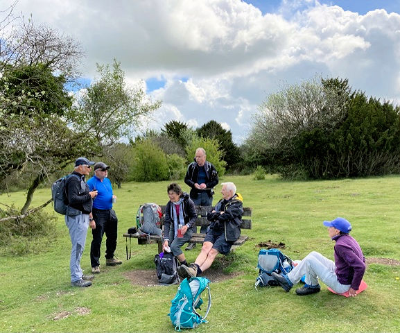 Enjoying a break
 Admiring the donkeys
 Mike leading the herd!
 Lunch in the bluebells
 Wiltshire view
 Wiltshire view after lunch
 Standlynch Chapel
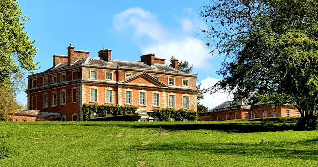 Trafalgar House
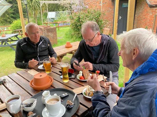
Tucking into cake
North/South Day Walk - April
It’s good to be out again – the north contingent meet up for a Peak District walk.

Preview of first part of the walk

The second group of six
Then it was a simple left into Coombs Dale, a lovely limestone dale wending its way slowly uphill for the next mile and a half. Evidence of the valley’s mining past are all around, including the entrance to the abandoned Sallet Hole mine.
 Sallet Hole Mine
 Andy at the gate

Steve, Dick and Ed ready for lunch

Old lime kiln
Romans, the Duke of Marlborough and cake

 morning coffee
 the ruins
 mosiac info
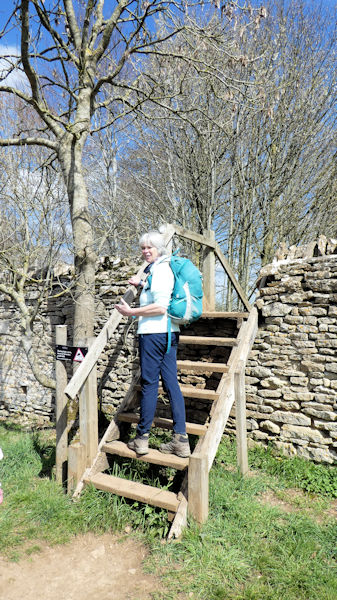 Julie crossing into the park.

In the Great Park with Column of Victory behind.
 Lake and Grand Bridge with Palace behind
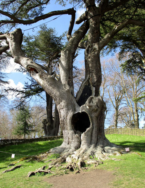 The Harry Potter tree
 Enjoying the afternoon tea....
 ....chatting away and eating cake!
