


|
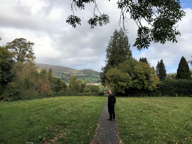
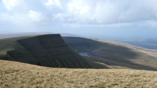
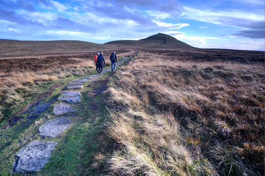
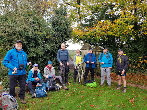
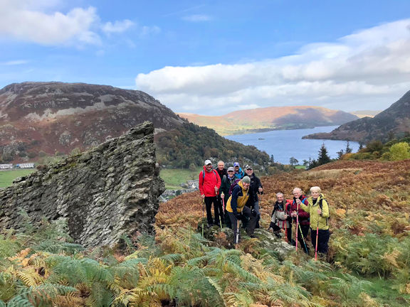
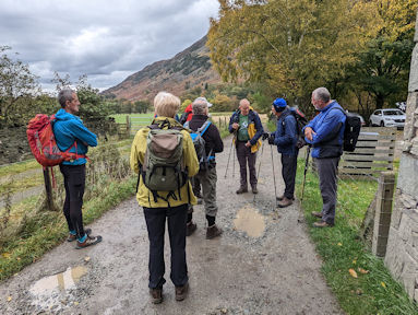
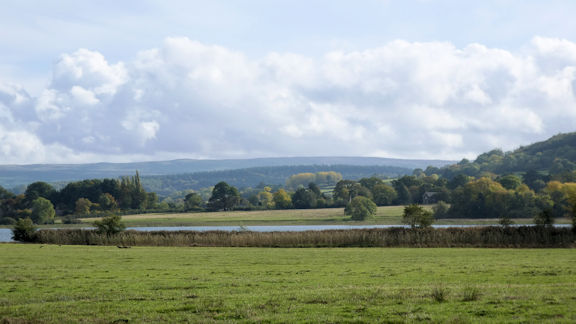
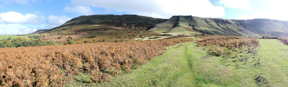
Meeting point for the walk was Clough House car park (free but no facilities) near the hamlet of Wildboarclough twixt Buxton and Macclesfield on the western edge of the White Peak district. Thus a little further west than usual but 6 hardy souls travelled from Nottingham and Chesterfield to join Dave Matthews by 10.30am. Local “peak” Shutlingsloe (506m), the Cheshire Matterhorn! towered nearby but on weather advice from Ian Mateer, who consulted his dog Harvey and possibly his GPS device, we set off in a loop which left Shutlingsloe to the end of our walk. A wise decision as we kept the wind and rain to our backs for most of the hike and it cleared by the afternoon giving us clear views from the summit. | 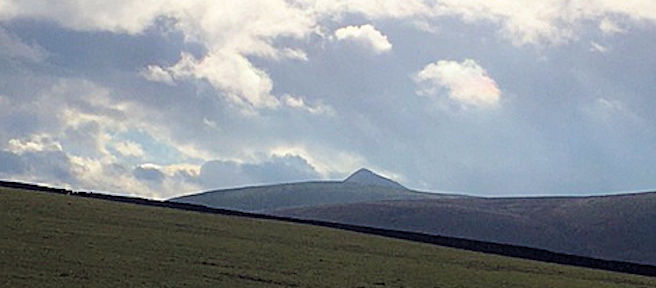 View towards the 'Matterhorn'
|
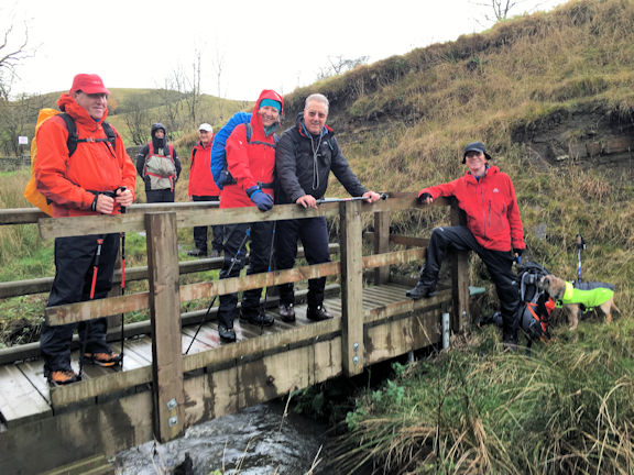
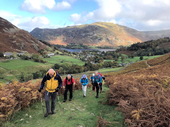
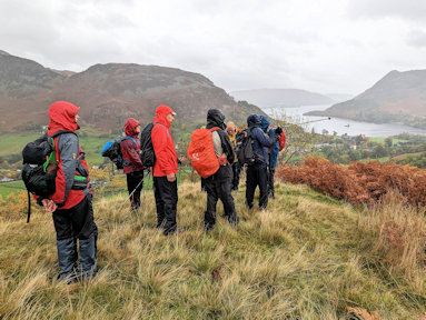
The walk itself commenced up a stony trail beside Cumberland Brook- very picturesque- leading to a narrow path up to open moorland- waterproofs on! A gradual ascent brought us up to the Cat and Fiddle, former pub but now gin distillery, which sadly offers no refreshments (except gin) to the passing trade.
 Waterproofs on!
|  Big puddles!
|  Forest Chapel Congregation
|
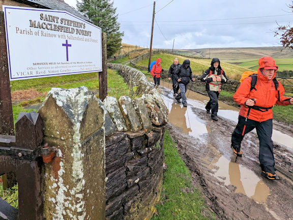
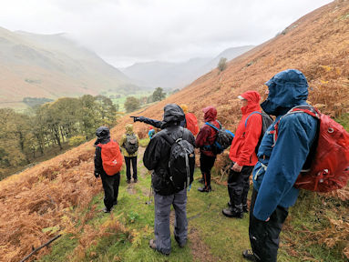
Undaunted we turned downhill via a narrow path which hugged a steep clough (ravine) down to Bottom o’ the Oven- another hamlet with another closed pub- where we lunched al fresco beside a stream before climbing up a steep footpath to Forest Chapel-officially St Stephen’s, an isolated place of worship with few discernible local inhabitants.
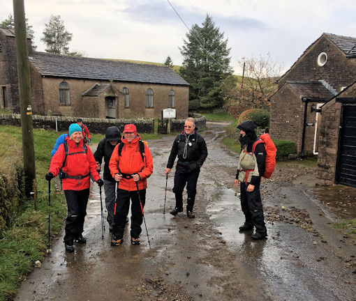
Dave Matthews popped inside and maybe it was coincidence but not long afterwards the skies began to clear and the sun emerged!
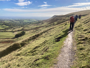
After a short road walk we turned onto a forest trail which eventually brought us to the western approach to Shutlingsloe, paved with slabs.
 flagging up to the top of Shutlingsloe
|
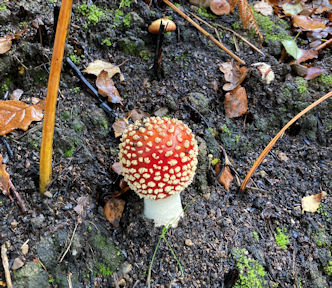
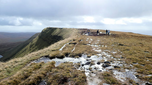
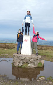
The ascent from here took little time (20 mins?) and we were rewarded with fine views all round: Croker Hill, Maccs, Jodrell Bank and Beeston Castle to the west, Manchester to the north, the Roaches to the east and Mow Cop to the south (all approx.). It was rather blowy but dry.  | 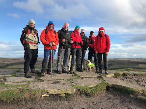 Summit of the Cheshire Matterhorn
|
We then descended by the eastern path, steep in parts, and within 20 mins were back at base.
All round a good walk! Approx 8 miles and approx. 2000 ft of ascent/descent.
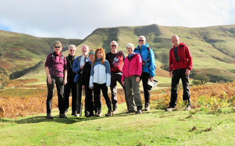
Walking party consisted of:Dave Matthews, Andy Burton, Steve Caulton, Marcus and Michelle Tierney, Ian Mateer and Mike Griffiths. Not forgetting Harvey, (14 yrs), who led most of the way!
PS apologies from Heather Eddowes, who was away but recceed the walk with Dave last week!
Photos from Andy Burton, Mike Griffiths and Ian Mateer
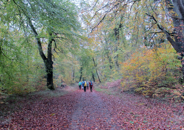
Nine members and guests meet at Great Bedwyn, near Marlborough in Wiltshire for this ramble around the Savernake Forest. Great Bedwyn was an important medieval market town. Now its main claim to fame is the railway station with links to London Paddington. In addition, there is free parking both at the station and the nearby canal trust car park!
|
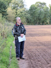
Today we had two members, Rosie and Richard, and two guests, Fi and Steve, joining us for the first time. We were all prepared for a mixed weather day and for no pub or café on route. We set off down the main street and quickly reached the village outskirts and went up the track, Hatchet Lane. We followed the good bridleway, passing Stock Common and Bedwyn Common to arrive at St Katherine’s Church.
| 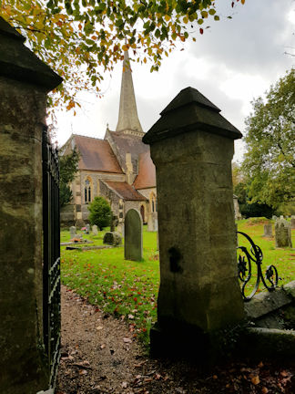 St Katherine's church
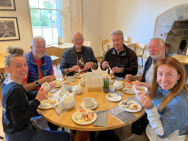
|  Second breakfast
|
 Checking the route
|  About to enter the forest
|
Continuing the walk we were soon entering Savernake Forest. Savernake Forest is the only privately owned ancient forest in Britain. The forest is mainly a mixture of oak, beech and birch trees and is more than 1000 years old. The first written record is in a charter of King Athelstan in AD934, it refers to the forest as Safernoc.
| 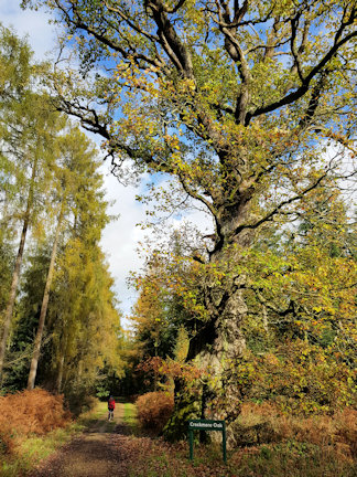 Crockmere Oak, over 500 years old
|
 Walking through the forest
| 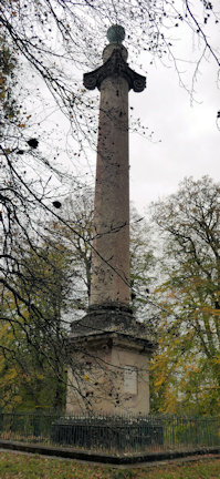 Monument
|
For the next three miles we followed a series of well maintained tracks through the forest. We walked down Three Oak Drive to cross the Grand Avenue, laid out by Capability Brown, which runs from the A4 in the North through the forest to Tottenham House – the seat of the owners of the forest. At the end of the drive was a large monument. This over the top monument was built by the Earl of Ailesbury in 1790. It was dedicated to King George III in ‘Commemoration of restoration to perfect Health from a long and afflicting Disorder’. | 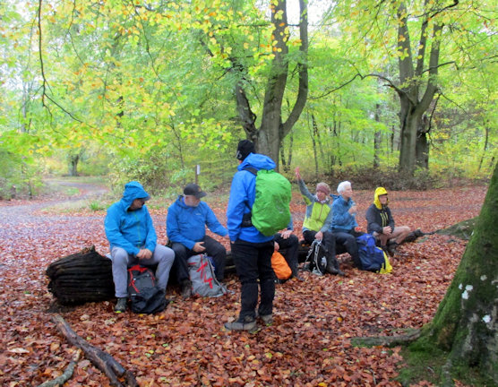 Lunch
|
A nearby fallen tree made the perfect picnic spot – and it had started to rain. Although the rain was heavy we were mainly sheltered by the leaf canopy and the rain had nearly stopped when we moved off. After a slight, avoidable, detour we retraced our steps to reach Lover’s Walk.
 Edge of the forest
|
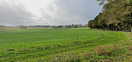
Following this green lane we quickly reached a minor road and the Kennet and Avon Canal.
| 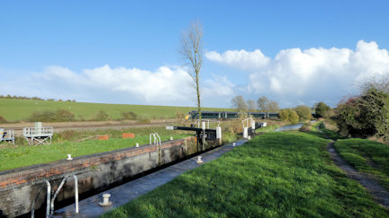 Canal and railway
|
An easy 13 mile walk with great views of the forest. We escaped the rain and finshed in the autumn sunshine.
Attendees: Paul Stock, Mike O'Dwyer, Mitch Sneddon, Judy Renshaw, Rosemary Hadfiled, Richard Hampshire, Steve Butterfield, Fi and Mike Goodyer.
Photo contributions: Mike G, Mitch, Judy, Rosie and Richard.
With the A592 having major roadworks this autumn Ed and I plumped for an afternoon walk in the Yorkshire Dales on our way up to Patterdale. An emergency gas leak on the A629 near Low Bradley and its resultant long queue of traffic, prompted a quick ‘U’-turn and the next right off into the hills, to end up at the village of Lothersdale, which sits on the Pennine Way.
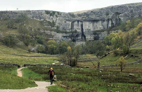 Ed approaching Malham Cove |
The sight of the Hare and Hounds at high noon proved too much of a temptation for us both. A glass of Hetton bitter from the Yorkshire W.R. Brewery alongside a 4oz steak, parmesan frites and salad, proved a diversion worth exploring. After lunch we parked up near Langscar and walked down under Pikedaw Hill through the old workings and settlements into Malham. As we cleared from under the claggy cloud cover, one of Ed’s favourite views of Malham, with its impressive cove and ancient limestone walled field system, opened up. Walking up to the cove and enjoying it almost to ourselves we continued up onto the limestone pavement above, through the dry valley under Ing Scar and Watlowes climbing up through the nick at Langscar Gate back to the car. Arriving at the Hut around 7-30pm we found the fire on, always a treat, and friends gathered, sharing food and drink and conversation in the warm embrace that we have all become so used to. |
Saturday morning nine of us set off for Glenridding, whilst others set off bagging Wainwrights and other routes, near and far.
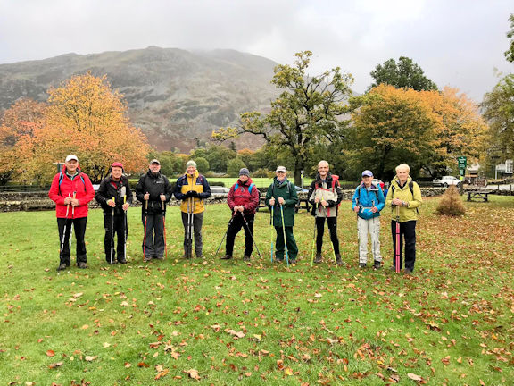 Ready for the off
|
The nine of us met Nicky Sproson who runs Walx Helvellyn Ullswater and Hiking Highs from her office next to the river and the National Park office. There we were introduced to our Nordic poles and accompanying wrist loops, and began our training on the green, migrating once Nicky was sure we could actually use the poles without tripping over, onto Jenkins field, for some more training, working in pairs in order to improve our rhythm. Nicky then took us up through the grounds of Patterdale Hall along the woodland path at the side of Grisedale Beck where some mixed ground training took place. Continuing out of the woods to the bridge, and up the steeper grassy slope practicing traversing uphill and down and introducing us to skipping with poles. We headed off up to Lanty’s Tarn, which was now full of water again, in stark contrast with its level in | 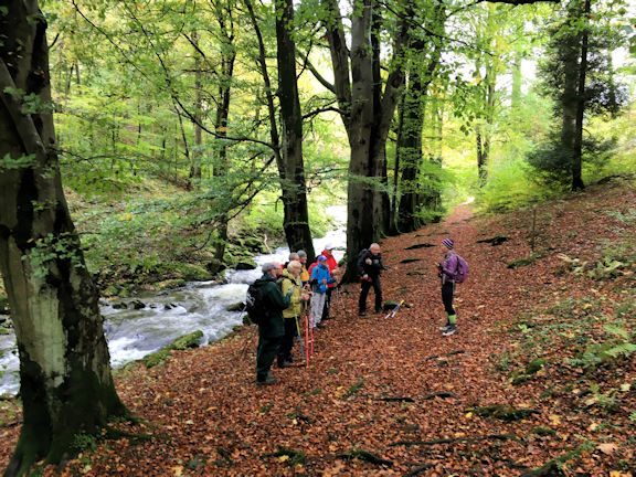 Instruction in Grisedale Beck
|
 Nearly lunchtime
|
the summer. Nicky showed us the location of the old icehouse, before we walked up around the storm blasted woodland to have our photo taken by the large boulder/erratic? Lunch was taken on the grassy knoll complete with bench looking out over Glenridding to Ullswater.
We all elected to return on the higher path rather than end up clicking our way down the concrete road from the mine. As we came back down past Eagle Cottage, I think Nicky was surprised to see most of us skipping in line astern down the path behind her accompanied by renditions of Bring me Sunshine.
|  Ed leads the way
|
Returning to the Hiking Highs office and handing back all our hired equipment, it turned out that Roger was the lightest on his feet, and that everyone had gained something useful from the day. Many thanks to Nicky for an informative fun day out.
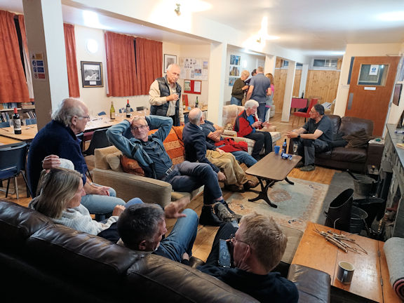 Relaxing in the hut |
Twenty sat down for dinner in the Hut on Saturday evening to enjoy the culinary delights of Andy Hayes cooking. Menu:
|
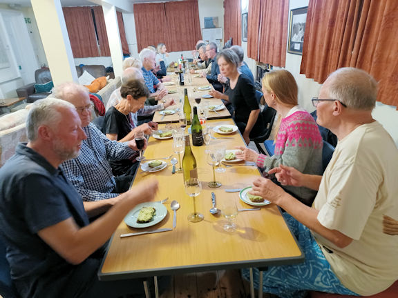 Dinnertime |
 starter |
 main course |
 veggie main |
 dessert |
On Sunday morning a similar sized group joined Mike Parsons, pretty much reversing Saturday’s Nordic Poles walk, as Mike shared his recently acquired knowledge of glaciology with us all. Other attendees continued seeking out Wainwrights, and other local walks. We all returned damper than we set out, with a better understanding of ‘U’-shaped valleys, roche moutonnee, truncated drainage, and local erratics, in good time to decamp in daylight out of the valley. |
 starting out, in the dry |
 on the hill |
 Mike pointing out a feature |
Many thanks to all who attended my second Presidents Meet and mucked in to make it a most enjoyable weekend. Special thanks to Nicky Sproson for the Nordic Poles training, and Andy Hayes for the great food for all banquet.
Attendees: Catriona Archer, George Harper, Judy Renshaw, Don Hodge, Alison Henry, Rick Snell, Ed Bramley, Andy Hayes, Dave Matthews, Heather Eddowes, Myles O’Reilly, Mike Griffiths, Ian Mateer, Daniel Albert, Howard Telford, Roger James, Mike and Marian Parsons, and yours truly.
Report by Andy Burton
Photo contribrutions: Andy Burton, Don Hodge and Ian Mateer
Once again we were based at the New Inn in Bwlch and were made very welcome by Neil and Sarah. Up to 13 members attended the meet with two staying nearby in a camper van. Evening meals were taken at the pub and the Black Welsh Beef pie was still a favourite!
The weather forecast was looking a little bleak, but we were blessed with reasonable weather. Over the weekend different outings were made by different groups, so each group have helped compile this report.
The Northern team arrived shortly after midday, having had an early start. Mike had recently arrived, so after donning boots the four of us were off before 1pm for an extended walk around Langors Lake and back via the Brecons way from Mynydd Llangorse.
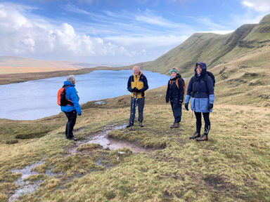
We set off from Bwlch along the 'Three Rivers Ride'(see Sundays walk for a further reference) and walked up to the church on the lake shore. Setting off around the lake we were surprised how dry it was underfoot. Visiting the hide didn't reveal any unusual birdlife, but continuing pass reed birds and woodland we shortly arrived at the cafe on the North shore. Quickly refreshed we pressed on through the village of Llangors and headed steeply uphill to the ridge. The path was often indistinct, but on reaching the ridge the broad path shortly led us to the trig point. Easy downhill walking took us back to the pub, just as the part of the Bristol team arrived.
Everybody arrived in time to enjoy dinner at 7pm. Plans were then hatched for the next day.
 Church at Llangors Lake
|  View across the lake
|
There were three teams for Saturday - the waterfall team, the canal team and the Black Mountain team.
|
Waterfall Walk by Rick Snell
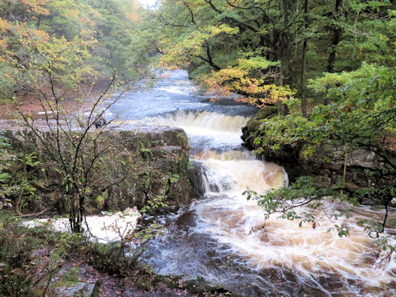
Saturday was always going to be the poorer day for weather, so some of us opted for a valley walk, actually a rather popular “waterfalls walk” down part of the Afon Mellte from Ystradfellte to Pontneddfechan and the River Neath (Afon Nedd), then back up the Nedd to the cars again.
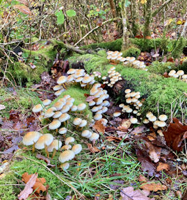
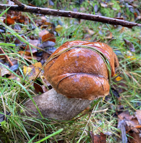
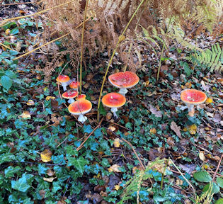
We were in for a treat, as the woods had all sorts of mushrooms and toadstools coming through, everywhere was wet, and the rivers were in spate after rain overnight, so the waterfalls were all giving their best performance. Part of the path at one section of the Avon Mellte was closed off due to collapse and accidents in the summer, but it did not affect our walk much. At one point on the Afon Mellte the path crosses the river by going behind a waterfall about ten metres wide and with plenty of spray to wet us.
Coffee and tea was enjoyed at a good cafe in Pontneddfechan just before joining the upstream section, and plenty more waterfalls awaited us on the way up. We went far enough upstream for the path to become impassable and we were forced off-piste up a steep bank and through various sheep fields before regaining a bridle path towards the cars. We all know that what’s marked as a bridleway on the map is a very variable event on the ground, but this one was exceptional, involving a high ladder-type style over a stone wall with wire above, and no way through for a horse or bike. The walk was somewhat marred near the end, on the same bridleway, by massive amounts of disintegrating discarded silage bag wrapping running down into the local waterways. Mary took a video which we have submitted to Natural Resources Wales (Welsh equivalent of Environment Agency). Apart from that, we all had a great day out, and got back to the cars more or less dry! |
|
'Canal and River Circular Walk' by Steve Caulton
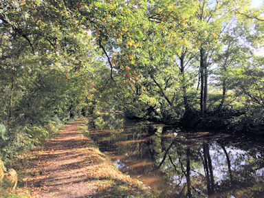
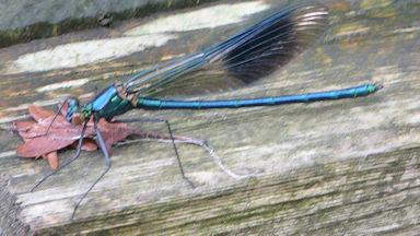
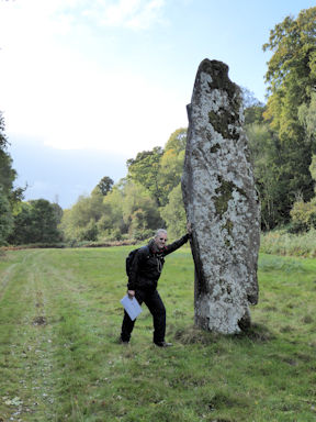
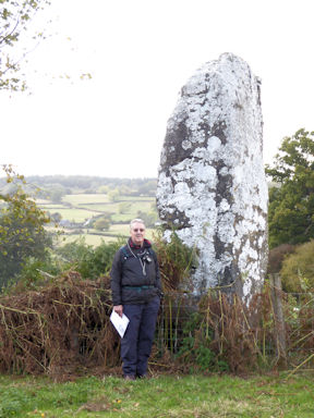
We awoke Saturday to the promised splatter of rain on the window panes but by the end of tea and toast the sun was shining benignly but with no guarantees of staying that way. Like some horses I'm better on the flat than over the fences so I opted for a low level circular amble to take in the local geography. I had the pleasure of Andy's company and we made for the nearby village of Llangynidr to partake of a fry up at the Walnut Tree cafe. Suitably replete we fell onto the towpath of the Monmouthshire and Brecon Canal heading eastwards towards Crickhowell. By now the sun was on our side and the waterway a picturesque delight as the rays picked up the waning colours of autumnal trees reflected in slow moving water. An occasional breeze shook loose a hail of acorns to plop like machine gun fire into the peaceful flow. They are surprisingly painful to the head as we discovered. Our scenic saunter ended at the Llangattock Lime Kilns, a revelation of local industry and reason for the canal. Much remains and it has become a popular mooring for boating enthusiasts.
After a downpour, lunch and a pint of Guiness in Crickhowell prepared us for the walk back to Bwlch along the north bank of the River Usk. The water flows fast enough here to attract waterfowl aplenty and it was still sufficiently warm for insect life to capture one's attention. We were busy observing a damselfly, sedate enough for Andy's photographic attentions, when we were subject to the sudden ire of an aggressive Labrador. Apparently we had upset it not only by being there but because we had backpacks. We promised not to be so inconsiderate in the future.
Our path continued towards the imposing Glanusk tower bridge over the Usk and past a monolithic stone marked on the map as 'The standing stone'. Known locally as 'The fish stone' it stands around fourteen feet tall and does look like an upright fish. A possible Bronze Age route marker it pointed our way well enough. The privately owned Glanusk estate is a holiday venue for those with deep pockets and fishing is the main activity. A very nice,well spoken young man, who we suspect was more than an estate employee, politely explained that the level of the river was down by two feet. Fish numbers were down to but what the angler was trying to catch by casting into the trees on the opposite bank is a mystery. With no objections from him as to where we were headed we pressed on as per our map route. A very nice path along the riverbank, took us past the Gliffaes Hotel high up on our right. Clearly a Victorian pile it was a top rated hotel until very recently. Now local gossip has it that of all people an Egyptian princess has acquired it and intends to live in splendid isolation protected by bodyguards. Whether it is just chinese whispers or a future walk along the Usk will see us confronted by swarthy scimitar wielding guardians in flowing headress remains to be seen.
We emerged just topside of the lovely bridge above Llangynidr village, Andy from a gateway and me over a wall. If we try it next year we may never be seen again!. From there it was a walk back to the New Inn and a cup of tea. A 15 mile circular adventure and a lovely walk apart from the confusion of the Glanusk estate which, being wiser after the event, I'm sure is easily avoided if there is a next time. |
|
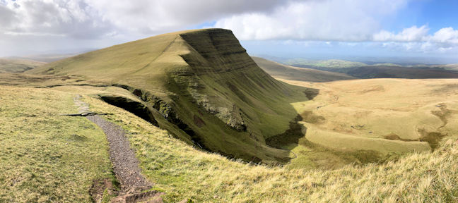
Fan Brycheiniog round by Mike Goodyer
For several years I had planned to do this walk, but other forays in the Brecons or low cloud had always thwarted my plans. We woke to improving weather and shortly after breakfast Ed, Martha, Nan and Anna joined me in the drive round to the start of the route just North on Glyntawe. Setting off along the Beacons Way we quickly turned up the hillside and followed a good trod approaching the ridge. It was a windy day, but mainly high cloud which gave us extensive views. Fast moving low cloud dropped short sharp showers on us, some with hail!
After lunch we followed a good path on a watercourse and then cut up a well defined trod to reach the bottom of the spur of Fan Foel. Here we rejoined the Beacons Way path, which we followed, past the Lake, all the way back to the road. We had thought that now we were low down we would be sheltered from the wind, but no the valley was like a wind tunnel! As we got below the lake the blistery wind stopped us in our tracks a couple of times!
A brilliant 13 mile route with far reaching views, but not recommended in extreme winds or poor visibility. We were back at the bunkhouse shortly before 6pm for a late tea and cake fix. Everybody was ready for their dinner! |
After a hospitable evening at the New Inn the Sunday was bright and sunny and everybody agreed to join up for a group walk. We said our goodbyes to Alice and Rachel and then set off in a convoy up to Gospel Pass.
After a slow journey up to Llanthony Proiry the road narrowed and there was then an interesting 10 mile drive up a narrow single track road to the Pass. Luckily, as we were in a convoy, vehicles coming down from the Pass (mercifully few) pulled in out of our way.
The limited parking at the Pass was already full, owing to a group of campers selfishly using the hard standing for their tents and camper vans! We continued on to a large parking area below Hay Bluff to start the walk.
 Ridge on the way up
|
Rather than take the direct route up the front of Hay Bluff we ascended the easier angled Offa’s Dyke Path to the ridge and then turned towards the Bluff. The stone path that was laid several years ago has blended into the hillside and makes the way easier and keeps you off the fragile peat areas.
|  Hay Bluff
|  On Three River Ride
|
 Looking towards Gospel Pass and Hay Bluff
|
We followed the path down to Gospel Path and after a short lunch break continued up to Twmpa (Lord Hereford’s Knob). It was good to see that the much eroded path up from the Pass had been repaired. We continued along the edge for a while before dropping down to pick up the Three River Ride (used on Fridays walk).
|
|
At the end of the walk a group of us dropped down to Hay on Wye in search of afternoon tea. Anna, Nan and Martha raced ahead and got to the Hay Castle Museum Café just before they shut. The follow up group were only allowed in to join them!
|  Afternoon tea in Hay on Wye
|
Maps of the walks
Friday: Llangors Lake
Saturday: Fan Brycheiniog
Sunday: Hay Bluff
Attendees: Andy Burton, Ed Bramley, Steve Caulton, Rick Snell, Alison Henry, Martha King, Anna Kaszuba, Rachel Howlett, Nanette Archer, Alice Quigley and Mike Goodyer (Mary Eddowes and Johnny in the camper van).
Photo contributions from: Martha, Andy, Rick and Mike.
Report by Mike Goodyer
For the Friday afternoon arrivals on this meet, Yorkshire was giving a typical welcome – the rain so long desired had now decided to arrive in some quantity. Prudently, we all met up at one of the local café’s in Richmond’s main cobbled square, before visiting one of the local museums; the Green Howards museum for the more militarily inclined and the Richmondshire museum for those who wanted a glimpse behind the scenes of local life.
Saturday we were up and off early, so we could make the short journey up-valley to Gunnerside, where three additional members and a guest joined us for our walk. Even at 9am, a goodly proportion of the car parking space was already taken. The first part of our walk, through woodland adjacent to Gunnerside Gill, gave us no indication of the strange landscape that was to dominate much of our route. It was only when we broke out into open country that we came across the first feature that hinted at what this region was once famous for – lead mining.
As we crested a rise, the middle part of the Gill came into view with spoil heaps, ripped hillsides and mine buildings in many different states of repair dominating the view like something from Lord of the Rings. At the same time, it held a strange fascination, making sense of the chaos we could see in front of us – mine entrances, places where water wheels would have been, ore stored and crushed, and wondering just how hard such a life would have been.
A little further on, at the bottom of the valley, we came across two sets of buildings. The first was a peat store consisting of multiple arches for one wall and a short distance away was the remains of a smelt mill, with the rubble that was its flue running up the hillside. Further upstream still we needed to cross the Gill so that we could climb to the top of the plateau, but today made more entertaining by the previous days rain. After a gradual ascent and descent, we then had our main ascent of the day, following the line of one of the old lead veins up the hillside. Old lumps of lead ore, each weighing several ounces, could easily be found along the track. On cresting the top of the rise, the landscape continued to be lunar, with the remains of the old veins still clearly visible, and devoid of any vegetation, even leadwort.
Open to the element, the temperature now dropped significantly, and the occasional squalls now picked up in frequency as we headed for our late lunch stop at the Old Gang smelt mill. As if to emphasise the point, the final few hundred yards to shelter gave us all a soaking, before we could get in the shelter of the old buildings. Our way for some time now had been easy and wide – a good levelled track leading across the moorlands, and this continued after lunch as we descended to Surrender Bridge. One last pull up put us on a limestone bench that we followed round the hillside, offering great views up- and down Swaledale, finally descending back into Gunnerside to complete a great day out. Saturday evening we enjoyed the hospitality of the Bridge Inn, including local beers and all retired replete to the hostel.
On Sunday, it was another early off, this time starting in Reeth, just a couple of miles away from the hostel. Our route took us up the lowest part of Arkengarthdale, broadly following the Arkle Beck as far as Langthwaite, and then back again. A significantly less wild and industrialised landscape than the previous day, there was nevertheless no shortage of things to spot, starting with a slow worm catching the sun on our path.
Further along, the blackthorn trees were burdened down with sloes and inevitable thoughts of some went to gin. As we descended to the river, there was still much evidence of the 2019 floods that so impacted this valley, with scores of ripped up trees virtually blocking the river at one point, whilst at others, it looked like an outflow moraine from a large glacier, with rocks and stones pushed way out of the normal river bed. To add some levity to our route, we decided to make the short hillside climb up to the hamlet of Booze, but were neither rewarded with a sign, or a pub. Instead, as we descended towards Langthwaite, we were greeted by a sunlit vista of the village, clustered around the pub, which was to be our lunch stop.
As we entered, we could have been back forty years or more, as this, along with the neighbouring bridge, featured in the opening credits of the original ‘All Creatures Great and Small’ and inside the pub were mementos from the filming that took place. So too were photos of the flood damage, showing the devastation inside as the floodwater exceeded the height of the bar. After a very relaxing session in such a cosy Dales pub, we headed back down valley to Reeth on the opposite bank, where a final cuppa and cake awaited us before our journeys home.
Whilst most people went for the walking option, Dick and Lin went for the e-bike alternate.
Sunday - meant to be a more gentle day, haha. Grinton, then backroads to Crackpot and up to Askrigg common, with a number of gates on hills making restarting fun. Bolton Castle for tea and cake and then back to Grinton avoiding the bullets from the active firing ranges - 30 miles about 3400ft descent.
Maps of the walks
Attendees: Catriona Archer, Dave Blackett, Ed Bramley, Andy Burton, Steve Caulton, Heather Eddowes, Mary Eddowes, George Harper, Dave Matthews, Dick Murton, Judy Renshaw, Elsbeth Robson, Lin Warriss & 1 Guest
Photo contributions from: Catriona, Ed, Andy, Dave and Judy.
Report by Ed Bramley
We all met at Bilbao airport for a transfer to Potes, or more precisely Tama, at 1:30pm on the 3rd September. Mike, the owner of our accommodation Casa Gustavo, kindly picked us up in his minibus for the 2 hour journey. On arrival we were greeted by Mikes wife Lisa and given the grand tour of the quaint and very rustic 500 year old farmhouse. After our rooms were allocated and we had unpacked we took a familiarisation trip to the local town and walked back along the river.
Sunday, after a hearty breakfast, we were transported to the start of the Cares Gorge (Garganta de Cares).
Mike gave us our directions and we started to ascend to the col which was the highest part of the walk. It was a particularly hot day. The route followed the river which was seldom seen in the deep gorge. As the sides of the gorge closed in it gave some very welcome shade. The path then followed the remains of an old canal through tunnels and cut out pathways on the steep gorge sides.
Monday we were again transported for a linear walk to the village of Bejes.
The plan for the day was to walk over two ridges and ascend Peńa Mora then descend to our accommodation at Tama.
Tuesday we planned to do another linear walk along the Ridge of Coriscao.
On arrival at the Collardo de Llesba we dismounted from the minibus into some rather inclement weather. The morning forecast of rain had proved to be correct. This altered our plans with us splitting into two groups one traversing the ridge and the other following an old pilgrim route just off the ridge.
Wednesday we had an early start to catch an early cable car at Fuente De. The objective of the day was the peak of Horados Rojos.
At the top of the cable car we were greeted with the limestone rock scenery of the central massive. It is similar to the Dolomites.
Thursday we did a linear walk from Puerto de Gloria pass to Cucayo.
The route finding initially proved a little difficult to the ridge but once we established the ridge path it was much better. We passed over the summits of Peńa de Portillo de las Yeguas, 2103m and Alto del Naranco 2219m and onto the Collardo del Robidario where we took lunch. After lunch we followed a river valley to meet Mike. It was a long descent of 1800m to village of Cucayo. That evening we received the very sad news from home of the passing of our Queen.
Friday we took another linear route from Cucayo to Caloca via Peńa Astra (Bistru).
From Cucayo we crossed the river and up to Collada de Arruz. Enroute we engaged with some friendly farmers in a car who kept us on the correct path. From the summit of Peńa Astrua (or Bistrui) at 1987m we had views of our target villa
Every evening we had dinner at 9pm, often outside especially when it was warm and often it was beautiful traditional local cuisine. Mike and Lisa at Casa Gustavo were the perfect hosts and without their hard work and the use of their minibus we would have had a very different experience. We left very early on Saturday for our return journey to Bilbao. It had been a really fantastic trip to the Picos and I would thoroughly recommend it to anyone.
Photo contributions from Ed Bramley, Andy Burton, Heather Eddowes, Mike Goodyer, Judy Renshaw and Rick Snell.
Report by Paul Stock With the last hotel-based meet being the 110th Anniversary one at Klosters in 2019, and Pam having stood down from organising this meet after so many years too, the first such meet post the pandemic was an experiment for us all.
Thanks to Paul Stocks excellent research in finding the Alfa Soleil in Kandersteg, all the rest of what follows was made possible.
Mike Goodyer and I arrived at the hotel shortly after 1pm on the Saturday, and met up with Mike and Marian Parsons who had just arrived having driven steadily through Europe in their VW campervan.
A leisurely Fitness-Teller lunch, slightly altered by two large beers and a plate of frites to share, put us in good shape for a wander around Kandersteg in the afternoon.
Mike (your Editor) and I last stayed in Kandersteg in 1973 on our month-long post ‘A’- Level walk along the Bernese Oberland chain using the high-level summer passes, inspired by the writings of Showell Styles in the Climber and Rambler magazine. We camped 49 years ago at the International Scout Chalet on the outskirts of the village, courtesy of Mike’s long-standing commitment to that world-class organisation.
So, it was only right that we started our week by walking along the river Kander which runs right through the Scout camp grounds. Enroute, we visited the Allmenalp cable car station to find out when the first and last lifts ran, and bumped into James and Belinda Baldwin who were sat on a bench in the shade by the river. Near here we saw a stoat darting among the rocks on the opposite bank.
Returning in time to find our room and get ready for the pre-dinner drinks and local knowledge briefing, saw all of us gather to listen to Nico Seiler, our host, and his dad Peters excellent advice, on what to do in the valley and surrounding areas, prior to sitting down for our first Menu 1 dinner!
Sunday morning at breakfast various plans for the first day's walking were laid. Rosie and Bill Westermeyer with Don Hardy set off first to climb First, 2549 metres. (See Bills account later in the report)
Mike and I wanted to explore the pass over to Adelboden via the Bunderalp or Bunderchrinde with a view to reaching the Bunderspitz at 2546 metres, so we set off for the Allmenalp cable car along with Daniel Albert, Rick and Carol Saynor, Geoff and Pauline Causey, and Katharine and Richard Heery.
Some confusion over the Wanderweg signs to the next watering hole at Untere Aussere, coupled with Peter Seiler’s final bit of advice not to overdo it on the first day, meant we all opted for the traversing panoramic path, where photo opportunity stops appeared at each and every corner as a new mountain vista opened up.
With views of the Doldenhorn, Balmhorn and Altels across the valley, and towards the cable car at Sunnbuel and the way up to the Gemmipass, plans for later on in the week began to form. All signs for the mountain restaurant destination vanished, and all that remained was to follow the slightly homemade yellow sign to Rycher Baergli, and hope that we would find something there.
Lady luck was with us, and under the rock walls of what is called the Klettergarten on the maps, where several people were busy enjoying the climbing, we found a high alpine meadow farm complete with a little seating area tucked round the back, offering drinks and tasty local fare for us to enjoy.
Daniel, Mike and I decided to go back down and across the valley to go up on the Oeschinensee gondola, to have a look at the iconic lake that draws visitors from all over the world to this Unesco World Heritage area, and research the ease of signing and access to the higher paths that were highly recommended to us all by Peter.
Monday morning saw several of us set off to walk up to the SAC Doldenhorn Hut at 1915 metres.
This proved to be a steady climb mostly among the trees of the Oeschwald, up onto the rock shelf that lies under the giant slabs and walls of the Aeusser Fisistock. Here nestles the Doldenhorn Hut with views out across the Kandertal from its seated terrace area, where fresh pressed apple juice and homemade apricot torte (cakes) could be enjoyed.
Everyone then made their way round to the other side of the hut, where a view right down on the opal blue Oeschinensee, could be relished by us all, from our various vantage points.
After lunch Daniel, Mike and I walked back down the way we had come up until we reached the alternative traversing shelf path that takes you around the Biberg, and back down into the valley not far from the International Scout camp. We decided to walk across the valley to have a look at the start of the Via Ferrata that lies underneath Allmenalp. The farmers with their specialised farm vehicles were all very busy cutting and collecting the hay in this quite lumpy valley area that lies in and between the steep sided valley walls and the road, the railway and the river.
Tuesday morning, Marian’s Birthday, everyone agreed that we would all go up to Sunnbuel on the bus, and take the large cable car up to Spittelmatte at 1920 metres, with a view to walking up to the hotel at Schwarenbach, which has links with the Club through Otto Stoller who used to guide members for many years on Summer Meet walks in the Alps.
Rosie, Bill and Don made the earlier bus and cracked on, whilst the rest of us went for the 9-45am slot. Luckily, we got a seat before the train disgorged a whole load more walkers intent on doing the same thing. The 10-minute ride in such close proximity to so many people was enough to make sure we didn’t do that again for the rest of the week.
The cable car very quickly whisked us all up over 600 metres enabling a great day's walking to be enjoyed by all along this ancient Bronze Age trade route up to the Gemmipass.
The hotel provided drinks and a generous slice of Heidelbeeren torte (Myrtille tart) before we carried on up to the Daubensee, with an unusual sighting of a couple of sheep grazing in among the rocks on our way up.
The Daubensee, according to the blurb, is Europe’s highest natural lake fed by glacial and snowmelt waters. It reaches its highest water level in July, and by the end of October, all the water percolates away through the porous slate rocks leaving the dry lake bed safe to traverse.
Here on the upper path, we met Rosie and Bill on their way back from the pass, both very excited by the view of the Matterhorn and many other peaks they had identified.
Mike and I noticed that at 2200 metres alongside the path were a wide variety of different plants that we had not noticed lower down, among them little deep azure blue gentians and groups of the large distel thistle.
At the pass, 2350 metres, we were treated to the ultra-modern Gemmi Lodge that sits alongside the Gemmibahn cable car. This uplift brings people from Leukerbad in order to enjoy the spectacular views of the mountains of the Valais, including the Matterhorn, Dom, Dent Blanche, and the Weisshorn, to mention but a few, that this lofty perch affords.
Here Mike and I tarried long enough to enjoy a cold one, and be joined first by Daniel, then by Richard and Katharine and Rick and Carol, on the overhanging terrace of the restaurant. It would have been very easy to stop here all late afternoon and evening drinking in the views, but the last lift down from Sunnbuel at 6pm, focussed our attention on making a start back.
Daniel, Mike and I decided to consume our food and drink in a little sheltered crease in the land, full of alpine flowers, before crossing the neck of the lake at the pass end to walk on the opposite side of the Daubensee. We saw the others pass by on the path heading back too, so that was everyone accounted for. We all made it back in time to get on one of the last cable cars down, and met up with a couple more of our group waiting for the bus at Sunnbuel.
At the evening meal we were joined by Pam and Alan, and Marian’s Birthday was marked with yet another very convivial gathering over food and drink.
Daniel, Mike and I made the earlier bus which dropped us off at the Sunnbuel cable car. We took the path to the left of the lift station, which makes its way up alongside the Kander river gorge, crossing over the river to join for a short distance the private road, that on payment of a fee can be accessed by car, in the narrows shown as Chluse, on the map.
Eventually the tumultuous river waters steady off as we reach the Gasterntal proper. A preserved and protected alpine pasture landscape opens up as you walk around the grounds of the Hotel Waldhaus. We made a bit of a detour to the waterfall at Bise, that higher up must bisect the path up to the SAC Balmhornhuette, which sits on a 1956 metre perch looking out across the whole area. Some of our group walked up to this delightful hut during the week (See Bills account and photos below).
Crossing back over to the other side of the valley we made our way up mainly through mixed woodland to the settlement of Selden and continued on to the Berggasthaus at Heimritz, where we enjoyed a welcome drink and homemade raspberry cake.
We then continued on round the corner to where we could see up towards the headwall in the end of the valley at Kanderfirn, the source of the Kander river. Here we turned round and set off back on the opposite side of the river for a short while, crossing back near Selden, having negotiated a couple of hanging bridges. Here we saw some of our group enjoying similar comestibles at one of the two hotel gardens to be found here in Selden. This is also where the private parking is and the local KanderReisen minibus service drop-off and pickup stop.
A steady walk retracing our steps with one last drinks stop at Hotel Waldhaus, to enjoy the late afternoon sunshine, before committing ourselves to the inevitable shade in the gorge, which was even more spectacular now due to all the increased flow from the melting glaciers and snowfields high up in the mountains above us. We made the bus with five minutes to spare, ensuring we were not late for dinner. Just as well as Wednesday’s evening meal was when Nico and his team pulled out all the stops with a Gourmet meal for us all, as we marked Pam’s 80th Birthday.
For Thursday’s outing Mike and I decided we would try again to cross the ridge between Kandersteg and Adelboden, with a view to reaching the top of the Bunderspitz at 2546 metres. With a quick uplift in the now quite familiar Allmenalp cable car, we set off up over the Bunderalp.
At the col we met Heather and Don coming up from the other nearby Bunderchrinde col, with tales of having negotiated some lengthy vertical metal ladders, on the Adelboden side of the pass. Together we all ascended to the top of the Bunderspitz. Here we were able to sit, and enjoy some lunch with the 360-degree view of the mountains of this part of the Bernese Oberland chain. Having put our names, and that of the Association in the summit book, we began our descent.
Friday’s walk for Mike and I was always going to be the highpoint of Hohtuerli, (Literally translated High Little Door) at 2778 metres, with its spectacular views down into Kiental. With various members of the group having completed this walk already as the week had evolved, we talked Daniel into joining us too.
The Heuberg and Oberbaergli areas were as beautiful and spectacular as Peter Seiler had promised they would be, with stunning views down onto the Oeschinensee, and up to the glaciers and their associated summits.
Above the last farm the landscape becomes more and more mountainous, leaving the high pasture well below. With occasional glimpses up to the Hut encouraging us on, we, each at his own pace, continued making upward progress until the pass on the ridge was attained, and the lofty aspect of this gateway between two valleys could be enjoyed and photographed.
In the shade of the door way to the Hut we met Mike, and after soup and drinks, and a few photos of the three of us, we set off back down to Kandersteg.
The meet ended with another fine evening meal, and an informal thanking of the Alfa Soleil team who had looked after us so well all week, and to all the attendees for their excellent company on our various days out in the mountains together. We all agreed that Kandersteg and the wider Kandertal had once again done us proud.
Attending the meet were Marian and Mike Parsons, Belinda and James Baldwin, Ann Alari and Derek Buckley, Carol and Rick Saynor, Rosie and Bill Westermeyer, Katharine and Richard Heery, Pauline and Geoff Causey, Don Hardy, Daniel Albert, Roger Newson (short visit), Heather Eddowes, Mike Goodyer and Andy Burton.
Photo contributions from Andy Burton, Mike Goodyer and Carol and Rick Saynor.
Report by Andy Burton Saturday-
Rosie and I drove from Divonne-les-Bains today to begin this year’s ABMSAC Meet. Based on recommendations from Pam, Roger and Jill, we decided to make a side trip to the Kiental before heading to Kandersteg. This is the next valley over in the direction of the Lauterbrennen Valley. We parked at Tschingel just before the road rose steeply and narrowly and virtually impossible to drive, especially when Post Buses were on the road. From here, we hiked steeply uphill along a roaring stream, eventually to reach Griesalp, with its impossibly beautiful views of the Blumlisalp and other peaks high above. Griesalp itself had several hotels and restaurants and was the start of hikes to the Blumlisalp and Gspaltenhorn Huttes. As beautiful as the area was, there was too high a concentration of people here. We continued on to Golderli and shortly thereafter found a bench and had lunch as we gazed out over the valley. Continuing, we walked along a beautiful balcony for some time before descending steeply back to the Kiental and thence a short way back to our car at Tschingel. The hike was about 4 miles long and gained approximately 350m in elevation.
We then made the short drive to Kandersteg and checked into the Alfa-Soleil Hotel, where we paid a little more than the standard rate to have a balcony and view of the mountains. We were just able to see the Doldenhorn Hutte from our balcony, about 750m above us. All-in-all, we had a beautiful view. Later, we checked out the town and walked about a mile. People began arriving in the afternoon, and at 6:30 we were given a welcome drink and a brief summary of hikes we might like to do. Dinner, this night, as indeed for every other night this week, was a raucous event, with non-stop, overly loud chatter.
Sunday -
Today, Rosie, Don, and I climbed a small, but prominent peak above the top of the Almenalp Lift called First. Our total ascent was about 825m, which we did in two hours, beating the posted time by 30 minutes. The distance was about 8.6 miles. Not bad for a first full day. We saw many wildflowers, plus herds of grazing brown cows and flocks of sheep. Some inquisitive sheep high up the slope came up to us when they saw us eating, clearly wanting a change of diet from grass. We had good weather most of the day, but on the summit itself clouds drifted past, often obscuring the views. Only occasionally could we see the Oeschinensee far below us and off in the distance. Back at the top of the lift after a slow descent, Don bought Rosie and I drinks, a beer for me and a Rivella Blu for Rosie. Others showed up a few minutes later and shared their exploits of the day with us.The three of us clearly had exerted the most effort on this day, but we did not feel overly tired.
Monday -
We had a larger group today to ascend 750m to the Doldenhorn Hutte, a roundtrip distance of about 7.5 miles. In addition to Rosie and Don, the hikers were Rick Saynor, Richard Heery, Mike Goodyer, Andy Burton, and a new meet attendee, Daniel. At the top we had great views of the Oeschinensee and of Kandersteg far below. Also, we had a great view of First and of the long ridge that connected it to the Bunderspitz. While climbing First, we had seen several people slowly making their way along this ridge. It looked quite difficult from a distance, but the people we saw were not using ropes and only occasionally needed to use their hands for balance.
After returning from the Doldenhorn Hutte, some of us ascended the Oeschinensee lift to do a brief reconnaissance of the trail to the Blumlisalp Hutte. The sign indicated that it should take 4 hours to reach the hut, not the 5.5 that Andy had thought. That was encouraging! Rick, Richard, and I had a beer at the top of the lift while Rosie descended to the town. There were far too many people here for our taste.
Tuesday -
We decided, with others, to ascend the Sunnbuel Lift and to hike in the direction of the Gemmi Pass. I had a modest goal in mind to begin with, as I thought that reaching the Daubensee would be enough for the day. However, upon reaching this goal, it appeared that without too much extra effort, we could make it all the way to the Gemmi Pass and so look down upon Leukerbad below and the high Alps off in the far distance. And so we did. The hike itself was not the most dramatic we have done, being mostly in stark, treeless terrain; however, once we reached the Gemmi Pass itself and could look upon the Alps to the south, the long walk was worth it. We could see the Matterhorn, Weisshorn, Dom, and many other high peaks. Fabulous! On the return, we hiked along the Daubensee, then passed many in our group still heading up the upper trail (road). Further along, we met up with Jeff Causey heading down by himself. The three of us then took an alternate, and much nicer, route at the base of rocky cliffs back to the top of the Sunnbuel Lift. The only down note of the day was that we had to walk all the way back to our hotel from the bottom of the lift, about 2 miles, as the once-hourly bus had just recently left. All-in-all, we hiked about 22.22 km and ascended about 600m.
Wednesday -
I was determined to have a “down” day today. However, after much confusion about how to get into the Gasterntal, when to go, and who was going, we finally set out with Richard and Katherine in their car. We parked at the base of the Sunnbuel Lift and walked into the valley from there, paying 7 CHF to park. Others paid 15 CHF to drive all the way to Selden along a very narrow road that had one-way time restrictions. Ten or more years ago, Rosie and I went with Roger on a bus to Selden and from there we took a trail over the Lotschepass into the Lotschental, and thence down a lift, to a bus, and finally to a train that took us back through the Lotschberg Tunnel to Kandersteg. The Gastertal is a beautiful near-perfect U-shaped glacial valley, similar to the Lauterbrennen or Yosemite Valleys—but without the crowds. The four of us stopped at the Hotel Waldhaus for a drink and enjoyed a classic Swiss mountain view. Later, we scouted the start of the trail leading to the Balmhorn Hutte. It is our intention to climb it on Friday—assuming we survive tomorrow’s planned big hike to the Bluemlisalp Hutte. Somewhat later, I was determined to turn back so as to reserve energy for the Bluemlisalp Hutte. Rosie later joined me, while Richard and Katherine continued all the way to Selden before turning around. All had a great day. This evening, our group was treated to a “gourmet” meal, a 5-course meal that was indeed excellent.
Thursday -
Bastille Day! After our “rest” day, Rosie, Richard, and I set out to do our big hike to the Bluemlisalp Hutte. We caught the earliest lift possible, which was a few minutes before 0830.
There were two possibilities to reach a place called Oberbargli, a high route and a low route. We chose the upper route on the way up and took the lower on the way down. Both had spectacular views of the Oescheninsee, the one from higher up, the other from much closer to the lake.
Friday -
I wasn’t sure I wanted to do a big hike after such a long day yesterday. However, we had spoken about hiking to the Balmhorn Hutte during the week, and by the time breakfast was over, I was talked into doing it with Rosie, Don, and Heather. It turned out to be the most spectacular hike of the week. Starting up from the Sunnbuel Talstation, we first walked into the Gasterntal along the Kander River Gorge. Past the Hotel Waldhaus the valley opened up into a beautiful U-shaped glacial valley. After a short distance, we turned onto the trail leading to the Balmhorn Hutte. This is a steep and very exposed trail, although not a difficult one. There were plenty of cables to provide assistance when necessary. High above the valley floor, the similarities with Yosemite Valley were striking. The hut itself was quite small. We were greeted by the hut warden with tea and a biscuit. We ordered a delicious barley soup, while Heather had rosti. After a pleasant lunch, we climbed a little higher to take photos. We also saw a lone girl descending and discovered that she had climbed a peak called the Gasternspitz some 800m above the hut. This peak did not show on our map, although not surprisingly Roger Newson knew about it. Perhaps for another year! In all we climbed about 800m. This was our last day of hiking. I judged that we had climbed a total of more than 4750m for an average of about 680m per day.
Saturday -
On the morning we were to leave for home, we learned that Rick Saynor had tested positive for COVID. He and Carol immediately decided to return home without even staying for breakfast. Later, we learned that Alan Norton, who had been at the meet for only two days, had also tested positive. And we now know that Carol Saynor has also tested positive. We ourselves appear to be negative, but we wonder how many more of our group will eventually test positive as a result of close proximity during the Meet. I guess it was inevitable that some would contract COVID during this week of hiking, but it was nevertheless a down note on which to end the meet. Thus far, all who contracted COVID appear to have only mild symptoms.
Special Note
One of the waitresses we met during the meet, Anastasia, had only recently arrived from Ukraine, having left unwillingly as a result of the war with Russia. She was a very sweet young woman, and one who has had her life turned upside down, probably never to be the same again. In one sense, she is lucky to have found her way here with her mother, who also had a job at the hotel. However, it is small compensation to having one’s life devastated in this way. Also, her brother is still in Ukraine, and she has other family in Poland. She has not mentioned her father. When we were checking out she gave me her WhatsApp number. I would be interested in communicating with her and learning more about how she came to be in Switzerland, but will wait to see how she responds to an initial short note from me.
Bill The meet for the Baldwin’s was a very up market visit after camping in 1976 with the children and Youth Hostelling in 1960. A walk up to Oeschinensee and back, a visit to Schwarenbach and walk back down the valley past the BMX track plus a gorgeous walk alongside the Kander River through the gorge into the Gasterntal valley were our limits of highish altitude. We were happy to walk amongst the mountains rather than up them.
We had the excitement of part of a new walking route that follows the Lotschberger rail line from Frutigen up to the Sunnbuel lift south of Kandersteg. We decide to walk along high-level paths to the east of the valley but instead of a downhill walk we found ourselves walking uphill. The GPS recorded significant ascent whilst only descending 400ft over the 11miles to Frutigen, but we had outstanding open views and glimpses of the train line as it winds in and out of the rock face.
Having tested a route, we decided to walk down the signed path. This was significantly easier and quicker down to Blausee within a Naturparc. It turned out to be a magnificent tourist trap with a big car and coach park and expensive entrance fee, which we managed to negotiate down to half price after pointing out our ages and then told we had further discount for our guest card.
This so-called nature in the Alps was a strange experience. The lake was a wondrous blue but the trout within were raised artificially in their own fish farm. We looked and left it with its crowds for what was described as a hidden natural area. We entered through a gate to encounter alpacas grazing a long way from their normal habitat.
The route from Blausee climbs past the Rne. Felsenburg castle, the rail line goes under the castle in a short tunnel, and down to Inner Kandergrund. This part of the route was challenging in that the path was narrow, steep and in places in poor condition due to rock falls with notices to remind you to keep moving! A considerable amount of iron work has been added to retain the cliff face, catch rock falls, and prevent further falls. In one section a large concrete buttress supports the rock above and rail line. The end of this section has been made walker friendly by the installation of numerous metal stairways jutting out from the rock face and almost over the rail line.
The final part of the walk runs alongside the rail line and through hay meadows to the 1906 Kander viaduct, Rne. Tellenburg castle and into Frutigen station where the bus and train to Kandersteg run hourly.
Along the route instructive panels give the history of the railway, started in 1906, and ways of life along the way and its challenges and finally telling of the end of matchmaking in Frutigen in the late nineties with a pretty picture of the box. The line was opened in 1913, double tracking was completed in 1992 and flatbed car transport introduced in 1960.
We were amongst mountains whilst adding interest to what we thought was going to be a gentle downhill walk, while everyone else was going high up we were going up in a different way to go lower than Kandersteg.
James Four of us attended from Yeovil Mountaineering Club this year, for one week only, 9th to 16th July. They were Rick Snell, Stu Mackenzie, Mike Lock, and Rob Parr. Rob drove us there in his van. We didn’t know the campsite, and booking it direct was straightforward, with very helpful owners whose English was fortunately far better than my French. We had slight reservations before arriving as we were not permitted to turn up after 9pm, so had to make an overnight stop on the way, at Dijon, in a cheap but perfectly adequate hotel, with a pleasant evening exploring the town.
We took advantage of the free bus travel every day to get where we wanted in the Chamonix valley, and that first day took the Planpraz and Brevent telepheriques up to Le Brevent where we spent a while climbing the sport routes near the top station, with the aim of starting a bit of acclimatisation and getting a feel for the area. It was hot.
There were intentions to get up high and do some mountain routes, but in the end we spent almost the whole week rock climbing sport routes in the valley. Condition reports for the area were mixed, with some parties at the meet getting good routes in, but not us. Stu and Mike did start a route on the Aiguille de Blaitiere, from the half-way station on the Aiguille de Midi telepherique, but found that their approach and finding the route were far longer and more difficult than the guidebook suggested, so by the time they had a couple of pitches under their belts it was too late to continue. Other climbers they met had bivvied at the bottom of the route and were able to start early.
We went to different valley crags every day, the best probably being Vallorcine, where we did a nice seven pitch route. We did one or two or the many great walks in the area, all of which expose one to stunning scenery of course, although to be honest cooler weather would have been more comfortable.
One of the vicarious highlights of the trip was watching the womens’ lead sport climbing championship in Chamonix town centre, very inspiring! They all made climbing a 45 degree overhang on slopers look easy. Janja Garnbret won it. Unfortunately we didn’t stay for the mens’ final as we needed to get dinner down us.
Paul McWhinney was the Alpine Club co-ordinator for the meet, sometimes to be found at the Alpine Club’s tent for a chat and a drink. In the time we were there no big dinners were fixed to bring together the various attendees, which was a shame, but then I am as guilty as anybody in not making the effort to organise that. There was however a WhatsApp group set up, which was very actively used and was quite helpful for seeing what conditions other parties had found.
In the campsite bar we met various people we knew from previous years, and the meet for us was overall a great holiday, with no dramatic excitement or scary near misses, so we were happy to have made the effort.
Report by Rick Snell With the Queens’ Platinum Jubilee celebrations in full swing, we began to contemplate how long we had been coming to Rhyd Ddu and the Oread club hut (Tan yr Wyddfa) as a club, and how long we’d been having a communal meal as an integral part of that meet.
Well, to answer the easier question first. We’d been having a communal meal at Tan yr Wyddfa as an integral part of the meet since at least 2002, with a record of 27 people at one sitting (a full hut, plus others who lived nearby, or who were stopping at the pub). On how long the Rhyd Ddu meet has been going, the earliest date I’ve been able to find is 1982, when it was a winter meet. After that, it became a spring meet, initially called the Snowdonia Scrambles meet, and was sometimes based with John Berry in Bedgelert, and there were sometimes up to three meets there a year. By the mid 1990s though, the meet had become focussed on the Oread hut and the rest is an evolving history. The long and short of which means a Ruby anniversary for the Welsh meet as a whole, and a China anniversary for the communal meal!
Throughout the extended weekend, we had a variety of routes and aims on the go each day, from walking and climbing, to visiting Roman ruins, and even enjoying the scenery in an extended train ride.
Some people made use of the Wednesday evening start to get a days climbing in on Milestone buttress, and found they had Rowan route, a classic 88m 2star diff to themselves, despite how crowded Ogwen valley itself was.
My Thursday option was a round of Cnicht and Croesor slate quarry, starting with the south-west ridge of Cnicht. The lower slopes let you in gently to the mountain, whilst higher up, the angle noticeably steepens, with a further steepening just below the summit.
We are rewarded with great 360 degree views, from out to sea, to Snowdon, and the tip of the quarries at Blanaeu. From the summit, we take a long circling route past several lakes to the disused Croesor slate quarries, which we first visited a decade ago. The size of the spoil heaps and the skeletons of the various cottages stand as reminders to the history and toil that took place here at one time. From there, there are several options of path back to the valley – ours took us to the café on the edge of the village. An order for tea, Welsh scones and Barra Brith was swiftly placed.
Other parties had ventured to other locations, from walking up Snowdon and experiencing the bank holiday crowds at the top, despite the café being closed, to more climbing, this time on Pinnacle ridge on the East face of Tryfan (175m, Diff, 3 stars)
Friday saw a different passion involved – riding on old steam engines – this time along the Ffestiniog railway all the way into Blanaeu. Somewhat different, but the engineering remains a marvel, and we were lucky enough to see an osprey on the way down. As if to confirm our decision, by the afternoon the heavens had darkened, and we were treated to a thunder and lightning display of some ferocity. To compensate, on our return to the hut, we began the Jubilee celebrations with scones with jam and cream, suitably lubricated with a pot or two of tea.
As if to emphasise the fickle nature of the weather, we were back to a decent morning on Saturday for our outing onto the Nantle ridge, which was a first time experience for some of the group. Always a pull up to the initial summit, once that has been accomplished, the ridge itself is a pure joy. Never tricky, but with some nice moves on it, and the occasional position that would be classed as ‘good value’. We paused for lunch at the memorial on Mynydd Tal-y-mignedd, which was constructed in 1887 by workmen of the Prince of Wales quarry to commemorate Queen Victoria’s Diamond Jubilee.
After lunch, we descended down the shoulder into Cwm Dwyfor and a set quarry and mine workings I’d not visited before. Aided by various old sled tracks out of here we made our way back to the main route through to the forest track and back to the cottage.
Determined to show the flag for the Jubilee celebrations, we had bunting up in both the dining area and living room of the cottage and preceded the meal with a loyal toast. The meal itself had a couple of Jubilee twists. Starter of homemade Coronation chicken, followed by that British favourite – bangers and mash (with an onion and Madeira gravy), and a suitable twist – the whole formed into a crown shape. To keep things simple for pudding, I let the supermarket take the strain, with options of apple pie, trifle and sticky toffee pudding being dispatched in quick order. By now the story telling was in full swing and continued further in the living room over the last glasses of wine.
Sunday was turnabout weather again, with steady rainfall during the night and continuing into the morning. For some of us, it was a sufficient hint to start the journey home, but for other hardy souls, an ascent to Yr Aran still beckoned to round off another successful Welsh meet.
Participtants:
Katriona Archer, David Blackett, Ed Bramley, Andy Burton, Steve Caulton, David Clear, George Harper, Tony Howard, Mike O’Dwyer, Suzanne Strawther, Marcus Tierney, Michele Tierney
Report by Ed Bramley This meet eventually took place in 2022 after being postponed from both 2020 and 2021, and not without complications. The bunkhouse at the Braemar Lodge hotel, which had originally been booked, closed down so we were offered 2 cabins as replacements.
Later the hotel was sold but the new owners helpfully honoured our bookings as well as the agreed price.
Then the shock news came that the hotel itself burned down completely - but the cabins remained untouched, so we were able to use some comfortable accommodation at a good price. Unfortunately one of the expected group had been in close touch with a colleague with Covid so was unable to join us. However the six of us who did attend had an excellent week, with typical Scottish sunshine and showers, without any days of continuous rain, so we were able to do good routes each day.
We all arrived on the Sunday, including Judy who came on the bus from Aberdeen. Max had been in the area for almost a week beforehand and had booked places for us for evening meals in different venues. In addition there was a well-stocked shop in the village for self-catering. After sorting ourselves out, we discussed a list of possible routes that Max had helpfully provided, most of which were based on the Cicerone guidebook. Since the weather looked uncertain, with some rain, we all agreed on a moderate route for the first day, just north of Braemar, taking in a Corbett and a valley walk.
In the morning we set off, in two separate parties, for Carn na Drochaide. This required driving to the Lin of Dee to cross the river and parking near the Linn of Quoich. Andy, Celine, Max and Judy crossed the bridge (which had been repaired after the guidebook was written) to a few houses at Allanaquioch and started up the hill. We had some deliberation about where to go up, as there was no path and the description did not quite fit what was there. However, we made our way through the heather, which was high and made for quite hard going, then higher up we found some intermittent boulder tracks which helped.
After a short stop on the first top, we traversed to the main top and down a steep, wet descent north-eastwards towards a valley junction and the ‘fairy glen’ below. It rained for a couple of hours but not too heavily, with patches of brightness. The glen was extraordinarily pretty, with trees in young leaf and all shades of green. Later the sun came out and it became pleasantly warm, so a lunch stop was possible. We saw a lone stag on the ridge, sparrow hawks flying around, and tadpoles in the puddles on the path, as well as hearing the first of the many cuckoos of the week. Roger and Qing had started later, parking in the same place, but went up Glen Quoich to the top and descended further along. That evening we all managed to squeeze into the busy pub to eat, having been unable to book ahead that night, though the food and service were impressive. Some of us wanted a longer walk the next day, especially one that included a scramble up the Stuic on the Lochnagar massif. Since Max had already done this a few days earlier, he decided to do a different route, though he started with us from Keiloch, a short way east of Braemar. We all had a pleasant walk through the Ballochbuie forest on a good track, and saw a large red squirrel and many birds. Max continued on the track but Andy, Celine and Judy turned off onto a path that appeared to be the correct one from our reading of the guidebook, but later realised this was our mistake. We ended up plunging along a non-path by a river, through rocks and boulders, re-crossing the river several times. This wasted a considerable amount of time and energy. After emerging from the forest, we crossed the tussocky heather moor, taking a while to reach Sandy Loch below Lochnagar for a late lunch. However, we did see plenty of small frogs, red grouse, ptarmigan, mountain hares and some dippers on the way.
A heavy rain shower convinced us that time and conditions were not in our favour for going up the scramble, as it was still some distance away. So we headed up the ridge on the west side and made it to the top of the Stuic (1091m) in reasonable time.
On our way down we encountered another heavy shower, this time of hail (cold and unpleasant!). Then we made a bee-line across the moor towards a small corrugated iron shelter in the distance, which took us to the track we should have followed in the morning. Though it was boggy, through deep heather, it seemed comparatively easy after the morning’s efforts.
We reached the starting point some 9 hours after setting out, feeling well exercised. Max had followed the correct route (which we should have taken) along the track to the top of the Stuic and around to the top of Cac Carn Beg, the main top of Lochnagar, and back across the moor so he was back well before us! Roger and Qing went up Morrone (859m), the Corbett just south of Braemar.
The following day high winds were forecast, and most people expressed a wish for a more relaxing day. So Roger and Qing went to Inverness and did some sightseeing in the area, Andy and Celine had a leisurely morning (though Celine had to catch up with some work) and later went over Morrone.
I decided to do Creag nan Gabhar (834m), another Corbett further south of Braemar and then did Morrone as well. This turned out to be a lovely round and very satisfying, though windy towards the end. Max gave me a lift to the start, from where the ascent was straightforward, up the ridge to a first and then a second top. I saw more mountain hares, black grouse, curlews and a lone deer. From the top I saw a rainbow below in the valley. The route continued south, down to a wet col then around towards Loch Callater and back on a track along the Glen. There were sunshine and showers intermittently all day, but overall pleasant conditions. The only difficulty was a stretch of the valley where the track went through a deep ford so I had to make my way along a rough section without a path, until a bridge made it possible to reach the track again. Since I was back at the start by early afternoon, I decided to take in Morrone on the way back. The ascent was gradual but quite long, then the wind became very strong indeed so the final section was a difficult struggle until I reached the couple of buildings and masts on the top. The buildings provided welcome shelter for a much needed break, before a quick descent back to the village.
I had expected to see Celine and Andy on the way over Morrone but saw only two other people who were on their way up and said we were all crazy being up there on such a windy day! Later I learned that that Celine and Andy had set out in the afternoon but had taken a while to find the path so were somewhere in the woods below while I was on the hill. They eventually returned around 9.30 that evening, for a very late pre-prepared dinner. We were glad we had not waited for them before eating that evening!
Very strong winds were forecast again for the next day, so this time we all went together on a valley route along Glen Lui, over the pass of Clais Fearnaig and back along Glen Quoich. It was good to be with the whole group and we managed to stay together for most of the way. However, it turned out to be wise to have taken three cars as people’s different paces and interests meant that we finished at different times. We started near the Victoria Bridge, west of Braemar, parked along the road and walked up a good track towards Derry Lodge. Unusually, we met several other groups of people as this is a main route towards the high peaks of Ben Macdui, Derry Cairngorm and others. We turned off the track on a path up to Clais Fearnaig, a narrow valley with very picturesque scenery that appeared to some of us as if it could have been anywhere in the world, such as the Himalayas or central Asia.
A nice sheltered place above some narrow lochans provided a leisurely lunch spot, again with plenty of wildlife, then we descended to Glen Quoich, with many photo stops and bird watching. The forests around there were in the process of natural regeneration, with fallen trees left lying and small self-seeded saplings growing in random places. This may have accounted for the good numbers of birds to be seen.
Max and Judy followed an interesting narrow path across the river for the last part of the Glen, which wound through small forest areas and along the beach beside the river, then crossed a bridge at the ‘punch bowl’, a natural formation caused by water erosion close to some waterfalls. We all ate out at the very nice local pub that evening, having booked a table for six, making it a pleasant evening.
On the final day it was raining in the morning and high winds were forecast again, so there was much deliberation over what to do. Roger and Qing went to Balmoral to see the castle and gardens and to walk around the grounds. Max and Judy decided to go up Lochnagar by a different and longer route from Balmoral. Andy and Celine were still undecided when we left.
We started from the visitor car park near the castle and set off around 10am in rain, which stopped after half an hour or so. The guidebook took us around various outlying houses, churches and over a nice bridge on the river Dee. It was a bit of a shock to find armed police at most junctions - puzzling until we later learned that the Queen had been in residence at that time. We followed tracks through the forest then out to the south, past a bothy and a small house reputed to be the Queen Mother’s cottage. Again, there were hares and black grouse to be seen. Later we had to leave the track and head across to the base of the first hill, Craig Liath, which we traversed around and went up steeply to a small col, then on to the summit of Meall Coire na Saobhaide (974m). The going was inevitably rough, through boulders and heather. A brief snack stop was required, keeping on the lee side to avoid the worst of the westerly wind. Coming down to a further col was incredibly windy, with gusts reputed to be up to 70 mph at times.
The final ascent was better, as we went up the East side away from the wind, although there was still no path, and reached the main top, Cac Carn Beg (1156m), not long after 1pm. We met one person at the summit, who seemed to the only other one on the hill that day. We took time to look at the spectacular views down to the loch and its surrounding rock walls before descending on easy paths all the way, with nice rocks, which were smooth but with good friction.
As we came down towards the lesser summit of Meikle Pap, we saw two other walkers in the distance. When they came nearer they shouted out to us, and to our surprise, turned out to be Andy and Celine who had driven to Ballater to look around then decided to continue to Glen Muick and take to more popular route from there. This was a surprise! They continued to the top and came back via a circuit on a similar path.
We continued down the side of Meikle Pap, taking a path to the east where the wind funnelled through a gap, with gusts even stronger than before. I was holding onto everything and crouching down to avoid being blown over completely. On reaching a sheltered section we had to stop briefly to sort everything out and cross the valley to reach a good track, which took us back to the edge of the forest from where we had emerged in the morning. The full round back to the car park had taken 7.5 hours, well within guidebook time.
That evening we all ate in the cabin, with four of us having a most civilised meal together. Andy and Celine arrived back much later, so had to make do with a quick cheese on toast (which managed to set off the fire alarm for the second time this week!).
We all agreed that it had been a thoroughly enjoyable week, with pretty good weather as no days were written off due to rain. Braemar had been a good base, with plenty to do, good facilities and a transport link to Aberdeen. We all wanted to come to Scotland again next year and discussed some possible areas to consider for the future.
Report by Judy Renshaw.
Present: Andy Burton, Celine Gagnon, Judy Renshaw, Max Peacock, Qing Wang, Roger James. Unfortunately Hugh Chapman was unable to join us as he had been in close contact with a colleague who had Covid and was being careful to avoid passing it on to us. New venue at the Stables Bunkhouse, Ollerbrook Farm, near Edale, and a change of dates from the traditional May Day Bank Holiday weekend, together with other factors nearly conspired to force a cancellation of this meet, as initially only six people signed up for the weekend, in a property that sleeps 14.
David Clear on his first foray into the Peak District joined your Editor and I at the George Hotel in Hathersage for lunch, after which we parked at Millers Dale Station and cycled the Monsal Trail, giving Dave a glimpse of some of the delights of the White Peak, from Chee Tor through to Monsal Head and beyond.
Suffice it to say the River Wye and its many limestone crags and walls did not disappoint. Eventually ten people arrived at the farm on Friday evening, with six of the early birds walking the ten minutes into Edale on the hunt for grub. The Nags Head was well full by the time we got there, and not taking any table bookings all weekend, so off we tiddly popped down to the Ramblers, where the six of us found perches and settled down to some very promptly served good food and drink, as one of the lasses behind the bar took ownership of our plight, and made things happen.
Saturday morning greeted us with clear blue skies and a distinctly cool breeze off the Kinder Scout plateau. Sheila Wainwright and her son were already busy in the lambing sheds as we all got ready.
Ed and Myles prepared their bikes, and here is Eds account of the day:
From there, we joined the main road for a few miles, before taking a side road to eventually arrive at Ladybower reservoir. Lovely to get away from what little traffic there was, but there was still a steep pull through the picturesque hamlet of Thornhill, before we arrived at Yorkshire Bridge, at the foot of Ladybower and our last significant climb of the day, onto the main road. From Ladybower, there’s a great cycle lane which takes you all the way round to the dams turnoff – more a case of being aware of the pedestrians than the cars. From there, the road by the reservoir was much quieter and the inclines gentle and forgiving, so it wasn’t too long before we arrived at the café at Fairholme and the morning coffee refuelling could take place.
The rest of our route to the road head at the top of Howden reservoir is a pure joy, with dappled sunlight through the trees. As we wind round the inlet of the river Westend, we can see we will travel about two miles to be 300 yards further on. The terminus of the metalled road is as quiet as the rest of this route, and we take a break for a snack lunch, even spotting a lizard scurrying out of sight in the grass. Our return route covers the same route, but on the way back we spot the sculptures to tin town by the roadside – a reminder of all the navvies who helped build these dams.
The return leg goes smoothly and as we enter Hope, we spot a bikers café for afternoon tea. Myles opts for the Bakewell tart, and makes sure it is seen off in customary fashion.
Refuelled, we complete the rest of the journey without hitch – even the downhills we’d remembered on the way out don’t seem to have turned into significant uphills on the way back. To use another of Myles phrases about the day – “nothing shabby about all of this”. The rest of us set off back into Edale to walk along the original start to the Pennine Way from outside the Nags Head pub, heading up Grindsbrook Clough with its interesting little scramble out onto the plateau itself, crossing the moor and finding our way through the Kinder Gates to Kinder Downfall. Lunch was enjoyed at the Downfall with views out beyond Kinder Reservoir over towards Manchester. We then walked back along the current Pennine Way path to the trig point at Kinder Low, 633 metres, where Margaret, Judy and Catriona posed for a summit photo.
The official high point of Kinder Scout at 636 metres is a mere inconspicuous mound of grass amongst boggy and featureless terrain, northeast of this point. Sunday morning we made our way to the Nags Head again to meet up with the ten day visitors who by all accounts were having a bit of a to-do finding parking spaces.
Once everyone had gathered together, we set off back through Ollerbrook Farm and up alongside the brook of the same name under the Nab and onto the traversing path leading to Edale YHA. A stop on the path to chat with a local sheep farmer out on his quad bike gave us a glimpse into some of the difficulties that the community were currently facing. Before descending to the ford where Jaggers Clough and the stile over the wall into Backside Wood meet on the map.
Here the 20 strong group split up with 7 or 8 electing to continue up to Win Hill, (see Ed’s account below), and the rest electing to wander through the woods and out to the road past the National Trust offices, having found a grassy slope to sit and enjoy lunch close to where the water from Jaggers Clough joins with the River Noe.
Returning back to Edale and the farm and checking everyone was accounted for, if not all in the same valley, we took our leave of the Wainwrights, who were enjoying a much-earned cuppa themselves with Catriona and George, as Sheila said were swapping farmers tales.
Eds take on the Sunday walk - Win and Lose (Hill)
After out gathering outside the Nags Head on Sunday morning, we head east, realising that it’s going to be another good day and shorts and T shirt are the order of the day. After Passing back through where we are stopping at Ollerbrook, our next landmark is Edale YHA, which is over a mile out of Edale. Beyond there, our path takes a slow rising traverse to Jaggers Clough, and on the way we meet one of the local farmers, busy with lambing. George, one of our new members, and a sheep farmer himself, is soon in deep conversation, and enlightening for the rest of us. At the clough, it’s decision time as we’ve several route choices to complete the day. My own is to follow the high level tracks round and eventually up onto the summit of Win Hill.
The biggest feature on the ridge is the remains of an old Roman road, which is also very popular with mountain bikers, which mean it’s heads up for the nearly three miles to Win Hill summit. At the top, the reward is a great seat for dinner overlooking the Derwent Reservoirs, and also the Hope valley, and we take some time to drink all the scenery in.
From the top, it’s a steep descent to the outskirts of Hope, before we begin the long slow climb to the summit of Lose Hill. From there, we have more sublime views back to Win Hill, and also the Mam Tor ridge, partially obscured in the afternoon haze.
The going is straightforward along the ridge, with a lot of slabs having been laid. Necessary, as this is a popular route with all. As we traverse the ridge, we spot the paragliders above Mam Tor, over a dozen in total, and they look like a set of crows in the afternoon lighting. At Edale Cross, it’s a straightforward descent back to the valley and Ollerbrook, ready for the journey home. This part of the Dark Peak may have changed a bit over the years, but it has never disappointed since we first started coming here as teenagers. Long may that continue.
Thanks to everyone who attended, your support as always is what makes it.
The participants in the bunkhouse were: Catriona and George, David Clear, Margaret Moore, Myles, Ed, Mike Goodyer, Don and Judy, and me.
The day trippers were: Mike and Margaret O’Dwyer, Michele and Marcus Tierney, Steve Caulton, Dick and Lyn, Pete Hammond, Tony Howard and Roma.
Report by Andy Burton This months walk saw participants gather in the Outside Store in Hathersage. Due to heavy rain at the time of the walk start plans were revised. Instead of the intended walk around the Stanage area a different plan was hatched over an extra coffee followed by retail therapy (well it was for Michele who bagged the most bargains).
As the walk had been delayed it allowed for Ian and Harvey the dog to meet up with us and join us for our walk, which started near to Foolow. In fact technically the route started at a small, very small place called Housley. Housley is marked on the map, it has official Housley signs as you enter, but is comprised of only about three houses. Waste of a place name, or rightly recognising their existence? Anyway probably some kind of ancient tax fiddle.
Our route started by crossing the busy A623 onto much quieter pasture land where young lambs were doing what they do best gambling. How young lambs can have any knowledge of betting, hang on poke in the ribs from Michele it’s apparently gambolling they do so I will move on. The group descended along White Rake an old line of mine workings towards Wardlow turning left towards the top end of Ravensdale. At the end of the path there are good views towards Litton and it’s a good stop for a break. I know the club have stopped here before.
The walk continued towards the Peter Stone passing metal lids on potholes and soughs left by the old man a name given to the miners of old by the modern potholders. Upon reaching the Yonderman cafe it was found disappointingly to be closed. The group continued through the Wardlow Mires farm, home to a couple of the happiest and unhappiest farmers in Derbyshire, depending on which one you meet. The shortened walk soon found us back to our cars having pretty much dodged all the rain of the day.
The day concluded with a well earned pint and or hot chocolate at the Peacock in Barlow. A most civilised and relaxed day. Or it will have be if nobody mentions again that I paid for all day parking at Hathersage and having got it wrong at the machine actually paid for a coach to park there all day, no seriously don’t mention it if you see me.
Attendees: Andy Burton, Steve Caulton, Michele & Marcus Tierney, Ian Mateer and Harvey, the dog
Report by Marcus Tierney, all photos by Ian
The forecast wasn't great - showery day with heavy downpours. At least I would get to use my new overtrousers! We were a depleted group with various regular attendees away on treks or with family commitments. So it was that three of us arrived at the carpark above Combe just as the rain was stopping. Donning our waterproof jackets we set off, in improving weather, along the Bridleway above Combe walking over Walbury Hill along the ridge overlooking Highclere.
We walked through the small village of Faccombe with a big church and continued along the track/road to Linkenholt. This was another small pretty village.
At Linenholt we left the track and joined the Test Way through Combe Woods, which had seen some clearing of the trees.
We left the Test Way and after lunch we headed towards Buttermere and then continued up Ham Hill to join the Mid Wilts Way Bridleway. We continued along the Bidleway overlooking Hungerford, shortly arrivng at Combe Gibbet. As we arrived back at the cars the rain started again!
We completed the 12 walk, with around 1000' of ascent in the five hour window between the rain showers.
Many thanks to Margaret for organising the walk. Attendees: Margaret Moore, Judy Renshaw and Mike Goodyer.
Report by Mike Goodyer After many permutations due to positive Covid tests and unexpected work opportunities, our group “ŕ géométrie variable” settled to 8 members, all ready and eager to brush up on their mountain skills over the weekend. Andy, Heather, Steve and I arrived on Thursday eve so we could make the most of a whole day out Friday. After a swift drink at the White Lion, we went back to the hut to share Andy’s delicious cottage pie and plan our routes for the next day.
After breakfast on Friday morning, we went off in three different directions: Steve climbed over the Dodds from Dockray, Heather and Céline walked back from Troutbeck via High Street and Angle Tarn, and Andy enjoyed the view at the beacon on Thornthwaite Crag.
Steve parked at High Row and walked back down the road to Dockray to take the path up to Common Fell and Swineside Knott. Heading westwards to Hartside on soft snow underfoot he stopped at White Stones to refuel and take in stunning wintery views of Raise, Catstye Cam and Helvellyn.
The steady pull up to Stybarrow Dodd was made easier by frequent stops for photos and dramatic views to the south and west. From Watson’s a steady pull up north eastwards to Great Dodd followed. From the summit it was clear that the sky was darkening, and that weather was coming in from the northeast – a brief hailstorm rolled in while on descent from Calfhow Pike.
The Pike was a great spot for afternoon tea with good views over Keswick to the Solway Firth. Well fuelled with tea and hot cross bun, Steve headed north up Clough Head then on descent from the top of Clough Head to the Old Coach Road and the last leg back to the car. Andy kindly drove Heather and I to Limefitt Park so that we could walk back to Patterdale via the Roman Road, High Street and Angle Tarn. The initial path was a gentle route along Trout Beck and the valley, providing shelter from the rather cold wind whilst we were lower down. We joined the Roman Road and continued northwards along Hagg Gill towards High Street, glancing the beacon and Thornthwaite Crag on our left, but continuing upwards without stopping.
After a quick lunch on the snowy summit of High Street, a few stones away from the triangulation pillar, we went on the east side around The Knott. We made our way to Angle Tarn, where we were briefly stopped in our tracks by the same swift but intense hailstorm. We had afternoon tea at Angle Tarn and were entertained by two geese chatting rather loudly to each other. Our last stretch took us home through Boredale Hause and the path down to Rooking. Daniel arrived just in time to join our small party for dinner at the White Lion, where the fish and chips remains as generous and excellent as ever. Nan and Simon eventually made it to the hut after the longest and most frustrating car journey from Bristol. Early to bed for an early start.
Mike P. joined us as we were getting ready for our skills day. Sam, John and Robin from the Mammut Mountain School in Kendal took us through the plans for the day. We then divided in 2 groups – one experienced, and one younger (I’m happy to say that Heather and I qualified for the young group…).
The experienced gents went to Thornhow on the Grisedale valley side with Robin to learn the ropes (get it?) for steep ground skills, whilst the young’uns followed John up Black Crag to test their navigation knowledge. Steep ground skills included identifying a line of weakness, moving safely as a group, using ropes for safety, and practicing abseiling to descent on difficult ground.
Micro navigation covered reading a map closely, using a compass, handrailing, taking bearings from a map and from a landscape feature, and using pacing to measure distance.
We had lunch together, looking at the hikers going up to and down from Hole in the Wall from our vantage point, then swapped guide and activity so that the younger group could practice rope skills and the more experienced one could get their compass out. After a fabulous – if rather cold – day of mountain learning, we all went back to the hut to enjoy a much needed and warming cup of tea and some cake whilst listening to John’s very informative lecture on mountain weather.
Time for a quick shower than onto making dinner, which was chana masala (or chickpea curry), baked cauliflower and naan bread, followed by the traditional apple crumble and custard. We toasted to absent friends, who were with us in spirit and in recipes (Rachel’s curry and Johnny’s crumble).
We chased some Easter Eggs on Nan’s treasure hunt – a team effort as was most of the day – then went to bed on full stomachs and happy memories. Beautiful weather greeted us on Sunday morning, with the sun warming us a little. After much discussion on where to go, we headed out to practice our newly acquired navigation skills. We walked along the valley through Crookabeck and Beckstones towards Hartsop. then traversed across the fields towards Calfgate Gill where Steve left the group to go up Gray Crag whilst the rest of us went up along the gill than back towards Angle Tarn, navigating our way eastward of the tarn. We took it in turn to lead the walk whilst Daniel was keeping an eye on the sky by consolidating his mountain weather knowledge.
Back at the hut for a quick tea break and then homewards for some of us as we left Nan and Simon behind to enjoy another day of quiet contemplation in the Lake District.
A superb weekend all round. I, for one, cannot wait for the next skills meet! Thank you to Mary for organising and to Karen for the chana masala recipe.
Report by Céline Gagnon Our walk starts in Castleton, where the ruins of Peveril castle look down on the village. Completed in 1086, the castle was built for William Peverel, a favoured knight of William the Conqueror. Castleton’s fame equally lies below the ground, as the only place in the world where the semi-precious Blue John stone can be found, and our walk today takes us past several caverns associated with this rare stone.
Our walk begins stutteringly around the back streets of Castleton, past the stream flowing through the village, and out onto the moorland, where others coming towards us speak of slippery paths in front. The ground is cut up in places, but we make the bottom of Winnats pass and Speedwell Cavern without mishap. Originally a lead mine, Speedwell cavern is unusual in the caverns in this vicinity in that most of the travelling underground is by boat.
Our path continues onward and upward, past both Teak Cliff and Blue John caverns, until we are above the pass itself, and there is a clear route across to the upper flanks of Mam Tor. Known as the Shivering Mountain, the original road still lies in pieces below us, after repeated landslides took it away some years ago. The way up to the top has a number of cast metal interpretation pieces reflecting the ancient past of the summit, with its bronze and Iron Age hill forts.
On the tops, the wind is much stronger and colder, so we press on along the wide paved ridge to Hollins Cross before our lunch break, with its views back to Edale, and the Sheffield - Manchester train line. It seems that most people walking the route, and there are a fair few out today, are sheltering in the lee here for their lunch. From there, we can even see where our Peak meet will be in May, on the edge of Edale itself. After our break, we continue along the ridge to Back Tor and Losehill, with continuing great views, before we descend into Hope, rather than the more direct route straight back to Castleton. On the way, we cross over a branch line to the nearby cement works, which is a reminder of the mineral wealth of this valley.
From Hope, our route returns to over fields to Castleton, alongside Peakshole Water for much of the time, with meanders any geography student would be proud of.
The weather continues to be kind as we catch some afternoon sun and mild weather in the valley, before arriving back at our start point. Another grand day out.
Report by Ed Bramley Two of us (Margaret Moore and Judy Renshaw) were the only club members who managed to attend the Southern day walk on 8th March, so we picked a route roughly half way between us. The rest of the usual group missed out on a beautiful day with lovely views, sunshine all day, Spring flowers, new lambs, bees, a muntjac deer and many kites.
We started at Aston Rowant nature reserve near Stokenchurch and took the slightly unofficial path down the open field to the Ridgeway path, under the M40 and south to the crossing with the Oxfordshire Way. Then we went East past Pyrton Hill and up through woods to Wormsley Park and across on the Chiltern Way, through fields with many young lambs to Ibstone.
Report by Judy Renshaw It was a predictably grey and cloudy sky which greeted Andy, Ed and I as we parked at the Ladybower Inn by the side of the A57 at Bamford, close to the northern edge of the Ladybower reservoir.
Suitably attired we began the slow ascent on the clear pathway up onto Derwent Edge looking back on Ladybower reservoir now reflecting clouds in a variety of greys. Beneath these waters lie the drowned villages of Derwent and Ashopton. Pretty cottages, a church and chapel, shops, inns and a Manor House were demolished, and all disappeared when the reservoir slowly filled in 1945. In 2018, the long dry spring and summer saw the rubble revealed and the architecture of a bygone era was on view to those adventurous enough to wade across the mud.
We continued upwards along slippery open pathways, assailed by a cold and stiff Westerly breeze keeping any threat of rain at bay. (942)Ahead lay windswept moors and the famous rock formations which makes this walk so interesting and different. Much loved and visited, these geographical marvels of gritstone have been worn down by wind, rain and all that photography, into weird and wonderful shapes and precarious arrangements that baffle the mind. How they weathered into such complex shapes and parlous stability is perplexing, but I wouldn't put money on guessing how much longer they will remain as they stand.
They have been given some impressive appellations too, their origins born in local legend. The 'Coach and Horses' probably being the best known due to a passing resemblance from a distance to such a vehicle. 'Back Tor,' which marks the highest point of Derwent Edge and carries the appropriate Trig Point. 'Lost lad', where a young shepherd from the submerged village of Derwent supposedly got lost in a blizzard and died there but not before scrawling 'lost lad' on a rock. Now there is a cairn and a toposcope to mark his tragedy.
From here, high above the Upper Derwent Valley, we had views of Derwent Head and well over to the West, Bleaklow and Kinder Scout. To the East were the outskirts of Rotherham and Sheffield and away in the far distance the just visible, cooling towers and the cranes of Goole or some other part of the Humber Estuary.
Our route was along obvious, decent and passable trackway a good deal of which has now been impressively flagstoned. There were some waterlogged stretches and a few wobbly flags, as Roger found out the hard way, but all was navigable and made for easy walking.
(team)The loveliness of that open moorland we left behind as we descended steeply through Hancock Wood and Walkers Clough to the roadway beside the Eastern side of Derwent Reservoir. A convenient bench afforded us all the ideal spot for lunch whilst we imagined all that had occurred along the very stretch of water in front of us and between the twin towers of Derwent Dam to our left. This exact spot of course was where the famed Dambusters Lancaster Bomber crews had trained for their massive assault on those of the German Ruhr Valley in 1943. Hard to believe they could fly such an aircraft at speed at next to no height in the confines of a narrow valley but unfortunately there were some crashes nearby. Over the years many locals have reported sightings and hearings of an unmistakable Lancaster bomber over the area, linking them to a recorded disaster in 1945.
No such sightings for us sad to say and we passed the Dam towers to take in the spectacle of thousands of gallons of water cascading down in a thunderous, unbroken white sheet to wend its way into the households of Nottingham, Derby and beyond.
The two Dams of Derwent and Howden are over a century old now and the style and architecture of their massive stones hark back to the castles of medieval times and wouldn't be out of place in Lord of the Rings.
From there it was a very pleasant and easy stroll along the northern banks of Ladybower Reservoir. Looking across the water we could see where we had spent our morning high up on Derwent Edge and reflected on how good a stroll at 11 miles thereabouts it had been.
It had been a superb walk of contrasts. Open moorland above with great natural scenery set against the manmade wonders of mightily impressive structures taming colossal amounts of water affording a modern landscape to be enjoyed by all who are drawn to the varied opportunities this area offers up.
We were soon back at Ladybower Inn and it seemed rude not to go in and finish the day with a little liquid refreshment before going our separate ways.
An excellent day, a very good choice of route and good company.
Report by Steve Caulton
2022 saw the very welcome return of the Annual Dinner and AGM meet in the Lake District after a break in 2021 due to the pandemic.
It also saw our return to the Inn on the Lake after their re-furb was completed last year.
Before that however, many of the group had been out exploring the area.
Ed Bramley has written up the following account of his, Mike Goodyer, Mitch Sneddon, Andy Burton and Paul Stocks day out on Helvellyn on the Friday: As Mitch had not been up Helvellyn before, we decided that particular itch needed scratching. Having consulted the forecast, it was due to be above freezing, but increasingly windy, so we opted for the classic safe route. Up to Grisedale Tarn, up and along the whaleback from Dollywaggon to Helvellyn, lunch at the shelter, and then down the Zig Zags, to finish in Glenridding.
By the time we had reached Grisedale Tarn, it was obvious that Andy and I were going slower than the other three, and also that the weather was getting worse with height, we were left rueing that we’d left full winter gear in the hut, including gloves. Ours were like a pair of sponges and offered scant protection against the wind and cold.
Mike, Mitch and Paul continued on their route and were battered by the very strong wind coming down from the summit to Whiteside, the wind kept up its strength down the Zig Zags until the Greenside mines! The summit shelter was virtually deserted, and as Andy and I quickly ate our lunches with our gloves still on. Going across the summit plateau, we could hear the wind like a jet engine and feel it pushing us towards the edge.
It was then we made our schoolboy error. Instead of still having our map handy (or consulting it in the shelter a few minutes earlier) and noting the bearing we needed to find the path down to the zig zags we assumed we knew which was the correct path, and followed the most obvious path away from the summit trig point. (For those in the know, a northerly bearing is needed to correctly locate the zig zag path.) As we slowly descended in the thick cloud, we cursed the state of the ‘new’ path, its unevenness and slippiness, wondering when the replacement path work had been done.
As we emerged out of the cloud, there was a clear view of a body of water, followed soon after by the sight of a road and traffic. It was now clear that we had taken the wrong path, but where exactly where we, and what were our options to get back to the hut? After a few more minutes descent I could see sufficient to know that we were on Brown Tongue and headed towards Swirls car park in Thirlmere! Looking at our watches made it clear that if we were to try and either retrace our steps, or find Stick Pass to reach Glenridding, then we would definitely still be out when it was dark. On top of that, we’d already burnt a lot of energy, and re-ascending at least a couple of thousand feet wouldn’t be easy.
Down we went to the car park. Phones not working, as they were suffering from the cold and wet, so no easy way of contacting the others, both let them know where we were, and to try and get help with getting back. It was at that point that disaster turned to salvation. A man and his dog were just about to head back to Carlisle in his transit van and he must have noticed things were awry, as he offered us a lift part the way to the Dockray turning on the A66. What a relief to us! And that relief went further as we approached the turning – “I'll tell you what lads. I can turn down by the lake and drop you at Aira Force. It’s not that much further for me”. The man was a saint in our hour of need. If you read this and are ever passing the hut, there will be a brew and cake waiting for you.
Still no working phones at Aira Force, despite tucking them close into ourselves to get some warmth back into them, but there was now a clear path back along the Ullswater Way, and we’d be back before dark.
Relief from both us and our friends as we walked through the door, just as dusk was closing in, and a salutary reminder. It does’t matter how many times you’ve done a route before, always check regularly where you are, even if the conditions make that a chore. It’s an even bigger chore getting back from the wrong valley.
Andy’s fish pie that he had made for the evening meal that evening was very much welcomed by everyone!
Friday night saw most people gathering at the The Inn in the Lake bar and it was fantastic to see everyone catching up with old friends and enjoying their company face to face once again.
Saturday saw various groups out and about. Storm was hitting the area so most people decided it was sensible to stay low and not venture too high up for fear of getting blown away! The newly married Marcus and Michele Tierney were spending their honeymoon at a cottage with Rick Snell, Alison Henry and Mike and Maggie O’Dwyer.
The two Julie’s (Freemantle & Jones), Heather and Dave and Anne Jago decided to walk up to view the Priests Hole in Dovedale.
The wind was incredibly fierce even at low level and everyone needed to hang on to each to stop getting blown away.
The route back involved a a short river tricky crossing during which Dave gallantly built a bridge of rocks to help Anne hop across to the other side.
Other groups enjoyed walks across the weekend including Marian, Margaret, Roger and Qing who walked to Brotherswater on Sunday.
Paul, Mitch and Mike braved the windy tops again and enjoyed a leg stretch up to Baudale Hause and then a swift ascent of Place fell returning to the Hause so they could nip up Angle Tarn Pikes before returning to the hut. The wind was much less than earlier in the weekend, but the temperature reminded you that it was January!
Saturday evening saw us gather first for the AGM and then into our favourite chalet style room, The Candle Room, which had been decorated by Heather with the flags and the club treasures. The meal was excellent and the waiting staff looking after all splendidly.
Our after dinner speaker for the evening was Stevan Jackson. Stevan was a Captain in the Royal Navy and during his 30 years membership of the Royal Navy & Royal Marines Mountaineering Club he climbed in most areas of the UK and participated in expeditions to the Alps, Norway, Kenya, Tanzania, Peru, Bolivia, Brazil, Argentina, USA, Pakistan, Nepal and Tibet. He gave us a thoroughly entertaining and thought provoking talk about his expeditions to the Himalaya’s trips in South America’s and climbs in Scotland.
Thanks to everyone who made the effort to come to the dinner this year and we look forward to seeing everyone again in 2023.
Report by Julie Freemantle. With the Station café being a favourite meeting point, with cheap and plentiful parking during the week, it was easy to return to this area for the first day walk of 2022.
Eight of us gathered and set off over the railway bridge by the entrance to the three and a half mile long Totley Tunnel, the second longest in Britain, through which trains pass to Sheffield from Manchester.
We followed the track road bending left past Padley Mill, and Padley Chapel which is all that remains of the 14th century manor house owned by the Fitzherbert family. In Elizabethan times the head of the family was imprisoned in the Tower, and died there refusing to renounce his Catholic faith.At this time two priests were arrested at Padley and subsequently hung, drawn and quartered. The chapel was purchased in 1933 by the Church and restored as a memorial, and there was a school group having an outdoor history lesson there as we walked by.
We ascended up to the A625 via a circuitous route through boggy pastureland through Greenwood Farm. Here you cross over onto the lane opposite and walk till the end of the woodland on your right, to a fingerpost on your left that leads up a surfaced track which you follow as it bends right up to the house at Scraperlow, with its well-balanced façade.
Here we spoke to the owner who explained that the house was built on the salt trade route from Cheshire to Sheffield as an overnight stop and shelter for both the traders and their animals, and that was why we were still allowed to walk up his driveway, before we turned right onto the moor proper.
Continuing over a couple of stiles and down to join a track around Mitchell Field Farm we turned right by a stone bridge and climbed increasingly steeply past a previously abandoned farm now being lovingly restored by its new owner literally piece by piece.
Nestled in the moor side some way down from the road was a small green car that had clearly missed the bend and tumbled several times before coming to rest. Much conjecture about how the vehicle could be recovered ensued, with no need for any of us to take any action as according to Pete it had been there some considerable time.
On joining the minor road and crossing it by way of two stiles we climbed the stepped path up to the top of Higger Tor at 434 metres, where we hunkered down among the boulders and had lunch.
We then carried on to the outcrop to the south, Carl Wark, which shows evidence of having been fortified, probably in the Iron Age. The path then continues down to the brook where various crossing points were found before we all emerged on the relatively new wide footpath that runs under all the rocks in this valley from Burbage South End right up to North End.
This dry graded path has been made to allow everyone a chance to enjoy this part of the Peak District by allowing wheelchair/pushchair access with plentiful car parking at either end.
We crossed the A625 and followed the track to Longshaw Lodge where there is a newly revamped café and toilets. This hunting lodge was built in 1827 on an estate of some 11,000 acres owned by the Dukes of Rutland, and was used during the First World War and its aftermath to provide a place for injured soldiers to convalesce once they had sufficiently recovered from their injuries in hospital in Sheffield.
The Country Park now covers only 1600 acres, and has been protected by the National Trust since the 1930’s. Here you bear right along the enclosed path around the lodge, and fork left at a junction of two paths, through two hand gates to follow the level track though open woodland and managed moor.
After about one mile, having crossed another track turn right over a stone stile at the end of trees, and descend along an old paved path and then bear right down a gorge. At this point we chose to stay high and traverse the woodland edge path above the Totley Tunnel, which eventually bought us out on a lane which meets with the B6521. We crossed the road and went right for a short distance and then left down the enclosed surfaced series of steps back down to the station.
Another great day out in the Peak with Steve Caulton, Pete Hammond, Lyn Warriss, Heather Eddowes and Dave Matthews, Michele Pulford (not for long) and Marcus Tierney.
Map of the walk The drive to Streatley was misty and rainy and this was the poor weather stayed with us most of the day. What with family commitments and recovery from illness we were down to a hardy group of three! After Mike had parked in the Golf Club overflow car park instead of the National Trust one we met up and set off, slightly delayed! The track through the woods and steeply down to the Thames at Streatley gave us a taste of the mud and slippery conditions we would have all day.
We followed the Thames Path for a few miles to Moulsford, where we left the river and after a coffee stop headed towards Aston Tirrold. The rain was now intermittent.
As we walked towards Aston Tirrold we passed the area of a large battle fought between the Saxons and Danes in Jaunary 871. The Danes had come along the Thames from Reading and set off along the Ridgeway (this was a major route at this time) to take Wantage. Prince Alfred was camped at Kingstanding Hill near Cholsey and took his army up the Fairmile towards Lowbury Hill where the Danes were camped. King Aethelred was camped at Blewbury Hill and delayed his departure to battle so he could pray at the nearby church in Aston Upthorpe. This nearly caused an upset as he arrived late after Alfreds army and the Danes had set to! The Saxons won the day and the Danes were sent in disarray back to thier boats via Dean's (Danes?) Bottom.
We found temporary cover under the porch of the village cricket pavilion for lunch. After a short break we headed off up to the Downs and the scene of the battle.
The hills and track loomed up out of the mist and slowly the rain stopped. We didn't much fancy slogging up here preparing to do battle! On Lowbury Hill, we were on the highest ground but could see only mist. Very soon we dropped down to the Ridgeway and followed this back to the golf club, cut uphill along the footpath back to the car park.
An interesting walk of 14 miles and around 1000' of ascent. We were, however, glad to get out the rain and head off home. Map of the walk Attendees: Mike Goodyer, Margaret Moore and Judy Renshaw A jovial and fun meet took place at the hut over New Year, despite wet and extremely windy conditions on the hills.
New Year’s Eve saw me rock up outside the George Starkey Hut just as Judy and Mary and her crew were leaving the Hut. Quick donning of boots and a group photo and we were on our way. (extra comments from Andy B.)
Six people braved the conditions on New Year’s Eve, taking the riverside route to Lanty’s Tarn, along to Glenridding Hostel and up to the col of Greenside Mines. Judy continued along to Glencoyne dale and Aira Force, through a few more unavoidable fallen trees, and back on the new(ish) lakeside path which forms part of Ullswater Way.
The rest of group set off down the descending path along Bleabankside with views of Judy traversing the path running all the way round the head of the dale, as we made our way down to the National Trust properties at Seldom Seen. Here again was evidence of the power of the recent storm. A couple of very large old trees had been blown down from the upper bank across the road taking half of the road and its supporting walls down the hillside with them.
The most ‘interesting’ part of the walk was getting through numerous fallen trees, which had gone down in Storm Arwen in November. The worst section for this was on the footpath near to Lanty’s Tarn. Though the path was officially closed at this point, we decided to take the challenge getting through, which added a certain degree of interest to a low level walk!
Don had done various essential jobs in and around the hut, including mending a storage heater and unearthing the water meter from underneath a large quantity of water and mud, before taking a local walk. In the evening, a mix-and-match shared meal was enjoyed by 12 of us, including a home-made Christmas pudding with suitably flaming brandy and accompaniments.
During dinner prep and after dinner some of the twenty or so games that Rachel had brought with her were played, savoury snacks and chocolates and some deliciously warming drinks were shared in front of the glowing Hut stove.
Also one of the party taught us a wassail song and we went out at 12.00 in the rain to sing it and to welcome the New Year.
On New Year's Day Judy was up and out early. She did a circuit up and around Place Fell and Boredale, while Don went to view the swimmers at Glenridding Pier.
There were no steamers due to the high winds, but around 30 people braved going in to the water.
Marian was helping out at the pop-up café in Glenridding, in aid of village community activities.
The rest of the group dawdled a bit in order to allow the improving forecast to actually improve, before we set off in two cars to park at the disused quarry on the road up to Dockray, now run by the National Trust, as it allows access to a gate in the wall across the road and down to the top of Aira Falls where the Aira beck starts to cascade into its gorge proper.
Across the relatively new wooden footbridge and up and out of the trees towards Dockray before turning right and heading up the newly constructed stone stepped path to Airy Crag, which in parts is still a work in progress.
Airy Crag lived up to its name as the photos of us all on top show. We then continued down and around Gowbarrow to where the path joins the Ullswater Way where it comes out of the forestry at Swinburn’s Park.
Lunch was enjoyed close to the Memorial Seat with views across to Sandwick and Pooley Bridge, before setting off down and back across Aira Beck where it passes through the collection of specimen trees and carved logs and tree trunks.
Here having spotted a little feeding box lowdown on a tree with just a lift-up lid to gain access to the nuts and seed inside, we saw a red squirrel showing us all how it is done, much to the delight of most of the passers-by.
With the main waterfall only being viewed easily from the bridge above, due to fallen trees having blocked the lower bridge and viewing platform, this area was quite busy, so we continued on up past the various cuts and cascades, spotting a dipper feeding off the rocks, before exiting back out to the carpark.
A swift half in the Royal at Dockray whilst learning a new card game, and back to the Hut for another delicious shared evening meal, which was followed with some enthusiastic a capella style group singing, and another new game to learn, so it was no surprise that everyone was ready to call it quits before midnight. Happy New Year everyone!
We all managed to have a safe and enjoyable meet, having tested ourselves beforehand so that we could socialise in a normal way and have fun. It was well worth it!
Report by Judy Renshaw,
additional reporting from Andy B.
Present: Andy Burton, Anna Kaszuba, Don Hodge, Judy Renshaw, Karen Dickinson, Marian Parsons, Mary Eddowes, Mike Parsons, Nanette Archer, Pam Holt (AC), Rachel Howlett, Simon Palmer. Back to Report Archive
 A damp Richmond
Suitably entertained whilst the squalls passed, we then made our way up valley to Grinton Lodge YHA, our home for the weekend. Standing part way up the hillside above Grinton, the hostel affords great views over Swaledale. Inside, the hostel offered good facilities, both for those having meals provided, and for those self-catering, not forgetting the lounge with large leather settees and chairs, ideal for unwinding with a local beer afterwards.
 Youth Hostel
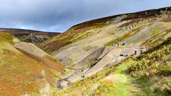 Bunton mine & Gunnerside Gill
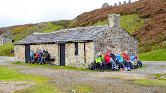 Lunch at Old Gang smelt mill
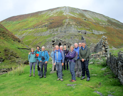 Group at the peat store at Bunton mine
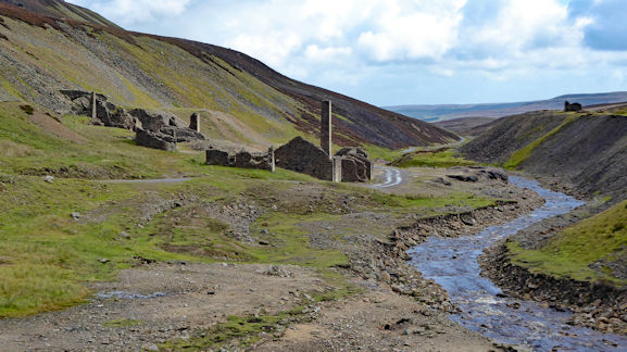 Old Gang smelt mill
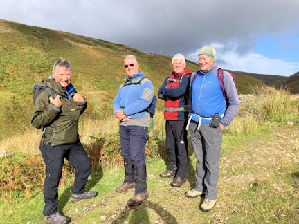 The boys on the plateau
 In Arkengarthdale
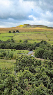 Sloes and Calver Hill
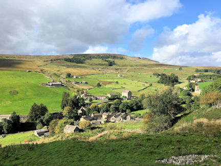 Langthwaite
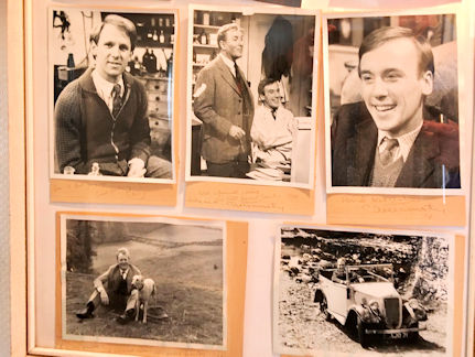 'Vets' in the Red Lion
Saturday - Grinton - Gunnerside - Muker into strong headwind most of the time, Keld, then a long pull up to the Tan Hill Inn, rewarded by a mainly gentle descent to Reeth and back to Grinton - 33 miles and over 3300ft of ascent/descent.
Map of bike ride
Map of bike ride
Saturday: Old Gang Mines
Sunday: Langthwaite walk
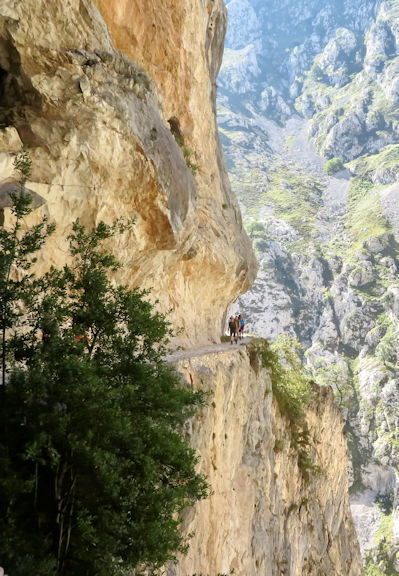 Dwarfed by the gorge
We emerged on our linear walk at Cain where Mike met us at the local hostelry for some very welcome refreshments.
During our trip back to the accommodation we stopped on a few occasions for short walks beside the road. On one of those short walks we saw a rare black squirrel. The drive back included a trip over the pass Puerto de Gloria.
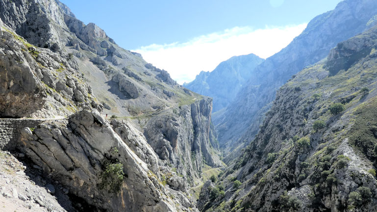 Gorge opening up
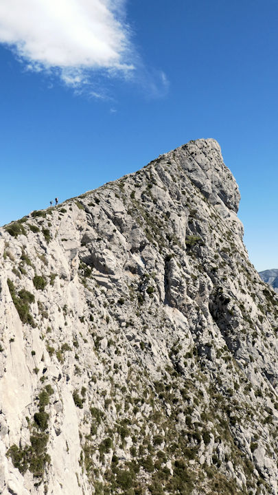 Ridge up to Peńa Mora
After descending from the first ridge we were having difficulty establishing the path on the ground and detoured via a more substantial farm track to the second ridge.
In the Picos it is very common to find cattle and sheep guarded by large dogs. In general these dogs are reasonably friendly but they certainly ensure their duties are carried out. The fields contained many wild flowers but there was an abundance of crocuses. On the farm track we encountered a snake which certainly caught me off guard but it slithered off harmlessly into the undergrowth.
After lunch the group split with 5 of us doing a minor scramble up a ridge to the top of Peńa Mora at 2103m. The views from the top were stunning and we were treated to a close fly by from a couple of vultures.
On our way down we met the others for a loose descent through a gully and a long ridge path to Pendes village where we picked up the pilgrim trail back to the accommodation.
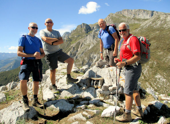 On the summit with the shrine
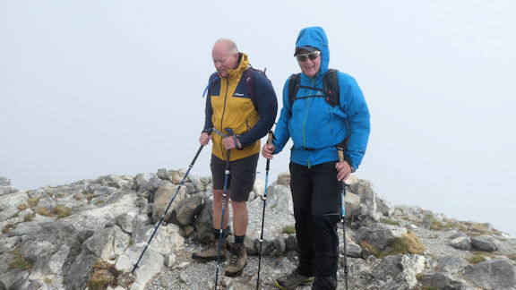 Ed and Paul on a wet Peńa Corsicao
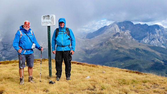 Mike and Paul on the way down as the weather improves
The lower group encountered a mass of approximately 40 vultures on a cow carcass.
The ridge group passed over 3 peaks, Peńa Gustavo, Peńa Caascajal and Corsicao at 2235m. The descent from Corsicao was 1600m to the village of Espinama which certainly took its toll.
The two groups met below a lake and Mike and his dogs joined us.
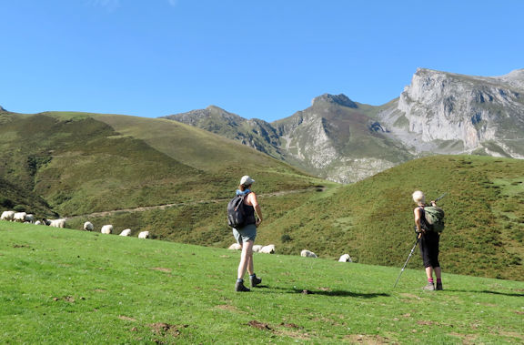 the valley walk
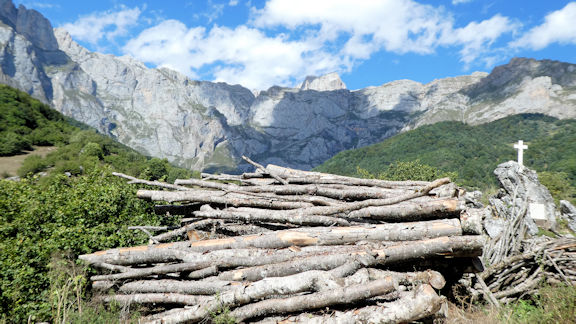 Looking towards tomorrows mountain
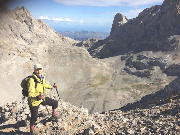 Heather on the way up
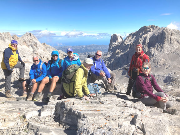 Team looking relaxed on the summit
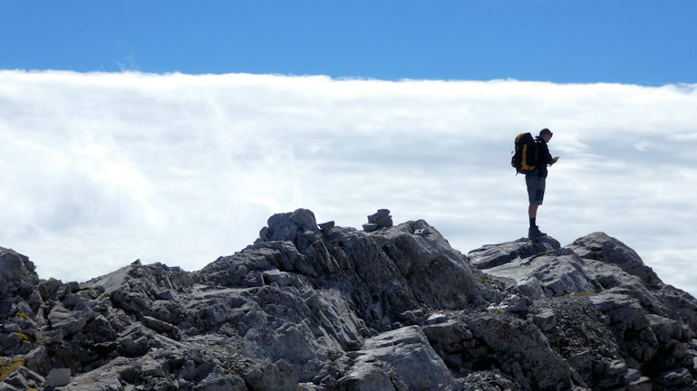 Summit and clouds
The early part of the walk involved a gradually rising path across large scree fields. Once we reached the col at the rear of the mountain it was a minor scramble to the top. This was the highest point reached by us during the week at 2508m.
The descent was a reverse of the way up but 3 of us took a short detour. There were quite a few Chamois first thing in the morning just along the tops of the scree fields.
On our return to the base of the cable car we visited the shops whilst we waited for the minibus to take us back to the accommodation.
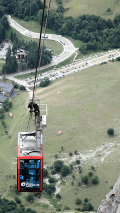 Cable car and the valley
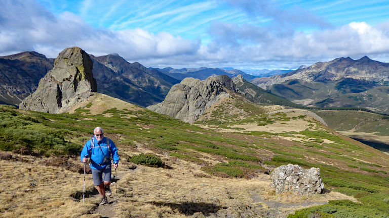 Mike on the way up to A. del Haranco
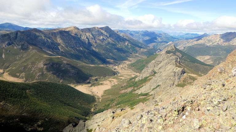 Descending below the Collardo del Robidario
ge. Initially it was a steep descent through heather clad slopes and finally across fields with cows and dogs. Some of the dogs and bulls were a bit verciferous in their duties.
We were very surprised to find a very nice restaurant in such tiny hill village clearly visited by outsiders, the drinks were well received and it had wonderful views.
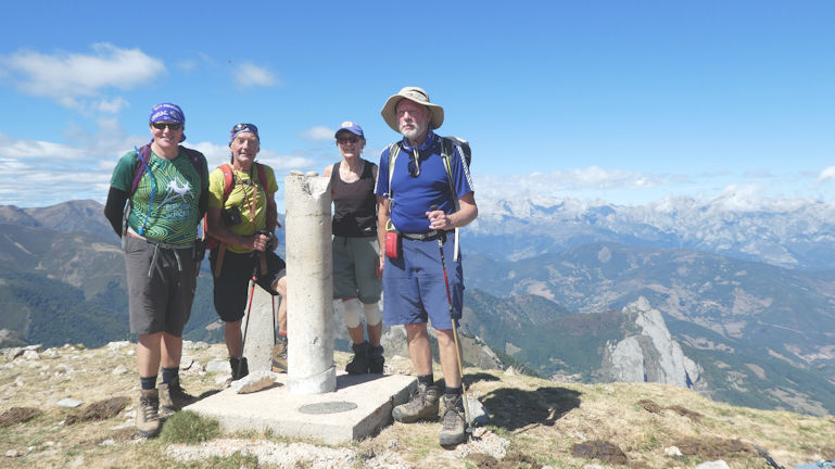 Team on the summit of Peńa Astrua
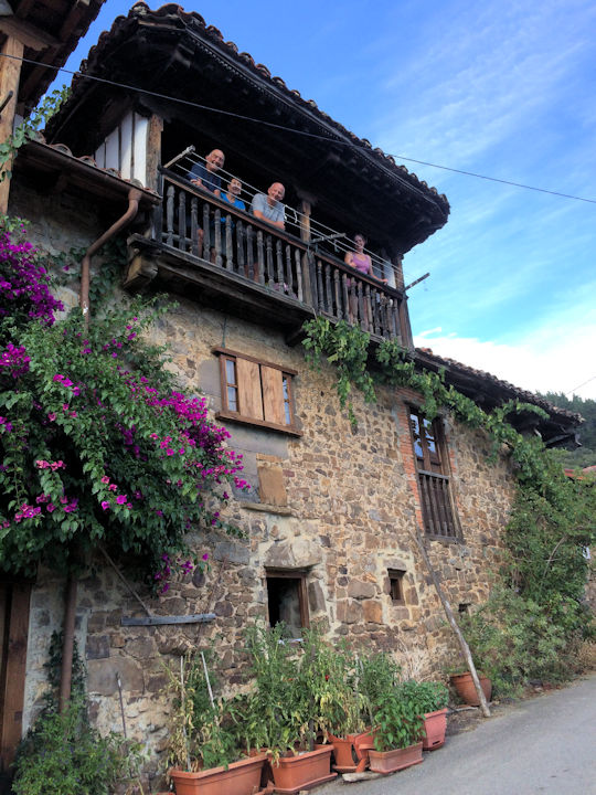 Casa Gustavo
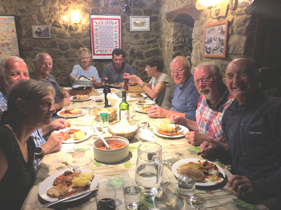 Dinner time!
 Mike trying on ABM buff given to him on the last evening
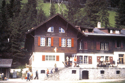 International Scout centre, summer 1973
Peter’s advice, coupled with the Guest cards for free use of all the uplifts and the local buses and trains, pretty much guided all 19 of us through the week.
 To set the scene for the week - Kander valley from the Doldenhorn Hut
 Photo opportunity, looking towards the Gemmipass
With a clear view in the morning sunshine of the Klettersteig/Via Ferrata from the 8-person cable car, and the waterfall flowing down the 400-metre rock face nearby, we all made our way up to Untere Allme, at 1725 metres, and setoff uphill towards Obere Allme, at 2017 metres.
A fairly leisurely Sunday lunch was enjoyed by us all, followed by a steady walk back to the cable car. Here we met up with Rosie and Bill and Don, in the little farm restaurant next to the top cable car station.
 The team at Rycher Baergli
We returned in good time for dinner and shared our knowledge with the group, and again plans were made for the next day.
 Appricot tart
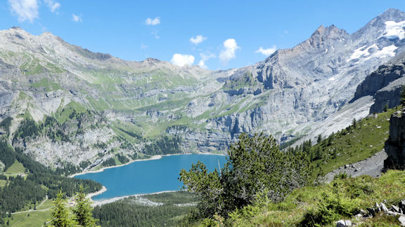 Oeschinensee from Doldenhorn Hut
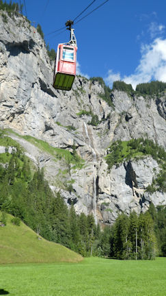 Cable car
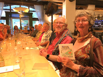 Birthday girl!
With views up to the Balmhorn and Altels and the Rinderhorn on our left, alongside the Swiss stone pine forest, at Arvenseeli, on our right, we hardly noticed the steady climb up to the Schwarenbach Hotel. Marmots were occasionally heard but not seen.
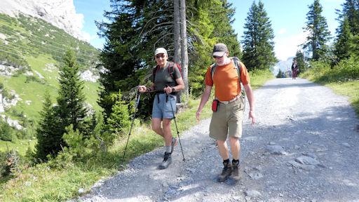 Andy and Daniel on the well made path
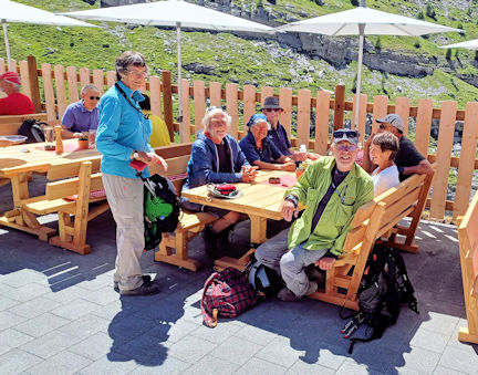 Morning coffee and cake
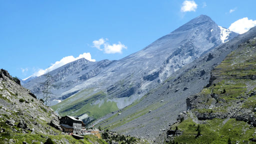 Looking back at the Hotel
On the last Sunday in July the annual Shepherd Festival is held here, with the shepherds herding up to 800 sheep, so the two we saw were not unusual at all up here! This festival celebrates the close relationship between the Valaisian and Bernese communities.
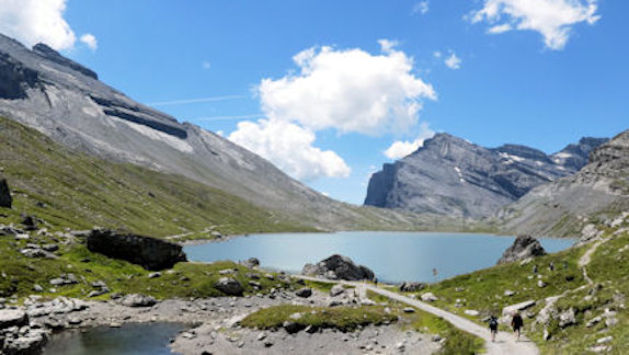 Walking towards the Gemmipass
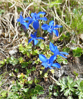 Gentians
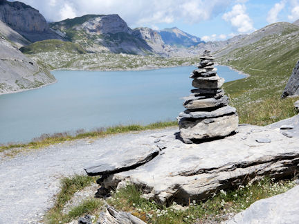 Daubensee
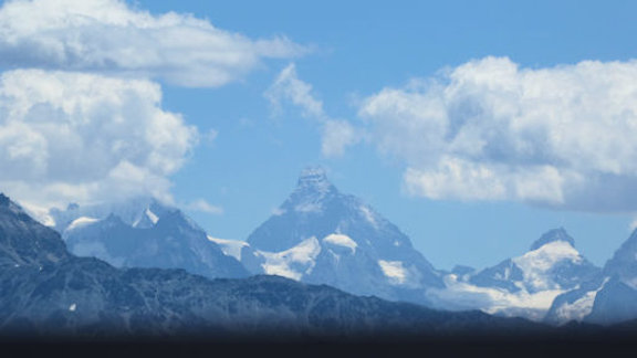 View from the Gemmi Lodge
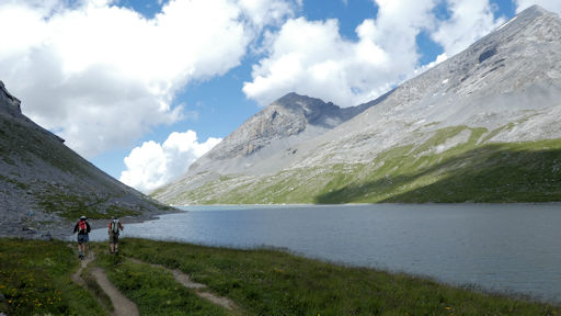 Daniel and Andy walking down the farside of the Daubensee
Whilst enjoying another balmy evening sat outside the hotel after dinner plans were made to go and explore the Gasterntal in the morning.
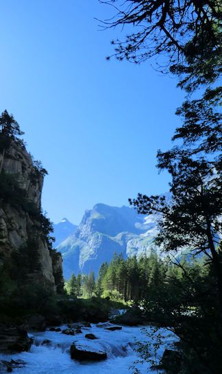 First view of Gasterntal
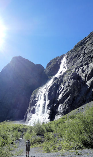 Waterfall at Bise
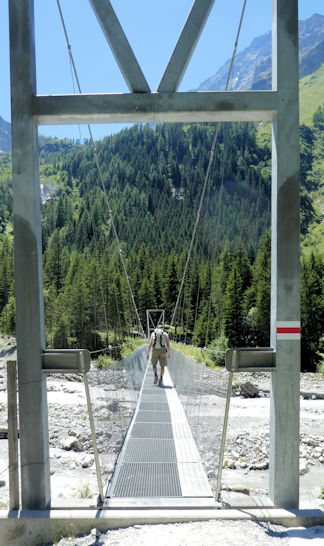 Bridge crossing
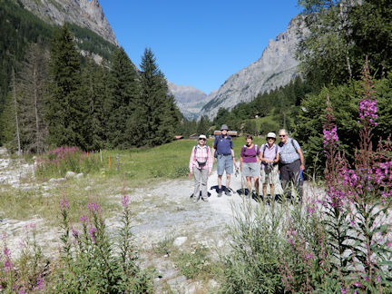 Gasterntal visitors
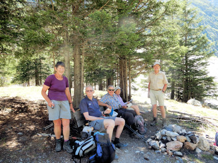 Picnic higher up the valley
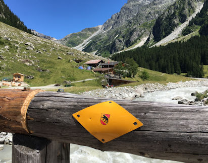 Berggasthaus at Heimritz
Pam very kindly responded by offering to organise next year’s hotel-based meet in the Saastal, with a view to us being able to visit the Britannia Hut during the week in early July 2023, to view the new stove, and celebrate with local SAC members there.
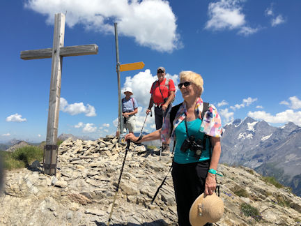 Don, Mike and Heather on the Budnerspitz
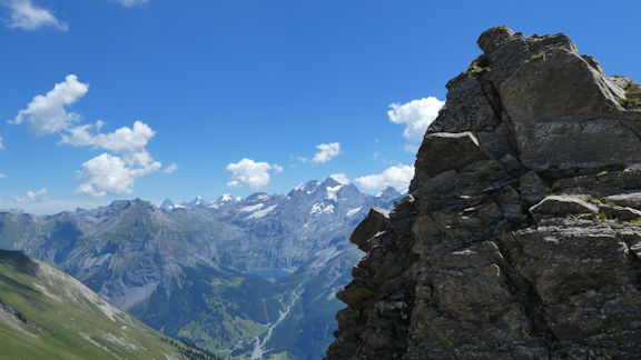 View from summit, looking towards Hohtuerli
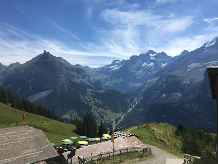 Refreshment stop at Untrallmenalp
With a refreshing large bottle of Rivella cooling in the trough at the farm café, right next to the cable car, having our name on it, again we enjoyed the lovely vista that these little high alpine pasture stops afford in the late afternoon sunshine, particularly secure in the knowledge that the nearly 500 metres of steep descent will be effortlessly managed in eight minutes by the Allmenalp cable car.
With the Bluemlisalp Hut situated just above the pass providing us with shelter and sustenance just as it did all those years ago, and the Oeschinensee gondola easing both the initial up, and the final bit of down, plus carrying much less in our rucksacks, made for a very enjoyable and steady day.
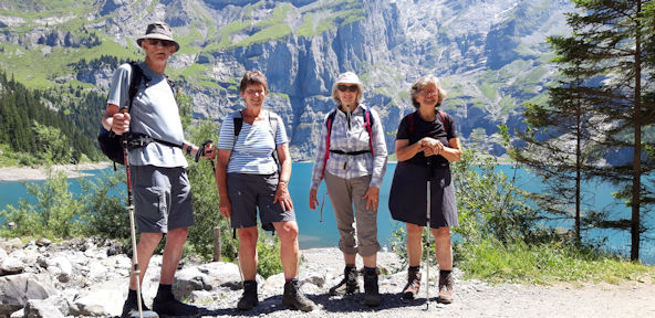 Above Oeschinensee
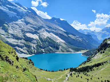 Looking down on Oeschinensee
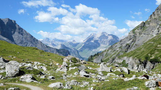 Refreshment stop at Oberbaergli
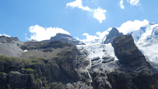 The Hut up at the pass
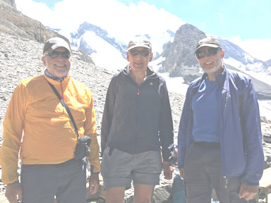 Mike, Daniel and Andy at the Hut
 Bluemlisalp Hut
Dropping down to the Hohturli Pass Mike and Andy posed for a photo 49 years after the last time they were at the pass!
At Oberbaergli we took the left-hand path down closer to the lake, and returned in time with many others reluctant to leave this glacial oasis hidden amongst its mountains, to the gondola station.
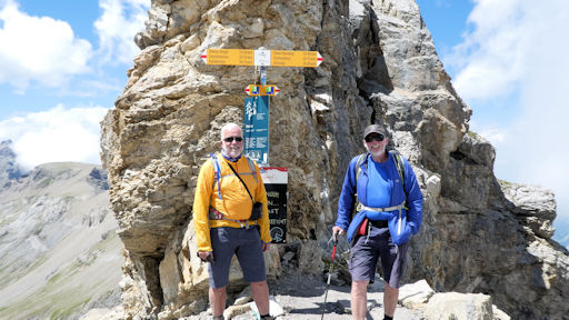 Mike and Andy at Hohturli
Herzlichen Dank meine Lieben, as they say in this part of the world.
 Changing transport, the old...
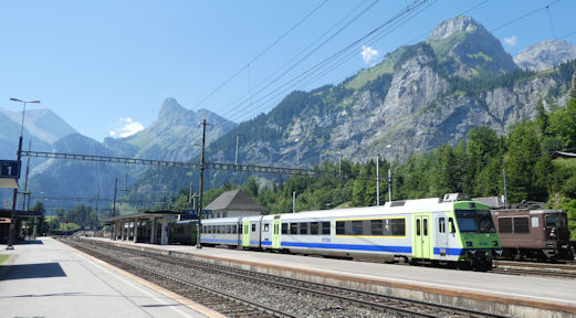 .....and the new.
Very Special guests for a couple of nights were Pam Harris and Alan Norton.
Trip Notes from Bill Westermaeyer
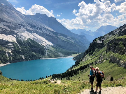
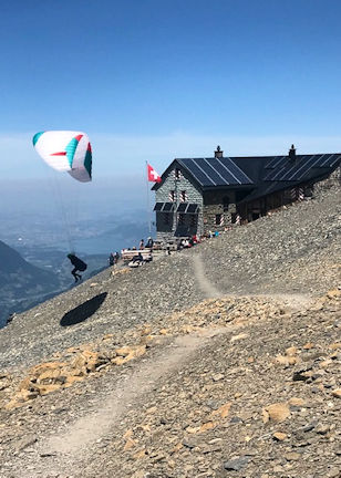
The route was a constant uphill slog, not especially pretty except for early views of the lake. Richard was a little nervous traversing some of the steeper exposed slopes, but he had no problems. After 3 hours and 39 minutes, we reached the hut and had great views of the Bluemlisalphorn and of many glaciers above us and of the Kiental below. We could have walked all the way to Griesalp from here had we wanted to. It is unclear what our total in elevation was, but from the map I calculated that we had climbed at least 1220m. (My Apple watch, curiously, indicated that we had gained considerably more in elevation, but I have not trusted it since I changed the measurement from feet to metres. Need to check this). At the hut, we saw two people launch their parapentes, which they had carried up from the bottom, and sail away high in the sky. I wished that we had had this option!
We congratulated ourselves on a good hike back at the hotel and ordered large beers. It seems we were very dehydrated!
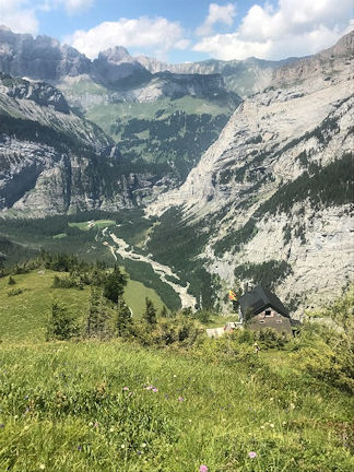 Balmhorn Hutte from above with the Gasterntal far below
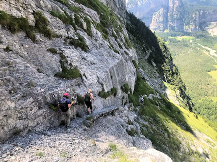 Descending from the Balmhorn Hutte
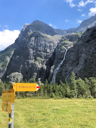 The trail ascends just left of the waterfall!
Trip Notes from James Baldwin
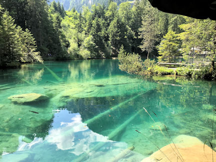
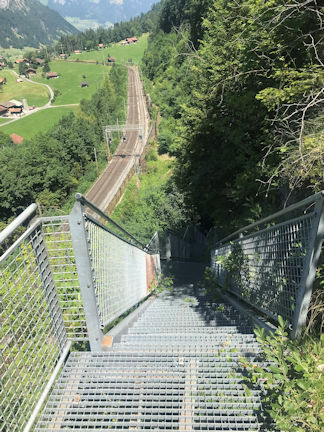
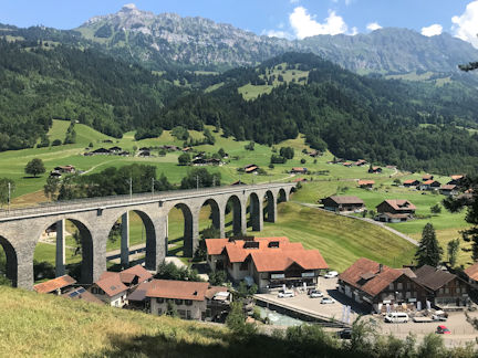 Kander viaduct at Frutigen
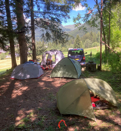
Arriving at the site next morning we were somewhat disheartened to see the whole site was on quite a slope, and very relieved to be shown a flat area at the top of the site under the pine trees (It was hot all week) with plenty of room for three small tents, a kitchen tent, and a van, and trees just right for slinging a hammock.
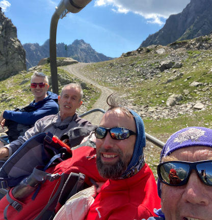
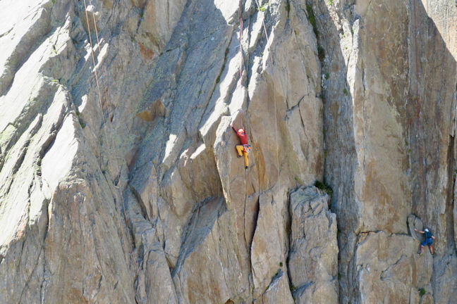 Mike climbing at le Brevent
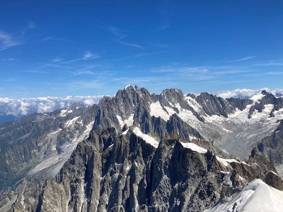 Aig. Vertes.les Droites. les Courtes from Aig de Midi lift
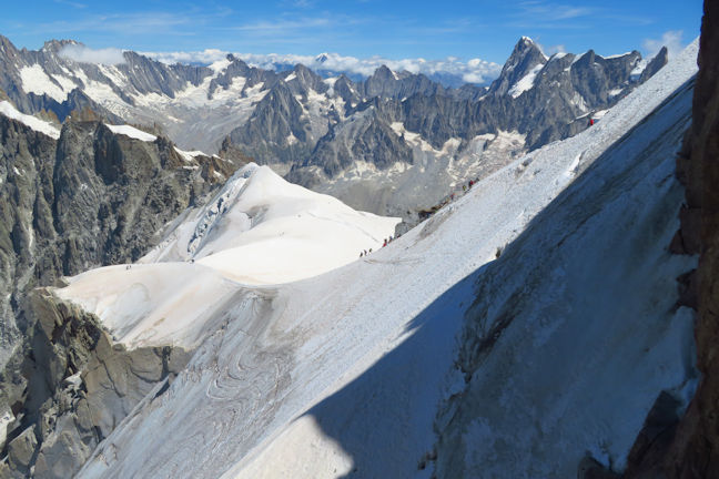 Looking across to M. Rosa from the lift
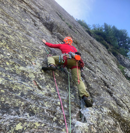 Mike at Vallorcine
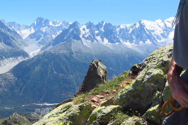 Aig de l'Index with Grande Jorasses and Mt Blanc behind
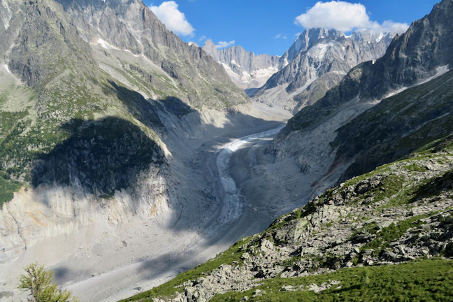 Mer de Glace - a sorry state!
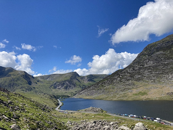
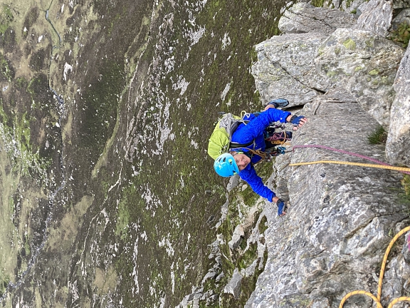
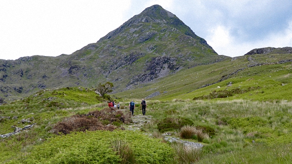 Ascending Cnicht
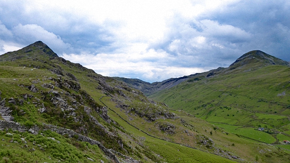 View of our Cnicht circuit
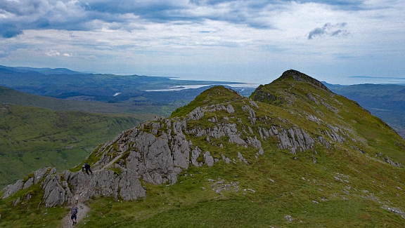 Cnicht summit
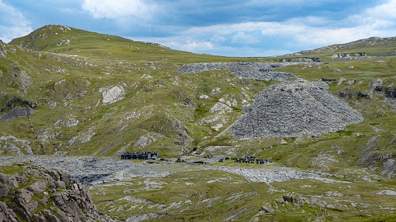 Croesor quarries
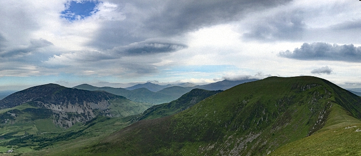 Nantlle ridge from the monument
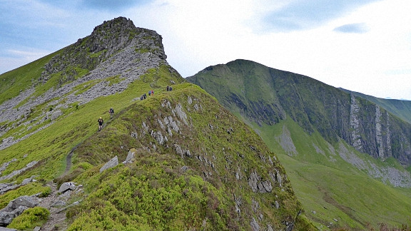 Starting the ridge proper
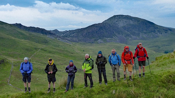 Wet, but still happy
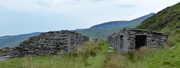 The slate sheds
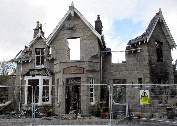
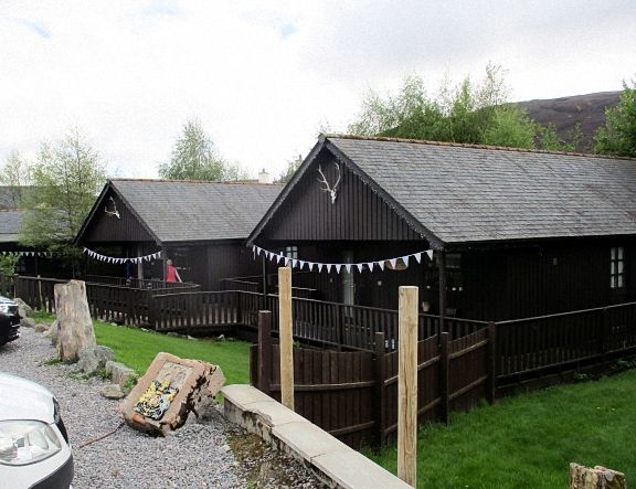
 Andy, Celine and Max coming up Carn na Drochaide
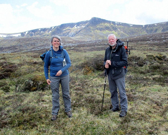 Celine and Andy below the Stuic
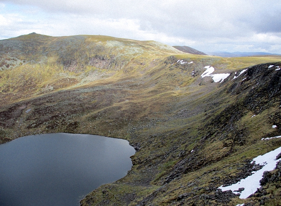 Loch nan Eun below the Stuic
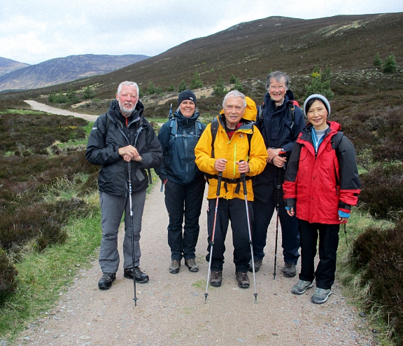 Andy, Celine, Roger, Max and Qing in Glen Lui
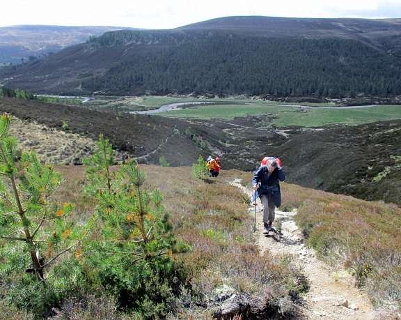 Coming up to Clas Fearnaig
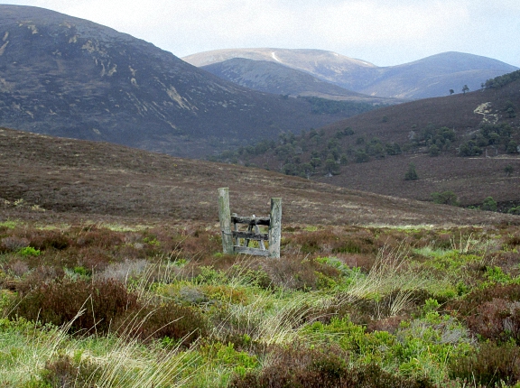 Gate into Glen Quoich
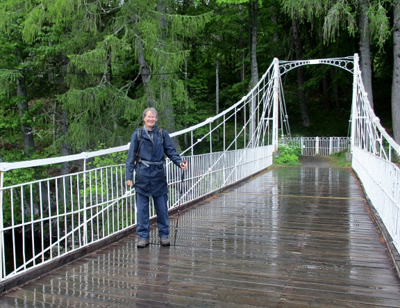 Max on Balmoral bridge
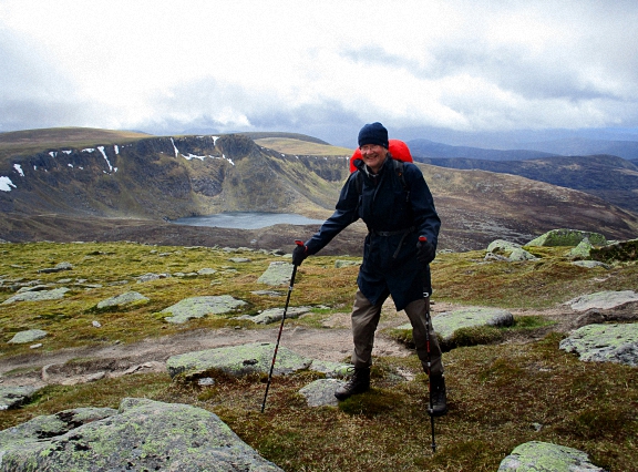 Max bracing against the wind, Stuic and Loch nan Eun behind
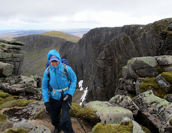 Judy in Cac Carn Mor
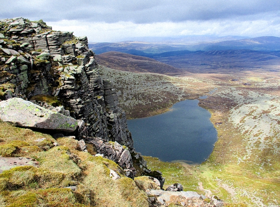 Lochnagar from Cac carn Mor
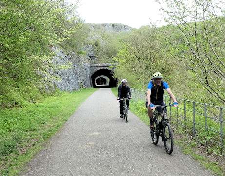
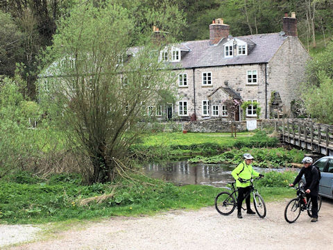
This made the decision where to eat on Saturday night for us. On returning back to base we spent time with Catriona and George, two potential new members, introducing ourselves and extolling the benefits of being an ABMSAC member, as well as listening to their various interesting experiences and what they were looking to do in the great outdoors.
With the arrival of Don and Judy the group was complete, and after discussions about the plans for Saturday, a relatively early night was had by all.
Myles and I set out early on our Saturday morning sojourn, but we hadn’t gone more than a couple of miles before a puncture brought us to an abrupt halt. Out came the spare inner, and with some deft handling of the tyre levers and pump by Myles, we were soon back on the road again; our first destination Hope.
Just beyond the café area the road is only open to cycles, which made the rest of the ride up to near Slippery Stones at the top of Howden reservoir an absolute joy. Just beyond our café stop is Derwent dam and a 60th anniversary memorial to the dambusters. Having seen the Lancaster fly through on the 50th anniversary, it still brings home what a feat of flying was achieved.
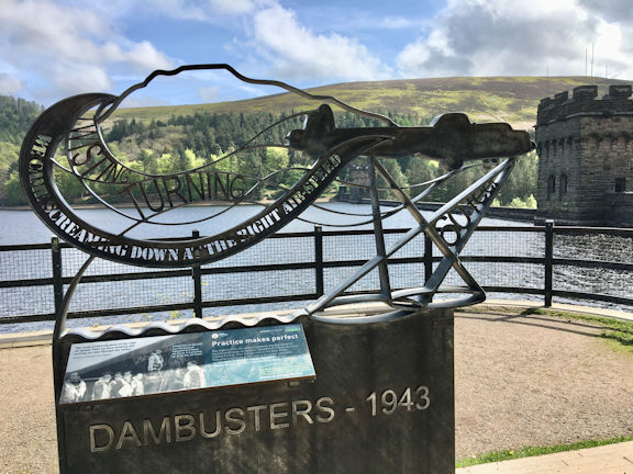
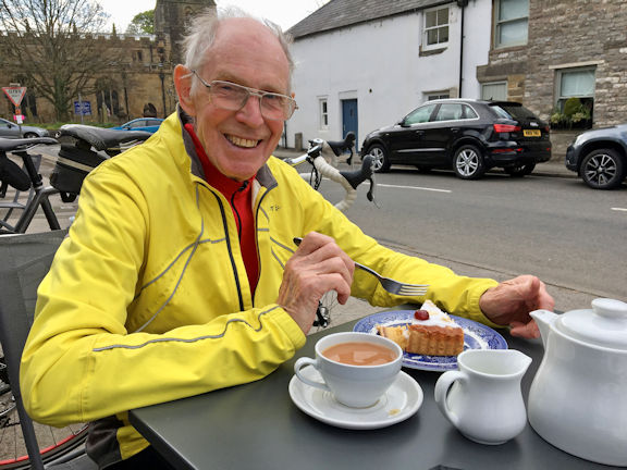
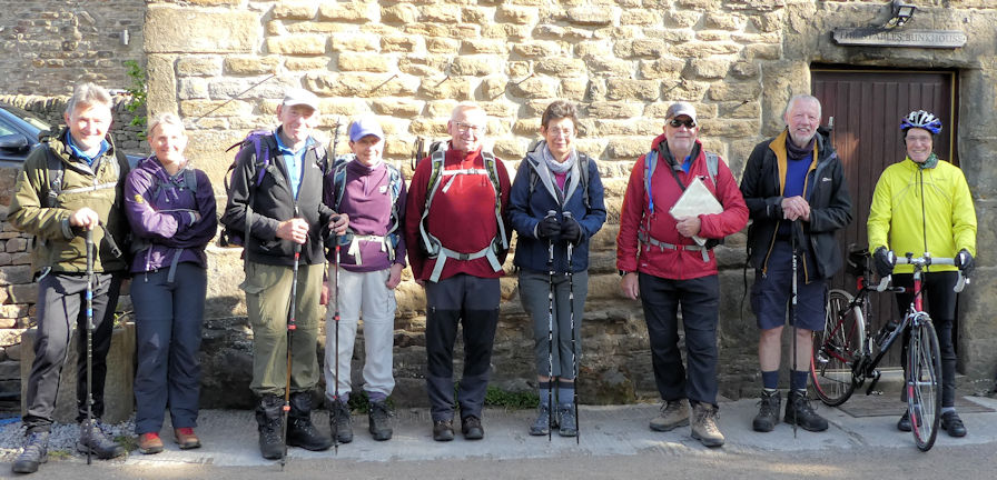 Group at the bunkhouse on Saturday morning
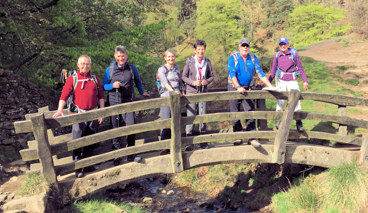 Bridge over Grindsbrook
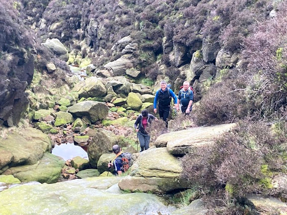 Climbing up Grindsbrook to the plateau
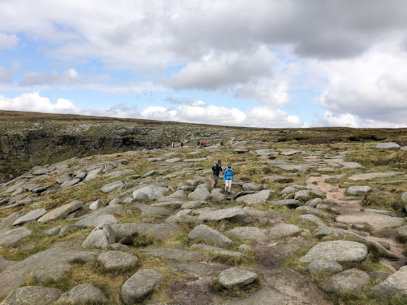 Above Foxholes looking for the path across the plateau
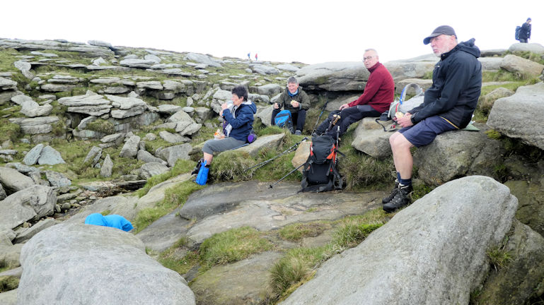 Lunchtime!
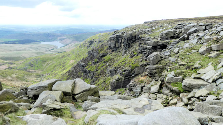 View from Kinder Downfall
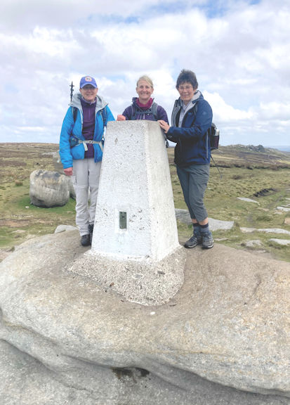 High point
Continuing on through Edale Rocks and turning left down Jacobs Ladder close to Edale Cross, we made our way down through Upper Booth and Barber Booth and back across the fields to Edale and the bunkhouse for a welcome pot of tea and a great selection of homemade cakes.
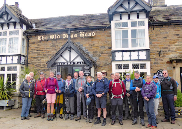 Ready for the off
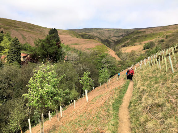 New trees planted just above the Hostel
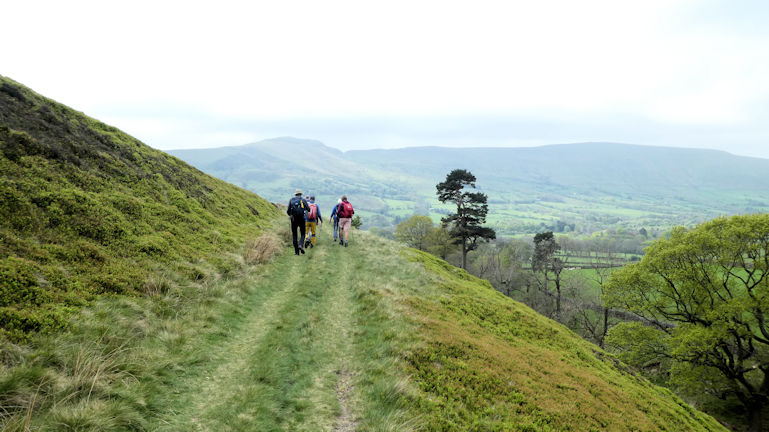 Above the Hostel with Mam Tor ridge in the background
Crossing over the road and under the railway line the path continues on the opposite valley side turning right at Townhead and making its way up to Lose Hill (Ward’s Piece).
Here we tarried a while enjoying the views all around before continuing to Back Tor and Hollins Cross where the path from Castleton to Edale bisects the ridge path.
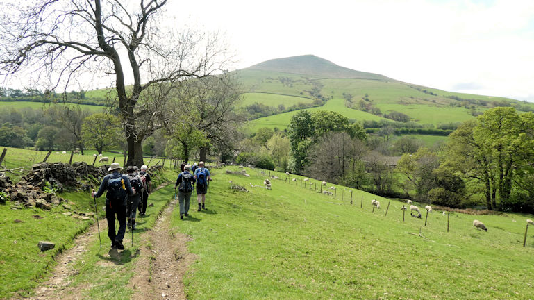 After lunch we head for Lose Hill
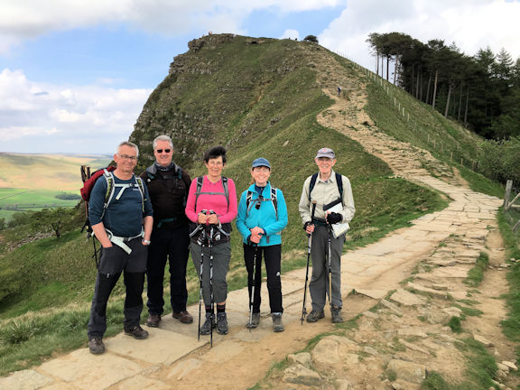 The team on the ridge with Back Tor in the background
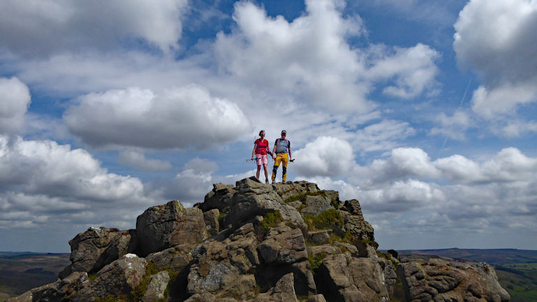 Michele and Marcus atop Win Hill
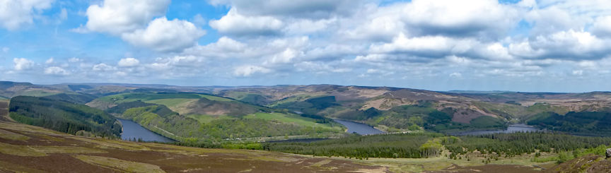 View of Derwent Reservoir from Win Hill
The group then made a quick visit to the Ollerbrook Farm bunkhouse to check over the accommodation intended for the upcoming proposed Peak Meet next month.
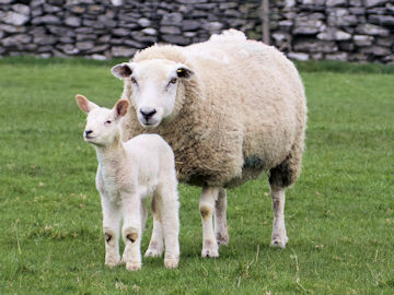
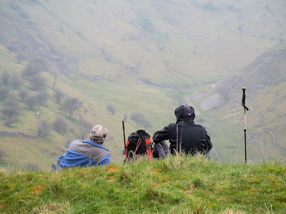 Time for a break
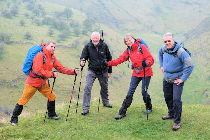 The happy group
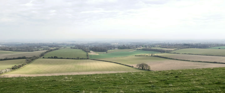
After a cooffee break in a small wood the waterproofs were discarded and the weather set fair for the rest of the day.
Just after Pilot Hill we turned off the bridleway and headed down to Faccombe.
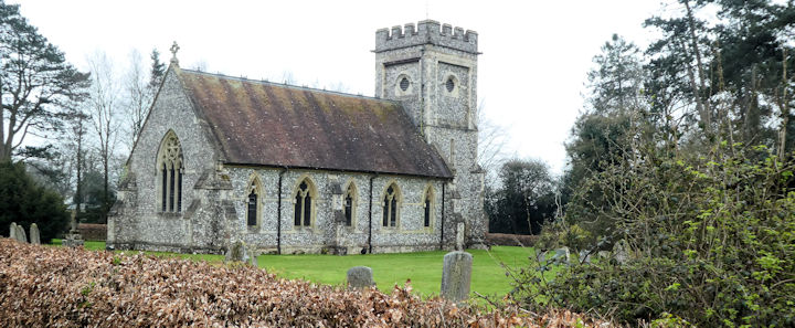 St Barnabas church in Faccombe
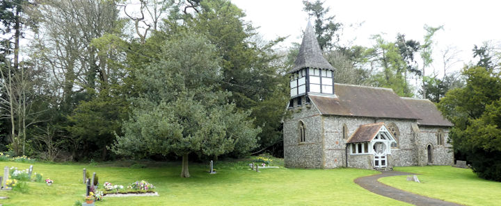 St Peters church in Linkenholt
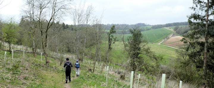 Heading towards Combe Woods
 Combe Gibbet
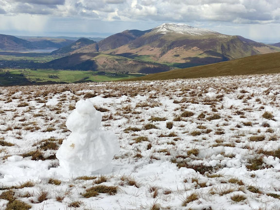 The last snowman?
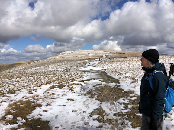 High Street
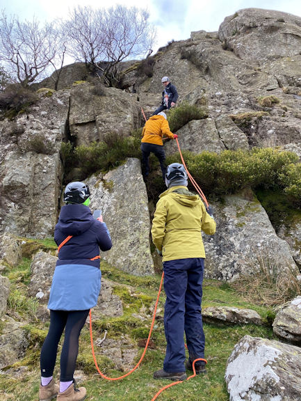 Rope work
 Crumble
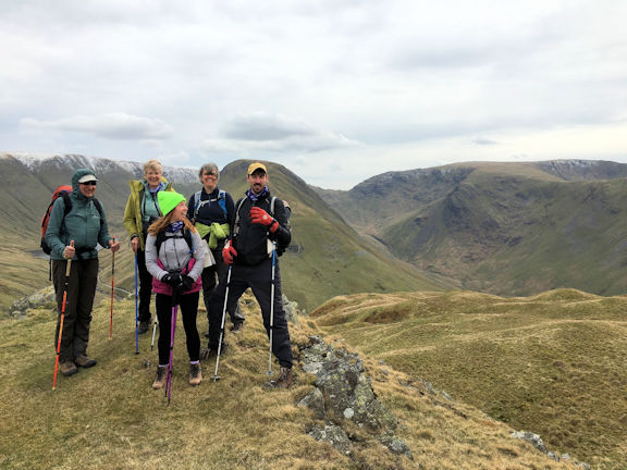 Top of Brock Crags
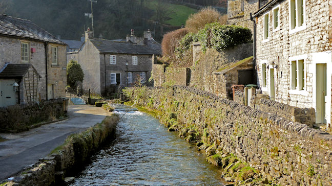 Castleton back streets
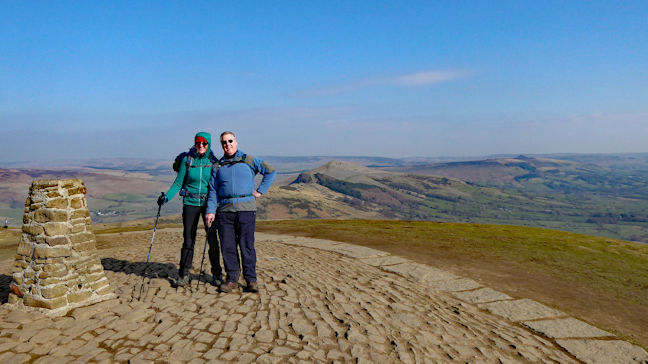 Steve and Michele on top of Mam Tor, with the afternoon route behind them
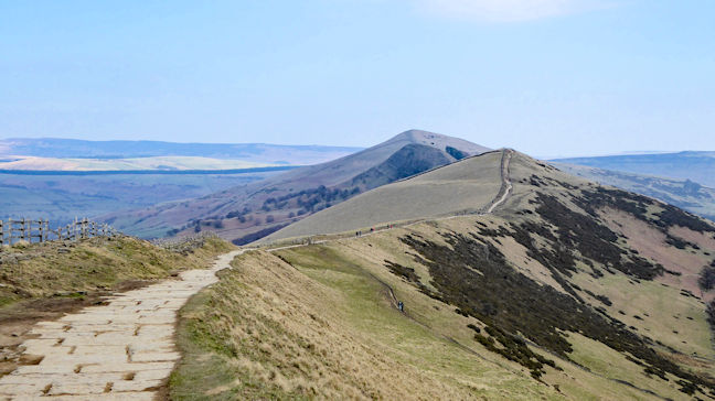 The route ahead, to Hollins Cross, Back Tor and Losehill – A popular ridge walk
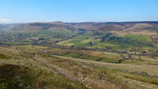 Edale and Grindsbrook from Hollins Cross
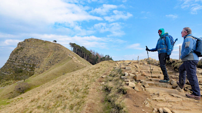 On the way up to Back Tor – Suitably insulated against the cold wind
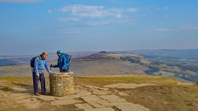 Losehill, with Win Hill in the background
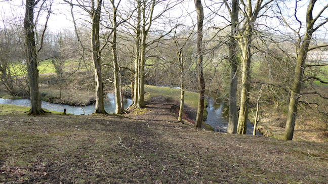 Meandering Peakshole Water
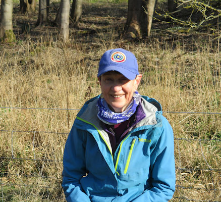
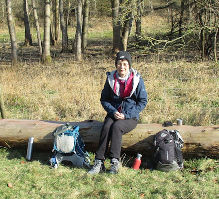
Judy and Margaret enjoying a break
 Judy by Wormsley Park
Then we went North to Studdridge and took a short section of road to make sure we were able to get back over the motorway to our car park. A very enjoyable day, walking a nice route in good weather.
.
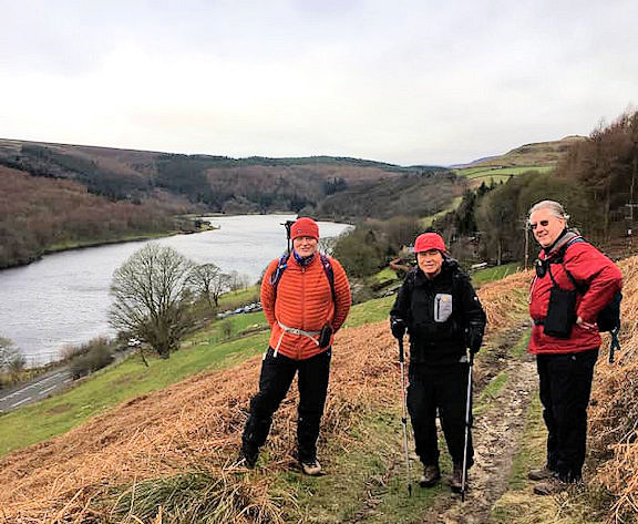 Ed, Roger and Steve
We were soon availing ourselves of a rather tasty full breakfast which seemed the right thing to do given a chilly breeze promised to be with us all day. Roger joined us and that was the party for the day. Worth noting that if you have a breakfast and become a 'patron' for the day the car park is free
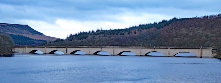 Ashopton Viaduct and Bamford Edge
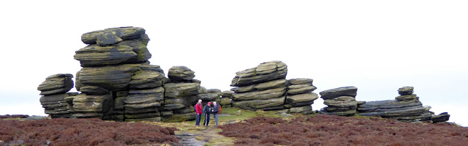 Coach and Horses rock formations
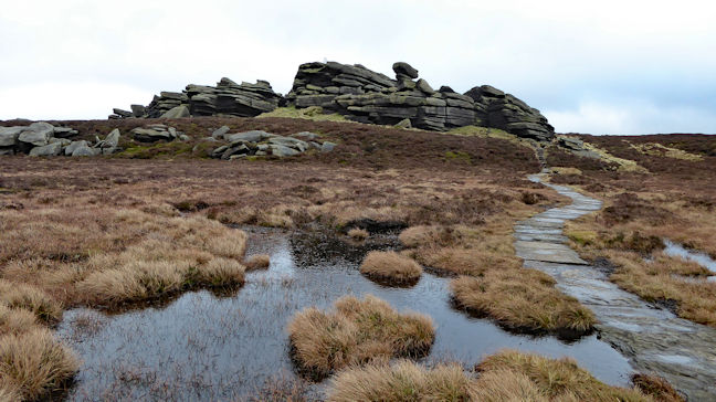 Retrospect Back Tor
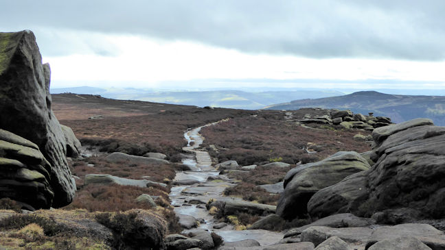 the well made path
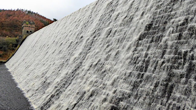 Derwent dam – cue theme tune…
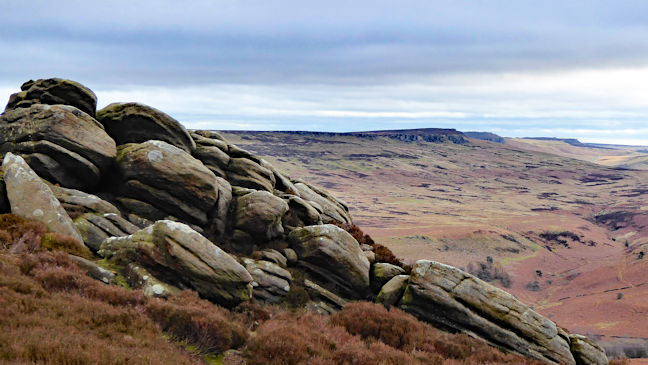 Stanage Edge from Whinstone Lee Tor
As our dear old friend Myles is wont to say, 'What's not to like!'.
Forty one of us gathered in various spots across Glenridding and Patterdale including the Inn on the Lake, the George Starkey Hut and various B&B’s and AirB&B’s, all coming together on the Saturday night for the Annual Dinner.
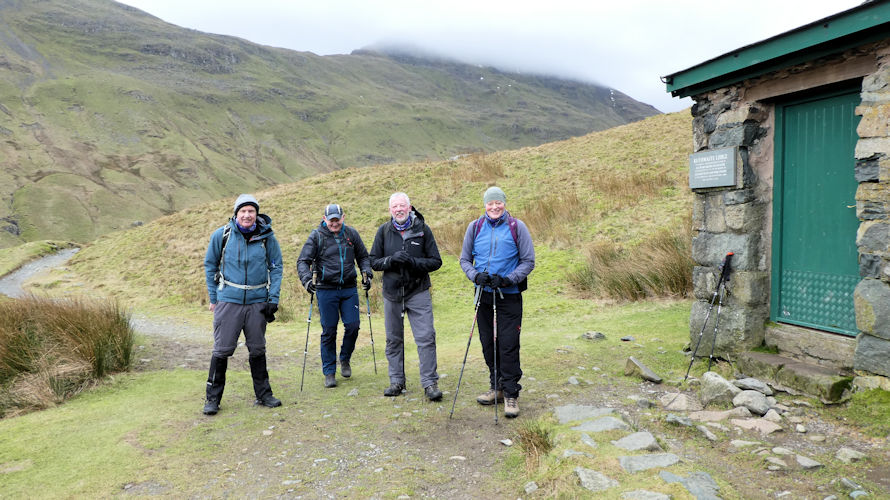 Team on the way to the tarn
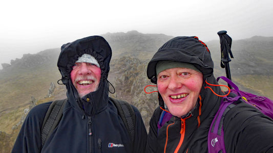 Selfie before the bad weather came in
They were joined by Andy Burton and some others to walk to the Brotherswater Inn who despite being struck by a power cut were still able to enjoy some mulled wine and some lunch.
 Marcus spying Michele, Alison and Maggie
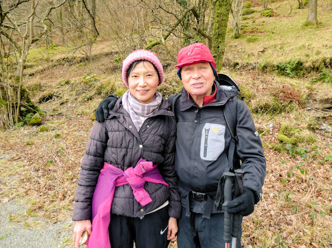 Roger and Qing enjoying the weather
 Windy top
Catching the moment around the tables
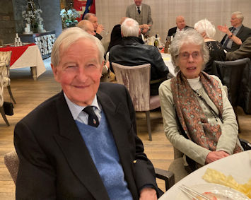
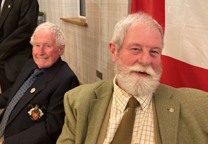
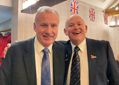
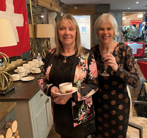
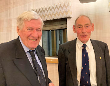
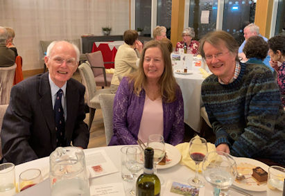
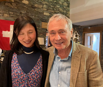
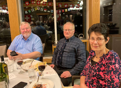
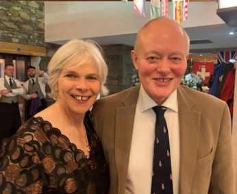
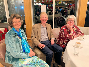
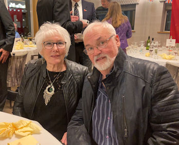
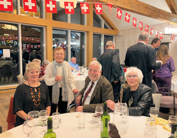
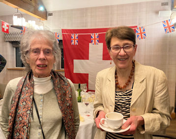
 President with Stevan Jackson
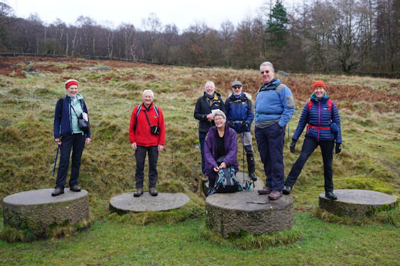 Millstones near the old quarry
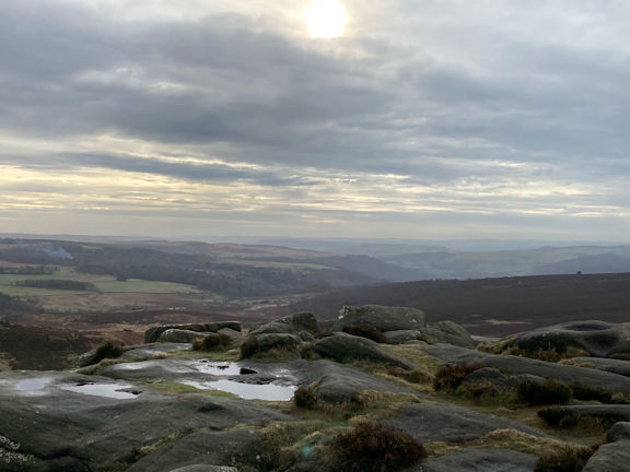 Views across the moors
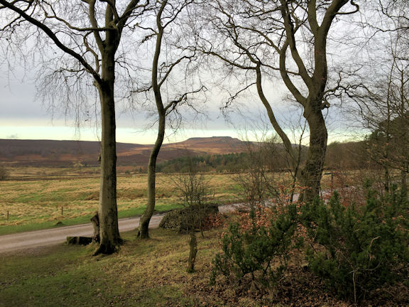 Higger Tor from Longshaw Esstate
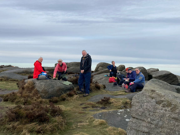 Lunch at Higger Tor
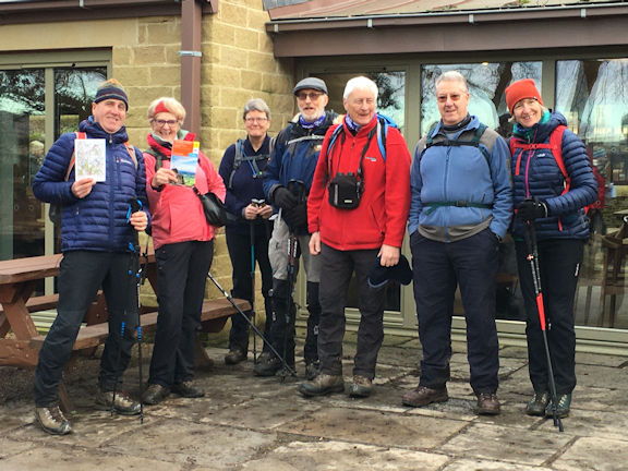 Outside the newly revamped National Trust cafe on the Longshaw Estate
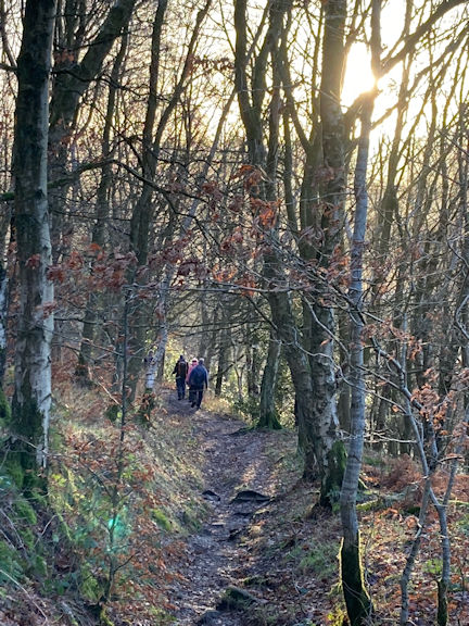 Woodland walk
Report by Andy Burton.
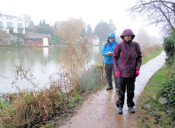 Mike and Margaret at Goring
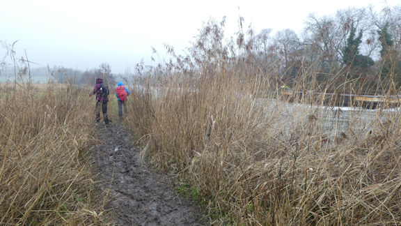 Thames Path
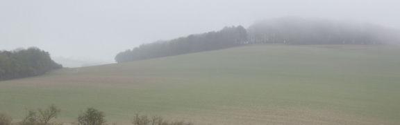 looking across to Langdon Hill
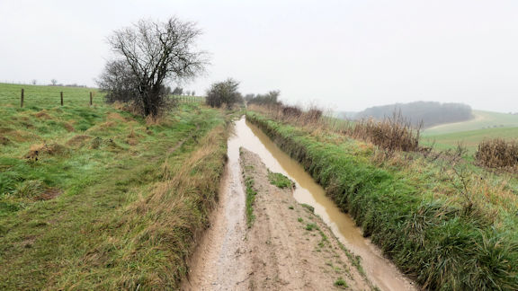 muddy conditions on the track
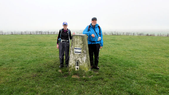 Judy and Mike atop Lowbury Hill, no battle today.
Report by Mike Goodyer
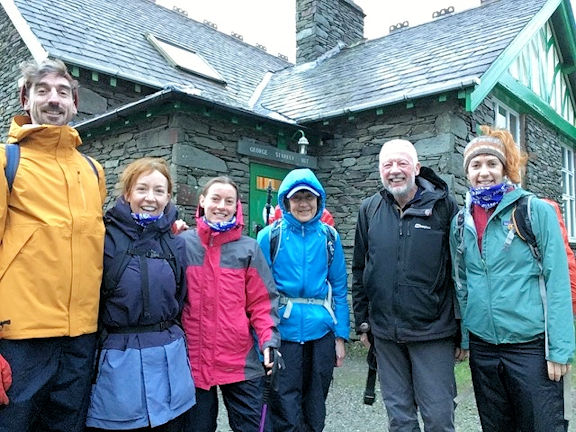 The group at the hut
It was at this point that Anna spotted a red squirrel, and everyone in the group was able to see this iconic British mammal for themselves.
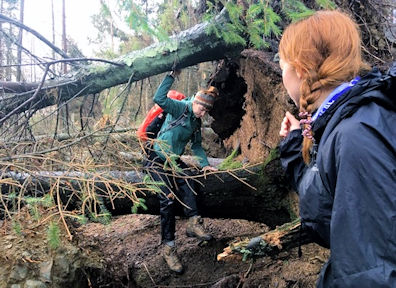 climbing through the trees
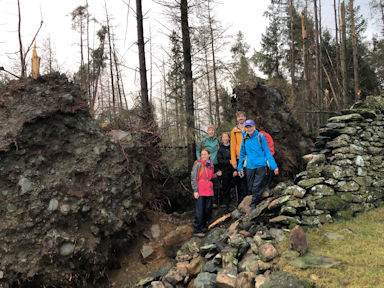 emerging from the trees
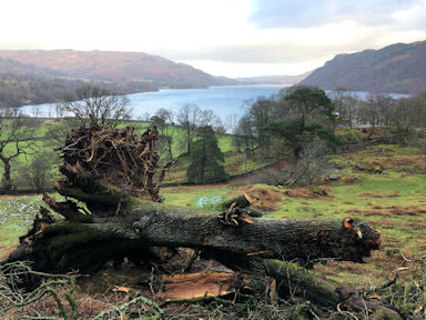 below Seldom Seen
 Party games!
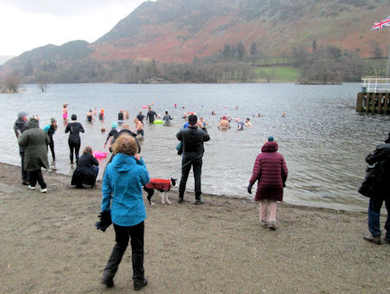 New Year's Day dip
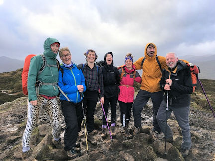 windy day on Airy Crag
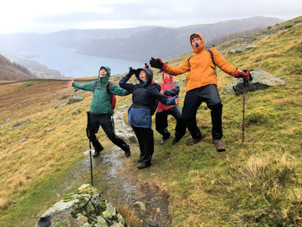 wind on Gowbarrow
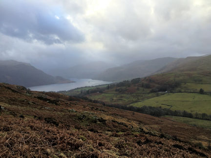 looking up the valley towards Kirkstone Pass