


Presidents Meet, Patterdale, November
Day Walks, November
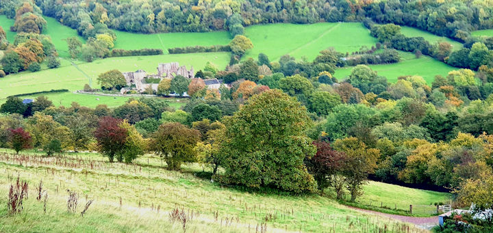
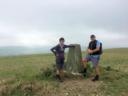
Bannau Brycheiniog Meet, October
Day Walks, October
Llangollen Meet, Wales, September
Tour of Mont Blanc Trek, France, September
Rhinogs Meet, Wales, August
Visit to the Britannia Hut, July
Saas Almagell Meet, July
North Wales Meet, June
Mendips Meet, June
Torridon Meet, May
Peaks Weekend, May
North(ish) day Walk, White Peak, April
Skills Weekend at GSH, April
Southern day Walk, Test Valley, March
Northern day Walk, Whatstandwell, March
Northern Day Walk, Lathkill Dale, February
Annual Dinner Weekend, February
Southern day walk, Chilterns, January
Twixmas Meet at GSH, New Year
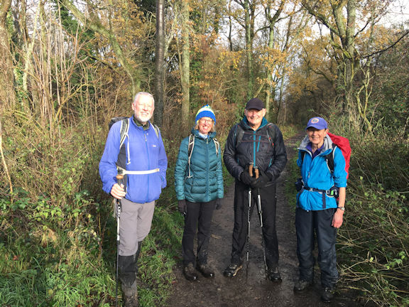
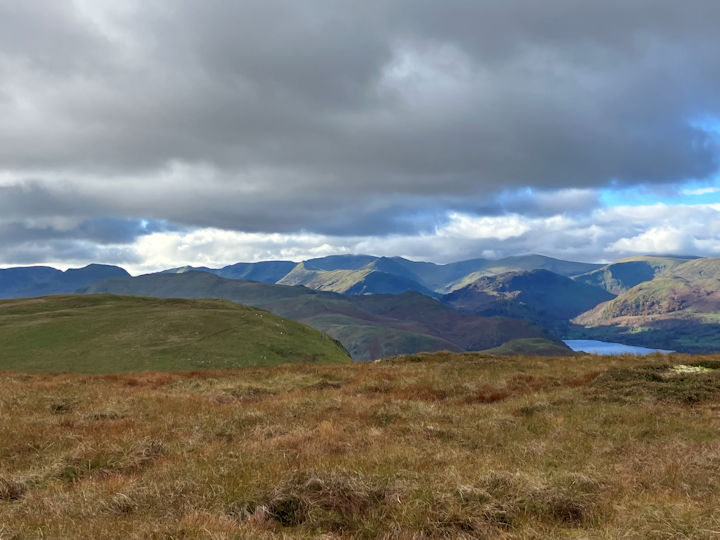
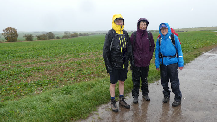
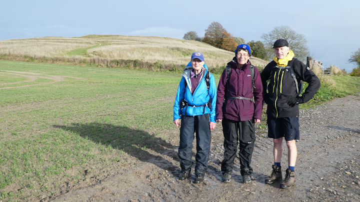
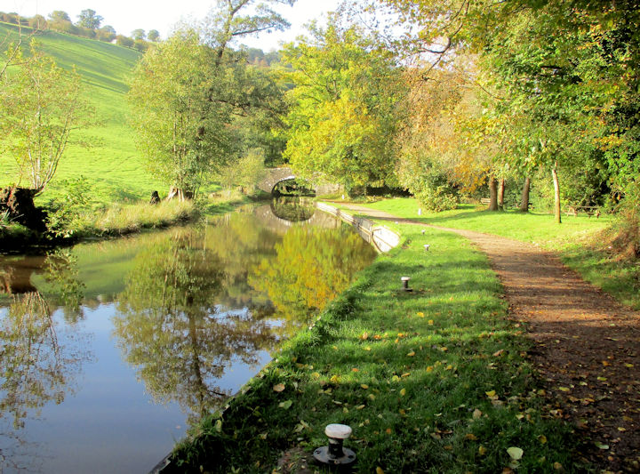
The last southern day walk of the year went from Stokenchurch to Bledlow Ridge and around, with an early lunch stop at a viewpoint towards Chinnor and a diversion to a trig point hidden in trees.
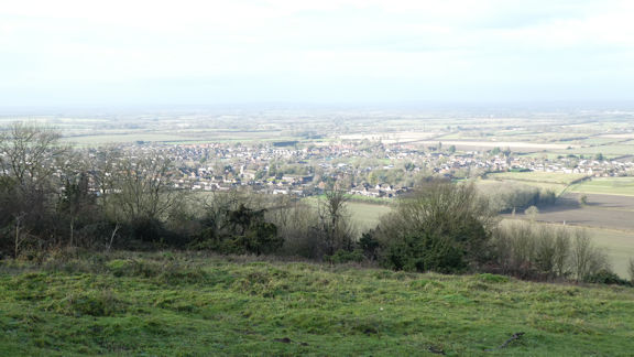 view towards Chinnor
| 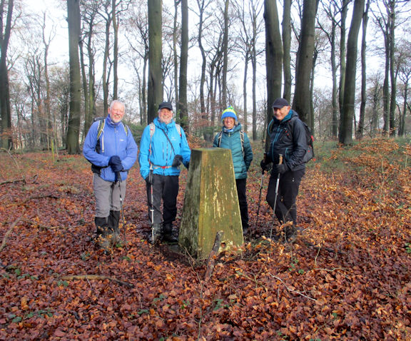 trig point hiding in the woods
| |
The weather was better than anticipated, having shown a forecast for rain most of the day, however we had some sunshine either side of a heavy shower for an hour and a half.
Amongst other highlights we saw 2 hares and a buzzard. We all enjoyed the day, including the surprise northern visitor to the group, though the saddest moment was finding the pub had shut by the time we were back at Stokenchurch! At least it gave us the opportunity for a reasonably early return home.
Present: Andy Burton, Mike Goodyer, Paul Stock, Fiona Tomlinson and Judy Renshaw
Report by Judy
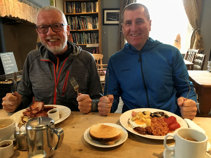
This year's Presidents Meet had to be moved at short notice to the first weekend in November to ensure that the rescheduled Brecons Meet at the New Inn at Bwlch could still go ahead. The regular chef could not make it due to work commitments, and one of the attendees fell off his mountain bike a fortnight before, injuring his shoulder, and causing him to miss both the Brecons meet, and this one, where he was sharing transport with your Editor.
I was beginning to get that ‘we’re doomed’ kind of feeling but three quick phone calls put the meet back on track. Celine agreed to help with the vegetarian meal option by making what is rapidly becoming a firm George Starkey Hut staple enjoyed by one and all, chickpea and spinach curry.
Daniel agreed to make an apple crumble for pudding (also a communal hut meal favourite), whilst Mike drove up to my place on Thursday afternoon, and we set off north in the Skoda, with my largest Tupperware tub full of spag bol and half a dozen bottles of wine, and other necessary supplies.
Concern over finding somewhere open for food and drink later on that evening led us to divert to the Brown Cow at Mansfield for a pint with Mr. Caulton and friends, and a great curry at the Modhu Mitha, scene of many a great post 2-10 shift unwind in my uniform days.
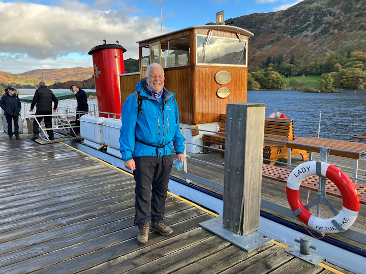
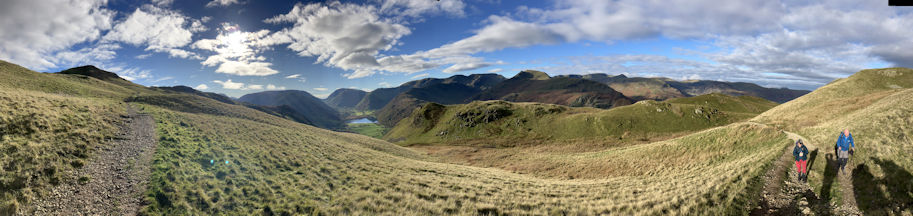
We arrived at the Hut just before midnight and as there was no fire on, we retreated to our pits. Consequently, Friday morning arrived quite quickly, and Mike and I decided to go on the first ferry to Howtown and explore the area up beyond Arthurs Pike and Lords Seat.
From the Howtown ferry pier we took the Ullswater Way out of the village towards Pooley Bridge. Crossing over Swarthbeck Gill and looking over to Sharrow Bay we reminisced on the fate of the flagship Country House Hotel which fell victim to the pandemic, before passing under Auterstone Crag and walking up towards the Cockpit hanging a sharp right onto Barton Fell and up to Arthur’s Pike, eventually joining with the course of the Roman Road, namely High Street.
On reaching the top of Loadpot Hill, 671 metres, and looking along the continuation of the Roman Road towards Wether Hill and eventually High Raise and across Bampton Common we both realised that there was a large area here that we had never walked in. Something to rectify at a later date when more daylight hours are available to us.
We made our way off the top of the fell and down towards Fusedale using vague bits of path and sheep and deer trods with glimpses of parts of Ullswater and the surrounding fells being illuminated in the autumn sun till we were sheltered from the wind.
Here with views of Hallin Fell and Martindale Common and Howtown nestling below we had some lunch and enjoyed the beautifully varied landscape laid before us. The descent into the back of Howtown, and a quick check to see if any of the Howtown Hotel facilities were open to us followed. They were not.
A short wait back at the pier, and we caught the last ferry of the day back to Glenridding. Initially we sat in the open part of the boat for the views, but the possibility of a hot chocolate and a sit in the warm proved too much for the both of us.
A brisk walk back to the hut saw us back inside as the light was fading. I lit the stove, Mike put the kettle on, and in short order we were enjoying the Hut again at its most welcoming best. Marion came and joined us and let us know that the White Lion was closed, as the business had gone bust, so the traditional Friday night fish and chip supper was taken at the Ramblers Bar in the Inn on the Lake. The same room where we hold our AGM before the Annual Dinner at the start of February, served us well on this occasion too.
On walking back to the Hut we met with Gilbert Roberts, a newcomer, and spent the rest of the evening introducing him to the place and things ABMSAC.
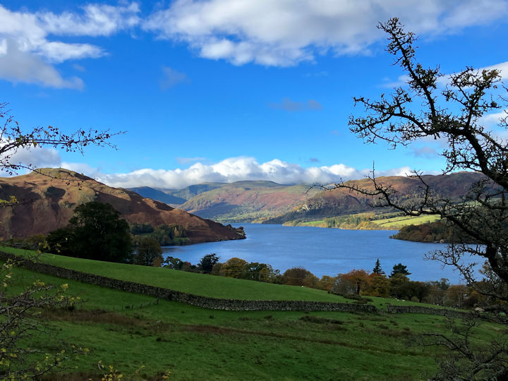
On Saturday morning I drove the three of us up to the National Trust car park at Aira Force and from here we completed a favourite round out above Ullswater in Gowbarrow Park, with the lake presenting a very still autumn surface in which to reflect the surrounding fells, up onto Airy Crag and down on the much more complete stoned path towards both Dockray and the top of the falls.
Just after 11am we found ourselves at the open door of the Royal Hotel at Dockray, with a roaring fire going in the stove, and the coffee machine working well enough for the three of us. Half an hour later we are back on the path up to Swineside Knott at 553 metres, and then traversing through Brown Hills towards Scot Crag into Glencoyne Head.
Just level with the disused dam well below us in Glencoynedale, we sat and ate our lunch, before continuing to traverse our way round this beautifully proportioned ‘U’-shaped valley to Nick Head. Here we descended on the opposite valley side to Seldom Seen. Returning back to the car along a short bit of the Ullswater Way, bumping into Celine who was walking back from having visited the falls herself, as we did so.
Returning to the Hut and following a similar MO to the previous day, we were joined by Daniel Albert fresh from skiing lessons, and Ian Mateer from house viewing nearby, and slowly the evening meal preparations began.
Mike and Marian, and Nicky Merrett from Hiking Highs also joined us for the communal meal where there was clearly a little bit of something tasty for everyone to enjoy.
Sunday dawned with another forecast busting clear spell allowing the six of us to set off from the Hut for another firm favourite walk up to Angle Tarn via Boredale Hause, on under Satura Crag and above Prison Crag, taking the path down to Hayeswater just before the Knott.
A little above the footbridge over Hayeswater Gill we all sat and had some lunch and looked at the changes implemented by the removing of the dam and the naturalising of the gill exit from Hayeswater Tarn.
Continuing on down the track towards Hartsop it was interesting to see that the old Filter House on the opposite valley side under Prison Crag had been well renovated into a private dwelling, made easier in great part by the designers in 1926 making a large building look like a small stone cottage from a distance.
The relatively new 250kw micro hydro plant building owned by the National Trust just to the left of the track continues to blend in over time, but not as well as the photogenic old moss-covered barn nearby that always draws the eye.
Walking back over the little rocky outcrop above Hartsop across the bottom part of Angletarn Beck back to Patterdale in the autumn afternoon light provided a fine finish to the weekends walking.
Attendees were Mike Goodyer, Gilbert Roberts, Celine Gagnon, Daniel Albert, Ian Mateer, Mike and Marian Parsons, Nicky Merrett and Andy Burton.
Photos by Mike and Andy.
Report by Andy Burton.
White Peak walk - Our group of five again met at the Yonderman one of our favourite cafes at Wardlow Mires in Derbyshire. Our planned walk was around the Tideswell and Millers Dale areas but with the amount of moisture both in the air and the ground, the route was always open to being changed.
From Wardlow our route left the main road and headed up towards Litton with views across to the Peter’s stone and the Ravensdale crag in the distance. Turning right on Mires Lane we traversed Litton Edge which although modest in stature gives good views in all directions.
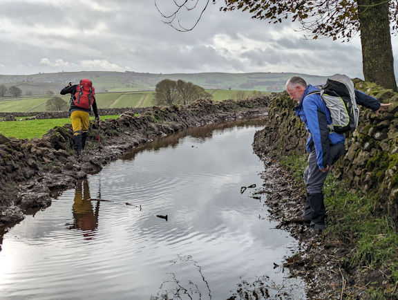
Walking through Tideswell ignoring the already open chippy we headed along Slancote Lane. Unusually for such a track Google Earth can be followed on street view. The pictures showed standing water, it didn’t show that the lane had been renamed the Tideswell canal!
We did manage to negotiate the ‘canal’ in various ways but it did give a sense of just how high the water levels would be.
Continuing along the Limestone way towards Miller’s Dale we stopped to look at the old Miller’s Dale Meal Mill. The River Wye was crossed close to the Anglers Rest. It was very tempting to stop there for refreshment but with the night’s drawing in and the fact that our cars were left at the Yonderman which closed at 3pm we decided to push on.
As we continued along the Monsal trail we discussed the possibility that Water Cum Jolly would probably be impassable due to the high water level. At best it would probably be extremely muddy, so we diverted to Tideswell Dale. In the upper reaches of the Dale the sun finally came out and it threw it down! Taking shelter at the car park toilets we donned full waterproofs.
Our walk continued along Litton Dale to then finish via Tansley Dale and again past the Pete’s stone to Wardlow Mires fortunately the rain had eased by this time.
An enjoyable walk with good company and despite a brief soaking we felt like we actually got one over on the weather.
Participants: Andy Burton, Ed Bramley, Ian Mateer, Marcus and Michele Tierney.
Report by Marcus Tierney
Blewbury Round - Four of us braved the elements on this mild but wet day.
The route went past Churn Knob to Blewbury Down passing over the disused railway and crossing the Blewbury gallops. We went on over Compton Down to meet up with the Ridgeway for a couple of miles. After passing the Roman Temple on Lowbury Hill we branched off the Ridgeway to head up to Aston Tirroid, then returning to Blewbury via Blewburton Hill. At least thats what the map said.
With our heads well inside hoods and the grey skies dulling the horizon we mainly saw the path in front of us! The rain eased for the last hour and we finished in weak sunshine.
We thought that we could dry off and warm up a bit by retiring to the local cafe for tea and cake - but the cafe had closed the week before for refurbishment!
Never mind, we had enjoyed each others company and the 10 mile leg stretch.
Attendees: Judy Renshaw, Margaret Moore, Mike O'Dywer and Mike Goodyer.
Report by Mike Goodyer
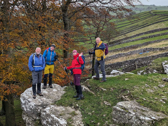
Despite having to change the dates from early to late October this year the New Inn at Bwlch with its unique charms sitting on the A40 road pass between the Black Mountains and the Beacons themselves provided the focus for eleven of us to meet up and complete the following walks over the weekend.
Mitch and Steve met at Llanthony Priory in the Black Mountains for a full day walk as described by Mitch here below.
The hike started at the ruins of the 12th Century Priory in the village of Llanthony in the Vale of Ewyas, some twelve miles north of Abergavenny, where there was free parking with public conveniences, adjacent to the lovely Llanthony Priory Hotel.
It was a four seasons type of day (sunshine, heavy rain squalls including some hail) thankfully with little wind, the route taking us directly up a muddy and at time slippery path onto Offas Dyke which sat at a height of 2227 feet, some 1440 feet above the car park.
Offa’s Dyke is named after King Offa of Mercia who reportedly built the dyke in the 8th Century to mark the boundary of his Kingdom. The Dyke roughly runs along the English/ Welsh Border.
Once up onto the Dyke, the landscape is open flat moorland with good trails and paths along with magnificent views towards Hereford in the east and the Black Mountains to the west. Red Kites and herds of Welsh Ponies and sheep abound on the Dyke top.
I navigated north on the Offa’s Dyke Path, to a point where I could descend back down into the Vale of Ewyas and head to the village of Capel-Y-ffin. Once in the valley, the trail starts as a tarmac road but quickly became a muddy ancient country lane which probably hasn’t changed in centuries.
At the village of Capel-Y-ffin, I came across two seats of religion on either side of the river (Afon) Honddu (both sit within a hundred metres of each other). The first was the Welsh Baptist chapel dating back to the 17th Century and on the other side of the river was the more modern Church of St Mary the Virgin which was built in the 18th Century.
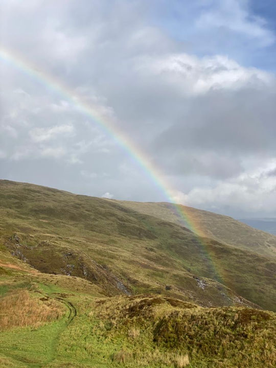
At this point the trail starts to head back up the hillside on the opposite side of the valley onto the Hills called Chwarel-Y-Fan & Bal Mwar at 679 and 609 feet respectively which form a section of the Cambrian Way. This point in the hike was noticeable for the views through the heavy horizontal rain and hail!
At Bal Mawr, I turned off the Cambrian way and descended back down into Llanthnony and its ancient Priory and made my way to Bwlch to join everyone else.
Ed and Andy parked up at the New Inn car park in time to check in with Neil, the licensee, and for Don and Judy to arrive too.
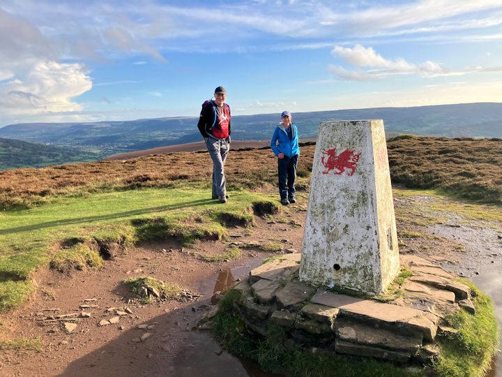
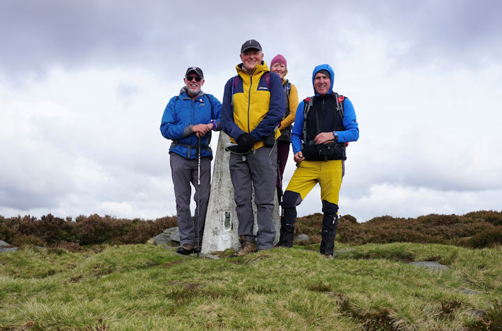
Judy joined us for a late afternoon walk up to the trig point on Mynydd Llangorse at 515 metres. Ed and I continued to Cockit Hill at the end of the ridge, which is marked with the word ‘fort’ on the map.
Here we were able to enjoy beautiful autumnal views across the farmland around the Llangorse lake below us on one side and extensive moorland views across the vale onto Mynydd Troed, 609 metres, and beyond, sharing them with just a few Welsh mountain ponies and a couple of dog walkers.
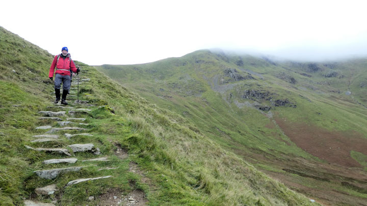
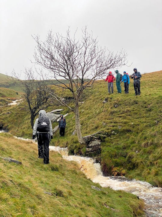
Martha and Paul drove up from Bristol in time for us all to set off in two cars at 9am Saturday to drive to the Storey Arms car park on the A470. The car park closest to the centre was already full so we used the next one which had a footpath gate and stile out onto the hillside where we ascended in the pouring rain to join the Beacons Way as it negotiates the various waterfalls that cut through the rim of Fan Fawr here.
 Wet start to the walk
|  Things are getting brighter!
| |
Negotiating these water courses now in full flow following a night of heavy rain proved to be a challenge in itself. By the time we reached the trig point at Fan Frynych, 629 metres, it was apparent to everyone that we were not going to complete the planned 13 miler before it got dark.
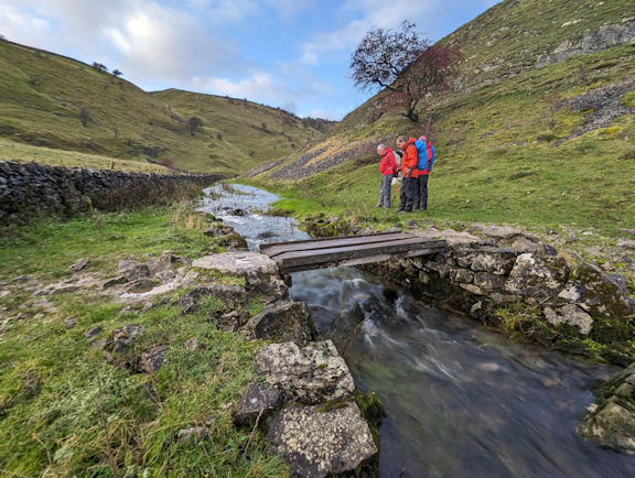
We continued into the Graig Cerrig Gleisaid NNR, a lovely hidden little gem tucked under the cliffs and high moor edge of Criag Cwm-du, as the rain abated, and the sun showed itself again, in time for us to stop and have lunch close to the footbridge at Pont Blaen-cwm-du. Here we joined the Roman Road for a short while, which had become a water course with occasional stepping stones.
Once we had all negotiated the flooded gate we turned left and struck off up the steep grassy knoll to its top at 570 metres where we crossed over the Beacons Way and negotiated the boggy and tussocky moor marked as Rhos Dringarth before rejoining with the Beacons Way near Craig y Fro, returning the way we had come.
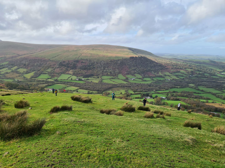
It was interesting to see how much the flow and depth of water in the various streams had eased off in the intervening five hours. This allowed everyone to complete the walk in good time without getting much wetter.
Everyone returned to the New Inn where we were joined by Jonny and Mary who came bearing gifts in the form of decorative pumpkins wrapped in a brand-new club beanie hat for those that wanted one. Our pre-ordered dinner was enjoyed by all and plans for the morrow were made as the open fire weaved its warming magic, ably assisted by a pint or two in good company.
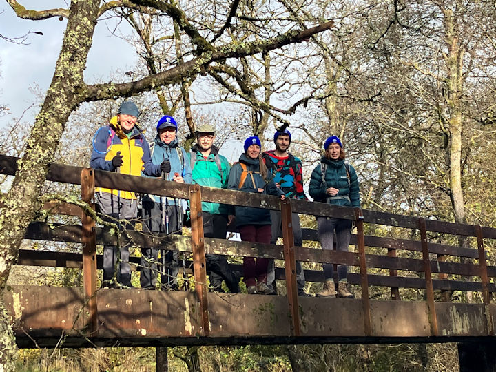
As the clocks changed at 2am Sunday morning we decided to employ a trick recommended by Don and Judy, that we ignore the change and just get up as we did the day before.
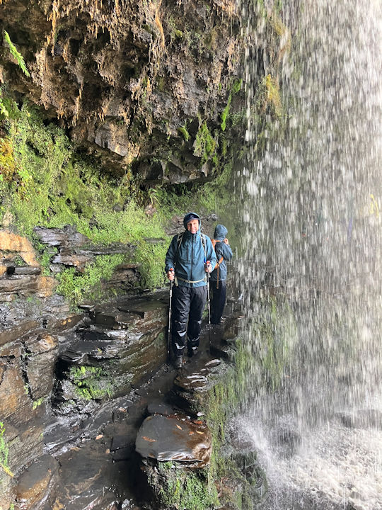
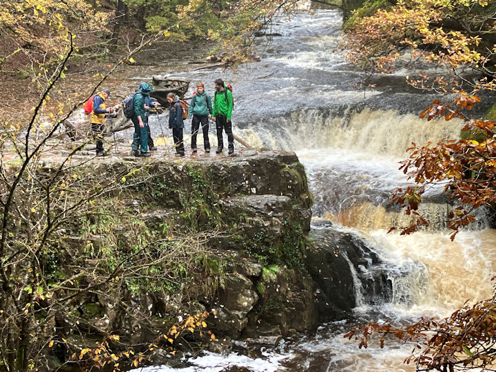
Confusing I know but it worked, and it allowed us a full day out including a café stop. A 45-minute drive following Jonny’s camper van lead the six of us to a small car park close to the footpath/driveway leading up to the bunkhouse and café at Clyn-gwyn, and down through the woods to the banks of the Afon Mellte where we saw the first of many waterfalls as we crossed over a confluence footbridge and walked up high on the opposite valley side and down through the woods to a complex series of waterfalls accessed by dead end footpaths.
Here the river cuts through a series of steps and natural rock sluices into another large waterfall which was running full with the rain of the last 48 hours draining off the higher hills where we had walked on Saturday. Walking back up out of this gorge we made our way round to Sgwd Yr Eira, a waterfall on the Afon Hepste with a rocky path behind a broad curtain of water, reached by a steep woodland trail and exited on the opposite bank in a similar manner.
Lunch was enjoyed on a bench in a clearing above the woods with views across the valley system towards Ystradfellte, before walking down to a coffee house in Pontneddfechan past the limestone quarries and outcrops of Dinas Rock.
From the café we crossed over the road back to the bridge turning left and into the Nedd Fechan river system, here we took another short spur by a bridge up to the waterfalls at Sgwd Gwladus, before returning to the main river and continuing back across the fields to our cars.
This is the second year that Jonny has shared his knowledge of this iconic waterfalls walk with Brecons meet attendees, and to top it all he showed Ed and I how to take tricksy photos of fast-moving water using our Iphones.
It is safe to say that the Bannau Brycheiniog just keep on giving.
Don and Judy also focussed on walking by water on Sunday by walking along the Brecon and Monmouthshire canal from LLangynidr, past the six locks to the tunnel and back higher up, along the Usk valley way. They also took in a quick visit to Dyrham Park near Gloucester on the way home. It was mainly sunny and beautiful with lovely colours in the trees.
Attendees were Mitch Sneddon, Steve Butterfield, Ed Bramley, Andy Burton, Don Hodge and Judy Renshaw, Anna Kaszuba and Eudald Rossell Vivo, Martha King and Paul Clarke, Mary Eddowes and Jonny Taphouse.
Photos from Mitch, Andy, Judy, Martha and Anna.
Report by Andy Burton.
The ABMSAC north walk began with some serious refuelling at Bank View Café, otherwise known as “the Dotty Café” after its role in the 2014 Tour de France (and bits of Yorkshire).
First thing the weather was misty, but soon cleared, although a noticeably chilly wind all day.
We head out on Langsett Bank, above the north shore of the reservoir. At its western end, we then head south, to follow a great path, often flagged, up Mickleden Edge and Cut Gate, eventually arriving at the top of Margery Hill, which is at the watershed of the Derwent and Little Don rivers. (Descending on the same path would take you to Slippery Stones, at the head of Howden reservoir).
There are great views and we can clearly pick out places such as Win Hill in the Derwent Valley, whilst looking north, there are views all the way to Emley Moor TV mast. At the top the wind is making its presence felt, so we shelter behind the rocks at Margery Stones for our lunch, before heading off on the next leg of our journey.
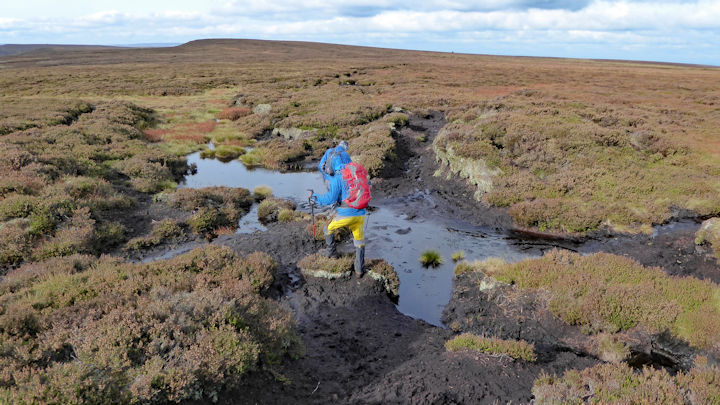
The terrain to Outer Edge now changes to bog trotting for the next couple of miles, necessitating a few serious detours or gymnastics to get round the soggiest parts. The sun has put in an appearance now and there are great and far views in all directions. Beyond Outer Edge, our path drops down Near Cat Clough into the Little Don valley. The valley and associated woodland provides a good respite from the wind, and we are soon round at the head of the reservoir. For our return leg, we take the path nearer the shore, watching the afternoon light and wind on the water.
Attendees:Ed Bramley, Andy Burton, Marcus and Michelle Tierney.
Report by Ed Bramley
 Cold Kitchen Hill
| The autumn day walks got off to a misty start today down at Longbridge Deverill. Margaret, Paul and I enjoyed a lovely walk over the small hills around the Deverills. The 9 mile walk took in Cold Kitchen Hill, which had elusive views across the misty hills and valleys, with red kites swirling overhead. This area, just south of Warminister and the Longleat Estate, isn't an area that any of us had visited before. The area is steeped in history with ancient roads to the North and South (following the River Wylye) of the Deverills.
We finished off the walk in sunshine and enjoyed a drink in the beer garden of the George Inn.
| |
Report by Mike Goodyer
This September we held a roving meet in Llangollen for the first time, from Friday 22nd to Sunday 24th September. (For those unfamiliar, Llangollen is that town with the traffic lights hold up on the A5 that you usually bypass on your way to Snowdonia). It was organised by Dave Matthews who grew up locally.
Llangollen is a pretty little town, on the River Dee, surrounded by hills rather than mountains.
We stayed at the independent Llangollen Hostel, in the town itself. It is based in a former house with 31 beds in 8 shared rooms over 3 floors plus lounge, kitchen/diner, and drying room. We found it comfortable and well maintained. There is parking to the rear (charges apply) plus other options.
We booked 2 rooms which conveniently accommodated 4 males and 4 females for the weekend, and we were joined by 3 others for the day walk on Saturday. On Friday night most of us dined out at the Three Eagles public house (old building with its own well!), within easy walking distance.
On Saturday we set off from the hostel at 9.30am, walked down the high street (100 yards!) and across the River Dee bridge with views of the river in full spate and Llangollen heritage railway station to one side. We were joined by John and Sarah- walkers and long time friends of Don and Judy -and shortly afterwards by ABM member Sondja . Sondja, incidentally, had travelled from Bangor by train to Ruabon, cycled to Llangollen, and crammed in a 30 minutes park run before joining us! We then crossed the Llangollen canal and passed Ysgol Dinas Bran (Dave’s old school) to climb the hill to Castell Dinas Bran, ruined castle and former hill fort on a near conical hill overlooking the Llangollen valley, Eglwyseg Rocks (limestone escarpment), and Berwyn hills. Descending the other side brought us to the “Panorama Walk” scenic road. Then a narrow path up the hillside brought us to the “ridge” above the road, with extensive views over the Cheshire plain towards the Mersey Estuary, Peckforton hills, (Sandstone Trail) and the Wrekin near Shrewsbury. Descending through Trevor Hall wood (forestry plantation) – we met a minor road then took a path leading to the Llangollen canal at Trevor. This was our half way point (6 miles, 3 hours) and lunch stop at Trevor canal basin, with convenient seating and a gongoozlers view of canal boat activity.
After lunch we crossed the Pontcysyllte Aqueduct, Telford’s masterpiece, 220 years old, 1007 feet long, 126 feet high above the Dee-great views.
We then crossed the A5 at Froncysyllte and walked up the challengingly steep Methodist Hill to access the path above. (Here Dave bowed out with heel pain and returned by bus!). This path skirted the former Pen y Graig / Pisgah limestone quarry (once employed over 1,000 men) and climbed to a view point on the summit road before a gradual descent via a track (Ceiriog trail) then pathways to Llangollen. Unsurprisingly another 6 miles and 3 hours to return.
The weather, incidentally, was surprisingly good all day, with sunshine and clouds and no rain!
We rounded off the day with pre booked dinner at The Cornmill pub, (you’ve guessed it, a former corn mill!) right beside the river Dee’s dramatic waters, and a good time was had by all.
Sunday’s weather was less good and some had far to travel so a smaller group took a stroll along the Llangollen canal to its source from the river Dee at Horseshoe Falls. Here there were brave parties of rafters starting their white water descent to Llangollen. We had a walk across the Chain Bridge at Berwyn and were minded to return by train but the times didn’t suit, so we walked back by towpath.
A final lunch al fresco at the little café beside the canal wharf then it was time to depart.
All in all, an enjoyable weekend in a different location, which seemed to go down well!
Participants: Dave Matthews, Heather Eddowes, Andy Burton, Celine Gagnon, Don Hodge, Judy Renshaw, Margaret Moore, Jas Phugura, plus Sondja Hoffman, John and Sarah on Saturday.
On Friday 1st September eight of us made our way to Chamonix. Five of us met up in time to watch the 170-kilometre UltraTMB runners start their epic challenge. Sobering to think we would see some of them during the first two days of our trek round the mountain, when they would nearly have completed their circuit.
As Judy and Catriona and George were first out of the starting blocks every day and the fastest walkers here are Judy's reflections on their TMB experience. We were super lucky with the weather, as we had warm sunshine every day and no rain at all. Although it did feel too hot at times, we really couldn’t complain about that! The paths were good and usually well signposted, though getting from the accommodation to the main path was sometimes a little challenging, even with the maps and GPS tracks. We were fortunate to have enough route maps and GPS information to allow us to separate into smaller groups to suit our different speeds. All this was largely due to Paul’s initial gpx mapping of the route and Mitch’s careful marking up of the printed maps. Each day we ascended and descended on average around 1000m.
The route is certainly popular! Many of our fellow trekkers had had to book accommodation at least a year in advance. We were never long without company, mainly coming in the other direction, as we were going clockwise and most people seem to go anti-clockwise. The popularity had its pluses and minuses. At the times when we were uncertain of the way, it was reassuring to see fellow TMBers on the track.
However, at times it did feel a bit too busy, especially on narrow paths where you either had to wait or divert to let people through. Another plus was meeting people from different countries, each with their own story to tell. George, Catriona and I spent a day walking with Erin, a young nurse from New Zealand whose friends were due to join her for the last 3 days. We had interesting conversations with her throughout the day and learned about her experiences on a Covid ward as a trainee.
The scenery was superb throughout and the walking was satisfying. Day 2 was particularly notable, in which we took the higher option of going over the Fenetre d’Arpette rather than following the Bovine route outlined in the guidebook. We all started together but agreed to go at our own pace, making sure that each group had sufficient maps and information. George, Catriona and I went ahead, taking frequent rest stops as it became steeper and made the top by lunchtime. We were up among the giants, with views of many of the famous 4000ers all around us. The descent was also steep, with a long boulder field followed by a loose rocky path. We were glad to see the umbrellas of the hut, Relais d’Arpette, in the valley and checking in for an early shower and drinks.
Some of the stops along the way were equally beautiful and, in some ways, more enjoyable than the main mountains. One particularly nice stop was at the refuge of La Peule, a converted farmhouse which had cows, sheep and pigs on the hillside below and a mobile milking parlour. George and Catriona enjoyed glasses of milk, fresh from the morning milking, while I took in the views and the sunshine. The music of the cow bells in the valley was lovely, though recording it and playing it back would not be the same without the rest of the setting.
Overall, the refuges were efficient, managing to feed dozens of people with excellent meals, including vegetarian options for those who wanted them. The facilities were variable and generally rather too few for the number of people using them, but we managed OK. The bedrooms were also variable but always comfortable and surprisingly quieter than I expected. Altogether a wonderful and memorable trip. Mitch Sneddon who was enjoying his first ABMSAC trek, wrote a daily blog on Facebook which he has kindly shared with us all. Day 1
The collection of our additional 10kg bags of luggage at the Montroc le Planet SNCF station car park this morning had to take place before we could get on with our walking tour around the world-famous Mont Blanc (TMB) which would take us through those parts of France, Switzerland and Italy that embrace this unique mountain massif before returning us to Les Houches and Chamonix in France once more. We left Montroc in the Chamonix Valley at 11am with gorgeous blue skies overhead in sunny warm middle teen temperatures wearing short sleeved base layers and shorts. We followed an easy trail up a wooded valley and over into the neighbouring village of Le Tour.
From Le Tour, we headed up the hillside strewn with edible Bilberry (similar to blueberries but with red juice) plants via a zig zag Alpine path (or laces as the French translate it) to the Col des Posettes at 1997 metres. A col is a saddle (lowest point) between two peaks. The hill was busy with hikers who passed us as I struggled up the mountain. Behind us on the opposite side of the Chamonix valley we had fantastic views of the Le Tour Glacier above Le Tour, which is retreating very quickly. To our left we had views down the valley to Mont Blanc and its range, the highest mountain in Western Europe
The col offered us fantastic views of the mountains beyond including the Emosson Hydro Electric Dam. We quickly dropped down into a shallow valley which was criss-crossed with ski lift towers and cables for the ski slopes that form here during the winter snows. We headed up the other side of the valley to the Col de Balme at 2191 metres.
We stopped at the Refuge De Balme, to top up our water sacks and grab a quick snack of cake and hot/cold drinks. The air was noticeably cooler at this time of the day and altitude, requiring us to put on another layer of clothing.
From here we dropped over into Switzerland on rough boulder strewn paths, eventually entered the tree line and into a thick forest which in total took us almost 2 hours to clear.
The UTMB trail running finals (part of a world series) are on this weekend which vary in distance from the Ultra TMB which is 171km (100 miles) long to the CCC at 100k and a few other shorter races. We were passing them at different points on todays trek especially as we entered Trient. I was tired after my efforts, but I couldn't help but feel a tad guilty when I saw the condition of these competitors as they struggled past us. They had been running continually since 1800 the night before and were still a long way from the finish line. We cheered and applauded them as they passed us, but many were concentrating hard and exhausted, so much so they couldn't even lift their heads from the route in front of them to make eye contact with us.
We arrived at our hotel/dormitory at 1840, after close to eight hours on the trails just in time for our supper which is served to the whole hotel in one sitting at 1900. The Hotel Grand Ourse is a very clean and well equipped traditional built modernised hotel with a mix of rooms and dormitories.
Day 2
An earlier start today saw us clear of the Hotel Grand Ourse by 0830. Up the wooded hillside onto a track through the forest that was originally built for a business that used to harvest ice from glaciers that were then obviously much closer to Trient. The ice was transported down the hillside in wooden built sluice boxes or chutes that had water running through them to lubricate the ice.
From the end of this path through the forest, we started to climb up the side of the valley opposite the Glacier De Trient which has badly receded over the years. The valley paths were busy with hikers and were a mix of boulder stones and scree and turf which is really hard going.
We were heading up to the Fenetre d'Arpette at a height of 2665m, 950 metres higher than the start point at the Hotel Grand Ourse. It was a tough climb but easier than the previous days climb which was good news. We passed a family of 4 perched on an outcrop, the two youngsters merrily colouring in some drawings of the local landscape. An hour later they passed us and watched as they stopped to pick and eat the bilberries growing by the path up the hillside.
We eventually reached the col window after four hours, where we took in the views from either side before setting off down into the Val d’Arpette to our overnight accommodation at Relais de Arpette, which was very good and very friendly. If the climb up was tough, the descent was tougher as there was a very large boulder field created by glacier moraine which had rocks ranging from the height of a double decker bus to the size of a fist. This has to be traversed by following a marked path and climbing over, or jumping between the rocks which after a day's hiking is jarring on the knees. It took us about an hour and a half to clear the bigger stuff and then it was a two hour walk down a further rock stepped path to the Relais itself.
Day 3
Struggling for phone and internet access in this part of the mountains, so everything was delayed. It was an early start to catch a local bus to Orsieres from the bottom of the ski lift below our accommodation, and then onto La Fouly where our hike would continue. We started our hike initially not using the TMB trail, instead cutting inland and followed a more challenging trail, rejoining the TMB on its approach to the Grand Col Ferret which forms a natural border between Switzerland and Italy. Another tough constant climb of around 1000 metres on busy trails, passing lots of senior US citizens on their bucket list.
It should have taken six hours but for us mere mortals a wee bit longer. Once over the col at 2536m we dropped down quickly on a tough boulder and stone track to our overnight stay at the Refuge Elena at 2062m.
Elena is a big refuge, dorms of 20 plus people, so its like being back in basic RN training accommodation standards. Food was good, pasta as expected.
Day 4
We left Refuge Elena and continued our hike down the valley leaving the border into Switzerland behind us. An easier start to the day although once in the bottom of the valley we started climbing up onto the balcony trail called the Mont de la Saxe which gave us some fantastic views of the glaciers on the opposite side and also of Monte Bianco which we were approaching in the distance. We were now virtually on the opposite side of Mont Blanc from where we started almost 4 days earlier.
A bug appeared to be going through a couple of the group members which was causing obvious discomfort when hiking.
There were a few Refuges on our valley side where we could stop and take on refreshments and food. The speciality in the valleys around Mont Blanc is Myrtille Pie made up of Bilberries or Wild Blueberries as they are known locally. It's delicious and if you ever come across it, try it.
The weather was again bright blue skies and hot temperatures in the mid to high 20's. Our destination was the ski resort of Courmayeur where we would catch a local bus to our Refuge Monte Bianco which was nestled in the hills above and opposite Monte Bianco and its glaciers on the Italian side.
We continued down the valley side on the balcony trail eventually passing the entrance to the Mont Blanc road tunnel with queues of trucks lined up to pass through it, reaching the Refugio Bertone at 2000m overlooking Courmayeur where we had to descend 700 metres very quickly. It was another tough boulder strewn stepped track which some very brave (or crazy) mountain bikers were also descending towards Courmayeur.
Courmayeur in the Aosta Valley is a small town, fairly quiet in summer but in winter it comes alive with skiers.
Day 5
We left our overnight accommodation, the Refugio Monte Bianco (5450 feet altitude) near Courmayeur and headed down the hillside trail through the dense forest to the village of La Visaille and joined the road climbing towards the Col de la Seigne at 2516 metres and just under 8 miles distant from Monte Bianco. As it was tarmac road for a lot of this section there were a lot of cyclists on expensive electric rental bikes on the route complete with solar powered chargers.
We climbed till we reached and passed the Refugio Combal at 1971m which overlooks a flat marshy flood plain complete with ponds filled with fish! It was very hot up here and we continued on the flat dusty track before beginning our ascent towards the Refugio Elisabetta Soldini a further 600 metres up the mountain. The Elisabetta was very busy with travellers / hikers the majority of which were travelling the TMB in the opposite direction to us. A quick stop here to fill up our water bottles and bladders before pushing onwards towards the top of the Col de la Seigne, some 2 miles further up the trail and 1200 feet higher.
The types of trails we hiked varied greatly, from proper wide tarmac roads to dusty boulder littered Alpine paths, no greater than 18 inches in width with steep drops of many hundreds of feet to the valley below. The rule of the road here is if you are going up a track, you have priority over travellers coming down but always ensure if you have to stop to let travellers or cyclists pass you that you are stopped on the higher hillside of the path so that you do not get bumped by passing hikers or cyclists with possibly serious consequences!
We summited the Col de la Seigne and were treated to some amazing views looking back over the old customs house, recently renovated and modernised, and forwards towards our accommodation at Les Mottets, some 2.5 miles away down a steep drop off boulder path some 1200 feet below.
Day 6
We left the Refuge Les Mottets nice and early but I was still struggling a bit with the bug, not so much the cramps but the lack of energy from not eating as much on the previous day. It was going to be another tough day as we were climbing to the Col Du Bonhomme, we decided to jump on a local shuttle bus to get us down the mountain some 6km nearer the start of the climb at Les Chapieux (1550m). We would climb from there up towards the Refuge et Col de la Croix du Bonhomme which sits at an altitude of 2450m.
Initially l was okay but before long I was taking regular breaks and Andy thankfully would take breaks to allow me to catch up. There was a large guided Taiwanese group snaking ahead of us and all them had bright orange covers on their rucksacks for identification purposes and thankfully a couple of them were struggling in the heat, this gave me a target to aim for or at least keep up with! The hill was busy with lots of trekkers, quite a site to see so many people on a mountain, but the TMB is one of the most famous hikes in the world. Once at the Refuge du Col de la Croix du Bonhomme, we caught up with the Taiwanese party and eventually we decided that as the track up here was really narrow and very hard to pass people, we would take a break to allow them to get further ahead and hopefully pass them when they had their break a bit further down the path.
There is little change in altitude between the Col du Bonhomme and the Col de la Croix du Bonhomme but the path is very rocky and uneven and not to be rushed plus there are some sheer drops off the path. We reached the Col Du Bonhomme at 2329m and from there the track goes steeply downhill towards our overnight accommodation in Les Contamines, still quite some distance away, and you have to keep your wits about you (I have the bruises to prove I didn’t do that very well)!
During World War 1 the Col Du Bonhomme was the scene of fighting between French and German soldiers. On 8 September 1914, the commander of the French 41st Infantry Division, 69-year-old General Bataille, and six of his men were killed in a German artillery attack. A memorial to the General and his men stands at the pass.
We started downhill and caught up with a couple of our party, Ed and Steve at the Refuge de la Balme, not surprisingly Myrtille Tart was on their menu but with my dodgy condition, a cold drink and an ice cream was a safer option for me. We pressed on heading further down this mountain valley, the sky crossed with power lines that had been installed to bring power to this remote area.
We passed the Refuge Nant Borrant which led us onto a Roman Road (not surprising in this part of the world - French / Italy border region!) and into a gorge with an amazing church called the Notre-Dame de la Gorge, where we were collected by our travel company van and taken to our overnight stop at the Chalet Caf hostel in Les Contamines - Montjoie. Another 4 double bunk dormitory which was basic but clean, with very friendly staff, especially Joe the barman and cook. Probably the best meal of the trip starting with delicious French Onion soup, locally sourced oven cooked sausages with creme caramel to finish, oh and a couple of cold ones!
Day 7
I woke and felt immediately better than I had all week, my energy was back and the effects of the bug had disappeared thankfully.
An early start from Chalet CAF at an altitude of 3770 feet and a route initially heading for the Chalets du Truc at 1705m and then dropping down to the Refuge di Miage 1559 metres. From there, it was a steep climb up to the Col de Tricot (where Mitch returned the favour and waited for me so we could top out together at our highest point of the day just shy of 7000 feet, some 5 miles from our start point). Once over this col, we were essentially heading to the end of the trek at Les Houches near Chamonix.
We left the refuge and a short walk through a section of Les Contamines - Montjoie and up the valley side through a heavily wooded forest passing a beautiful log cabin set in the edge of the woods overlooking the valley and mountain beyond.
Once over the Col de Tricot, we dropped down the opposite side with the amazing view of the Glacier de Bionnassay on our right. From here it was a narrow rock filled path to a narrow ravine with a wobbly wire rope bridge heading on a narrow alpine path to the Col de Voza and the Prarion gondola down to the finish at Les Houches just in time to collect our bags that had been left there for us. We had a bit of a sweat at the end, trying to make the last cable car of the day at 1700 but we managed it with 20 minutes to spare, otherwise it was another long downhill slog to Les Houches.
A 45-minute local bus ride followed to our Hostel in Chamonix followed and some welcome pizzas and beer on our last night.
I’d lost a stone in weight during the 8 days in the Alps which was a combination of the exercise and the bug. Personally I would recommend trying a diet! Ed was the only one of the four of us who was not affected by the bug, and this may have prompted the following: Bring me Sunshine – A musical (?) interlude on the TMB
I can’t sing or hold a tune. My school music teacher had established that very quickly. My musicality is probably best described by the late Eric Morecambe – “All the right notes – not necessarily in the right order”. So you might ask why I was singing, humming or otherwise creating what I took for music on a regular basis as Steve (McCain) and I wended our way along the Tour de Mont Blanc.
Firstly, I was enjoying myself. But secondly, Steve and I were having a bout of what might loosely be described as a Popmaster session, naming tunes and artists as we went along the trail. The songs varied from the relevant – “River Deep, Mountain High” (Ike & Tina Turner) or “Here comes the sun” (George Harrison), to the ridiculous “ça plane pour moi” (Plastic Bertrand) or “My old man’s a dustman” (Lonnie Donegan). And the time span was from the 60’s to occasionally this millennium, probably reflecting our ages and musical tastes.
Surprisingly, as we passed people, some of them actually wanted us to keep singing, or joined in themselves. Particularly the timeless classics and the uplifting songs. Hopefully we didn’t cause any diplomatic incidents or distress to small children as we travelled our merry way. And the miles just seemed to melt away as we thought of yet more obscure records to tax one another with, or even create the tune to – Try whistling any Ennio Morricone tune from the spaghetti westerns and you’ll know what I mean! So there you have it another Club trek completed and I think you can tell enjoyed by all who took part.
This years cast were Judy Renshaw, Catriona Archer, George Harper, Ed Bramley, Steve McCain, Mike O’Dwyer, Mitch Sneddon and Andy Burton.
Report compiled by Andy Burton with contributions from Judy, Mitch and Ed.
Photos from Ed, Andy, Judy and Mitch. We arrived at the Bunkorama at Barmouth on Friday at 2pm. The bunkhouse was a late replacement for the Corris Hut due to a double booking by the owning club. After quickly settling in we undertook a short walk from the bunkhouse up the nearby ridge to see the tremendous views of the surrounding hills and Barmouth bay sweeping around.
On Wednesday our walk involved a short drive to the car park at Graigddu-isaf and then a boggy approach through the woodland to Bwlch Drws-Ardudwy cairn.
The path from the cairn to the summit of Rhinog Fach was initially very steep and then easing off before steppening up for the final section.
Lunch was taken by the side of Llyn Hywel after the descent. After lunch we made our way around the bottom of Rhinog Fach back to Bwlch Drws-Ardudwy.
At this point half of the attendees made their way back to the car park and the other half started their ascent of Rhinog Fawr.
The path was very steep and narrow eventually joining the Cambrian Way to the summit.
We descended by the most direct route across heathered terraces and woodland tracks to the car park.
On the following day, Thursday, we made our way to Minffordd to undertake our the circuit of Cadair Idris.
The walk starts with an ascent of the Fairy Steps through woodland next to a cascading waterfall.
The walk up to Lynn Cau saw the summit of Cadair Idris covered in cloud. But just as we arrived at the summit the cloud started to gradually lift and we gained some glimpses of the Barmouth Bay.
After lunch at the summit shelter we carried on to the summit of Mynydd Model. By this point the cloud had lifted and the sunshine lit up the whole hillside. The descent back to the top of the Fairy Steps was warm on a newly engineered mountain path.
Well earned tea and cake was taken at the café by the car park.
In evenings we did 'mass catering' at the bunkhouse, which was just as well as the cooking facilities were minimal. We departed for home on Friday morning from the Bunkorama after another successful meet.
Attendees: Ed Bramley, Andy Burton, Steve Caulton, Mike Goodyer, Mitch Snedden, Paul Stock, Fi Tomlinson and Steve Wood.
Walk: Rhinogs round. Photos from: Ed, Andy, Mike, Mitch and Steve.
Report by Paul Stock
After a rather excellent Gala Britannia Dinner on Wednesday evening in the company of our three guests from the SAC Geneva Section SAC, Therese, Marc and Jacques, and all thirty-three Meet attendees, twelve of us caught the 8.42am Postbus up to Saas Fee so we could meet our guides Marc et Jacques and wend our way through the village to the Plattjen gondola station. Pam and Alan accompanied us up onto the platform that formed the base of the old Plattjen top station at 2569 metres. Here Alan took the obligatory group photos and waved us goodbye as we set off into the all-embracing brouillard following Marc and Jacques as they set a slow steady guides pace into the mist. Initially the route winds its way through a boulder field before becoming a classic belvedere path, as the large tumble of rocks finishes. With Marc leading and Margaret keeping his bright orange boots clearly in her sights, and Jacques walking among us chatting and pointing out things of interest, they made sure everyone remained in contact and walking steadily together. The path passed underneath the mist shrouded Mittaghorn and Egginer peaks, the narrower parts of the way being helped by a series of handrail chains and a few rocks bolted into place, before crossing the rock-strewn remains of the Chessjengletscher, threading its way around the remnant glacial pools.
Here the mist let slip its grip enough for us all to be able to see the Britannia Hut up on the ridge above us.
With our destination now in sight everyone made steady uphill progress, arriving in good order on the new terrace at the Britannia Hut, shaking hands with our two guides, taking stock of our unique location.
Very quickly we were enjoying Swiss alpine hospitality in the form of traditional Walliser platter of cured meats, cheese and pickles followed by raclette with potatoes and gherkins, all accompanied by a very quaffable local white wine, selected by Jacques. Andy duly thanked our gracious guides/hosts, and the Geneva section of the SAC, for all their efforts on our behalf in the time-honoured manner.
After coffee for most of us and a couple of hot chocolates, plus a Toblerone triangle each, we were treated to a whistle stop tour of the Hut, with Marc and Jacques pointing out the various plaques and signs, both inside and out of the building, marking our long-standing connection with and support of the Britannia Hut.
Marc and Margaret went to see her brother Mike’s ice axe that she bought up and presented to the Hut Guardian on her last visit in 2014, clearly visible in the main foyer. An emotional reminder for Margaret of how important the mountains of Switzerland were to Mike, and how grateful she was to Dario for displaying it.
Marc and Jacques were very pleased and proud to be able to show us the water collection system, from the collection trough outside by the insulated large patch of snow, to its new internal stainless-steel settling and filtering system, which enabled us and everyone else visiting the Hut to enjoy fresh drinking water on arrival. The solar array that was the ABMSAC’s last donation prior to the stove, has played a major part in allowing the Hut to function all year round, and to make these latest costly improvements work well into the future for everyone who visits to enjoy.
All too soon it was time for Marc and Jacques to set off back down in order for them to safely make the last lift down from Morenia, leaving us in the very capable hands of the hut staff. We were shown our rooms, and started to settle in.
By this time the weather had cleared up massively and everyone was able to explore the surroundings close to the rock promontory that the Hut sits on, in company with the resident Steinbock/Boquetin/Ibex population staying close to the Hut courtesy of the placement of a saltlick nearby, and the many alpine choughs swirling around us, plus some snow buntings that were also taking advantage of the new terrace and the possibility of an easy snack.
Several of us climbed up the little rocky Klein Allalin summit at the side of the Hut to take photos, as it offers a perfect 360-degree viewing platform of the surrounding mountains and down onto the Hut itself and was by chance home to several patches of the beautiful azure blue gentians that were in full bloom.
Jonny and Mary took advantage of the beautifully lit backdrop of the Strahlhorn, Rimpfischhorn and Taeschhorn peaks with their attendant glacier remnants and the Britannia Hut below to test and video Jonny’s clever new wood burning titanium stove, which in four minutes boiled a large mug of water and enabled us all to enjoy a fresh brew at a little over 3000 metres.
Celine and I went to have a look at the start of the Britannia Klettersteig in readiness for having a go at it in the morning. We met a group of young climbers practicing various rappelling and belaying techniques at the base of the wires whilst enjoying the early evening sun. Dinner was a simple but tasty three course meal taken in the company of over 75 guests staying the night and enjoyed with a beer or two. Noone in our group elected for the 5am breakfast option, but it wasn’t long before a final walk around outside, for some just looking for where the phone signal was best, and for all an early night beckoned. Once we’d made the most of the lovely breakfast goodies laid out for everyone, we split into smaller groups to take different return journeys in the sunshine.
Margaret, Heather, Mike and Ed went back the way we came the previous day, catching the views we’d missed on the ascent. Margaret reports that after watching the helicopter make several visits, Mike, Ed, Heather and I set off to retrace our steps back to the Plattjen lift. Visibility was much improved, and I enjoyed the return walk. We were able to see the routes we had been on earlier in the week; at various times seeing the Mattmark reservoir, our walk to viewpoints from the Heidbodmen lift, a bird’s eye view of Saas-Almagell and our walk round from Kreuzboden.
On reaching the lift station we had drinks and cake before going down the gondola. Heather and I, ever keen to use our lift passes, decided to go up the Felskinn lift. Looking down we were very glad that the plan to get off the lift at the midway Morenia station and walk up the scree slope had been shelved.
Roger, Don, Daniel and Mervyn took the opposite direction towards the Glacier Trail and Mattmark having spoken to Marc and Jacques and confirmed that the route was a good option for them.
Daniel reports that the four of them found that the route was well marked – blue/white, including on poles across two glaciers. The glaciers were deemed to be safe from crevasses. We went unroped.
The glacier surface was covered with so much gravel that it probably formed the grippiest part of the route, at least on the flat parts. Beside these were steep scree slopes that turned out to be just one stone deep, over sheet ice. One step up and two sliding down. It was however beautiful.
In 7.5km and 3ľ hours the four of them were down. 'Strava' told Daniel that it had cost him 1,763 Calories. They began putting this right at the nice café at the dam, whilst waiting for Postbus back to the village.
Celine reports that she Mary, Jonny and Andy took up Marc’s kind offer to borrow VF equipment and try the new Britannia via ferrata, beautifully and cleverly designed by the hut’s warden Dario Andenmatten. It promised “thrills and unique views on the Saas Mountains” and certainly delivered. Under Andy’s calm and clear guidance, we climbed through a few tricky K-3 and K-4 sections relatively seamlessly – even though I must confess to having to having to catch my breath for a moment. The track culminates on the ridge of the Hinter Allalin, with a spectacular 360 degree of view. The descent follows the blue and white alpine route down to the Hohlaub glacier and back to the hut. We returned our borrowed equipment to the kind and helpful staff, shared a potluck lunch between us before starting on our return journey by the Glacier Trail.
The route started from the way we came down from the via ferrata and continued south towards the Hohlaub glacier. It was strange, for an alpine novice, to walk over ice in the middle of summer. We were able to look underneath the ice sheet and see the water running furiously down as the ice was melting in the mid-afternoon sun. After walking over a mixture of boulders and moraine, on the well sign-posted route, we reached the Allalin glacier which was bigger but less impressive somehow. It also had black ice covered by moraine, making it very tricky to walk over without slipping.
The blue alpine route ends and the red path starts at the top of Schwarzbergchopf (2,868m). Here we stopped for a quick drink, snacks and enjoyed the views over the Mattmark dam towards the paths that we enjoyed at the start of the week.
We made the Postbus to Saas Almagell, arriving in time for kaffee und kuchen at the Monte Moro and a well-earned beer. What a fantastic journey to end our week in the Saastal.
The twelve attendees were Margaret Moore, Celine Gagnon, Mary Eddowes, Jonny Taphouse, Daniel Albert, Mervyn Powell, Heather Eddowes, Don Hardy, Roger James, Ed Bramley, Mike Goodyer and Andy Burton.
Thanks to Margaret, Celine and Daniel in helping compile this report of our visit to the Britannia Hut in July 2023 and Pamela for organising another great week at the Monte Moro, which enabled all of the above to take place.
Report by Andy Burton On a sunny Saturday afternoon, 33 ABMSAC members, including our President Andy Burton and most of the committee, as well as a younger contingent, gathered at the Hotel Monte Moro in Saas-Almagell on what to prove yet another exceptional week in the Swiss mountains. Apart from an occasional thunderstorm the good weather stayed with us all week and we were out in the hills every day, making the most of our free bus and lift passes and assisted in our route-finding by the Cicerone guidebook “Walking in Zermatt and Saas-Fee”.
The club had first stayed at the Monte Moro on our centenary meet in 2009, and again in 2012 and 2013, although the only ones present on all four occasions were myself and Bill and Rosie Westermeyer. However, since our last visit the hotel had been taken over by Fabian and Esther Zurbriggen who owned the neighbouring hotel, named after Esther’s brother Pirmin Zurbriggen, one of Switzerland’s greatest downhill skiers. Annette, the previous owner, still worked part time at the Monte Moro, and both she and Fabian went out of their way to make our stay a success. Fabian had hidden talents for one evening there was a concert where he entertained us with rock ‘n’ roll and Beatles songs. Our younger contingent joined in the fun with Mary Eddowes leading a demonstration of Morris Dancing.
But it was the meals that made our stay exceptional, with four-course gourmet dinners every evening and afternoon tea and cake at 4 o’clock, which most of us managed to get back for. The special “Gala Britannia” dinner in the middle of the week was even more splendid, with five courses each more delicious than the one before. Fabian offered us an aperitif of white wine and nibbles beforehand, and Annette had prepared a special menu card and had helped decorate the room with Swiss flags, Union Jacks and the ABMSAC banner, brought over by Heather Eddowes.
The Britannia Hut has been an important part of our history since it was donated by the club to the SAC Geneva Section in 1912 and has always been central to club anniversaries (see the updated “History of the Britannia Hut: 1912 – 2023”). So we had invited three Britannia Hut representatives to the dinner as our special guests: Thérčse Andenmatten-Renaud who had been warden of the hut for 35 years and is the mother of Dario, the present warden; her husband Marc Renaud, President of the Geneva Section Huts Committee; and Jacques Bondallaz, Geneva Section representative for the Britannia Hut. Dario himself was sadly unable to be with us after a serious ski-mountaineering accident in the spring had left him with two damaged Achilles’ tendons. It was Marc and Jacques who were to accompany the group to the hut the following day.
As on past meets in the Saastal, the focus of the meet was to have been a lunchtime visit to the hut for the whole group, this time to see the eco-friendly storage-heater donated by the club for the hut’s 110th anniversary last year. But a day trip was no longer possible since the easy path we had taken on all previous occasions is now indefinitely closed due to rockfall and the recession of the glacier, as shown by photos of those who went up the Felskinn lift.
The only viable option was to take the lift from Plattjen, a longer and more exposed route necessitating an overnight at the hut to avoid missing the last lift down. In the end only 12 opted to do this, some who had never been to the hut before.
Alan and I went up to Plattjen with them to see them off on a cloudy morning and wished them luck as they disappeared over the boulders into the mist, some wearing their new beanies, brought over by Mike Goodyer for our 115th anniversary next year. A separate account of the time at the hut is presented at the end of this report.
This prompted much reminiscing by Geoff Causey and Richard Heery who had climbed many of these peaks as long ago as the 1960s. From Hohsaas we watched teams descending the nearby Weissmies, noticing the lack of snow and how much the route has changed with glacier recession since a large group climbed it during the 2009 Meet.
A bonus for me and the other flower lovers was finding the rare King of the Alps (Eritrichium nanum) growing in the rocks in profusion, together with moss campion and a tiny saxifrage.
Some of us spent so much time looking at the flowers that we didn’t get very far, but the more energetic continued along a balcony path high above the valley all the way to Almagelleralp, giving splendid views across to the Strahlhorn, Allalinhorn and Rimpfischhorn, and south to the Mattmark lake and Monte Moro pass. They made the descent to Saas-Almagell on the Erlebnisweg “Adventure Trail”, an exciting path protected by cables, with metal ladders set into the rock and narrow rope suspension bridges.
In a lovely location high above Allmagelleralp is the Almageller Hut, though only Don Hardy and Mervyn Powell made the 1200-metre ascent to reach it. As the oldest member on the meet Don deserves a special mention, for not only was he out every day but he did the most challenging routes, seemingly with no effort.
Another popular destination was the Mattmark dam, just a short bus ride up the valley. The only one to walk there from the hotel was Alan, who set off on the first day to test his recovery from a recent heart operation. After a 520-metre ascent over 7kms he decided that he was fit enough for the rest of the meet! From the far end of the lake the Britannia Hut was just visible on the skyline above, the nearest sight of it for those who did not make the two-day visit. Only the fittest headed for the Monte Moro Pass and the golden Madonna high above, on a track which became steep and rocky as it neared the top of the pass and the border with Italy.
The pass is an ancient trade route which we had crossed from Macugnagna on the 1999 Tour of Monte Rosa, my first trek with the ABMSAC. On that occasion we had walked over the pass all the way down to Saas-Grund, which I am sure I would not be capable of doing today. For Bill and Rosie this was also a trip down memory lane, for it was the first hike they made together after meeting on an ABMSAC Meet 35 years ago. Towards the end of the week they returned to the lake, along with Richard and Rick Saynor, to explore the Schwarzberg Gletscher on the west side, a route recommended by Annette. Unfortunately, as they climbed higher it got cloudier until eventually the rain and sleet got worse and the visibility deteriorated so much that they were forced to turn back. But they had walked high enough to see the dramatic recession of the glacier below the moraine.
The Furggtälli to the south-east of Saas-Almagell was another favourite destination for our walks, a lovely unspoilt valley with few other hikers. This could be accessed either by walking from the hotel up to Furggu at the start of the valley or, as Alan and I did, by taking the chairlift to the tiny hamlet of Furggstalden, where there were two attractive mountain restaurants. After a short section through pine and larch trees, the valley opened out and became a lovely natural rock garden of all colours, with alpenrose, carthusian pinks, alpine asters, bellflowers and many others growing in profusion. High above was the Antrona Pass on the Italian border, a trade route used since Roman times. As we gained height, the grassy track became stonier and we finally climbed up steep boulders onto the moraine to reach the bridge at Bitzbrunnen, our highest point. From there we descended on the other side of the stream through low scrub and grassy meadows used by farmers to graze their cows and goats. After meeting a herd of large black cows blocking our path, we were then overtaken by a herd of goats heading down for milking. Goats cheese was on sale at the farm, and some of our group stopped for the local delicacy of coffee with goats milk.
From here a steep path zig-zagged down through the trees to the chapel at Zermeiggern, a place of memorial for the 1965 Mattmark disaster. In August that year an enormous avalanche of ice and rock from the Allalingletscher engulfed the construction site, killing 88 of the dam workers. Their bodies were kept in this chapel until they could be taken to their final resting place, and on the walls inside are two panels recording the names of those who lost their lives, most of them Italians.
By far the most challenging hike of the week was that taken on the second day by Bill and Rosie, Don, Mervyn and Roger James. This was a long 8-hour traverse from Mattmark up to the Jazzilücke and Antrona passes, then along a high-level route above the Furggtälli to the top of the Heidbodme lift, with a total ascent of 1100 metres over 21 kms. Described by the Cicerone Guide as “a fine and committing day-long walk, one of the best in the Saastal”, it was indeed challenging. With exactly 8 hours between the arrival of the bus at Mattmark and the departure of the last lift at Heidbodme, they were always conscious of having to keep to the guidebook times for if they missed this lift, they would have an extra two hours of descent. The route started by crossing the dam wall and then climbed into the remote and flower filled Ofental to reach the high cliffs of the Jazzilücke, 3081m.
They stayed close together on the next section, which was the most demanding, on a narrow exposed ledge protected by cables, with steep drop-offs. Fortunately this did not last long, and the path became wider and easier, though still rocky, and they eventually came down to the Antrona Pass 240m below.
There were two possible routes from here, that taken by Roger descending directly down the Furggtälli, while the high-level route to Heidbodme was taken by the others. This involved a further steep ascent through rocks before the descent began, taking a lot longer than anticipated. They only just managed to catch the last lift from Heidbodme, although they all missed the lower lift from Furggstalden so had to walk back to the hotel after what had been a long but memorable day.
On the same day, Alan and I took the chairlift to Heidbodme, hoping we might meet them on their descent. From the top of the lift we walked up the steep path to the Panorama Platz 370 metres above, marked by a red and white Valaisian flag fluttering in the breeze.
It was a splendid viewpoint, this time over Monte Rosa and down the valley as well as across to the other peaks, and we even found King of the Alps growing in the rocks at the foot of a via ferrata route. Several others in the group walked up to this viewpoint later in the week, when Mary and Jonny had a closer look at the via ferrata route, and Ed Bramley and Mike G. hiked further along the high-level route towards the Antrona Pass.
There were also plenty of lower walks, one of which was the Suonenweg or “Bisse trail” between Saas-Almagell and Saas-Grund, taken by Jay Turner and Caroline Thonger.
Once at Saas-Grund they left the bisse and crossed the Saaservispa stream, climbing up through larch and pine woods to the hamlet of Sengg with its traditional old wooden chalets. The path then levelled off to reach the Waldhotel Fletschhorn on the way into Saas-Fee where they stopped for a welcome cup of tea, to their delight served in a very English way with a white china teapot and white china cups.
One of the easier walks we all took was from Saas-Almagell up to Saas Fee, past the Restaurant Waldhüs Bodmen. This had a large terrace with a spectacular view of the lower Saastal, the perfect place for a relaxed lunch or afternoon drink, with the added interest of an inside enclosure full of guinea pigs, rabbits and chickens.
A variation of this was to walk from Saas-Grund up the steep “Kappellenweg”, past 15 small shrines depicting the life of Christ, ending at a chapel at the edge of Saas-Fee. Alan and I discovered a small track leading down from here to a narrow bridge over the Feevispa gorge, with dramatic views into the rushing torrent below, and then climbed up to join the wide path from Saas-Fee at Waldhüs Bodmen again, necessitating another beer stop. Surprisingly few walks were taken from Saas-Fee itself, partly due to the closure of the Hannig lift this summer which meant we could not do the “Gemsweg”, one of my favourite routes. Instead, we found a shorter walk beneath the Spielboden lift which climbed up through larch trees to Gletschersee and on to the superbly sited restaurant at Gletschergrotte. Part of this was on a nature trail past a series of information boards on glaciation and glacier recession, making us even more aware of the effect of global warming in the Saastal.
But even though we didn’t walk much from Saas-Fee, we all made good use of our free lift passes, riding up to Spielboden and Längfluh, Felskinn and Plattjen for closer views of the glaciers and high peaks, and for some to indulge in a leisurely high-altitude lunch.
And back in Saas-Almagell there was always the spa of the neighbouring Wellness Hotel Pirmin Zurbriggen for a relaxing afternoon in the sauna and jacuzzi, although only Bill and Rosie took advantage of this luxury, surprised that no one else seemed interested in joining them.
As the week drew to a close, we reflected that even though some of us are slowing down with age, we had all found plenty to do, and agreed that the Saastal had once again proved an excellent centre for a club meet.
Participants: Pamela Harris & Alan Norton, Daniel Albert, Andy Burton, Ed Bramley, Derek Buckley & Ann Alari, Geoff & Pauline Causey, Heather Eddowes, Mary Eddowes & Jonny Taphouse, John & Marj Foster, Celine Gagnan, Mike Goodyer, Don Hardy, Richard & Katherine Heery, Roger James, Margaret Moore, Dinah Nichols, Mike & Marian Parsons, Mervyn Powell, Rick & Carol Saynor, Jim & Margaret Strachan, Caroline Thonger, Jay Turner, Bill & Rosie Westermeyer
Photo contributions from Pamela Harris, Alan Norton, Rick & Carol Saynor, Caroline Thonger, Bill Westermeyer and Mike Goodyer
Report by Pamela Harris
Being retired has its advantages, so when Andy and I met up on Thursday night for fish and chips at the Anglesey Arms in Caernarfon, we had the added bonus of watching the sun go slowly down over the Menai Straits.
With a sunny day in prospect on Friday, we, along with Paul Stock and his friend Mark, headed round early to the Ogwen valley, only to find that Marcus and Michele had just parked up after journeying across from Nottinghamshire that morning. Whilst their plans involved climbing Grooved Arete on Tryfan, our plan was a more modest round of the Carneddau. From our parking spot near the campsite at Gwern Gof Isaf, we had an easy start, heading east along the Snowdonia slate trail for about a mile, before crossing the A5 near Helyg.
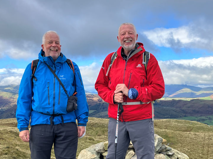
From there, a farmers track then footpath takes you up onto the ridge of Y Braich, crossing over a catchwater for the nearby reservoir, which was undergoing a few repairs. The ascent to Pen yr Helgi Du (833m) is straightforward, gaining us the height over perhaps a mile. Then comes one of the more interesting sections of the route – descent onto Bwlch Eryl Farchog down a section of mixed rocks, grass and soil, before an easier ascent onto Carnedd Llewelyn (1,064m), which we made our lunch stop. Despite the sun being out, there was a decided increase in wind and drop in temperature on the tops, so a mix of sunscreen and thermals was required.
There is then a simple wide ridge route to Carnedd Dafydd (1,044m) and Pen yr Ole Wen (978m), with great views all along the ridge, from the Snowdon massif to out towards the coast. Tryfan is continually standing out as a mini Matterhorn, even in the afternoon haze. The descent from Pen yr Ole Wen is down the easterly ridge, with a couple of rock steps on the way down to Afon Lloer to add a little spice, but after that it is a straightforward descent back to the road.
The weather on Saturday follows the same hot and humid pattern, and a group of us opt for a simple round of Moel Eilio. The route out through the quarries at Chwareli, just to the north of the hut, is now well established, but the massive mounds of slate, skeletons of buildings and embankments supporting old trackways always impress.
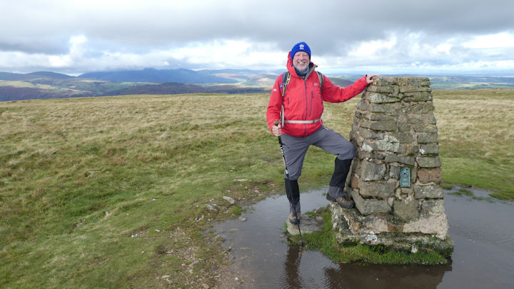
Before long, we have reached the Ranger path and cross it, to then pick up the ridge ascending to Moel Eilio. In contrast with Friday, the air today is even stiller, and the horse flies are making the most of it, but our tally seems to be better than theirs. It’s straightforward grass slopes up both Foel Goch (605m) and Moel Eilio (726m), and the view and welcome breeze on top to Moel Eilio makes it the perfect place for lunch. Even despite the haze, the quarries at Dinorwic stand starkly out, and the railway and route up Snowdon are equally easy to spot.
After lunch, we descend the northern path off Moel Eilio, before picking up a great track round back to the start of the ‘Telegraph Road’ – as the route back over to the Ranger path is called, because it used to be the route for the cables out of the Llanberis valley, and there are still remnants of cable poles there today. Beyond the Ranger path, we retrace our route out and get ready for evening meal.
This year, it’s a return to some old favourites, melon with Parma ham for starters, pasta Neopolitan for mains and a range of pre prepared summer puddings, including a mango semifreddo, which all go down well, especially when accompanied by an assortment of wines.
Sunday is trying to be more downcast than the previous two days, so our plan is to follow the usual track into Beddgelert, have a spot of lunch and the obligatory ice cream, and then decide on how we get back.
Thinking that the trains are not running following a fire on the track yesterday, we opt to leg it back.(Editors note: Judy reported - On Saturday there was a fire on the line towards Caernarvon, so the trains were stuck for ages and had to send people home in taxis) Part way we are greeted by the familiar rumbling of rails and a diesel busy pulling the train back to Rhyd Ddu. Never mind, we needed the exercise.
As ever, a great weekend away with friends and the chance to both enjoy the hills and swap memories. Long may it continue.
Photos from Andy, Don, Judy and Ed
Up to 8 members attended this 'roving meet' in the Mendips, based at the Mendip Bunkhouse at Larkhall in Somerset. Seven of us stayed at the bunkhouse with a member joining us for day walks. Overall we were blessed with good weather and braved the traffic of the Glastonbury Festival attendees.
On the Tuesday the seven of us arrived late morning, unpacked refreshed and set off for a walk around the local countryside. To get the meet off to good start the Waggon and Horses was our lunchtime stop within the first 2 miles.
The walk continued along country lanes and fields, often braving the tall nettles on infrequently walked footpaths, passing an Alpaca farm. As we climbed up to Maesbury Castle, an iron age hill fort, the Somerset views opened up with glimpes of Glatonbury Tor. The walk returned to the bunkhouse through the pretty village of Oakhill. A gentle walk of 9 miles and around 800' of ascent - it the Somerset levels after all.
On Wednesday we travelled up to Cheddar and met up with Margaret. Leaving the centre of town we headed up the hill to the top of Jacobs ladder - a good viewpoint.
This part of the walk was quite busy but after we dropped down into the Gorge and crossed over the road walking towards Charterhouse we virtually saw nobody for the rest of the day. Our highpoint today was Beacon Batch on Black Down. There were amazing views across the Bristol Channel into Wales. Steve spotted planes in the far distance, using biconulars we could the comings and goings from Bristol Airport.
At lunch time light rain started and we decided to shorten the walk. After lunch we returned to Cheddar via the West Mendip Way and the Warren Hill Road (with go cart race track). A 10 mile walk with extensive views and around 1500' of ascent.
On the Thursday we travelled to Nunney and met up with Margaret again.
Nunney is the site of a magnificient moated castle and after exploring the castle we followed the riverside through woods, across fields and country lanes.
After lunch we returned to the river side and walked along the disused train/tram way past old quarries and ruined lime kilns. All this area has now been turned into a nature reserve after the quarry company has moved on.
Finishing the 8 mile walk in the pretty village of Nunney we were dismayed to find the cafes not open on Thursdays.
Present: Mike, Andy, Paul, Mitch, Margaret, Fi, Steve and Helen.
This year’s Scotland meet was very successful, despite late changes of plan over the accommodation and the attendance of several members but, in the end, 5 of us made it for the full meet. The bunkhouse I had booked the previous summer experienced a disastrous flood in the Spring, putting it out of use for the foreseeable future, so I booked places in the youth hostel in Torridon for the 8 people who had expressed interest. We had to reduce the number of days, due to lack of availability, but were still lucky enough to get 5 nights for all of us. Then 4 of the potential attendees had to cancel but later one of them had a further change of situation and was able to join us after all! We ended up arriving on the Sunday, which was less good for public transport, but we all made it in the end, although Celine and Andy had a long train delay which meant they only just managed to reach the hostel before the 10pm deadline.
The weather forecast for the first day looked the best of the week, so Max and I decided to go for the traverse of Liathach. This was the only one of the Big 3 mountains in this area that neither of us had done before, so was top of both of our agendas. The others, understandably, felt it was too much for a first day, especially after the late arrival for Andy and Celine and Roger’s rapid recovery from a serious health problem and wish to try himself out on something less committing.
We had planned to go from West to East along the ridge, as recommended in the latest guidebook, so I suggested taking the car to the far end to avoid a long road walk back at the end of the day. The main problem was that we did not check the location sufficiently thoroughly and ended up in a further car park, which gave us an even longer walk in and out! I was very annoyed with myself for a while but got over it once we started. But it did mean that our actual start on the hill was not until 10am. The ascent path was very well made, though steep, on good solid rock but seemed quite long. It was picturesque, with waterfalls on the way and views at the top pf the first Munro, Mullach an Rathain (1023m) towards Loch Torridon and the surrounding giants, with Beinn Alligin and Beinn Dearg to the north west.
After a quick lunch stop, we started on the Am Fasarinen ridge of sandstone pinnacles. This is usually described as a grade 1.5 scramble, which seems accurate. Although exposed, the rock is mainly pretty solid and has good friction. Just a few slightly tricky moves are involved but it is mainly straightforward. There is a path to avoid the pinnacles but it is not recommended as it is very exposed and crumbling in places. We took something over an hour to do the traverse and were on top of the second Munro (Spidean a Choire Leith, 1055m) around 2.30 or so. It was quite sunny, but with haze in the distance and enough wind to make it cool. We met 2 or 3 other parties along the ridge and one person on the last top, where we lingered to rest and chat. From there you could see good views of the complex massif of Beinn Eighe. The way down looked obvious from the top but it took longer than expected to descend, over 2 minor tops (with a surprise further scramble move) and fields of small boulders. After turning right towards the valley, the path was clear but loose, not as solid as the ascent path, so concentration was needed to avoid slipping.
We made it down to the final car park well before 5 and I guarded the rucksacks while Max very kindly went to fetch the car, so we were back at the hostel in good time for tea and cake, with tired legs but much satisfaction.
Celine, Andy and Roger had walked along the north side of Loch Torridon towards Inveralligin, with a diversion for part of the way up the Choire Mhic Nobaill path alongside the Abhainn of the same name towards Sgurr Mor to test out their abilities for future days. This is the path that leads up to a series of pinnacles known as the Horns of Alligin by hanging a left at the footbridge, and can be part of a much longer ridge round over Beinn Alligin. Alternatively following the main riverside path leads up to Loch Grobaig and down into Coire Dubh Mor and back to the A896 with good views up into the northern faces of the Liathach massif.
They finished off down the side of the gorge and waterfalls that lead into the back of Torridon House, with a sighting of a red deer doe up in the big trees that shadowed them all the way out of the estate.
In the evening we all went to the pretty village of Shieldaig to eat local seafood in a restaurant, with great views over the bay in late evening sunlight. The restaurant had changed significantly since I was last there, when it had been a bar attached to the hotel, but it was nice.
The next day there was very low cloud and a few spots of rain at times. Max and I wanted to do a more relaxing walk without going up into the cloud, so we took a similar route to that done by the others the day before. In contrast, they wanted to go up something, so took a car to the car park below Beinn Alligin and went all the way up to the top of Tom na Gruagaich (recently designated a Munro at 922m) via the good path to the left of the bridge over the river above Torridon House. Though it was cloudy they had the satisfaction of getting up and back the same way.
Max and I started along paths and road from Torridon, with a diversion onto an interesting headland with an outdoor ‘church’, which had lines of rock at seat height, like pews, looking out to the south. We wandered around the rocks of the headland until stopped by a fence and notices of private property, then went back to a higher path above the road. Then we did much meandering to find a path from Torridon House and grounds through to holiday homes in Rechullin and the village of Inveralligin. The way back was quicker, as we knew the way, so we were in time to stop in at the shop and reach the hostel early. This hostel did allow you in at any time, once you had registered and been given the door code, which was far more hospitable than others in the past. On previous occasions I can remember being locked out of youth hostels until 5pm and waiting outside the door.
That evening we went to the Kinlochewe hotel (where I had originally booked the bunkhouse) for a very good dinner, with some people enjoying local venison. On the way back along the road we saw a red deer, the only one seen on this trip.
The following day started with some rain and even lower cloud, covering all the minor tops as well as the high ones, although the forecast was for clear weather later on. Max had a scrambles guidebook and the idea of a low level scramble was more appealing than going up into the cloud, so we headed off to the village of Diabaig, further along the coast on the North side of Loch Torridon. This was along a narrow, winding road with a steep descent to the harbour. Most surprisingly, there was a huge articulated truck down at the front, delivering supplies to an exclusive restaurant near the jetty, which later ground its way back up the hill, looking quite surreal.
Unfortunately the tide times were just wrong for us, as it was just coming to high tide when we arrived and the scramble starts on the beach. We started to make our way across the uncovered rocks until it became impossible, so retreated and looked for the upper part via a path at a higher level. We were still unable to identify the scramble and realised later we had definitely been looking in the wrong place, so no wonder that it seemed too steep and overhanging for a scramble.
So we continued on the path and around the hill above, finding masses of lovely crags higher up for good scrambling on nice rock. Some were pleasant slabs and others had the odd challenging move to add interest. So many of these crags had to be done, taking us over to a headland via numerous interim tops. We eventually arrived at the final top for a lunch stop and headed down to a small bay with a boat moored off shore and a ruined building that looked like an abandoned croft. There had clearly been fields for livestock and cultivation there in the past. One bonus was the sighting of a white tailed eagle. Later we found out that a pair were nesting on an island just off Sheildaig and one of the hostel staff had been looking out for them most days.
After stumbling through bracken and heather we made it back to the original path, went down to the (now uncovered) beach and easily identified the scramble once we were looking in the right place! It began on ‘easy angled slabs’ as described, so we did the first few sections. Some changes in the 20 years since the guidebook was written meant it was overgrown in places and the ‘small trees’ were now large. By the time we reached the path again we were just about ‘scrambled out’, so we decided to call it a day and return to the hostel for a welcome tea break.
Andy, Celine and Roger had decided to do the Liathach traverse, despite the initial weather, as there was promise of better later. Roger took his car to the nearer car park and they all set out together. I had a text from Andy some time after 5pm to say they were just across the pinnacles and would be back quite late, so I kept the phone close to keep in touch with their progress. Since Andy had offered his home-made shepherd’s pie for us all for dinner I checked out the details with him and did some preparations. Much later we heard they were getting close to the finish, so Max went out to bring back Andy and Celine from the further car park and drop Roger at his car.
We were all set up for a late dinner when a call to Roger indicated some problem. Eventually he turned up, having locked his keys and rucksack with all his possessions into the boot of his car. (I blame new car technology which allows the boot to close automatically when a button is touched accidentally - all too easy to do when you are changing your boots at the back, with everything beside you.) So first we all sat down to enjoy Andy’s excellent pie, then much discussion went on about what to do about the car key. Eventually the problem was resolved by a family member sending a spare key by first class post to the Post Office at Kinlochewe, which arrived after one day!
The last day was forecast to be sunny and clear, so Max and I went for the Eastern ridges of Beinn Eighe, including a scramble along the Bodaich Dubh ridge. On the map this looks straightforward but with a fair walk in, though the route did take a full day. We started from a car park near to Kinlochewe, taking a clear path straight towards the hill. It followed a river which soon turned into an impressive deep gorge filled with trees. We had to cross the river later to get to a minor ridge above the confluence of this and another river to ascend a small ridge. Looking across to the descent route, we realised that we would need to cross the further river at a high enough point to gain the main path this side of the deep gorge. Fortunately the rivers were low, due to the dry spring in Scotland, otherwise we would have had to cross much higher up.
It took almost 3 hours to gain the ridge and the top of the first peak, Creag Dhubh. Though it was sunny and sheltered on the way up, the wind was strong so there was nowhere suitable to stop for refuelling before the main scramble. We ended up teetering on the very steep side of the ridge, just below the top. I was crouching sideways, balanced above the drop with my rucksack carefully balanced behind me. Although Max looked more comfortable, he gave up and went back to the windy ridge and I joined him later. Soon we were at the start of the pinnacles.
In contrast to those on Liathach, the pinnacles of Bodaich Dubh were a very different type of rock which had far less friction and felt cold to the touch, like marble. It was also quite unstable, as I found on one of the first pinnacles where a very tempting juggy handhold came away in my hand. It was so loose that I let it fall as there was no one around and it was safer out of the way. After that I treated all the holds with extra caution, especially as there was less friction for the feet. However, the ridge was shorter than that on Liathach and soon we were at the top of Sgurr nan Fhir Duibhe (963m). This would have been a much nicer place for lunch but came just too late.
After looking around and taking photos, we descended on scree and boulders to a minor top and shoulder before going down towards the second river. The guidebook recommended crossing into the corrie fairly high up but we were tempted to stay high to avoid yet more scree and to cross lower down. Although the river was low, so it was not difficult to cross, the vegetation was deep, so we had to flounder around through heather and trees before reaching the confluence of the rivers and the original crossing to the main path. We finally reached the car not much less than 7 hours after setting out, so were glad we had not been tempted to take in any of the other tops of Beinn Eighe.
While Roger had had to spend much of the day making phone calls and sorting out arrangements to retrieve his car, Andy and Celine went to Diabaig to walk along the coast to Craig in sunshine.
They had a good day, with a surprise sighting of the PS Waverley sailing from the direction of Gairloch on its 6 day Inner Hebrides tour, but not the white-tailed sea eagle they originally set out to look for.
Nevertheless the Bealach na Gaiothe pass with its glorious wide angle view of Torridon and its surrounding mountains and the roadless area beyond Diabaig allowed some beautiful photo opportunities.
In the evening Celine provided a lovely chickpea curry and all of us shared various other food and drink we had brought, making a convivial evening.
We agreed that it had been a great meet in a wonderful location. As it turned out, the hostel was excellent, well equipped, with good views, conveniently located and staffed by very helpful people. I think we would all have liked to stay longer if it had been possible.
Present: Andy Burton, Celine Gagnon, Judy Renshaw, Max Peacock, Roger James.
Report by Judy Renshaw The weekend of the Kings Coronation saw eight of us arrive on the Friday at Hartington Hall YHA. An interesting building in its own right, the Tudor manor house was built for the Bateman family in 1611.
Bonnie Prince Charles is thought to have stayed there on his ill-fated mission in 1745, and it is said the hall is haunted by a woman who was hung in the village square for being a witch.
With a working farm adjacent, and different types of accommodations from glamping pods in the gardens to ensuite rooms to suit most groups, and an all-day kitchen, and licenced bar, as well as secure lockups for bikes, it was easy to see why this hostel is considered to be one of the feathers in the YHA crown.
Ed, Celine and I had an afternoon on Birchens Edge, before booking in, basically learning to get to know our ropes again, as it was before the pandemic that we last climbed together. We managed one climb, The Promenade, a two star diff.
Friday's fish and chip supper was booked for six of us at the Longnor chippy and enjoyed as ever, but visitors should be aware there are currently no public toilet facilities available in Longnor, and the nearest pub is now the Packhorse at Crowdecote. I knew I should not have had that pot of tea! But at least a stop at the pub on the way back was guaranteed.
On Saturday morning Judy and Celine set off on an uphill and down dale walk heading south from the hostel.
The rest of us cycled down into the village to meet Lin and Dick for a day's cycling along the Manifold Trail. Even with a walk up to the preserved copper mine workings in Ecton Hill we managed to arrive at the Yew Tree Inn at Cauldon before they opened.
Pork pies and pints all-round and a quick game of bar skittles, and then back the way we came, with a final tea and cake stop at the Hulme End café housed in the revamped old engine shed at the northern end of the trail.
Here we donned raingear and cycled back along the road to the hostel with Lin showing the power of electric as she set off to overtake Ed.
Saturday's evening meal was enjoyed back in the Oak Room at the Royal Oak at Hurdlow.
Sunday’s day walk was also direct from the hostel gates, once we were joined by our one day visitor. Walking around Wolfscote Hill, 1272 feet, an Ethel, with its large well preserved bowl barrow on the highest point, we entered Biggin Dale and followed it down into Wolfscote Dale.
Taking the steep path up Sunny Bank, not the best choice after the heavy rains of the night before.
At the entrance to Beresford House, we turned right back to the River Dove and into Beresford Dale itself, past the Pike Pool and the free-standing pinnacle in the river close by, before exiting the woodland and continuing onto Hartington village and back up to the hostel.
Evening meal was enjoyed, pre-booked in the hostel, and we all agreed it was good wholesome grub at a reasonable price. Good local beers from the Wincle brewery were also enjoyed.
On the Bank Holiday Monday we all vacated the hostel, with Myles and Don and Judy with their respective longer car journeys setting off on their way, and Dave making his way into the village to get a paper. The remaining four of us walked up the upper Dove valley towards Crowdecote, visiting the motte and bailey fort at Pilsbury, another well preserved ancient monument site. At Crowdecate we found the Packhorse Arms open and serving food.
After lunch Dave and Heather made their way back home by car, and Ed, Celine and I crossed over the river onto the Staffordshire side and made our up and along the ridge with views out to the Staffordshire moorland on one side and back across the Dove valley to the White Peak on the other.
The path makes its way through the woods at the end of the ridge and back down to the footbridge over the river just before Bridgend. Where the Cheese factory once stood there is now a new quality housing development well underway, but the Cheese shop itself remains where it always was by the village duckpond.
Thanks to everyone for making it another great weekend in the Peak District.
This years attendees were Myles O’Reilly, Heather Eddowes and Dave Matthews, Judy Renshaw and Don Hodge, Ed Bramley, Celine Gagnon, and Andy Burton, with day visitors Lin Warriss and Dick Murton, and Steve Caulton.
Report by Andy Burton The second Tuesday in April provided the five attendees with a classic Spring Day in the White Peak.
After a Yonderman cafe start we set off across the main road through the adjacent farm complex and across the fields to Foolow with long views over the limestone walled enclosures up to the Barrel at Bretton where Hucklow Edge and Eyam Edge meet up on the ridge above us.
The way that the footpath pops you out by the little duckpond in the middle of Follow is always a treat. Continuing a little way along the road before striking diagonally right across several more green fields and past hidden dry valleys and the occasional farm lane we emerge among the first houses in Eyam.
With the Nook cafés (National Trust) inviting gateway and inner courtyard in the sun beckoning we elected to tarry a little while in the heart of the place where in the summer of 1665 the Plague arrived, and the villagers imposed on themselves a quarantine to prevent any further spread.
This they successfully did but not before 273 individuals succumbed to the bubonic plague over 14 months as the disease ran its course. This was out of an estimated total population of less than 800 inhabitants.
It is no wonder with this stark historical example that during the recent Covid-19 pandemic similar echoes of self-isolation to prevent the spread of infection were felt necessary.
The start of our return saw us able to look into the tops of a couple of the many quarries that dot the landscape either side of the A623 as it runs through Stoney Middleton, whilst looking at the newborn lambs and their accompanying ewes in the fields closest to us.
Crossing the A623 at Housley House we headed up towards Longstone Moor with the larks rising and singing as they climbed skywards above us, and the call of the curlew becoming ever stronger as we reached the old mining rakes and the higher moorland above, that they love to frequent.
Here we cut back to the southern end of Wardlow village, crossing the B6465 and taking the grassy lane and track that pops out at the northern end of Cressbrook Dale, where the spits of rain encouraged us to descend and make our way past the Peters Stone back to Wardlow Mires, just in time to avail ourselves of a pot of tea, and a toasted teacake before setting off back home.
This nine miler was enjoyed by Michele and Marcus Tierney, Steve Caulton, Ed Bramley and Andy Burton.
Report and photos by Andy Burton On the Friday Sonja and Celine arrived early and had a rainy day’s walk up to the Angle Tarn area, whilst everyone else joined later for the pub dinner at the Travellers Rest in Glenridding (our usual haunt the White Lion, Patterdale was not yet serving food for the season). We convened with photographer, Tim Taphouse and his young family ahead of the Sunday workshop and it was a jolly affair with ages spanning seven decades. Most people were in bed early after long journeys
and in anticipation of the skills training day the next morning.
Saturday - Skills Day
Led by leaders Robin, Kristine and Sam from Mammut mountain school and funded by the club, two groups of six ventured off up Grisedale valley to cover various mountain skills in the cold mizzley morning.
Robin’s group made their way with ropes, harnesses and lots of layers to Thornhow crag
to cover steep ground skills and crevasse rescue technique. Whilst Kristine took her group up the
main Helvellyn path to Brownend Plantation to look at steep ground and micro navigation skills.
Robin's group -
The group began the morning with simple steep ground techniques, including basic rope tying/taking in coils and useful knots.
Tying together ‘on a leash’ we used a rope ‘to aid a walker who has lost confidence on steep or difficult terrain’ and practiced anchoring/stopping a fall.
After lunch we moved with ropes in pairs over rocky ground, practicing hooking on and keeping safe in alpine terrain. We checked suitable rocks to secure to and navigated safe routes up and down the steep ground.
Kristine’s group
The group discussed ascending steep ground technique and then walked up past Brownend Plantation to ridge wall paying attention to false summits, maintaining good foot placement and zigzags, use of poles, direction of travel and observing landmarks to/from map.
The group continued along the wall on towards the main footpath on Birkhouse Moor. Before the path was reached a practical rope work exercise of walking together and securing to a belay point was attempted. The group leaned the importance of testing that the rock is firmly embedded so that the rope does not pull up and over the top surface of the boulder. After various scenarios were trialled by all, the group ascended to “Hole in Wall’ during which time we micro managed ourroute by:
Next was ‘Pacing’ - how many paces an individual would take to cover 100m. The techniques is
to count only 1 foot i.e R step=1, R step=2, R step=3 and so on. Thus counting one’s steps
enables the distance to be observed which again assists in knowing whether or not one is in the
right place; important when visibility is poor.
Micro navigation - observing features in the landscape, on the map - distance, height, direction
Simple use of compass for general direction of travel, direction of observable feature eg summit,
lake, gap/point on a ridge etc.
From the ridge the group descended the main footpath to Grisedale and stopped for a late lunch
and a discussion about GPS and other navigational equipment available to walkers in the hills.
The pros and cons of the various products were discussed.
The descent back to the hut was completed and some very valuable lessons had been learnt -
one hopes!!
Back at the hut, post cake and showers, Mike Parsons gave a talk on textiles through the history
of mountaineering expeditions and shared important points from his book, Keeping Dry and
Staying Warm. This was whilst a spicy veggie curry was being prepared by Jonny T and Mary, and
of course the fine creation that was Jonny D’s famous apple crumble. Simon provided some tasty
honey rum to finish the dining experience, before board games and relaxing ensued.
Sunday - Photography Walk - The majority of the group joined Tim Taphouse for a morning of slow meandering and
photographing the local area around Patterdale and the west side of Ullswater lake. Mike showed us new lesser known paths up to Silver Crag via Rooking, past disused quarries, streams and with beautiful views across the valley. It was so lovely to pootle along, taking photographs and to really take time to see small details in the landscape. Quite a contrast to the steady pace of hillwalking and covering ground.
Here are some of the photos of the day. More photos of the walk are in the photo gallery We closed the morning just near Silver Bay with a demonstration of the brand new LOFI stove from Jonny T. He has been developing this biofuel camping stove for the last 5 years and having been funded on Kickstarter in October 2022 is now at the assembly and distribution stage.
As it was Louise and Simon’s first time to the area they instead chose to get up high in more promising weather and took the Striding Edge route up to Helvellyn, enjoying impressive cloud formations shaped by the ridge. Staying on a third night, Mary and Jonny followed this same route on Monday, and were gifted with blue skies, sunshine and incredible views all day (and a cup of tea on the LOFI stove on the summit of Nethermost Pike).
It was yet another successful and enjoyable skills meet, where we welcomed newer and less experienced members as well as the trusty veterans who shared their knowledge and experience with generosity and patience. At least five members of the group are looking forward to testing out these new skills at the Saas Almagell meet later in summer 2023.
A big thank you on behalf of everyone who was at the meet, to the ABMSAC committee for agreeing to fund the skills training day, to Tim Taphouse for leading the first photography walk, to Heather Eddowes and Daniel Albert for their general support and to Mammut Mountain School for their training guides.
Report by Mary Eddowes and with a contribution from Heather Eddowes
Meet attendees:Jonny Dixon, Anna Kaszuba, Sonja Hoffman, Celine Gagnon, Nanette Archer, Will Priestley, Jonny
Taphouse, Mary Eddowes, Heather Eddowes, Daniel Albert, Louise Mundy, Simon Coleman, Mike Parsons.
We gathered in the village of Overton in the Test Valley Hampshire, it was initially cool and with some light rain, several members of the group took full advantage of the Honesty Cafe in Overton to enjoy a hot cup of coffee.
The route took us through the side streets of Overton before we ascended onto the rolling Test Valley Hills with great views over Brandon Copse to the east and Abra Barrow an accent burial mound.
The next 4 miles was cross country on a mix of farm tracks, woodland paths with stunning views of the Hampshire Downs. We took a slight deviation to avoid as much tarmac roads as possible as we descended into the River Test Valley itself -the premier chalk fishing in England -I am told by Paul Stock-no doubt Marcus would agree.
Walking along the River Test until spending sometime at Lynch Hill Weir to see at least 20 fish swimming against the river flow, the water was absolutely crystal clear and made for one great photographs.
The lunch stop was at the 19th century Whitchurch Water Mill still in operation today producing high quality woven clothing attire, rugs, throws etc.
The afternoon saw us return to follow the River Test up stream on the opposite bank to the morning, stopping at Bere Mill before ascending to the Harrow Way also known as the Old Way, which has been in existence since c 600-450 BC but according to the local archaeologists probably in existence since the Stone Age.
Finally descending from the Harrow Way through a single track woodland path, crossing the main Salisbury to London railway back into Overton with a well earned drink at the White Hart.
Distance 13.6 miles and 760 feet of gentle ascent- a great days walking!
Map of the Test Valley
Attendees: Mike & Maggie, Margaret M, Mike G, Judy, Paul, Mitch, Steve, Fi and Helen.
Report by Mike O'Dwyer Only a small group turned out for the latest walk, heavy snow on the west side of the Peak District made travelling difficult for some and were others unable to attend. Andy, Steve, Michele and Marcus met at the Family Tree cafe at Whatstandwell. The car park was already full on the Cromford canal side but there was room in the fisherman’s car park by the river.
After a very nice breakfast the group set off along the canal side with Marcus Pike spotting (three small jacks) heading in the direction of Ambergate. The route continued through Crich Chase woods and onto the ridge known as The Tors. At this point it became a bit black over Bills Mothers as they say. Snow and graupel began to fall. This unfortunately spoiled the usual fine 360 degrees views at this point, however the precipitation was short lived and had stopped by the time Crich was reached.
As the weather improved the walk continued up to the Regimental Memorial. The monument here is in form of a lighthouse. The Regimental Memorial Crich is a Mercian Regiment War Memorial dedicated to those who paid the ultimate sacrifice in the Mercian Regiment and its antecedents; the Worcestershire and Sherwood Foresters and the Sherwood Foresters. The views from the memorial are superb and the area is very well maintained by the resident warden and is a great tribute to those who fell in the Great wars. Those who have lost their lives in later conflicts are also remembered here. If you are in this area a visit is highly recommended and on a day when the tower is open it is possible to see seven counties and even Lincoln Cathedral 50 miles away although you would need binoculars for that.
The walk continued and after a short descent crossed the Tram lines of the nearby Crich Tram museum. As arranged by the walk organiser the last tram used in Sheffield did a drive by for us loaded with enthusiastic waving schoolchildren. As the tram stopped at the terminus the driver got out and with a long bamboo pole reversed the wire connection before heading back down the line.
The weather continued to threaten as the walk continued down through the Dukes Quarries. There are some really impressive walls of Gritstone which would be a very popular climbing area if it wasn’t such a dank north facing area shrouded in trees. There are a few minor classics here including Great Crack which is superb when dry. A very interesting area to explore with evidence remaining of the original quarry work done here.
The route finished black along the canal and by the time the car park was reached it was snowing quite steadily. It was at this point that Marcus decided it would be really clever to lock the car and house keys in the boot of his car. It did however mean that the cafe had to be again visited for a variety of sweet things and tea whilst the problem was fortunately sorted. It is not known how Michele managed to get into the locked car. Michele seemed to use some sort of mysterious energy to open the drivers door, clamber through the car and into the boot to recover the keys. Anyhow, Michele either won’t or can’t tell the three retired Police Officers how she got into a locked Audi.
A very nice walk which defied the weather which threatened all day.
Attendees: Marcus, Michelle, Andy and Steve
Report by Marcus Tierney With the weather promising to be kind, the adventure began with Ed and I partaking of a formidable breakfast cob in the Aisseford Tea Room on the main street in Ashford in the Water. We were joined by Michelle and Marcus and when suitably fortified for the exertions of the day we travelled across country the few miles to the meet start proper at Moor Lane car park just west of Youlgreave. There we joined Heather, Dave, Lynne and Dick, all raring to go, especially Dick astride his magnificent machine, all togged up and di rigueur for his solo biking escapade.
With the bike rearing up enthusiastically and a wave worthy of the Lone Ranger himself, he was off in a splatter of mud and gravel, never to be seen again that day.
It was crisp and sunny as we headed northwest across the fields, skirting the trees of Low Moor Plantation and on towards the farm buildings at Calling Low. This was our first glimpse of the land beyond Lathkill Dale. With Monyash distant on our left and seemingly nothing but countryside stretching to the horizon, it was a marvellous, sunlit vista.
The obvious footpath led to the numerous and steep stone steps leading down to the little footbridge straddling the River Lathkill. Once all safely across, we turned right along the path leading to the Nature Reserve area and Palmerston Wood. The Dale has a less open aspect in places but the walk through sparse woodland is not an arduous one.
The River was flowing abundantly for the time of year but various weirs and other obstacles nature herself has put in her way has provided quiet, languid pools and backwaters where coots and moorhens have ensconced themselves, safe from those creatures of the night looking for a supper.
Ed took the opportunity at suitably scenic locations to take photos of the group, as is his want, whilst we strolled on through this Limestone area, trying to imagine what the Dale must have looked and sounded like 200 years ago. Dilapidated stonework and roofless little buildings, natural sinkholes and evidence of sunken shafts are all apparent along the Dale and are testament to the hand of man having shaped this now tranquil and picturesque landscape, returning inevitably to nature with a little help.
We soon came across a little arching bridge, reminiscent I thought of those to be found in Monet's artworks. Once across we explored the skeleton of a once substantial building known locally as 'Bateman's House'. Built in 1830 by The Lathkill Dale Mining Company to drain the many surrounding mine tunnels, it housed a very novel design of water pump called a 'Disc' pump. It was primitive and experimental for the time and there is debate still whether or not it was the success expected of it. It was apparently regarded as working satisfactorily enough in 1833 but had had its day by 1842.The house name refers to James Bateman, an agent for the mining company who occupied the building as a family home from 1836.Having read the information boards I have to say 'rather him than me!' because the house straddles a forty foot deep shaft which can be viewed by descending a metal stairway to a railed off viewing platform. You can peer into the murky depths aided by an electric light which illuminates the dark and dank shaft.
We found this out only after seven people from various professions requiring a certain level of intelligence and with a combined age of around 450 years, finally managed to figure out what the crank handle on the box next to the railing was for!
Now thirsty for more architectural wonders we visited the cold, stark remains of the once solidly built Mandale Mine. Built by The Mandale Mine Company the tall and impressive structure remaining is a tower of massive stone blocks of sandstone and limestone twenty feet high, erected in 1839.How they maneuvered these into place in 1839 is hard to imagine. It eventually had a massive beam engine sat on the top driven by steam engines. All of this was of course to pump out water from the mine workings. Always an enormous problem to the mining industry it had been so in the Dale since the middle ages. Various primitive water management systems had been applied over the centuries requiring ditches and tunnels and even a form of aqueduct over the river, the pillars of which you pass by even today. All efforts to get topside the problem had proved to be to no avail and the marvellous technology of the Victorian era was the last resort. I t too was not up to the job and the boilers went cold in 1851 due to the all familiar problem of rising costs.
Today the building is a Scheduled Monument and the visible entrances to old workings are a favourite haunt of cavers and other troglodyte inclined oddbods.
We continued along the Dale to the outskirts of Over Haddon and the lovely waterside path along the Lathkill. This is a true riverside walk. The river here is wider and free flowing with the usual inhabitants of ducks and geese effortlessly and peacefully gracing the scene. A Dipper was spotted which is always a good indicator of water quality.
A little further along this all too short a pathway and we emerged on the famous and amusingly named 'Conksbury Bridge'. It's a three arched structure of simple design, unsurprisingly built of limestone and dating from the eighteenth century. It crosses the Lathkill carrying the road between Bakewell and Youlgreave and is unusual in that it has a pronounced curve to cope with the topography there.
Apparently the name Conksbury is a reference to a medieval village that once lay between nearby Over Haddon and Youlgreave. It was recorded in the Doomsday book of 1086 but disappeared sometime during the 17th Century.
(Derbyshire, it appears, had a high crime even then, but it was reported as missing and so the Police have promised to look into it when they have someone available).
Now I had the scent of The George Hotel at Youlgreave in the nostrils and found myself picking up the pace, which as you all know, is unusual for me. It was a nice stroll into the village and always a pleasure. We arrived at the George and having exchanged niceties with the hostess seated ourselves to peruse the menu. It was never going to be a hard decision and all of us chose something commensurate with our varying appetites. Some even had a beer I'm told.
An hour later, and satisfyingly replete we set off down the main street of Youlgreave and took the lane past the Community Centre to cross the River Bradford via the old footbridge. It was by now a lovely afternoon of bright sunshine and once by the riverside we found ourselves walking along a dappled pathway with open patches of sunshine to aim for.
The River Bradford flows eastwards passing Youlgreave and the pretty village of Alport where the gardens go down to the river's edge. It joins the River Lathkill here and flows onwards to merge with the River Wye. Its water quality is well known for being very clear and the bottom is clearly visible in most places. Beds of watercress and reeds are common, together with other plants that favour a watery environment. There are various weirs and structures along the river which give rise to pools and ponds of still water. I believe these were constructed to encourage fish populations and no doubt still do.
There are a number of bridges spanning the Bradford. Some are old pack horse bridges.
The whole dale is a delight to walk through. A rare place of genuine peace and quiet when it's respected by its visitors.
We crossed Marcus' little bridge and began the not too steep ascent up to Weddow Lane, running between Middleton and Youlgreave. Turning right here towards Youlgreave we passed the very enviable Lomberdale Hall, a mid 19th Century house set in lovely gardens and standing well back from the road itself. Not too ostentatious it's the type of architecture favoured by the successful Victorian entrepreneur and lottery winners.
You can have a holiday in the accommodation formerly the stables if you can afford it. The views from up there are very good.
We were soon across the fields on a bit of The Limestone Way walk and back at the car park.
Attendees: Ed, Marcus, Michelle, Heather, Dave, Lynne, Dick and Steve
Map of the Northern Day Walk
Report by Steve Caulton The 2023 Annual Dinner weekend began for me like they mostly all have done over the years, with a drive up to Calverley, where Ed kindly offered to drive again. A quick cuppa and a righteous number of biscuits, a transfer of kit, and the treat of a clean dry garage for the Skoda, and we were on our way.
Plans for the Friday were made with some route and parking advice supplied by Suzanne, which saw four of us park up and don our waterproofs close to the Sun Inn in Coniston and set off towards the fells of the same name. Crossing the Miners Bridge, we continued up the Coppermines Valley, slowly ascending in the dreek until we finally popped out on Wetherlam top at 762 metres.
Here the wind speed increased dramatically pressurising the rain even more. We turned left and followed the top path until a path heading down presented itself in the Black Sails area. As we descended the weather cleared sufficiently for us to be able to see Levers Water, and eventually the waterfalls that were spouting out at its southern end into Boulder Valley.
We tucked in left just before Kennel Crag and descended down the well-preserved mining ramp back into the Coppermines Valley reversing the route up in the morning back to Ed’s car.
Friday evening was well served by another culinary delight, this time from the Bramley kitchen, and puddings were provided by your Meets Secretary on both occasions. In keeping with Annual Dinner tradition, we all made our way down to the Inn on the Lake to meet up with those club members who were staying there, and it was just great to see everyone and have an informal catch up.
Saturday morning saw Ed, Mike, Paul, Daniel, Roger, Judy and Myles set off for a walk from the Hut. The walk went up to the top of Angle Tarn Pike, via Boredale Hause, continuing round the tarn and up to the Knott. The winds were very gusty on the tops! They returned via Hayeswater down to Hartsop and then took the back lanes to Patterdale.
Ed has done a write-up of his day which I include here.
Things just don’t work the same any more
So we set off down into the valley – I was concerned about what I’d just done, but knew it was the right decision. But perhaps I should have appreciated that true friendship runs deeper than that, and our talk and mood became one of recounting the many adventures we’d enjoyed together. “Did you spot yourself on the latest video – the one of us in the Karwendel – the one with the horrendous screes day after day?”. “Yes, they’d even got a shovel to put the path back in on one particularly steep bit”.
As we sat eating a belated lunch by the side of Hayes Water, recounting further shared experiences, we realised there are some things that the years can’t take away; friendship being one of them. And the realisation that if we can’t solve things in one way, then we can certainly have a good go at trying to solve them in another way.
I set off to find where Michele and Marcus and Margaret and Mike O’Dwyer were staying near the White Lion and join them on a walk from there. The five of us set off around the back of the Patterdale Hotel where there is a footpath leading up to Glenamara Park.
We continued up past Oxford Crag and onto Arnison Crag with its good value extensive 360-degree views over Ullswater and the surrounding fells, before heading out to Trough Head and the steep path up onto Birks at around 600 metres. Here we joined the path up St. Sunday Crag before contouring round onto Gavel Pike, 784 metres, and Lords Seat to enjoy the vistas these two places afford.
Once again, the wind speed and its chilling factor became much more noticeable, but thankfully sans yesterday's rain. We all decided we had had enough of the high places for the day, and that a brisk descending walk back to Glenamara Park was in order. I returned to the Hut and enjoyed afternoon tea together with the gang before getting ready for the evening at the Inn on the Lake.
Always a bit of a miracle that us sweaty oiks manage to brush up so smartly for dinner in relatively short time order? By contrast the ladies of course just glow and glide seamlessly through the whole process, or so I have been told.
The AGM went smoothly with the annual administration duties of the club being formally fulfilled in the presence of the attending members, where there were many familiar faces and a fair smattering of new ones too.
Switching into Annual Dinner mode I met our guest speaker, Ronald Turnbull and his wife Clare, and after testing of the audio-visual system for the evening with Don’s assistance, all 40 of us were able to relax and enjoy the evening together.
Ronald’s talk about Hut-to-Hut walking in general and specifically the Stubaier Hoehenweg in Austria with his adult son, Tom, was very well received by everyone, and on a personal note I enjoyed it immensely.
Sunday morning came and we were joined at the Hut by Ronald and Clare. After a little look round at what facilities the Hut had to offer, Ed, Roger and I set off with our guests for a walk-up Place Fell.
We then followed the path down under High Dodd past the disused quarry and its quite substantial building ruins with Scale How Beck on our left and its impressive set of little falls tumbling down alongside us until the former mining ramp ran out and we joined the path along Ullswater back to the Hut from the barn now converted into a café and rooms close to Sandwick.
Paul, Mike G. and Margaret M. went up Wansfell to the Pike from Troutbeck church and enjoyed extensive views across the west and south lakes before continuing their journey home from there.
Others stayed on and took advantage of another day of fine weather on the Monday with Celine bumping into Ronald and Grace somewhere on the Gowbarrow round.
My thanks go to Julie Freemantle, your Membership Secretary, for organising everything with the Inn on the Lake for us. Heather Eddowes for getting the room ready, and Don Hodge for preparing both the rolling slide show of the years Club meets, and the audio-visual equipment that enabled Ronald to be able to share his photographs with us all during his after dinner talk.
Thanks to everyone who made the trip up to the Ullswater Valley to join in the fun. I hope you all enjoyed the proceedings as much as I did.
See you all next year and on as many meets as you can during 2023.
Report by Andy Burton Thanks to Don Hodge for compiling this review of 2022 Meets from the website and for Ed Bramleys technical tweaks.
Three club members braved the rain to attend the January day walk. Since the December walk had been cancelled due to snow and ice, impassable roads and Government advice to avoid all but essential travel, we had a ready-made route already planned for this month.
Based in the Chilterns, the route took a 10 mile clockwise circuit from Hambleden, near Marlow, up through tracks and woods to the picturesque villages of Turville, Fingest and Skirmett. Rain was forecast throughout the day, with the main front passing over by midday, so we were not sorry to have a slightly delayed start after some traffic problems. Although it runs through pretty countryside it was not at its best, due to very low cloud and mist. Fortunately some parts were on tracks but there were also plenty of woodland paths, with liquid mud making progress somewhat challenging, especially on the hills.
We left out some of the longer detours, such as the steep hill to the Turville windmill, saving this for another day in drier conditions. A good sheltered lunch stop was provided by the church porch in the village. We saw and heard a number of red kites, also saw a muntjac deer and a herd of around 8 or 9 roe deer running through the woods. After returning to the start, the rain stopped for long enough to enjoy a welcome tea and tea-cake at the Hambleden village shop before setting off for home. We all agreed that the walk had been good, despite the weather.
We are considering repeating some of the previous day walks this year and next as some new members and friends have started to join us (possibly doing some of the walks the other way round). Also differing weather conditions would make a quite different experience. This particular walk could well be enjoyed in sunnier times and with more members participating.
Map of the Southern Day Walk
Present: Margaret Moore, Mike Goodyer, Judy Renshaw
Report by Judy Renshaw
This year’s Twixmas meet saw a total of 19 attendees, most of whom stayed in the hut. We had a mix of weather extremes, from thoroughly wet and windy to beautiful sunshine with snow on the tops. In the evenings many games were played, sociable dinners were enjoyed and some unusual and unforgettable musical experiences were provided.
Most people stayed 3 nights, from 30 December to 2 January. On New Year’s Eve the morning was almost dry but the rain became steady as the afternoon progressed. However, three parties went out from the hut. Andy, Mary and friends took the Hare Shaw route up Place fell and came down by the main path. Sonja and Pamela took a different route over Place Fell and returned via the lakeside path. Judy, Jeannie, Sandra, Vanessa and Daniel went to Aira Force (where the waterfalls were spectacular after all the recent rain), over several summits of Gowbarrow and over Little Mell Fell, before returning on the Ullswater Way around the front of Gowbarrow. Don undertook some essential repairs and examination of the roof spaces in the hut.
In the evening, meals and snacks were shared in several groups, mulled wine and other beverages were the prelude to many games, including varieties of quiz games, the ‘Werewolf’ game and a riotous ‘Chocolate Game’, in which the aim was to throw a dice to attack a huge bar of chocolate as fast as possible with a knife and fork, while dressed in hat, scarf and gloves. The highlight for some of us was playing tunes after midnight, including Auld Lang Syne, on a set of antique hand-bells, as directed by Simon, our musical expert.
New Year’s Day was seriously wet, so some people opted for gear shopping in Ambleside, while others took short local walks which led, in some cases, to the pub and in others to the community pop-up café at Glenridding, where Marian was again helping out. Some of the pub-goers later went over the col below Glenridding Dodd and down to Seldom Seen. More games followed in the evening, though we all had a quieter and earlier night. Don watched the traditional lake swim (in the rain) at Glenridding before visiting the pop-up café, then examined yet more leaks around the hut.
The next day was spectacularly sunny and clear, with snow on the higher tops. Some people were staying another night and others delayed their departure for long enough to get out and take advantage of the lovely weather. Andy, Mary, Jonny and others went over Helvellyn and were able to enjoy the snowy conditions. Judy, Jeannie, Sandra and Vanessa had a quick trip over Place Fell and were able to see clear views of fells in all directions, which was particularly satisfying as two of them had not been here before.
The journeys home were pretty slow for many, due to a mass of vehicles on the road, but it had been worth it!
Report by Judy Renshaw
Attendees: Andy Burton, Anna Kaszuba, Daniel Albert, Don Hodge, Eudald Rossell Vivo, Jeannie Worsfold, Jonny Taphouse, Judy Renshaw, Marcus Allard, Marian Parsons, Mary Eddowes, Mike Parsons, Nanette Archer, Pamela Holt(AC), Sandra Wynn, Sonja Hoffman, Simon Palmer, Vanessa Osicki, Will Priestly. Back to Report Archive
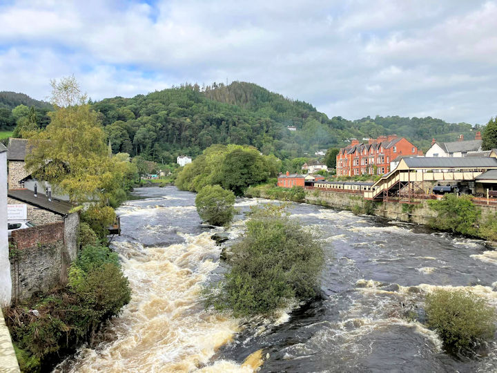 River Dee in Llangollen
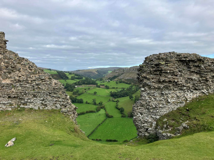 Castell Dinas Bran ruins
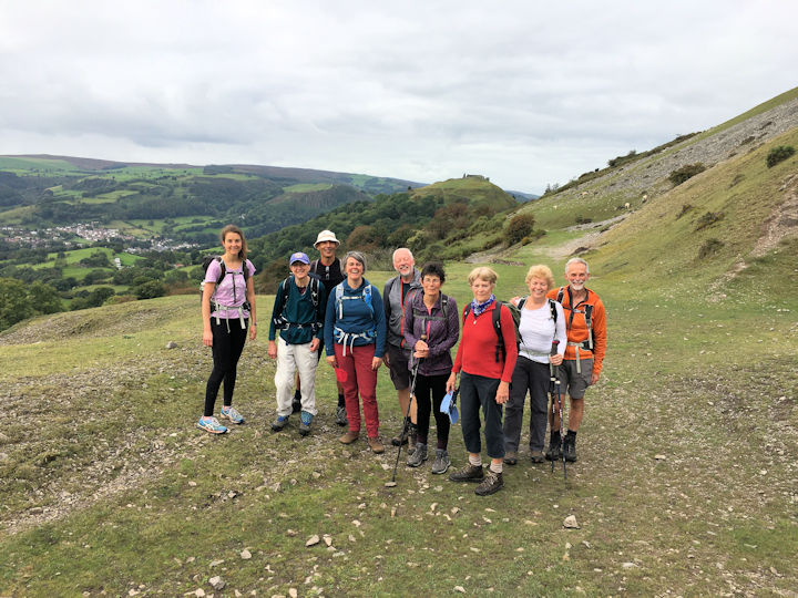 Group on the scenic road with Castle behind
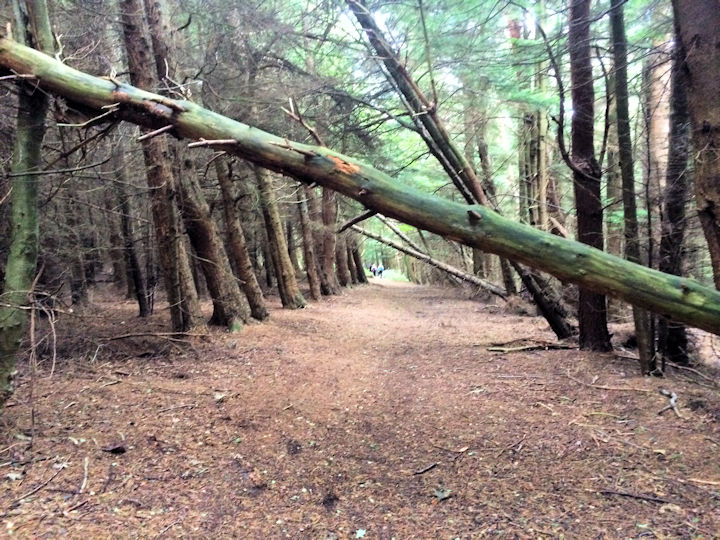 Descent via Trevor Hall Wood
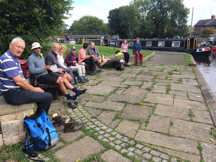 Lunch at Trevor Basin
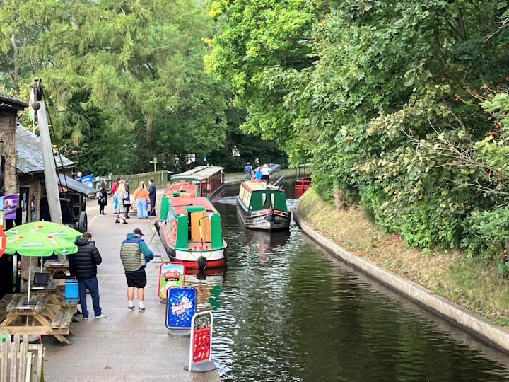 Canal
Canal
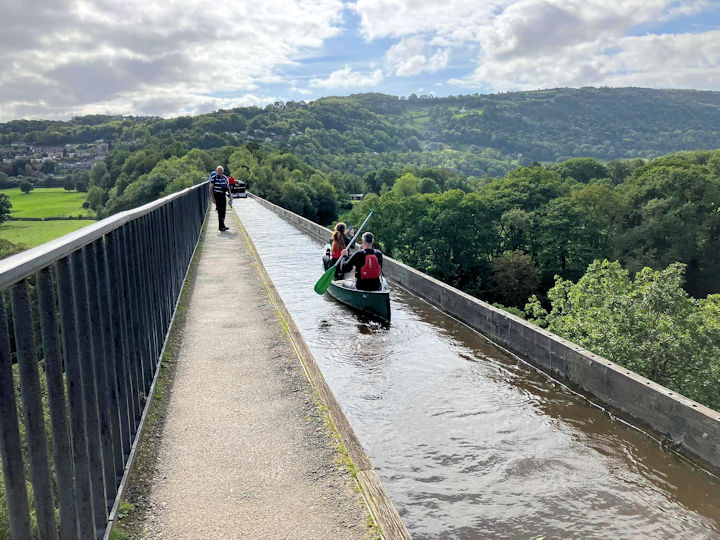 On the Aqueduct
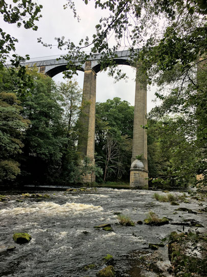 View of the Aqueduct from the river
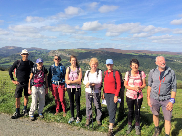 Froncysyllte Summit
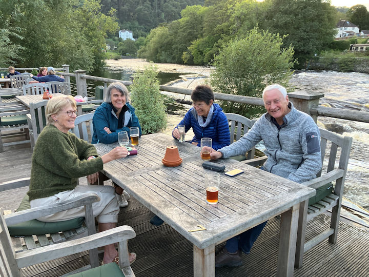 The Corn Mill
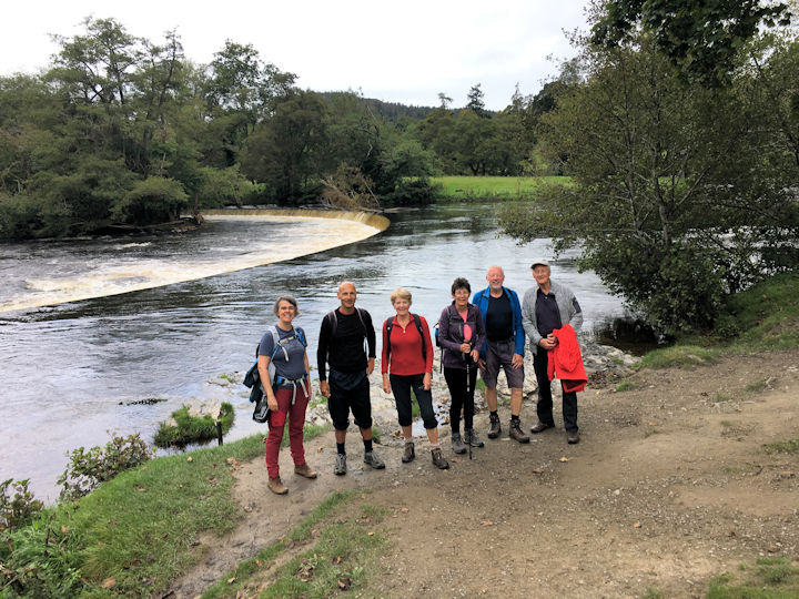 Sunday group at Horseshoe Falls
Photos by Andy Burton and Dave Matthews.
Report by Dave Matthews.
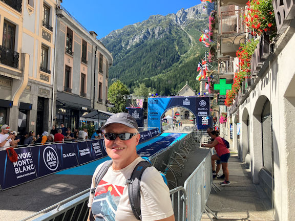 Ed at the UTMB finish ramp on Friday
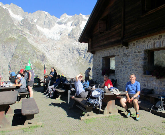 coffee stop with Erin, Catriona and George
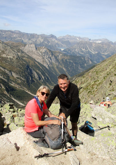 George and Catriona at the
Fenetre d'Arpete
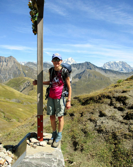 Judy at the
Col de Grand Ferret
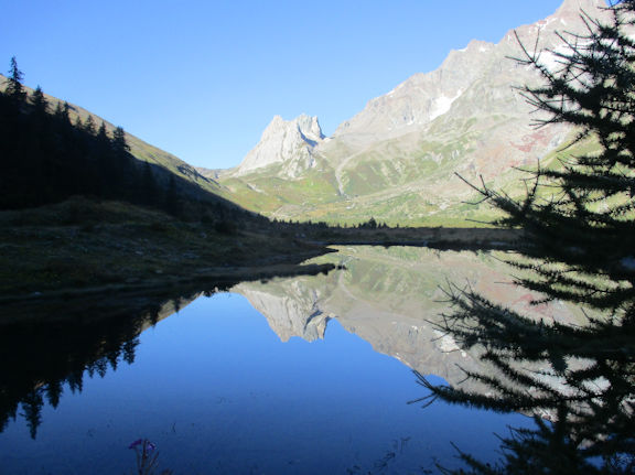 Reflections on the way up Val Veni towards Col de la Seine
Our baggage was transported ahead to our Day 1 overnight stop at the Gite de la Grande Ourse, Trient in Switzerland, as will be done every day to our overnight stops. Our bespoke tour of Mont Blanc is unguided, meaning we rely on paper maps, and guide pamphlets supplied by a local travel company, Altitude Mont Blanc, plus digital maps on our phones and more importantly on the experience of fellow club members.
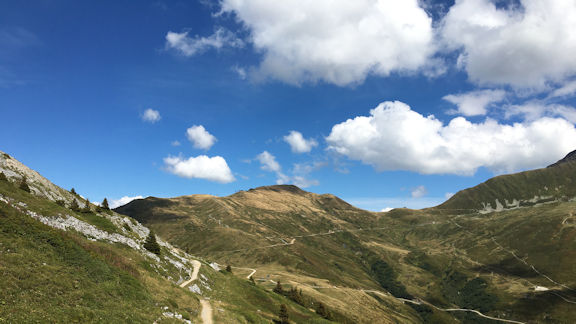 View towards Col de Balme
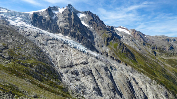 Remains of the Trient glacier
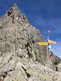 The Arpette window col
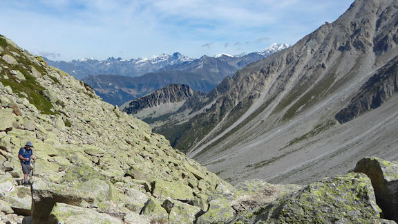 Mitch descends the boulder field below Fenetre d' Arpete
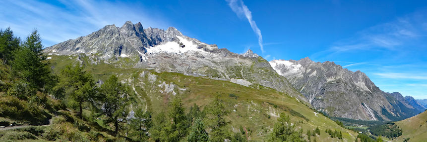 Retrospect towards la Fouly
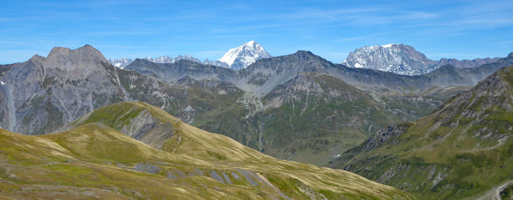 Retrospect of route up to Col Ferret
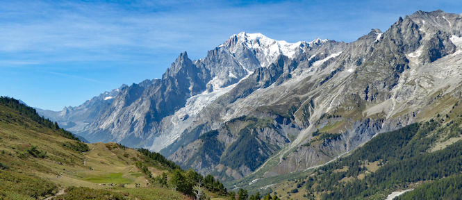 Ferret valley and Mont Blanc
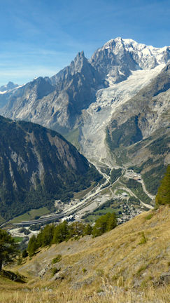 Mont Blanc and tunnel, from the Italian side
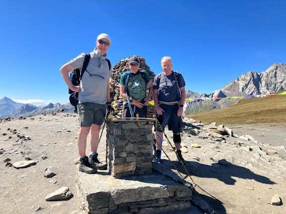 Steve, Ed and Mitch at the Col
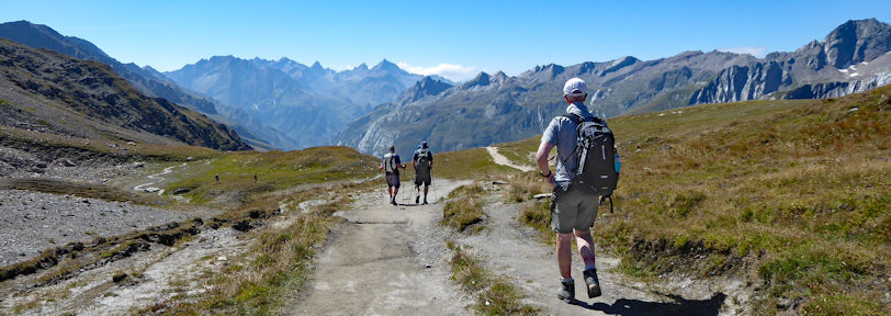 Descending from Col Seigne towards refuge des Mottets
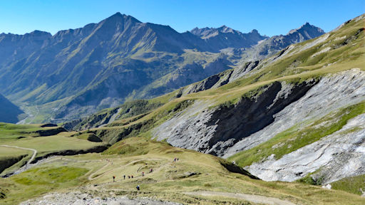 A popular route - spot the orange packs!
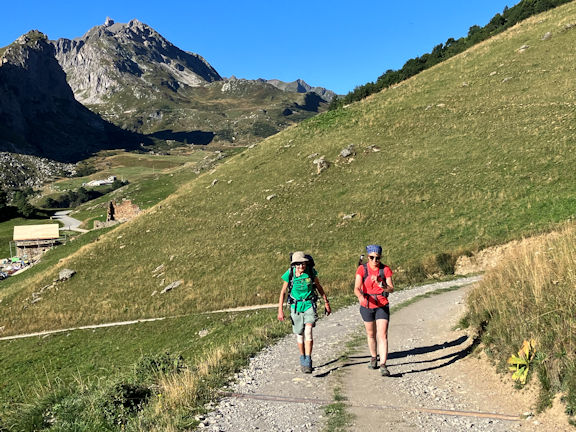 Judy and Catriona on the path from Les Chapieux up to the Col du Bonhomme
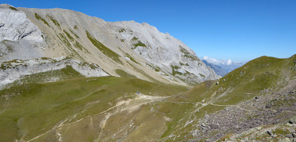 Descending to Col Bonhomme
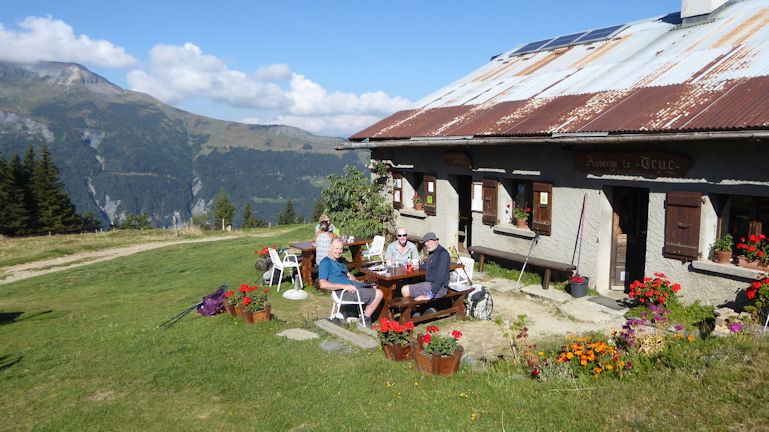 Coffee and myrtle tart stop at Chalets du Truc
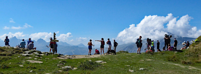 Col de Tricot
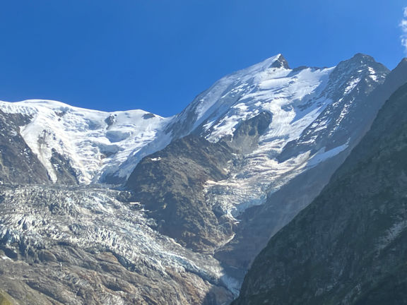 Bionnassay Glacier
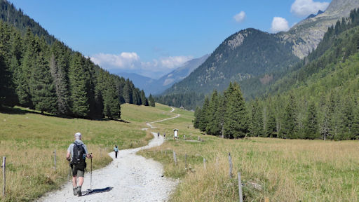 An interlude....
We reached a altitude of 412m at the nearest trig point and then back to the bunkhouse by a different path along the ridge.
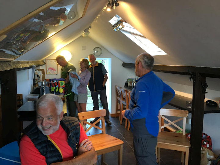 cosy bunkhouse
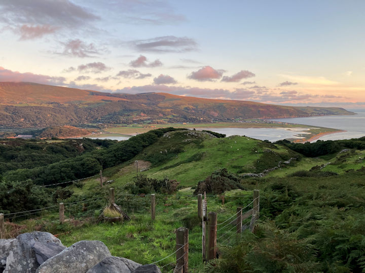 view from the bunkhouse
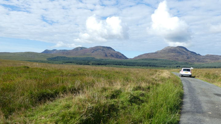 The Rhinogs on the way to the car park
Views from the summit were again very extensive.
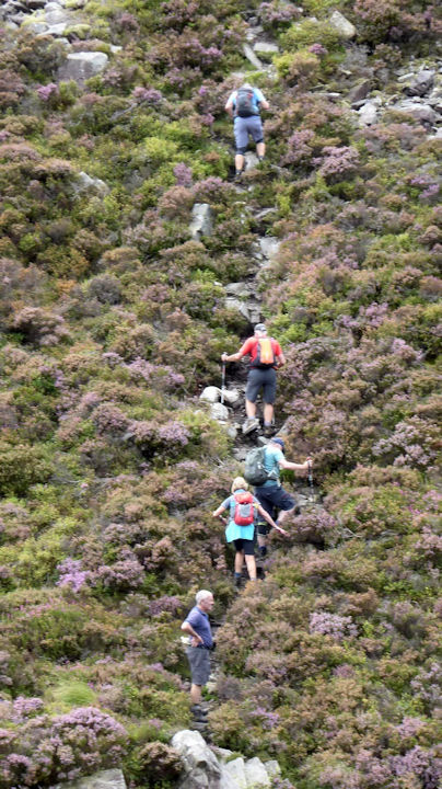 steep ascent of Rhinog Fach
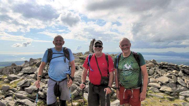 top of Rhinog Fawr
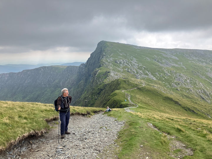 Cadair Idris ridge
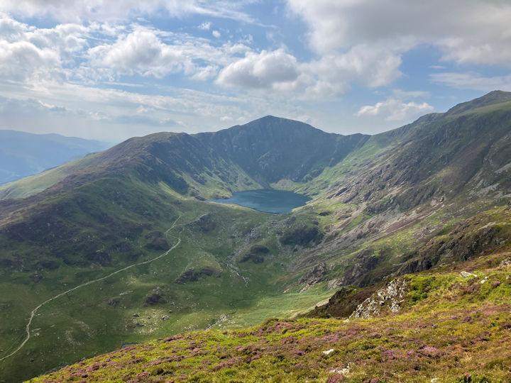 Cadair Idris view
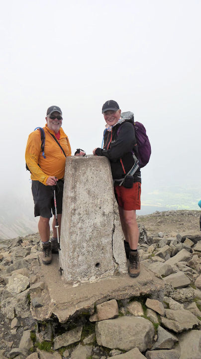 Cadair Idris summit
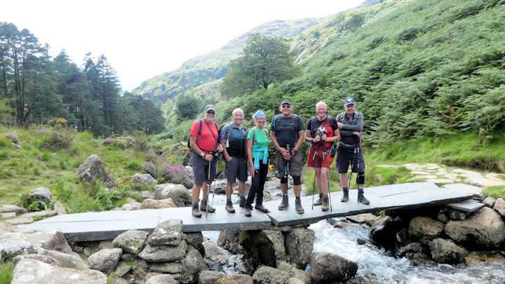 On the way down
The bunkhouse was very good but cosy!
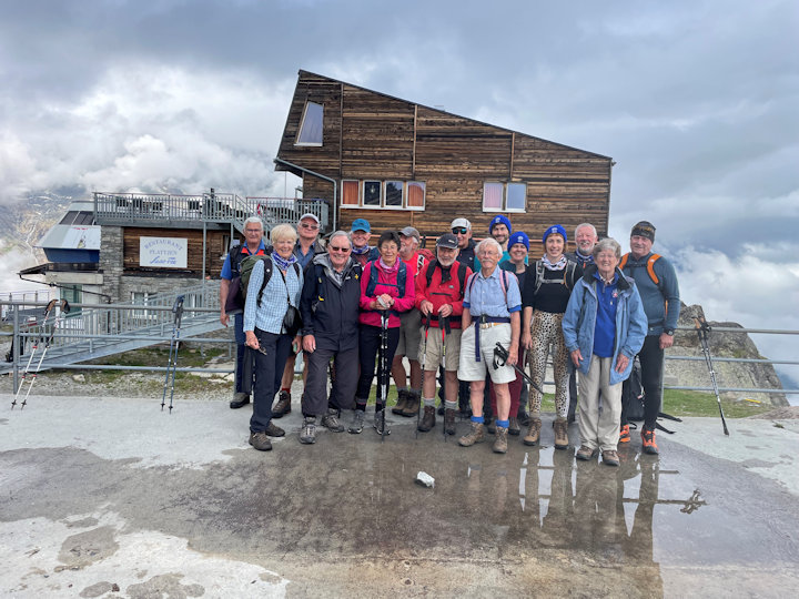 ready for the off
 on the way
 misty path
 mist clearing
 Hut now visable
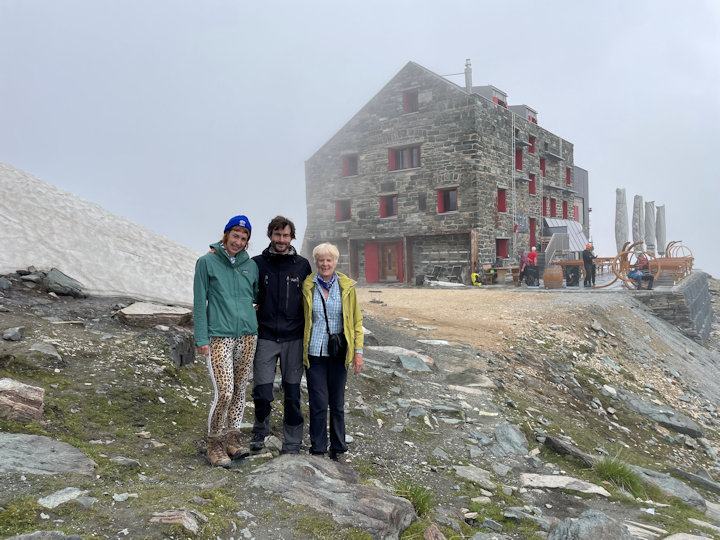 Arrived!
We were then shown into the room where the “fourneau a bois”, the wood burning stove that was an integral part of this year’s Saas Almagell meet because the ABMSAC had gifted the funds for the huts 110th anniversary in 2022. The stove was lit and warming the whole room in readiness for our arrival.
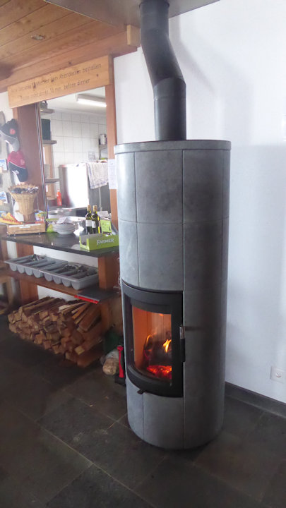 The stove
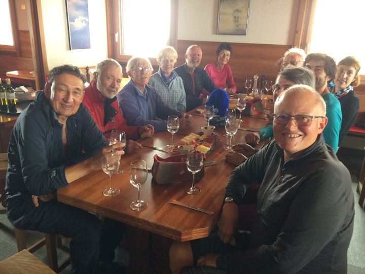 Ready for lunch
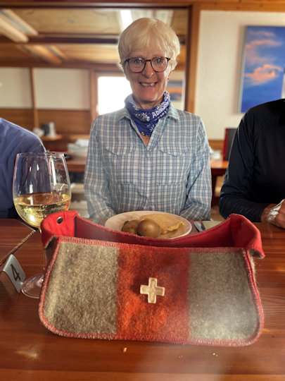 Heather on her marks!
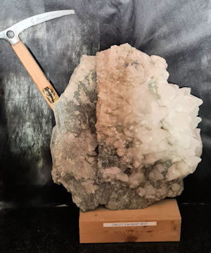 Ice Axe
 Filter tanks
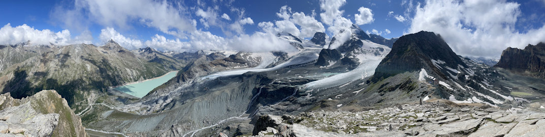 View from the 'rocky outcrop'
All the various paths off very quickly allowed you to enjoy a variety of high alpine plants thriving in this now predominantly summer rock garden, should you choose to do so.
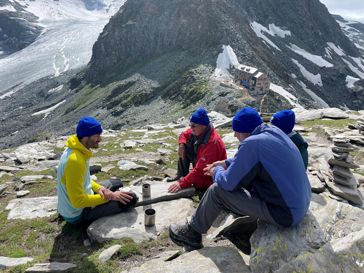 Tea time!
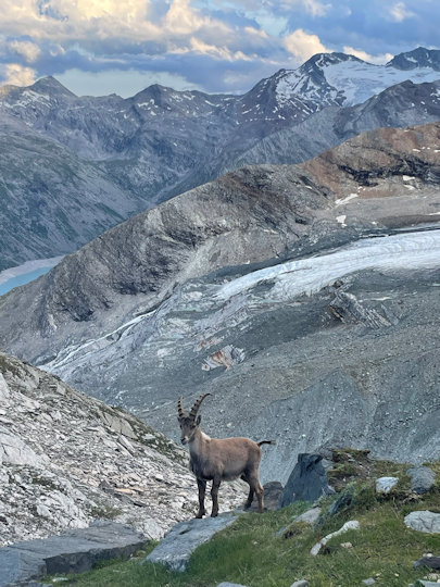 Steinbock
Some slept better than others.
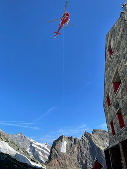 Fresh supplies arrive
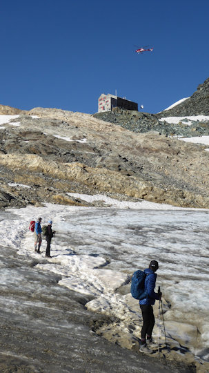 descending to the snow field
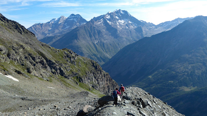 on the way back to the gondola station
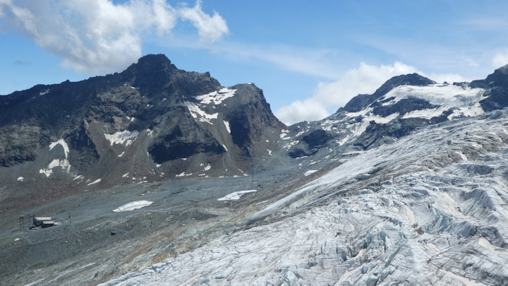 Route up to pass from Morenia Cable car
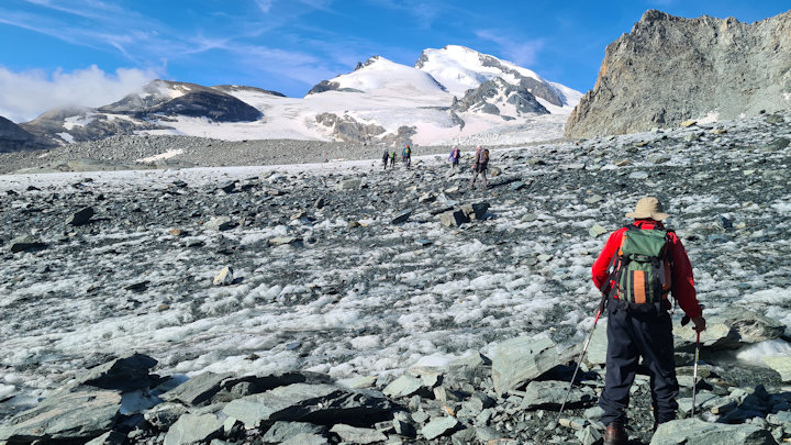 on the Glacier trail
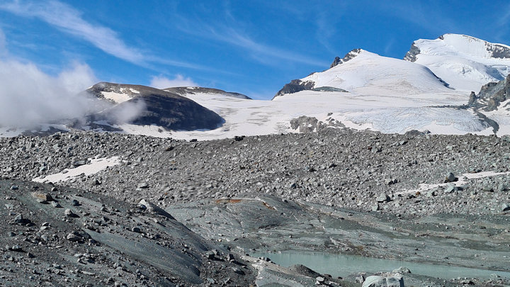 further down
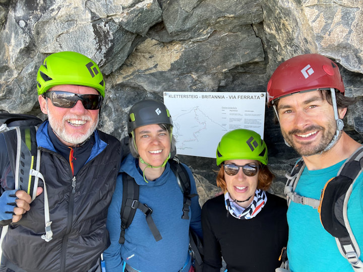 the team
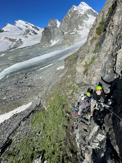 hang on!
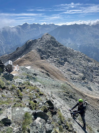 higher up
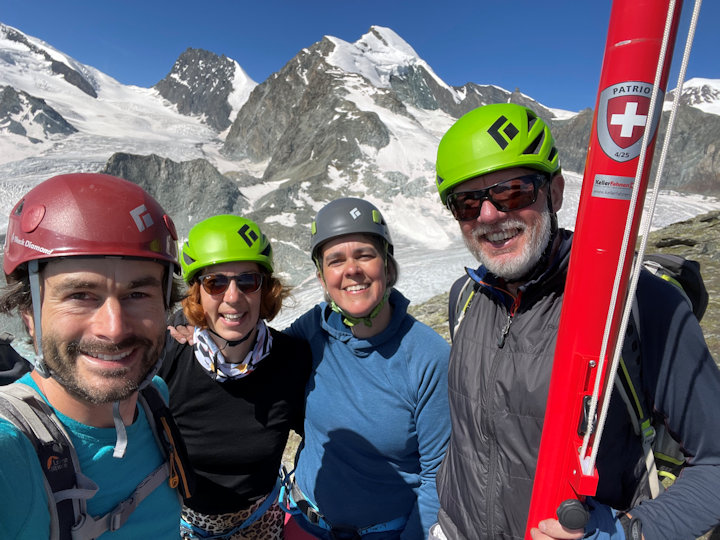 the team at the top
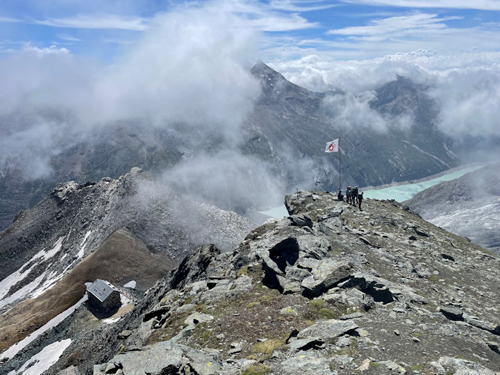 the view
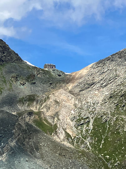 hut far above the glacier
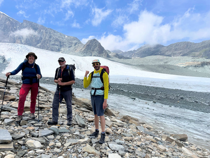 on the glacier
Alpine Hotel Meet - Monte Moro Hotel, Saas Almagell, Switzerland - 8 - 15 July
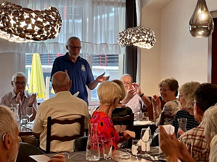 Gala Britannia dinner, photo Bill Westermeyer
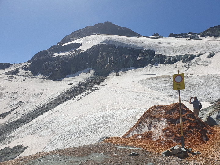 Looking at the closed trail, photo Carol Saynor
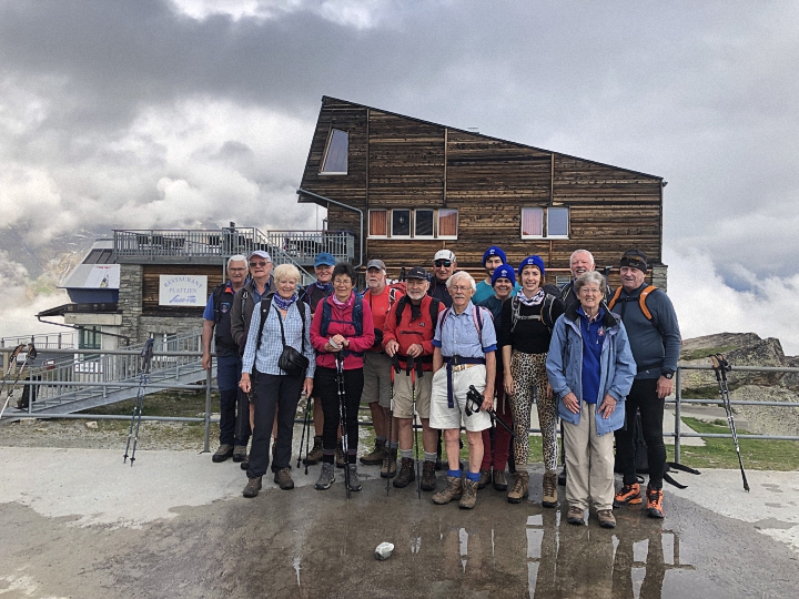 Britannia Hut group at Plattjen, photo Alan Norton
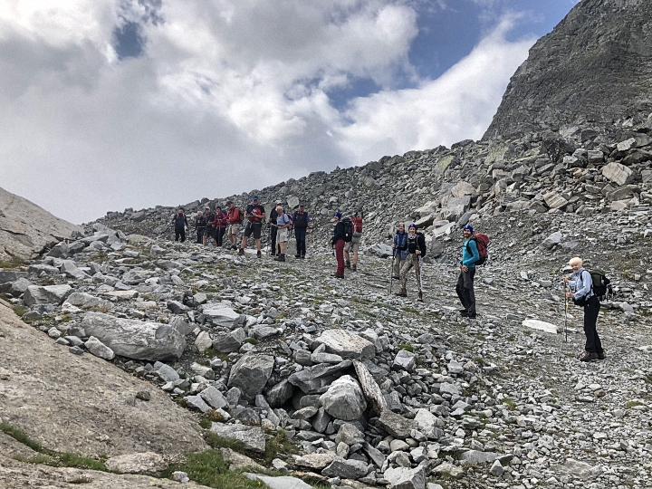 Setting out for the hut, photo Alan Norton
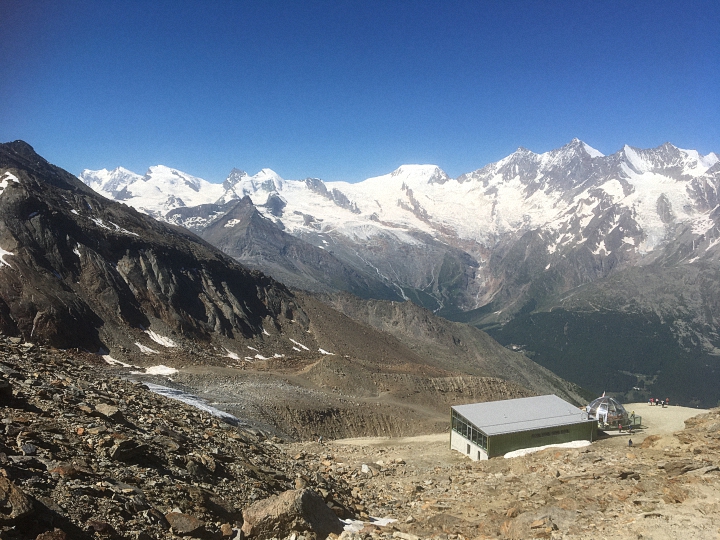 Many of us began the meet by taking the cable-car from Saas-Grund up to Hohsaas at 3100m for what is arguably the best viewpoint of all 18 summits in the Saastal
photo Pamela Harris
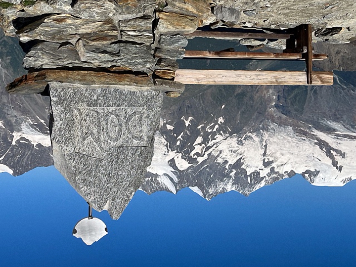 From here we set out on the rocky “4000m Peaks Trail” which led up to a series of cairns representing each mountain, with information boards detailing their first ascent
photo Bill Westermeyer
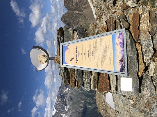 Alphubel cairn
photo Alan Norton
From Hohsaas we took the lift down to Kreuzboden and set out on the lovely “Blumenweg” or Flower Trail, with 240 boards enumerating each flower. Some of the loveliest were black vanilla orchids and pale blue perforated bellflowers, only found in this part of Switzerland, with edelweiss growing by the avalanche barriers in the same place as on my last visit in 2021.
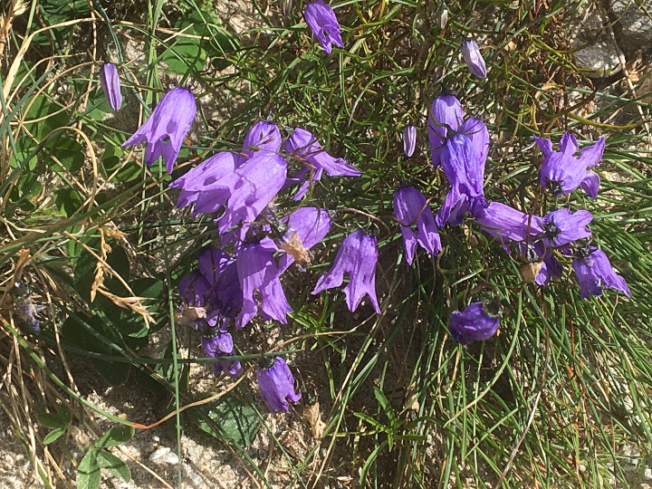 Perforated bellflowers
photo Pamela Harris
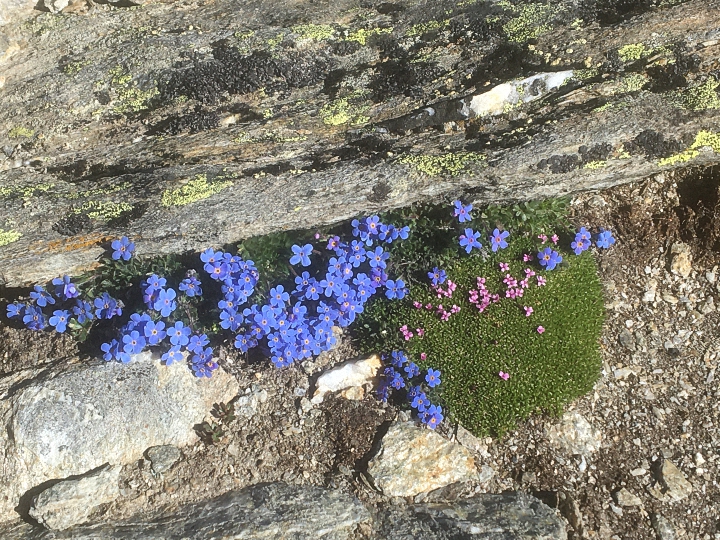 King of the Alps at Hohsaas
photo Pamela Harris
Others took this same route later in the week, while some did it in reverse, walking up from Saas-Almagell.
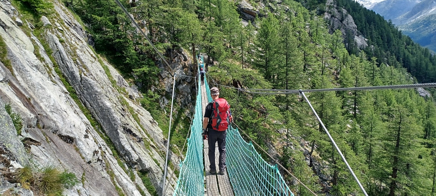 On the Adventure Trail
photo Rick Saynor
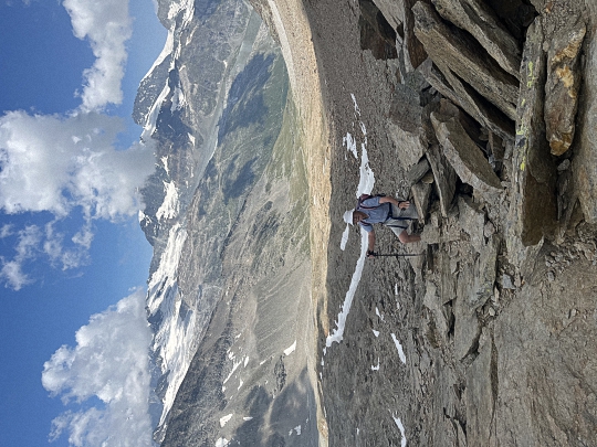 Don on a rocky ascent
photo Bill Westermeyer
Mike Parsons cycled up on his e-bike later in the week and reported that it was no mean feat. Once at the dam the walk round the lake was a delightful stroll, the path on the eastern side beneath hillsides covered with alpenrose.
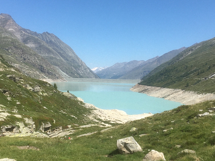 Mattmark dam and lake
photo Alan Norton
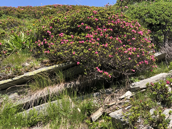 Alpenrose beside Mattmark lake
photo Alan Norton
 Madonna on the Pass
photo Mike Goodyer
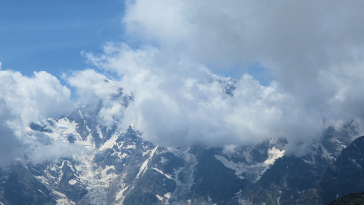 Monte Rosa from the pass
photo Mike Goodyer
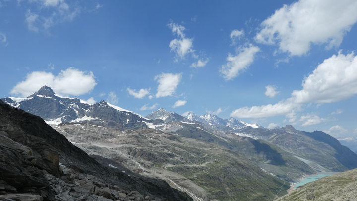 Looking towards the Britannia Hut
photo Mike Goodyer
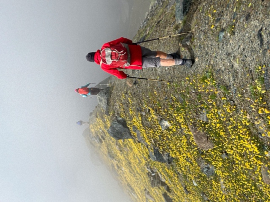 Heading into the clouds on the Schwarzberg moraine
photo Bill Westermeyer
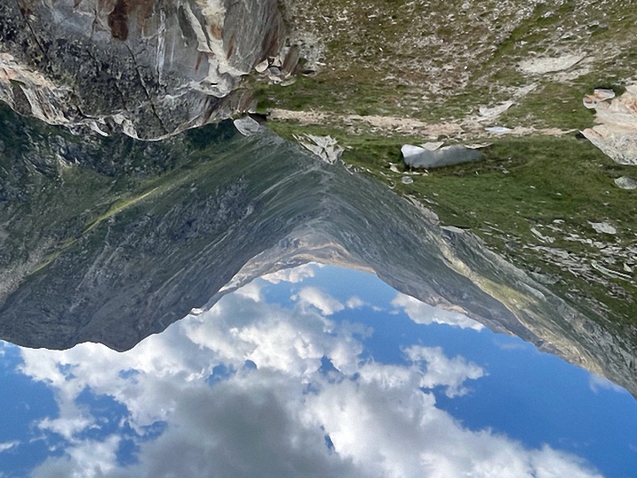 Looking up to the Antrona Pass, photo Bill Westermeyer
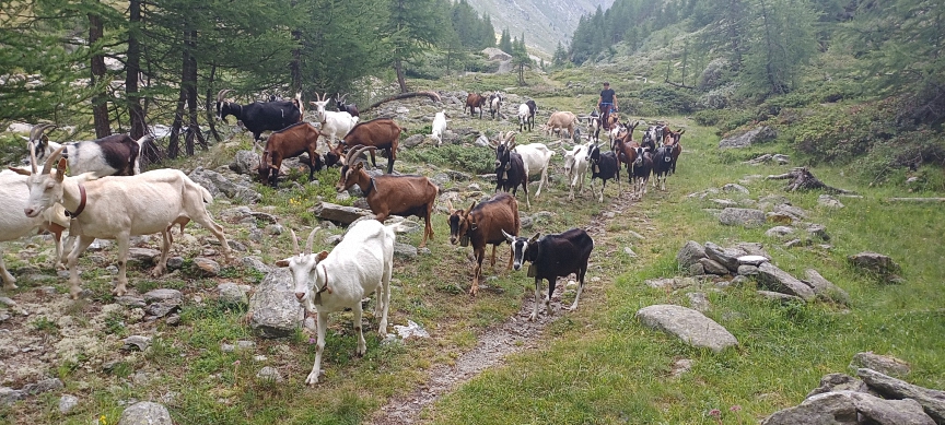 Goats heading down the Furggtälli
photo Rick Saynor
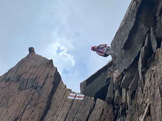 Nearing the Jazzilücke,
photo Bill Westermeyer
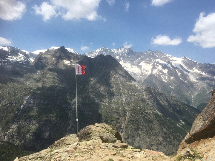 Panorama Platz, photo Pamela Harris
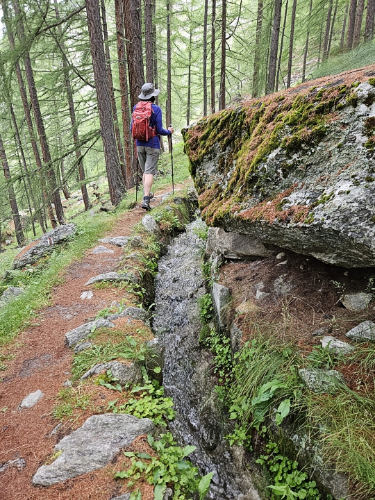 Walking beside the bisse,
photo Caroline Thonger
This was a narrow and uneven path which followed alongside the water-channel, at times vertiginously close to the edge of the forest.
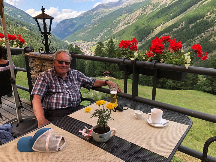 Beer stop at Waldhüs Bodmen,
photo Pamela Harris
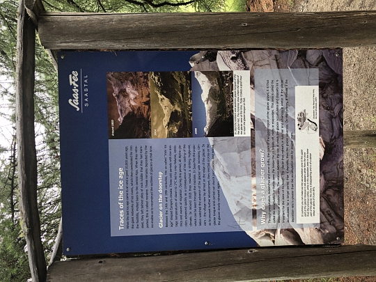 Glacier nature trail, photo Alan Norton
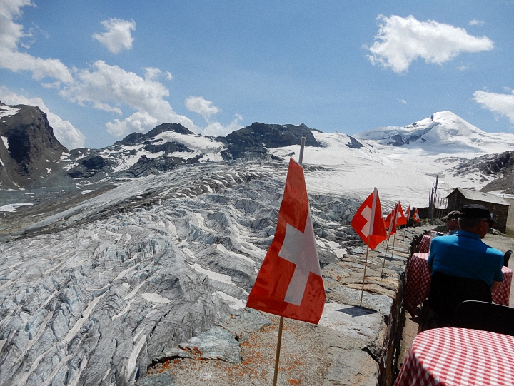 Feegletscher at Längfluh, photo Rick Saynor
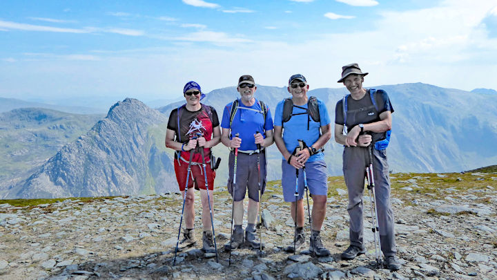 The team on the top
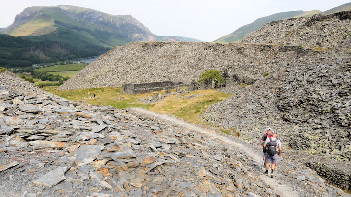 On the way to Moel Eilio
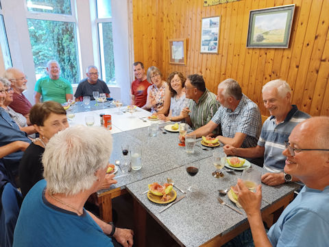
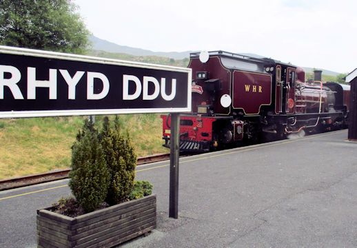
Report by Ed Bramley
More photos will follow
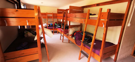
The bunkhouse was in good order and tidy and very roomy.
We were able to have communal evening meals enjoying Mikes' homemade Chilli con carne and Mitchs' luxury Mac&Cheese with everybody else suppling starters, desserts and cheese and nibbles. No went hungry!
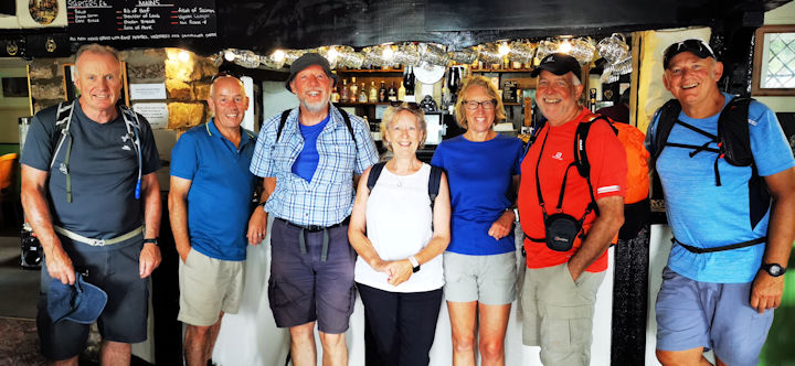 Tuesday walking team
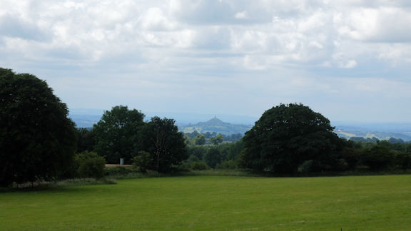 Distant view of the Tor
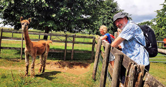 Local farm animals!
Afternoon tea and cake was taken on the rear patio of the bunkhouse.
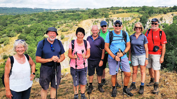 Wednesday walking team
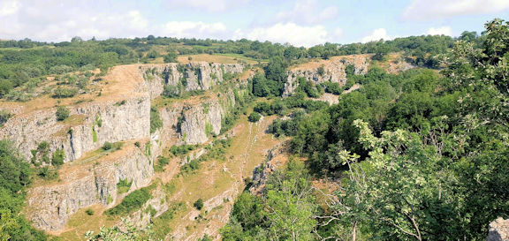 the Gorge
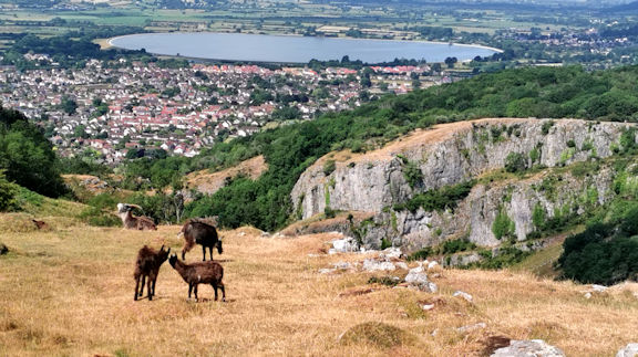 Views from top of the Gorge
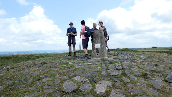 Beacon Batch
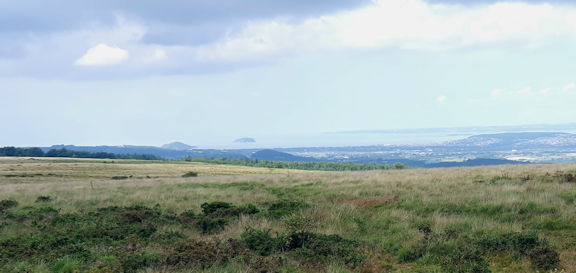 the view
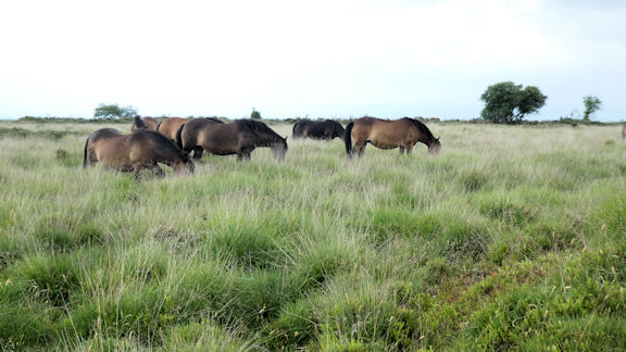 Horses on the Downs
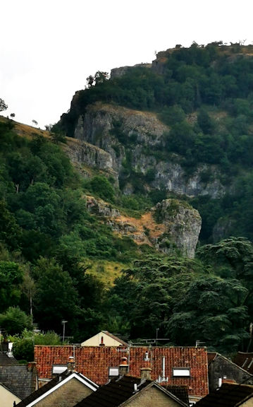 Returning to Cheddar
Finding a cafe open on a Wednesday afternoon was a challenge, but we managed it and cream teas were enjoyed.
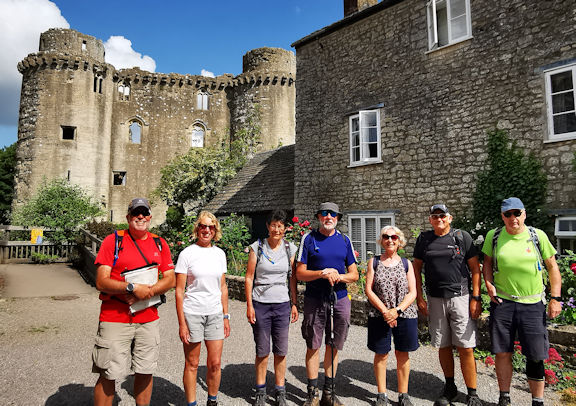 Thursday walking team
At one point, much to Pauls discomfort, we crossed fields with cows. We all got across safely!
Crossing the river we climbed steeply up the valleyside to the church at Great Elm where we had lunch.
We returned to Nunney across fields via Frome Football Club ground. Perhaps the eight of us were more than their noraml crowd??
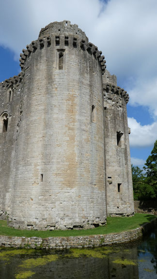 Nunney castle
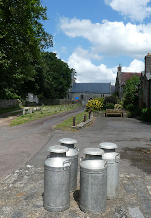 Lunch stop at Great Elm
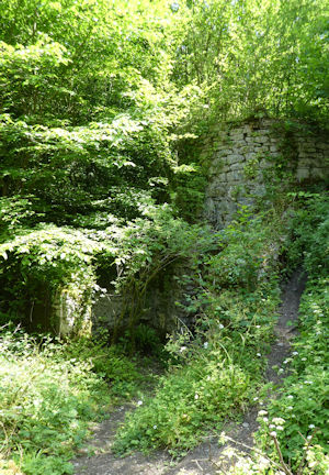 Ruined lime kilns
We said our goodbyes and headed off home, hoping to miss the Glastonbury traffic.
This was enjoyable meet and in new area and we all enjoyed exploring the different types of walking available.
Photos from Mitch, Andy, Steve and Mike
Report by Mike Goodyer
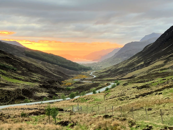 Sunset over Loch Maree from Queen Victorias' viewpoint on the A832
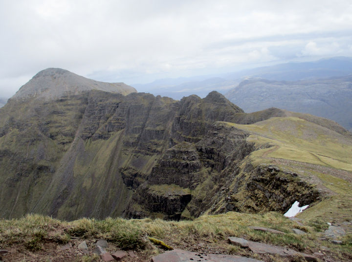 Am Fasarinen Ridge
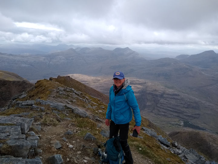 Judy on Spidean a Choire Leith
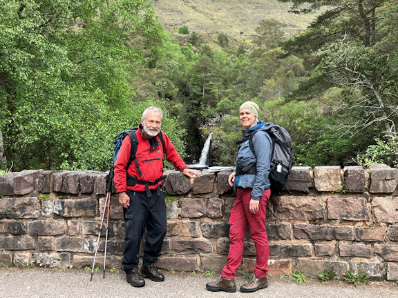 Roger and Celine on the bridge over the Abhainn Coire Mhic Nobaill,
with one of the many waterfalls in the background.
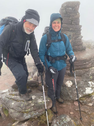 Roger and Celine on the top
of Tom na Gruagaich
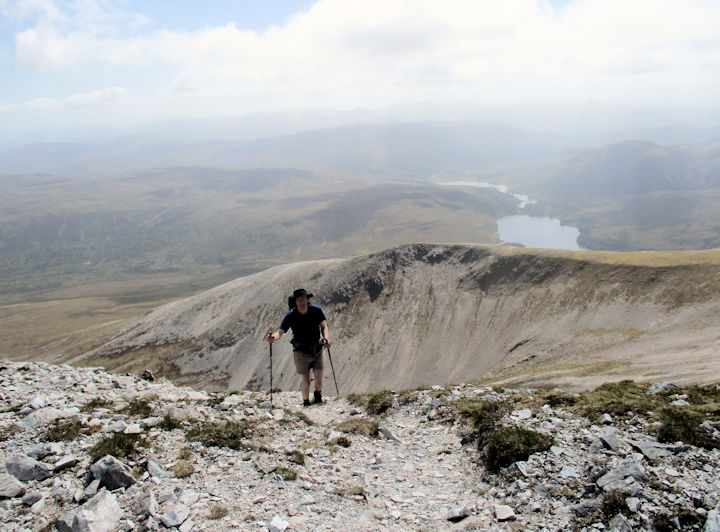 Max ascending Creag Dhubh
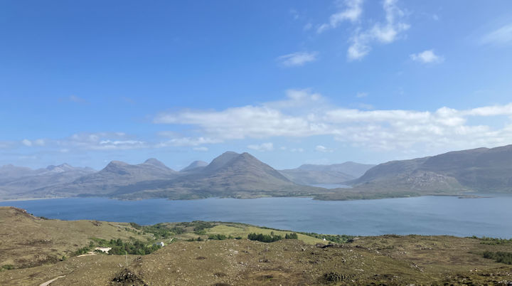 Upper Loch Torridon from the Bealach na Gaiothe viewpoint
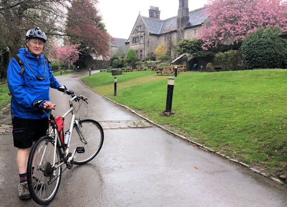 Dave outside the Hall
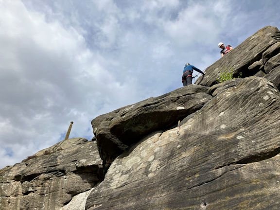 Ed belaying Céline on The Promenade with Nelson's Monument to commemorate the Battle of Trafalgar and his death to their left.
With its unprotected start, the route provided enough of a challenge for all three of us.
It was just good to feel the warm rock through our hands and the grippy, when not too polished, gritstone beneath our feet once more, on this delightful edge with its numerous short routes and its many references to Lord Nelson in their names, as well as the simple monument to him on top.
By then the forecast heavy rain clouds made their ominously dark presence felt sufficient enough for us to skedaddle back to the car, and head over to Hartington.
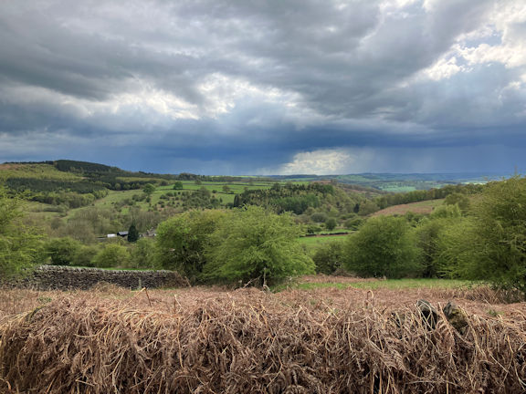 The forecast heavy rain clouds made their ominously dark presence felt sufficient enough for us to skedaddle back to the car.
Here is Celine’s account of the day:
Judy and I left the youth hostel by foot through the town, finding our way to a path opposite the farm shop onto a field just on the edge of Hartington. We reached the pretty village of Hulme End after walking a couple of miles on a mixture of busy road and quiet fields. From there we went southwards to Weston Hill via Ecton, a few fields and some farmland. The 358m top of Wetton Hill gave us great views, despite low clouds and a grey sky. Descending the hill down to the valley, we noticed a large cave from a distance, but were not curious enough to deviate from our original route! We stopped at a busy Wetton Mill for lunch (and coffee for me), then started our loop back on the Manifold Trail, where we were slowly overtaken by a group of aging cyclists (!) as we were walking back to Hulme End then to the youth hostel with a bit of rain on our tail. A lovely 10ish-mile day under our belt.
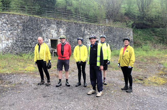 The team at the copper mines
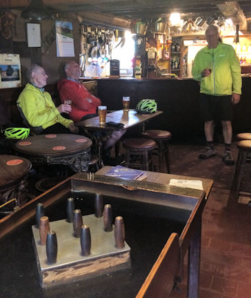 enjoying a pint
Here we turned left and walked along the bank of the River Dove all the way to Milldale where we sat a while by the river and its old packhorse bridge and had lunch in the sun.
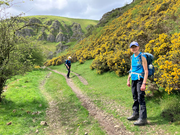 Judy and Heather in Biggindale
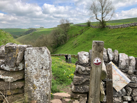 Myles and Steve coming up from Milldale
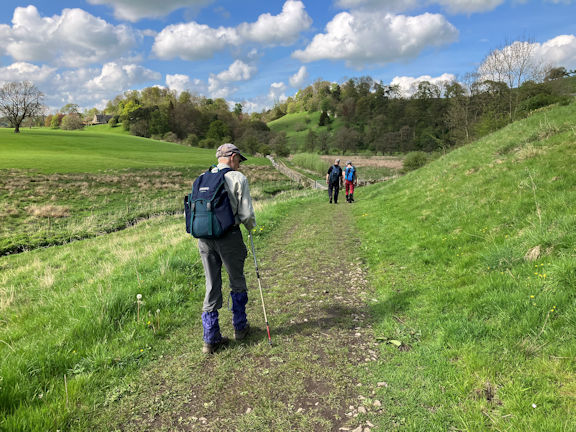 Myles and Steve and Céline in Narrowdale
Wet limestone and its accompanying soggy cement like soil made for an interesting ascent. I think we would all take the short walk up the road to the connecting footpath next time.
This path continued steadily up out of Milldale and led to the village of Stanshope, and into Hopedale where we happened upon the Watts Russell Arms. After a leisurely pint we continued across the field systems around Alstonefield, crossing the road into the area known as The Rakes and made our way towards Narrowdale Hill where we were treated to a fine aerial display by two biplanes, before descending into Narrowdale itself.
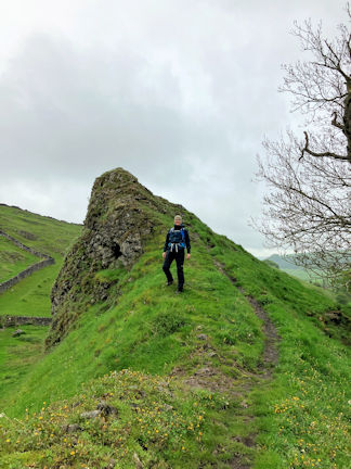 Celine on the limestone reef outcrop
at Pilsbury Motte and Bailey site
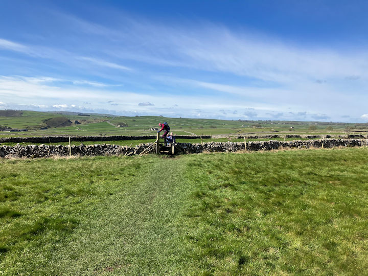 on the way to Follow
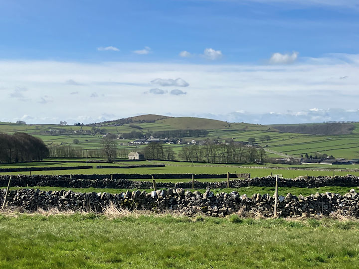 on the way to Wardlow
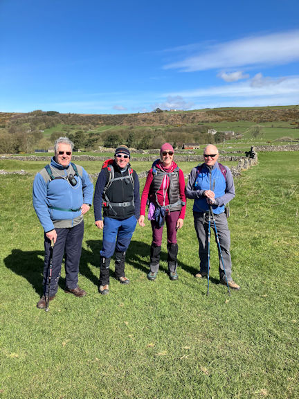 Having fun
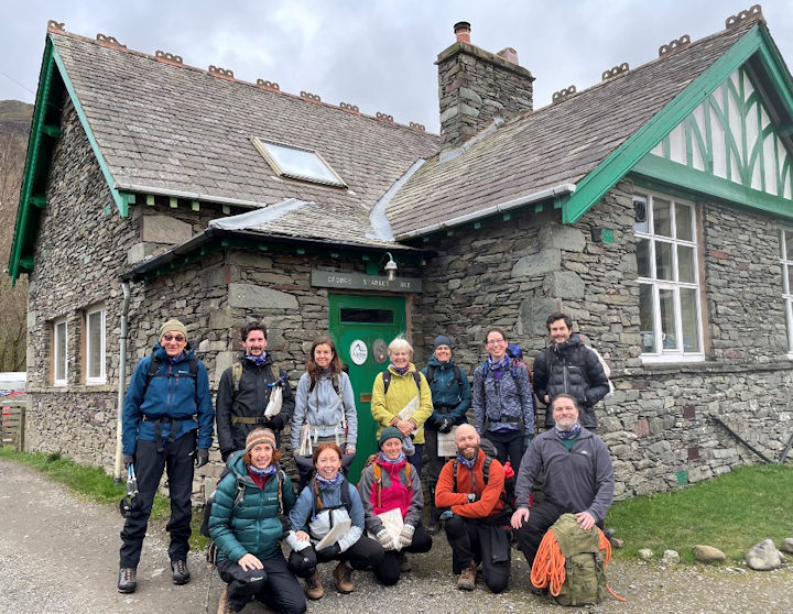 The teams ready for the skills day:
(Daniel, Will, Sonja, Heather, Celine, Louise, Jonny T, Mary, Nan, Anna, Simon and Jonny D)
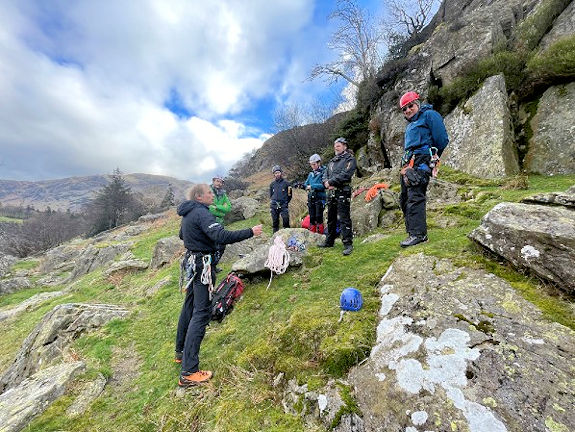
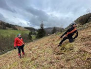
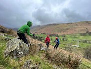
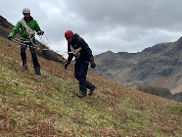
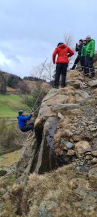
We then moved onto crevasse rescue theory and techniques higher upthe rock face. Robin talked about buried ice axe anchoring (T-slot) and demonstrated using a prussic to secure a fall.
We then tried out a crevasse rescue by anchoring a partner to a belay point and pulling them up with pulleys are friction devices.
- Working out height to be gained
- Time it would take from point to point
- Direction of travel
- Features en route that should be observed
All these things should ensure that the correct route is maintained. If not observed then a
reassessment should be done as probably off route!
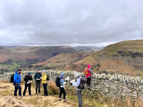 Sam, Kristine, Celine, Heather, Nan, Sonja, Anna
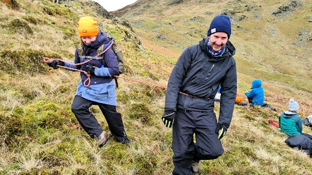 Nan and Will tethered for safety
Thanks to all who cooked, washed up and ate the meal and to Mike for his interesting and informative talk.
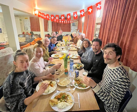 Fine dining (complete with Swiss flags!) at the GSH
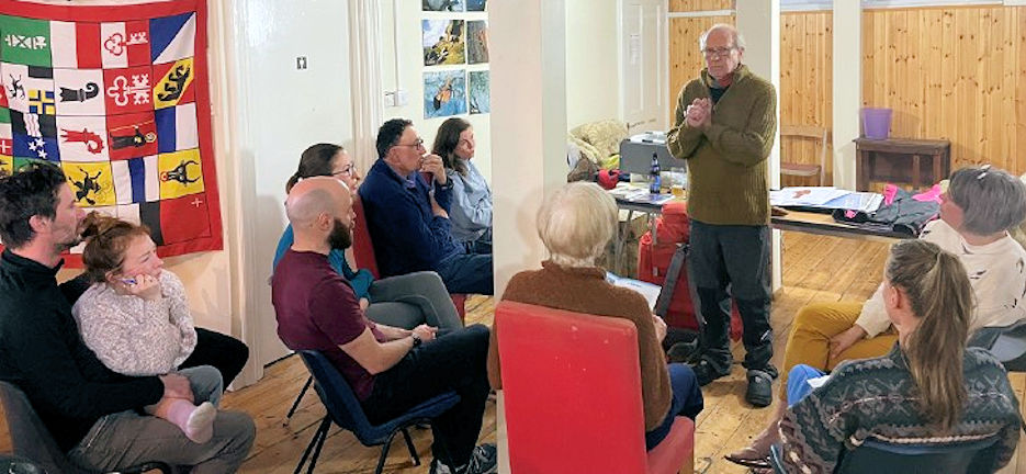 Mike Parsons in full ‘keep dry, staying warm' flow
 Heather
 Mary
Mary
 Daniel
 Jonny T
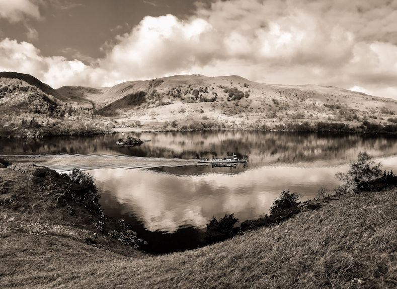 Jonny D
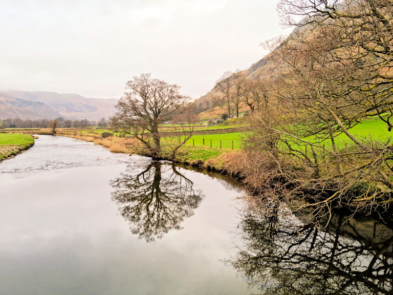 Sonia
Sonia
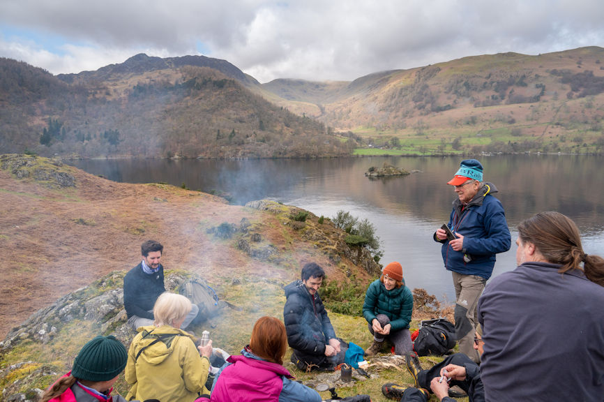 Tim
Tim
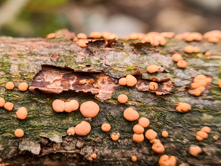 Anna
Anna
You can find out more on LOFI
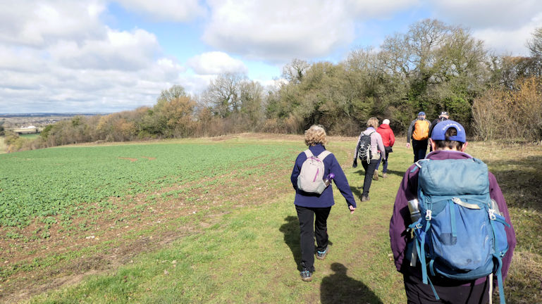 looking across the downs
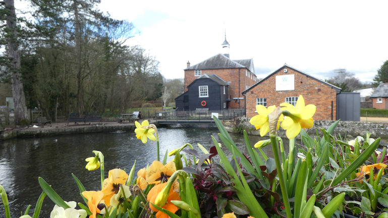 Mill over the Test
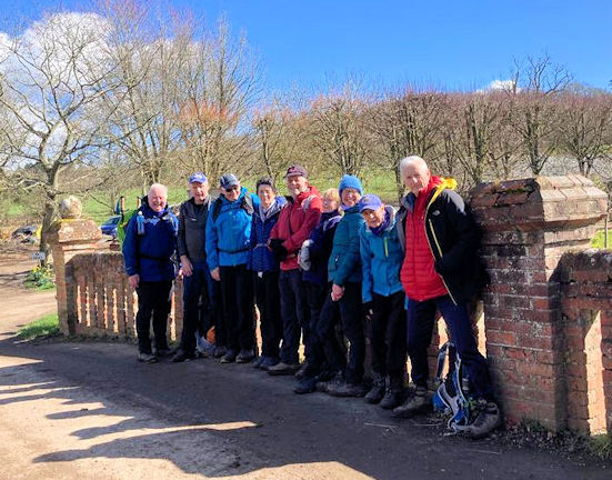 the group at Bere Mill
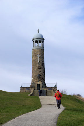 Regimental Memorial
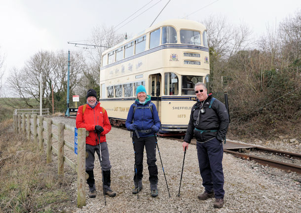 Last tram to Sheffield
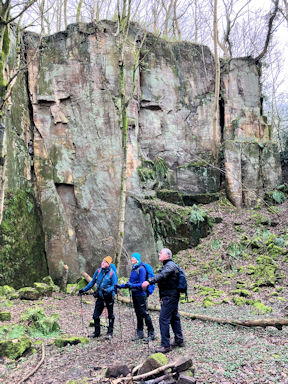 Admiring the quarry
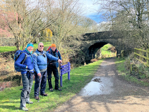 Canal on the way back
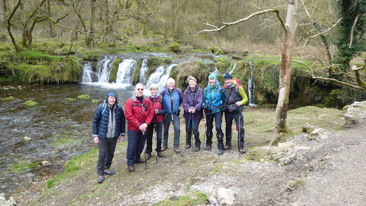 The team in Lathkill Dale
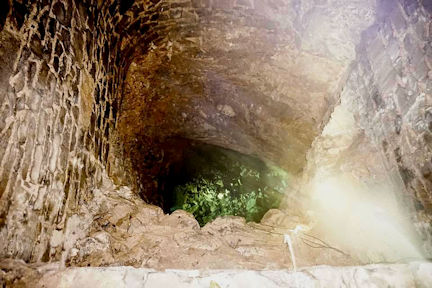 One of Bateman's shafts
Moving swiftly on.
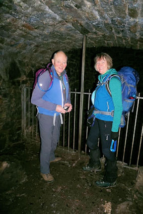 Ed and Michelle explore the pump
Another opportunity for Ed and his camera.
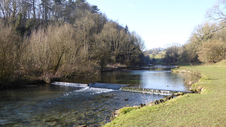 Bradford Dale
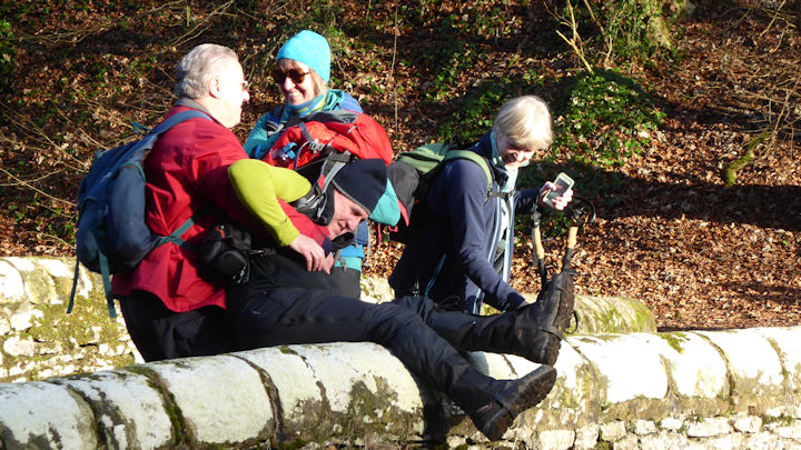 Rescue in progress!
Marcus had a moments anxiety on one of these when he very nearly had a much closer inspection of the water quality than he bargained for. I thought he was up for a spot of wild swimming but he had too much gear festooned about his person for such an impulsive decision. So, when he seemed about to slide off the parapet Michelle grabbed him by the bag in a wifely fashion while I grabbed him far more carefully in a more instinctive and manly manner. Whilst I was pulling I swear Michelle was pushing. Could be wrong!
I'm still hoping.
Another great day out with good company in convivial circumstances and a chance for Ed and I to do a walk we have done before ,but this time staying dry and in the sunshine.
Thanks to all for your company. We really must do this again sometime!
Resisting the temptations on offer as one drives through the Yorkshire Dales, and with the promise of a home cooked meal waiting for us at the Hut, courtesy of our Editor, we made good time indeed, passing the Queens Head at Troutbeck without a second glance.
A communal meal for four at the Hut instead of the White Lion has become quite a regular thing now, as the pub still struggles to guarantee serving meals. With Suzanne having got the fire going well, and drinks of choice being supplied just in time for Mike to declare that dinner was served, what's not to like.
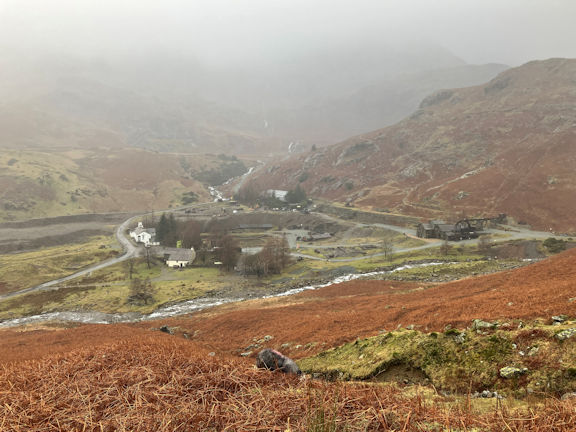 Copper Mines
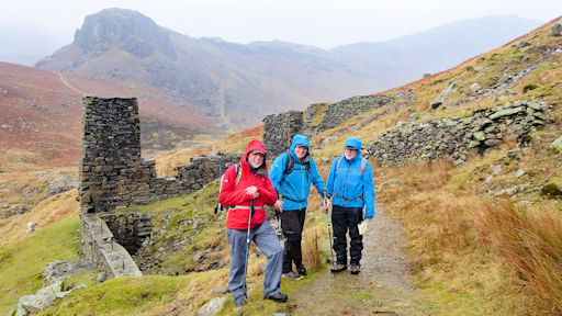 Andy, Paul and Mike
Some indication of how damp this little 7-mile excursion had made us was the fact that we did not tarry at the Sun Inn, electing unanimously to return to the Hut, but not before treating a quiet corner of Coniston to the sight of four fine physical specimens stripping down to the waist to put on some dry clothing.
By the time we returned to the Hut some more of the people who had let me know they were staying at the Hut had arrived and were settling in too.
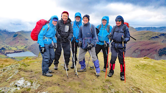 Team on Angle Tarn Pike
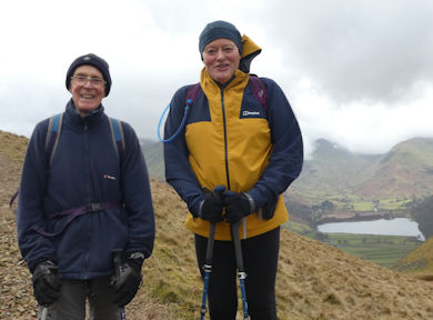 Myles and Ed
We’d made the pull up onto Boredale Hause and it was already obvious that some were travelling faster than others. As we turned south, into the cold prevailing wind of the day, that difference became amplified, and we were faced with making the potentially unpalatable decision to split into two groups. I turned to my friend and said, “At the next junction, I think you and I need to take the shorter option, straight down to the valley. How do you feel about that?”. After a short reflection, the answer came back, “Yes, you’re right – I’m finding days like this are increasingly hard work”.
“Or after we’d finished the Freedom Trail over the Pyrenees, the overnight bivouac where we were nearly all cold in our home-made tents. Not forgetting your delight when we reached Barcelona and the Marina, when a speedboat came in with what can best be described as a live figurehead on it?”
“What’s not to like” I think was your reply, probably capturing the thoughts of the rest of us as well.
“And our many trips to Morocco, including the edge of the Sahara”.
Whether it was the glissade and the aircraft carrier style arrest as you shot down the last slope from the summit of Mount Toubkal, or enjoying freshly baked bread under the stars, the memories came back thick and fast.
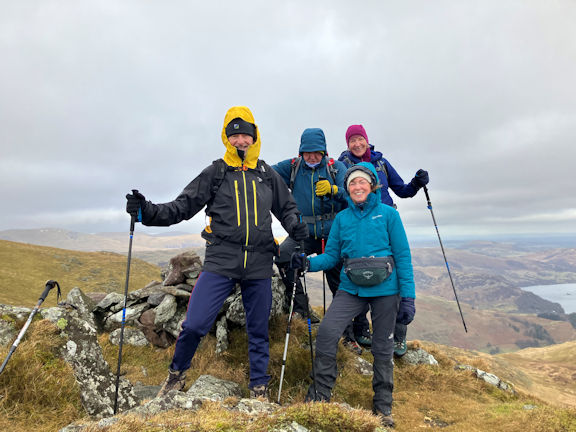 Enjoying the weather
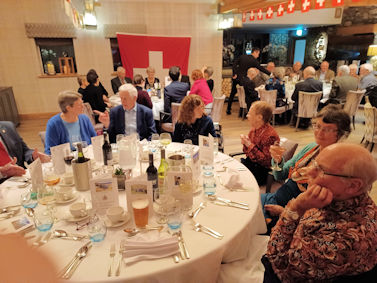
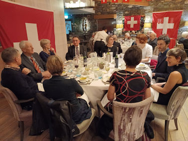
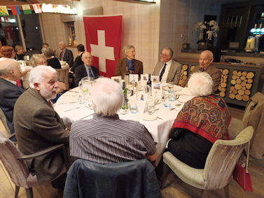
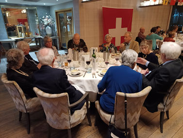
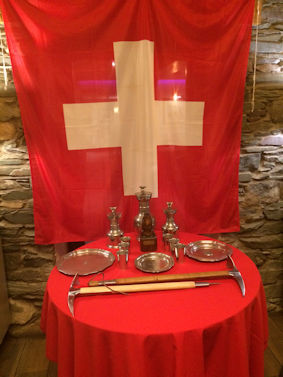
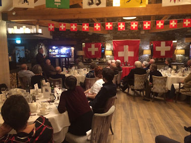
As we walked and talked it became clear that Ronald had an extensive knowledge of the Ullswater valley. Once we had topped out at the trig point on Place Fell, Clare’s first time there, we made our way down to the restored sheepfold at Low Moss and had some lunch.
 On the way up Boredale Hause
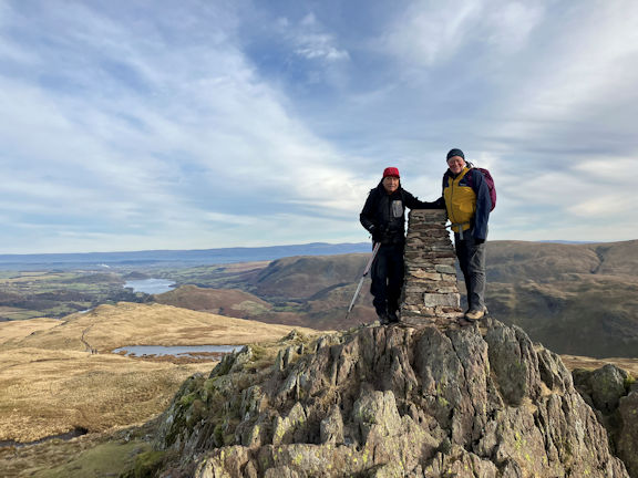 Roger and Ed on Place Fell
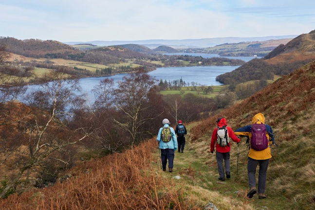 Descending from Place Fell
Afternoon tea and cake was enjoyed at the Hut with our guests who were planning to stay for another night and visit Gowbarrow and Aira Force on Monday. This ended another very fine Annual Dinner weekend at the Hut for Ed and I.
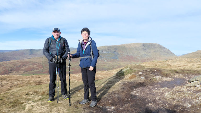 Paul and Margaret on Wansfell
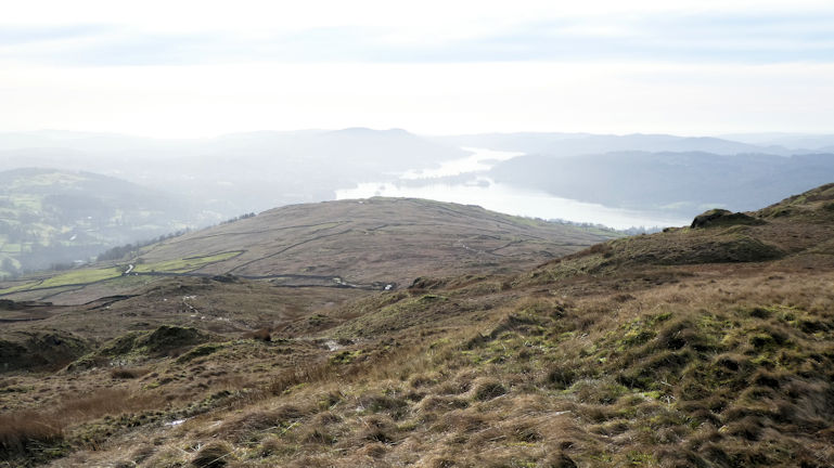 View from the Pike
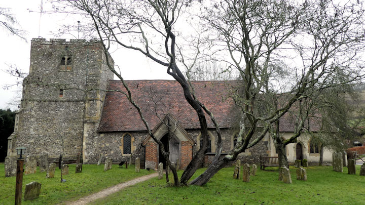 Turville church - a dry lunch spot!
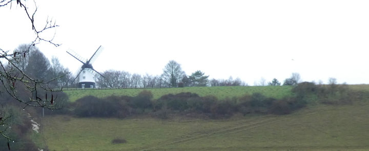 Windmill on the hill waiting for our next visit
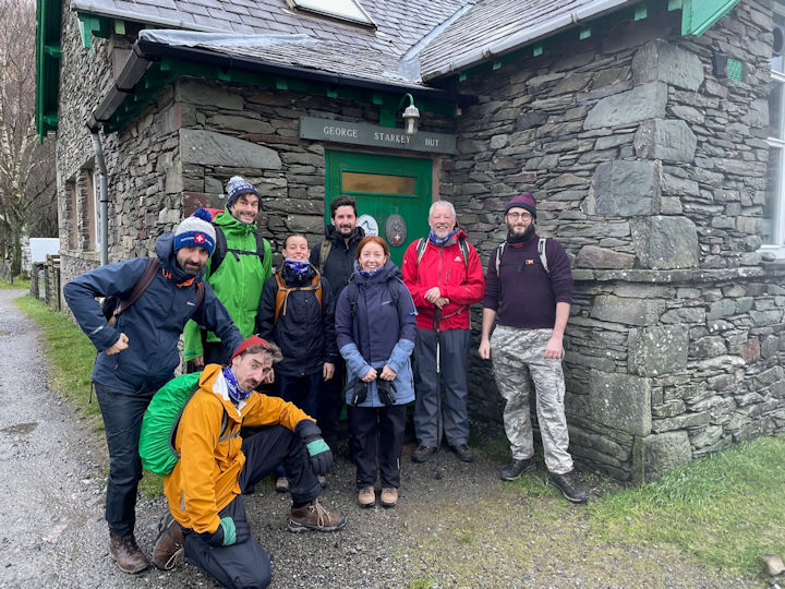 Fun at the GSH
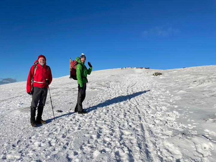 New Year in the snow
