Reports on club meets from members who took part. If you would like to send in a report please mail it to the Hon. Editor. Reports of members activites.


2026 MEET REPORTS


Maintenance Meet, George Starkey Hut August
Dartmoor Meet, Princetown July/August
Summer Alpine Meet, Klosters July
Wales Meet, Rhyd Ddu June
Arran Meet, Lochranza May
May Day Bank Holiday Meet Grinton
April South day walk Somerset
April North day walk Peak District
March Southern day walk Hampshire
February Southern day walk Chilterns
Annual Dinner & AGM Glenridding


Thirteen hard-working and conscientious members from both the ABM and the AC arrived from all over the country to give the Hut its annual August make-over.

The usual scrubbing and cleaning tasks were done with gusto, and upstairs, the dormitories were soon mould-free, hoovered, windows cleaned and mattresses wiped. The weather was a bit mixed but most folk took some time out and enjoyed a walk in between showers.

dinner
dinner
Communal dinner at the Hut after a hard days work

Downstairs, the kitchen was probably the most time-consuming and complicated job, with every cupboard and shelf needing emptying and cleaning, cutlery and pans sorted out and stoves and fridges wiped clean. No new mouse dirt was spotted, so hopefully the little blighters will stay outside, at least for a while, as I had to put traps down a few weeks ago, putting an end to three.

The club has acquired a lovely new photograph depicting the Matterhorn, and this was duly hung on the wall of the lounge by its creator.

The drying room walls received some necessary attention; the main problem was that the old plaster above the door was cracked, peeling and dirty. After a good scrub and a few coats of paint, it looks much better.

Outside, drains were checked and one had to be cleaned out: not a job for the squeamish! Overhanging branches were removed and the grass cut all round.

ditch

After our recent survey of the building by the professional Gordon Stelfox, we are trying to solve a few long-standing damp issues. Following his advice, we dug a ditch to lower the ground around the southern corner of the building, because rising damp has always been a problem inside the ladies’ washroom. This ditch is now filled with gravel and hopefully the rising damp will now be less of an issue – we’ll see.


Much heartfelt thanks and kudos to those who gave up their time and energy and in some cases, drove the length of the country, to work on our wonderful Hut this year.

Attendees: Daniel Albert, Mike Dunn, John Vernon, Judy and Don, Sam Higginson, Andy Brook-Dobson, Rick Snell, Ian Bisset, Fi and Andy Bunn, Mike and Marian Parsons.

Report by Marian Parsons, Hut Warden


Dartmoor Meet, Princetown, 31 July- 3 August

The Club’s third visit to the Plume of Feathers was poorly attended in numbers, but in no way diminished in the walks completed by the four attendees and one day visitor.

view
Upper Teigh Valley

I collected Judy from Exeter St. Davids Station around midday on the Friday, and after a slight delay whilst negotiating the A30 holiday traffic we found ourselves at Fingle Bridge a popular spot hidden in Dartmoor’s Teign Gorge.

Crossing over the old packhorse bridge with a pub nestling in the trees at the side of the Teign, Judy and I walked up the lefthand side of the river through the woods past the HEP station and up to the Castle Drogo National Trust facilities sat at the edge of the woods on the moor top itself.

Refreshed with a cuppa we enjoyed extensive views across this part of the moors which form the catchment area for the headwaters of the River Teign, before heading back down into the gorge and back to the car.


What followed was a delightful traffic free drive across Dartmoor to Princetown, with the late afternoon light showing the moors off perfectly.

Having reunited ourselves with the organisational vagaries of the Plume, Heather joined us and after an unremarkable fish and chip supper we had a walk around the almost abandoned prison end of the town. (In my opinion it beggars’ belief that with our prison system clearly struggling to house everyone that this purpose-built incarceration facility cannot be maintained and improved sufficiently to function again and breathe some life into the whole community.)

Judy writes:

The three of us drove a short distance to the pretty village of Postbridge with its very well-preserved clapper bridge made of large stone slabs. We were early enough to have it all to ourselves and to look into the clear brown river. This brought back memories for me of childhood visits to Dartmoor on family holidays. From here we took a path south through a forest area where we saw several birds, including wrens, and continued up to Bellever Tor, with its nice rocky tops and views around.

bridge
Andy and Judy on clapperbridge
view
Bellever Tor

From there we could see a tall chimney and some old buildings, so we followed a path west to investigate. They turned out to be the remains of an old gunpowder factory, with several buildings separated for safety reasons and water leats diverted from the river to provide power for grinding and mixing materials. The tall chimney may have been used to produce charcoal which was one ingredient.

chimney
Remains of Gunpowder Factory
view
Combestone Tor

After exploring these, Andy chose to go to Dartmeet via Combestone Tor, but Heather and I wanted to continue up some tors. First we ascended the hill to Longaford Tor, with another nice rocky top and a suitably sheltered spot for an early lunch. We met only two other people, a man and his young son, who had come up from Two Bridges just to the south, and continued past us onto the next tor. After lunch we followed them to Higher White Tor, with a slightly less impressive top but good views ahead to a further couple of tors.

view
Judy and Longaford Tor
view
descending Tor, ascending ponies

It did not take long to get to the next one, Lower White Tor, so we could not resist finishing the ridge by going over Braddon Tor as well. From there no paths were shown on the map, so we cut across to a wall which had a worn area alongside and was easy to follow.

Then there was much debate over whether to take the option of a stile over the wall with less of a path the other side or to continue on the easier route and hope to find a wall crossing lower down. In the end we saw some people in the far distance coming up from where we wanted to go so we continued down on the easy area to a dip and found the luxury of a gate and a path all the way back to the car park.

At Postbridge we went down to the river where we had a lovely paddle to refresh the feet and headed back to the bunkhouse for tea and nice sticky malt loaf.


In the evening it was good to have Paul, Andy’s son, joining us for the evening and the next day. On the way to pub at Merrivale we stopped to visit some stone circles and some amazing straight lines of standing stones on the hill above. Later Rick joined us for dinner which was a lovely surprise. The Merrivale Inn is famous for its special locally produced grass-fed beef so some people had to eat large amounts of high-quality steak, though the rest of us were also well fed there. A nice sociable evening.

group
Andy, Paul and Judy on Sheeps Tor

On Sunday we started at the bunkhouse, reversing a walk from last year, past South Hessary Tor, along the moor top path down to Burrator reservoir. We made our way up through Narrator Plantation to the top of Sheeps Tor, 367m, with its views out to sea over a fine collection of pillow mounds.

Our time at the top was marred by the sight of all the rubbish left by last nights revellers, many of whom we saw walking down past us on their way back to the reservoir car parks. Just a little disturbing glimpse into some of the problems our open access land now faces.

We made our way down to the walled wood edge with its large ingrown trees and lunched in a little sheltered dell at the side of one of the many little streams and leats that criss cross Dartmoor. We were all quite surprised that despite the hottest summer on record most of them still contained flowing water. After a little navigational discussion, we found our way across this ancient landscape to Eylesbarrow and the disused tin mine of the same name, before topping the moor at the Siwards or Nuns Cross, 406m, and back onto a recognisable path, close by High Harter Tor.

Here Judy and Paul picked up the pace and Heather and I followed on. I just got back in time to enjoy a homemade icecream and a long cold drink with my eldest before he set off for home.

Heather, Judy and I enjoyed a much better evening meal at the other pub in Princetown, the Prince of Wales, and after dropping Judy off at Exeter St. Davids on Monday morning I made my way up to Hankerton in the Cotswolds for a long overdue catch up with your Editor and Anne his good lady wife.

Attendees: Paul and Andy Burton, Heather Eddowes, Judy Renshaw, and Rick Snell

Report by Andy Burton


Summer Alpine Meet, Klosters, 2 - 9 July

This year’s Alpine meet was again held in Klosters, based at the Piz Buin Hotel where we had stayed in 2019. In a central yet quiet location next to the Landquart river, the hotel was even better than we remembered, and Herr Huber and his team went out of their way to make our stay a success. The rooms were large, well-appointed suites, some with kitchenettes, and the complimentary mini bar was re-stocked every day, a pleasant surprise. The balconies overlooking the mountains and river were a peaceful place to relax at the end of a day’s walk, as was the swimming pool which was used by many of our group. We started each day with a copious breakfast buffet with eggs cooked to order, and the evening meals were equally delicious and beautifully presented.

Andy wrote: As you will read many things came together to make our second visit to Kloster Platz and the wonderful Piz Buin hotel, a real treat. I suspect that for our current membership we could run a meet there every year without any complaints?! Everybody made good use of the Klosters Guest Card, that gave discounted rides on the uplift.

view
view
view
Evening meal at the Hotel

We started the week with two Birthday celebrations.
First Pam’s which coincided with the welcome aperitif. Stefan, our Matre’d organising a little candle lit surprise for her, followed the next evening by Alan’s, which Daniel dutifully acknowledged in the time-honoured manner for us all to join in with.

Intel was shared each evening and at breakfast between the thirty of us, ensuring each group made the route and group decisions that suited them best. Although to be fair you could just have read Pam’s walk suggestions and followed them, as they never skipped a beat as far as I am concerned. Over dinner each evening everyone was briefed over what options were available for the next couple of days outings.

After a welcome storm on our arrival day which cooled the temperatures, the first morning dawned bright and sunny so a large group of us took the train to Davos Dorf for the high-level route back to Klosters.

group
We're on our holidays!
We started our walk along Davosersee and then headed up past Wolfgang to arrive at the idyllic Schwarzsee in time for our picnic lunch.

Jonny took baby Taro for a paddle and Mary went for a swim, while Rick fed the baby coots.

We then headed off, some up to Cavadürli and the train station and the rest down the river gorge back to Klosters.

On Monday Andys group did a walk in the same area.


Andy writes: We got off the cable car at the mid-station and made our way through the mixture of hillside pastures and forest to Laret Station, currently being modernised and strengthened against whatever the mountains above care to let loose.

Tucked behind the station is the lovely little Schwarzsee, an ideal lunch spot before returning over the railway crossing and walking down to Gruenboedili where there was live music at a busy restaurant. We then followed the Schutzbach all the way down into Klosters, passing the railway car transport depot that leads into the Vereina Tunnel, which connects Praettigau with Unterengadin.

This was an easier day that allowed us to enjoy Kaffee und Kuchen on the hotel terrace, (rhubarb cake?) and a little Wimbledon before dinner.

During the next few days everyone in the group took the nearest cable-car up to Gotschnagrat, 2285m, from where most of us wandered along the aptly named Panoramaweg. As we neared the Parsenn hut there were spectacular views down onto the waters of the Davosersee below and across to the peaks of the Silvretta Alps over the border in Austria.

view
Walking along the Panoramaweg
view
Davosersee from the Panoramaweg

We noticed that the flowers this year were not as spectacular as on our last visit due to the intense heat of the previous weeks, though we did see the alpine favourites of spring and trumpet gentians, alpenrose and moss campion, as well as several varieties of orchids, including the black vanilla, small white and butterfly, with even a few tiny frog orchids. Heather writes: Walking along the Panoramaweg gave us spectacular views and a fun ascent up the funicular train to the col.

Andys group also visited the Panoramaweg on their way to the Strelapass, finding the benches on the Panoramaweg with great views well above Davos across to the Jakobshorn and beyond as they ate lunch, with Paul sussing out one of his walks for later in the week with Una. The train journey back from Davos Platz in the company of some mountain bikers who had clearly had an adventure of the wild-eyed kind, gave no clue, other than the steep gradient, to the lovely gorge walk that was available to us all during the week.

funicular
The funicular
view
View from Stralapass

A more difficult route from Gotschnagrat led up the rocky slopes of Casanna and a vertiginous ridge walk, taken by two groups (see Andy’s account below) on different days. The descent led down to the Panoramaweg to meet the rest of the group by the middle station of the mountain railway, where there were a variety of possibilities. Some took the train up to its highest point at the Weissflühjoch to see the ibex and to enjoy the views as far as the Bernina Alps, others continued along the Panoramaweg and up to the Strela Pass before descending steeply to Schatzalp and the funicular back to Davos Platz, while a few took the train directly down to Davos Dorf.

Andy writes: Our last walking day came upon us all too soon. We were joined by Jonny who was on a mission to make a new video of his Lofi 2 stove from a suitable lofty vantage point. Taking the lift to Gotschnagrat once more we took the path up to Casanna, 2557m. Jonny went on ahead and was to be seen on the ridge doing his thing and no doubt enjoying a brew, whilst we all made our way underneath and along an interesting path protected in part with wires.

By the time we got to Parsennfurgga, 2443m, Jonny caught us up and shot off down to meet up with Mary and Taro at the funicular mid-station. The four of us continued up through the current building site to the Weissfluhjoch at 2662 metres.

ridge
The Casanna Ridge above Klosters
view
View towards Weissfluhgipfel

Negotiating our way past the various areas of groundwork and the impressive collection of heavy machinery busy working around the station we made our way through the currently closed facilities to the cable car up to the Weissfluhgipfel, 2844m. Heather writes: Our Klosters guest cards gave us a discounted ascent up the cable car to the Weissfluhgipfel. Switzerland was laid out before us and 21 month old Taro used his Pointing Finger to guide us back down.

During the airy transition across the gap Mike pointed out the path that traverses steeply up the face of the Weissfluh, which he had walked up earlier in the week. He did not recommend that we use it as a descent path. Good enough advice for us all to return via the cable car to the funicular top station and take the Parsennbahn all the way down to Davos Dorf for a final train journey back to Klosters, in company with other attendees who were all maxing out their week using the transport infrastructure this lovely area has to offer.

Many of us returned to Schatzalp later in the week to visit the alpine gardens at the large hotel there, built as a TB sanatorium in the late 19th century but turned into a hotel in 1953 when penicillin was discovered and TB eradicated. Here there were five different gardens below the hotel, including a herb garden and a glorious border of bright peonies, while the upper garden with beds of alpines wound steeply up the hillside. Here we found several beds of edelweiss and a spectacular display of Sikkimese cowslips interspersed with iris, but we looked in vain for the bright purple Tibetan slipper orchid we had found on our visit in 2019. This year we found only the seed heads, yet another sign of global warming. The Thomas Mann Way wound up to the hotel from Davos, an easy gradient to take either up or down, and from the top of the higher garden a contouring path led eastwards to ErbAlp and a small alpine café before heading down to Davos Platz.

flowers
Peonies at the Alpine Gardens
flowers
Sikkimese cowslips at the Alpine Gardens
flowers
Black Vanilla Orchid - Andy

The other lift starting at Klosters went from Klosters Dorf up to Madrisa, though this year Max Peacock was the only person to make the ascent from there up the steep rocky slopes of the Rätschenhorn, 2703m the highest summit reached on the meet.

view
Mässplatte viewpoint
Other groups headed eastwards to climb the lower Schaffürggli or simply to take the route down to Schlappin and its small lake.

Alan and I were the only ones to follow the Herb Trail past information boards labelling the medicinal and culinary herbs which grow there, to reach the Swiss flag and Klosters sign at the Mässplatte viewpoint directly above the town.


Andy writes: Picking up tips from Jay and Caroline, Michele, Marcus and I walked down to the Madrisabahn gondola and made our way above the massive new solar array being installed above the treeline, predominantly to harness the power of the winter sun.

The walk up to Schaffurggli joined a rubble road up to the new ski lift top station cut into the furggli itself at 2380m. Here the view to the east opens into the Silvretta.

joch
At the Schlappinerjoch

A long diagonal traverse crossing the Schwarzbach stream and rising back up to the Schlappiner Joch, 2202m afforded us views into the Vorarlberg, with the sign on the col indicating which country you were entering or exiting.


A steep descent down to Schlappin, a collection of houses and a Berghotel at the side of the dammed lake, where a welcome cold one was enjoyed, before traversing through the woods down via Palfaern to cross back over the river using the new foot suspension bridge and into Klosters Dorf, just in time to see the bus negotiating the road below us.

A steady walk from bus top to bus top brought us back to the hotel in time for dinner.

view
View down to Schlappinstrasse

Two walks using minibus transport on private roads had been included in the meet planning, and everyone joined both trips. On the Sunday fourteen of the group set off from Wägerhüs on the Flüela Pass road to cross the Jöriflüelafurgga to the Berghaus Vereina, situated in a quiet secluded valley above Monbiel.

Andy writes: The ride up the Fluelatal was a treat in of itself and the walk from Wägerhüs, 2207m up to the Jöriflüelafurgga, 2725m was the easiest 500 metre ascent path I have ever walked up

chains
Daniel on the chains
view
View of the lakes showing little snow

The new chains on the steep side added a frison of interest for us all. Lunch was enjoyed among the Jöriseen, before continuing down to the Berghaus Vereina, 1943m. Coming against us were some very determined members of Pam’s group going for a sighting of the lakes whilst making sure they made it back in time for the bus.


group
Happy group at the lakes

This was very different from the crossing made in 2019 when the pass and the lakes were covered in snow, as the intense heat earlier this summer had melted it all. The group made a speedy descent to Jöriseen, proving it easier to reach the lakes by this route than by taking the much longer route up from Berghaus Vereina. Heather and Mary explored a side valley which led towards Austria. Very few of us who started at Vereina got as far as even looking down on the lakes, and to make up for not seeing them on that day, some with cars drove up to Wägerhüs later in the week and reached the pass overlooking the lakes with no problem.

The other walk we made using minibus transport was also beyond Monbiel, this time to Alp Sardasca, into another lovely unspoilt valley.

Andy writes: Here at 1650 metres the farmer has kindly adapted some of his buildings to operate as a mini service station for all those who pass this way.

Most of the group had not been here before and wanted to catch a glimpse of the receding glacier located above the Silvretta Hut.

view
On the way to the Hut
hut
Elelevenes at the Hut

Everyone made the Silvretta Hut, 2341m, and took advantage of the facilities at the St. Gallen Sektion Hut. It was great to see a group of youngsters in harnesses and helmets returning with their instructors from the local Klettergarten. Heather says: ‘the hard slog up to the Silveretta Hut was justly rewarded with magnificent views. The descent was less amenable for some of us’.

view
Glacier above the Silvretta Hut

Several of us made our way up and along the extensive info trail cataloguing the history of the glacier which leads up to where the current snout is visible. The evidence that the trail provides speaks clearly to the truth about global warming.

All too soon it was time to turn round and head back down. With everyone making steady progress we were soon back at Sardasca enjoying the cold drinks available in the water trough and met up with Pam’s group on their day up the Seetal. There was a mixture of excited conversation and quiet recovery in our bus on the return to Klosters. Everyone agreed that it was probably the best day of the week.

Those of us who had been to the Silvretta Hut in 2019 elected to walk up to the Seetal Hut instead, only 420 metres above Sardasca. This is a small SAC hut with no warden but with ten bunk beds and cooking facilities. As we were relaxing outside, a young Swiss family arrived to spend the rest of the day and the night there, their four-year old child having walked all the way up.

lake
Seetal Lake

Our group continued just a little further to the nearby Seetal Lake nestling amid the mountains, an idyllic spot for our picnic lunch.

Meanwhile, Bill Westermeyer and his group had raced on ahead to reach the hut from where they continued up to the ridge 600 metres above on a circuit which proved to be their most demanding exploit of the meet.

Bill writes: Without doubt, the most physically challenging hike of the week was the splendid circuit we made beginning at Sardasca, not much more than a cowshed at the end of a long road east of Klosters reached by a private minibus.


hut
Rosie and Caroline at the Hut
Rosie, Richard, Don, Caroline and I first ascended some 400 metres to the Seetal Hut, a small SAC Hut built in 1941 only a few kilometres from the Swiss/Austrian border.

The small, rustic hut did not have a guardian but otherwise seemed well-equipped.

Thoughts of the Von Trapp family escaping Austria to freedom in Switzerland over the pass to the north easily sprang to mind, but I am told that much of the story depicted in The Sound of Music is mostly made up.


From the Seetal Hut, we climbed another 600+ metres to a col shown on my map as Scharte. This was beautiful, wild country, and we had it all to ourselves. At one point where the going got momentarily easier, we passed several small ponds and noted some rather large frogs. Surely, their lifespans must be short, as this region is usually covered in snow much of the year. We followed red and white splashes through boulder fields, and slowly zigzagged our way to the top, where we passed through a narrow window or “breche” in the rocks. The other side was equally steep and even more intimidating. Instead of the rocky trail on the way up, we had to descend a steep grassy slope on a very narrow trail. After a half dozen or so tight switchbacks we were able to relax and begin to enjoy the magnificent scenery again. We still had a long way to go and a thousand meters to descend but enjoyed the impressive isolation, at least until we misread a sign on a high pole. Here, instead of continuing a little further on the trail before turning, we interpreted the sign as indicating we should head down a grassy slope, although we could see no trail. Confused, we nevertheless headed down. After eventually intersecting the actual trail down, we determined that the signs on high poles were probably intended for winter backcountry skiers, not us hikers. Despite the confusion, we had a great outing and proved to ourselves that we could still do harder hikes with significant denivelation.

There were lower-level walks too...

bridge
Alan on the new bridge
view
.....and on our last day Alan and I walked up to the Schlappin suspension bridge before taking the Gadäwäg Bärn Trail through the hay meadows above Klosters, to Bärn and then down to Aeuja. From here we walked back along the Landquart river where we discovered a marble reproduction of Michelangelo’s David, carved in 2017 from the same Carrara quarries as the original statue and loaned to Klosters for just four months. That evening we persuaded others to come and look at this with us, a beautiful sight to end a perfect week.

Participants: Pamela Harris & Alan Norton, Daniel Albert, Andy Burton, Heather Eddowes, Mary Eddowes & Jonny Taphouse with Taro, Phil Hands, Don Hardy, Richard & Katherine Heery, Roger James, Margaret Moore, Mike & Margaret O’Dwyer, Max & Vivien Peacock, Michele & Marcus Tierney, Charlie Rawson & Simon Whatley, Rick & Carol Saynor, Paul & Una Stock, Caroline Thonger, Jay Turner, Bill & Rosie Westermeyer.

Report by Pamela Harris with comments from Andy and Bill


Wales meet, Rhyd Ddu, 4th - 7th June

The first full day of the meet saw our group of Andy, Celine, Mike, Margaret, Michele and Marcus heading up the Nantle Ridge, ascending by Y Garn. Despite the forecast rain and a lot of the nearby summits being in cloud, the weather held fine and an ascent was made along the ridge, where there is some interesting scrambling.

hill
Ascending Y Garn
group
Team with the Nantle Ridge behind

Although relatively straightforward a fall to the northwest side would probably result in being killed to death. On the ascent the team were treated to some beautiful bird song coming from a pair of Ring Ouzels which posed conveniently on a rock nearby.

We ended the ridge at the Obelisk at Mynydd Tal-y-mignedd. The monument was erected to celebrate the Diamond Jubilee of Queen Victoria. Lunch was taken on the tumbled boulders at the side of the monument.

?w
From the top of the ridge

After backtracking slightly, a descent was made down the ridge above the Cwm Du woods, although the woodland is currently being harvested so not many of the trees have survived in this area. Huge areas had also been storrm damaged so the area looks devastated and reminded me of the Tunguska event of 1908. (Google it, other search engines are available).

Notice boards assure the public that harvesting the forest is all part of managing the woodland and it will regrow. The group also saw Stonechats here, again posing on the trees for us as we passed by. We eventually traversed back under Cwm Marchnad back to the hut where tea and cake was kindly provided by Don and Judy. We all agreed that the mountain gods granted us some divine favour as we managed to stay dry all day and enjoyed expansive views from the tops.

On Saturday Mike, Michele and Marcus decided to walk to Beddgelert but whilst wanting to do a little elevation we really wanted to stay under the cloud level as winds and rain were forecast all day. We headed off from the hut over the railway line and up the Rhyd Ddu Snowdon path to the junction at Pen Ar Lon. The right path leads to the large, quarried area at Bwlch Cwm Llan. By this time the rain was quite steady and there was already quite a windchill.

The route descended towards Cwm Lan and the Watkin path. We passed many Duke of Edinburgh teams in various states. Some were driving forward with purpose whilst others were head down and grinding it out with their huge 65 litre Vango rucksacks adorned with camping mats on their backs. What was nice was that we saw several instances of the groups helping each other along with encouragement and also physical assistance at times. Credit to them and we tried to give them encouragement by telling them that there was free ice cream shop when they reached the top of the next hill.

We continued with a slight diversion to the top of the incline at Bylchau Terfyn before descending the Watkin path to the cafe at Bryn Dinas. The cafe is built in an old chapel and they have retained a lot of interior features so you can actually have your coffee more or less on the pulpit.

We were able to take off our soaking wet waterproofs and enjoy coffee, tea and a scone (pronounced like stone not gone) before heading off again.
We continued briefly along the A498 before crossing towards Llyndy Isaf, (The farm at this location was used to film the Channel Four My Dream Farm series. Although we didn’t see the winners Loan and Sarah, we did see the Highland cattle they were hoping to introduce to the area.) and went along the side of Llyn Dinas to Beddgelert in warm sunshine. Here we bumped into Dave, Heather and Judy before enjoying the obligatory double ice cream.

After ice cream we returned through the Beddgelert Forest or rather parts of it as some of it as mentioned before is now Beddgelert reforest. Another day where despite an initial soaking we enjoyed some weather that really wasn’t expected; so another bonus day.

On Sunday the mountain weather was again not looking too good so a group of us went totally off piste. Heading towards the coast, Andy, Celine, Mike, Margaret, Michele and Marcus met at the car park near Mount Pleasant close to the village of Llithfaen.

From here we descended steeply to the Welsh Language and Heritage Centre at Nant Gwrtheyrn. After a brief look at the impressive complex of meeting halls, cafe and holiday cottages of this well renovated and repurposed former granite quarry community, we continued on the Wales Coastal path with beautiful views out to sea. Our path continued to a small settlement again with some impressive new builds at Pistyll.

view
Coastal path
view
Coastal path

We returned via the North Wales Pilgrims Way back to the car park. Looking back we could see the Nefyn peninsula. After reaching the car park Andy and Celine headed off to get Celine to the train station on time, and the rest of us enjoyed a coffee and cake at the Heritage centre.

This area is highly recommended for a trip when the weather is inclement in the mountains. Many were the days that it would rain all day in the pass (Llanberis to non-climbers) but we would still enjoy a full day climbing at Tremadog or Gogarth. The hills above Penrhyn Glas and Gwylwyr Carreglefain (don’t ask me to pronounce that, ask Dave) look very inviting and we shall certainly return to this area when the mountains are out of sorts.

On Friday Judy went along the ridge of Foel Goch, Foel Gron and Moel Eilio from the hut. The route towards the Snowdon Ranger path was extremely wet and boggy after recent rain, though it was reasonably well marked with signposts but the ascent was easy to follow as it goes up steeply from the col towards Llanberis. The early cloud lifted so even the top of Snowdon was clear, with a steam train making its way to the summit. Along the ridge tops it was cold and windy with a very welcome shelter on Moel Eilio. The views were magnificent, across to Anglesey, south to the Llyn peninsula and back to the high tops in central Snowdonia. Cuckoos, skylarks and buzzards could all be heard. She took the descent to the north then followed the Slate Trail back to Waun Fawr, investigated the ‘Rail Ale’ festival as it was being set up and took the bus back to Rhyd Ddu.

Saturday was forecast to be extremely windy and showery so Judy walked into Beddgelert through the forest, as did Celine, Margaret and Andy, and watched the steam train pass as it left the town and wended its way through the woods. Judy continued to the Aberglaslyn Gorge then took the path from Nantmor above the copper mines, an area that is always fairly quiet although there are paths through it. After a rapid lunch stop, as a shower could be seen heading that way, she descended on a steep path to the coppermines visitor centre. This took a while on slippery rock, with extremely wet bushes to push through. Then into Beddgelert where she met up with several of the others and took the train back with Heather and Dave.

The evening was sociable, with ten of us around the dining table and some good conversations and storytelling.
Andy noted that it took three of us to prepare the food for ten, whereas over all the years Ed prepared the whole thing, often for more than twenty diners, himself.

meal

Sunday was wet from the start in Snowdonia but dry in other places. Judy and Don drove to Attingham Park near Shrewsbury where they met up with a friend for a walk around the deer park before heading home.

Heather and Dave write: Friday we decided to have a look at Caernarvon en route.

windy
Looking to the Lleyn Peninsula from Dinlle airfield

In particular we took a walk around the outside of the town walls and the harbour. All interesting to see along with the old town streets. No time for the castle itself, saved for another visit. Despite the wind blowing hard we drove south to Dinas Dinlle on the coast, a little south of Caenarvon, as we’d decided to walk via the dunes and road, to the end of the headland and take a look at Fort Belan built 1775 (warning - after a 1 hour traipse there we were denied entry as it is Private!) However, the tide was in and the sun shone and we were rewarded with fabulous views over to the Snowdonia range, Anglesey and the Llyn Peninsula.

We were then off to Rhyd Ddu to settle into the Oread MC’s hut then a delicious meal with the gang at the Cwellyn Arms.

Saturday - Drizzle & wind kept us low and Dave, Don and I followed the trail to Beddgelert. Occasionally the mountain tops appeared. However, we had a grandstand view of the Welsh Highland steam train chugging its way uphill towards Rhyd Ddu. Around halfway Don donned his waterproof trousers, Dave followed suit but somehow lost his binoculars (have you seen them?) Don & I continued whilst Dave backtracked, unfortunately to no avail.

We all made it to Beddgelert and saw other members of the fraternity in the village. Ice cream was consumed before Dave, and I were joined by Judy for a ride back on the Harbourmaster steam train. Don took the bus. We even saw some sunshine! Dave had another walk (for a couple of hours) looking (in vain) for his binoculars. A super evening - both food & company.

train
windy
Blowing a gale from Trwyn Penmon to Puffin Island


Sunday - After packing and cleaning we headed off to Beaumaris, sunny but still very windy. We went to the historic Courtroom and Gaol - still and peaceful inside unlike it would have been in the 1800’s. Then north to Penmon to see Puffin Island and the lighthouse with a return walk along the Anglesey Coastal Path. An excellent weekend despite the weather.

Attendees:Andy Burton, Celine Gagnon, Judy Renshaw, Don Hodge, Heather Eddowes, Dave Matthews, Mike & Margaret O'Dwyer, Marcus & Michele Tierney.

Reprt by Marcus, contributions from Judy and Heather.


Arran meet, Lochranza, May 13 - 19

Eight people and one dog attended the Scotland Spring meet in 2026, based at the SYHA hostel at Lochranza on the island of Arran. Daniel and Nicola had booked separately into a hostel room where they could have their dog Kim with them. We were unbelievably lucky with the weather as we did not get any significant rain on us, though there were showers forecast every day and some did fall at night and in the early mornings. However, it was quite windy much of the time and cold on the tops. Most of us arrived on the Wednesday afternoon or evening, although Max had been on the island a few days earlier and took advantage of some clear, dry weather to do two routes.. Arran is a recognised Geopark, which provided additional interest to the trip.

On Sunday, Max climbed the ridge to the west of Glen Rosa - Beinn Nuis, Beinn Tarsuinn down to Beallach an Fhir-bhogha and back by Beinn a Chliabhain. Fine but there was avery cold north wind on tops. It was mostly walking, with a bit of easy scrambling to get down from Tarsuinn.
On Monday, from Sannox, Max did the ridge on the east side of Glen Sannox: Cioch na h Oighe, then Mullach Buidhe, North Goat Fell and Goat Fell itself, coming back by the ridge down to Corrie, which involved a lot of enjoyable easy scrambling in the ascent. Less wind, so not so cold that day!

rock

Thursday, the first day, was forecast to be very windy and showery, so we deferred the option of scrambling and, instead, took the coastal path around the north-east of the island. This enabled us to view some of the geological features for which Arran is famous, including Hutton’s Unconformity. In 1787 James Hutton identified a rock unconformity, in which there is an abrupt change in rock strata when a different rock is laid on top of an existing rock. In this case the older rock, a metamorphosed Shale, is found directly under a sedimentary gritstone. These two rocks are formed in such different conditions that they provided Hutton with evidence that the earth must be significantly older than was thought at that time, around 4.5 billion years, in contrast with 6,000 years as previously believed. This observation was as contentious as Galileo’s conclusion that the earth revolved round the sun and was treated with disdain by his colleagues and the church.

Four of us followed the coastal path from Lochranza to Sannox, where we had left a car. On the way we saw a variety of bird and insect life, including oystercatchers, cormorants, black guillemots, swallows, martins, a painted lady butterfly and a seal bobbing its head up in the waves. Cuckoos were calling constantly throughout the week, even quite late at night.

The other two pairs took the same path to the point where they could return over the headland. Nicola wrote ‘This walk gave amazing views and access to various rock strata, the Hutton unconformity, a giant millipede and fossilised tracks as well as raised beaches and caves. We also had a nice clamber over a rock fall of rough sandstone conglomerate.’


sunset
That evening we all ate at the local pub/hotel which was very good and we also enjoyed the short walk alongside the bay in lovely evening sunlight.

The forecast for Friday was better, so Max and Judy took the opportunity to do a more serious ridge route above Glen Sannox, which involved a scramble into and out of the infamous Witch’s Step on Caisteal Abhail. From the path along the glen they headed up the hillside across tussocky grass, eventually meeting another path from North Sannox and up onto the top of Suidhe Fhearghas.
The ridge continued with some scramble sections towards the Witch’s step, a deep cleft where the direct descent is a rock climb. Instead, they followed carefully around the north side of the climb, following indications that other people had gone that way. The rock was very pleasant, solid and with excellent friction. They met one person as they approached the step who was unable to find a suitable way down or around. He followed them for a while but later they lost sight of him and assumed he must have turned back.
The descent into the cleft was quite challenging, as they debated which way to go in several places, with a few exposed steps to reach the bottom. From there it was possible to scramble up the other side and over a couple of towers to reach the summit of Caisteal Abhail (Castle of the Ptarmigan) at 859m. This is the most northerly of the Arran Corbetts and has stunning views of the island peaks and beyond. The interim towers also required some interesting scramble moves over and around giant boulders.

sunset
Judy above the Witches Step
sunset
Max on Caisteal Abhail with Witch's Step and ridge behind

After a suitable lunch stop in a sheltered area below the top they descended to a col and went over the next top, Cir Mhor (799m) on a good path and down to ‘The saddle’ between Cir Mhor and North Goatfell. The good path continued down for a while then disappeared into a typically Scottish descent with rock sections and drops with no obvious route down. The guide book had described this part as ‘not without interest!’ They finally made it down to the glen and a along pleasant path back to the car, have taken almost exactly 8 hours for the full route.

Philip, Roger and the two Davids walked from Glen Easan Biorach onto a minor summit, Torr Nead an Eoin above Lochranza. Although only 330m, the views were extensive, including the Paps of Jura and Islay.

footprint

Nicola wrote ‘We travelled round the island and visited significant geological sites, raised beaches and caves formed at the end of the ice age. We also saw intruded basalt dykes and at Kildonan shore a swarm of smaller basalt dykes heading directly to Pladda island under the sea. We even found a massive dinosaur footprint 50m south of the last house on the right at low tide (and yes the instructions for finding it did work!).

map

Arran is often described as Scotland in miniature. A massive fault line cuts the island in half, the same one that delineates the highlands and the lowlands on the mainland. The northern half is dominated by the stark high mountains made of the remains of extinct volcanos. The southern half has more rounded lower fertile hills but is also made from volcanic activity. Here the volcano collapsed back into itself and sent up plumes of ash which then settled onto the landscape. We learnt that the weight of ice in the last ice age on the land caused Arran to sink. As it melted the land sprung back up, which is why there are so many raised beaches around the island and many sea caves to be found above the high-water mark.

cave

On the Saturday Daniel, Nicola and Judy took the route up the length of Glen Easan Biorach on an extremely boggy path, which was hard to follow at times and made for quite slow progress. Higher up it improved as they came around to a col near to the top of Bheinn Bhreac. The most notable feature was Loch Na Davie which is the water source used in the production of Arran Whisky.
The descent into Glen Catacol was very straightforward and the final section was an interesting path along the hillside linking Catacol to Lochranza, known as the Postman’s Path, presumably from the days before the road had been built. This was a delight of bluebells, wildflowers and rhododendron blossoms.

Rain had been forecast some time from midday to mid-afternoon, but fortunately it did not arrive seriously until we were all back.

col
Daniel and Judy on col below Beinn Bhreac

The two Davids went up Caisteal Abhail from North Glen Sannox. They followed the constructed path up into the forest, where the burn has some fine waterfalls and deep pools. After exiting the forest the views opened up to reveal the ridge of Caisteal Abhail at the head of the Glen, with the sharp cleft of the Witches step visible to the left. They continued along the Glen, crossed the burn and after a rugged climb reached the ridge of Sail am Im and continued to the summit of Caisteal Abhail. After lunch they retraced their steps and found a better footbath from Sail am Im down into the Glen, crossed the burn and descended through the forest back to the car park. ‘It was a great walk with lovely weather’.

footprint

On Sunday Philip and Roger walked the length of Glen Rosa to The Saddle between Cir Mhor and North Goatfell, taking the same route back, thus avoiding the ‘interesting’ descent taken earlier by Max and Judy.

This area is of significant interest to geologists with ample evidence of past volcanic activity. The granite that formed some 60 million years ago was silica rich in composition, formed slowly from a basic magma as the Atlantic Ocean opened. It may have taken over a million years to crystallise and makes up most of the mountains of Arran which are harder than the surrounding rocks.


The Saddle at the head of Glen Rosa showing the granite outcropping, looking towards the Corbett, Caisteal Abhail


view
summit

The two Davids went up Goatfell (874m) from Brodick Castle. They left the car park at the Cladach Centre 1.5 km North of Brodick and followed the well signposted Goatfell footpath. The path ascends up into woodland and then opens into heather moorland, then becomes a little rougher as you climb the eastern shoulder of Goatfell above Meall Breac. The views back were superb, with Holy Island prominent beyond Brodick. The final ascent was steeper, climbing between and over granite boulders. The summit views were stunning, with the great granite ridges of the other Arran peaks and the vista across the Clyde Estuary. After lunch they retraced their steps, enjoying the panoramic views over Brodick Bay.

Dave

cave

Max and Judy walked some sections of the coastal path on the West side. They started from a woodland car park to reach some enormous caves, known as the King’s Caves. These had to be explored as they were very impressive and went far back below the cliff.

They continued along the shore and rock path to Blackwaterfoot and walked back along a minor road. This part of the island is quite different from the north, with much farmland before it suddenly changes to moors and mountains. Afterwards they went up to the Glenashdale Falls above Whiting Bay which were very tall and worth the effort of getting there.

Nicola wrote ‘Having completely exhausted our small dog we spent the day at Brodwich castle, exploring the grounds and woods and drinking tea. We had a brief stop at the Arran distillery where we were assured that we would not have affected the flavour of the whisky by walking past Loch Na Gavie the previous day!’

castle

Later we all celebrated Daniel’s birthday with a special cake, as we took over the smaller sitting room for a sociable evening.

cake

On Monday, our last day, David, Philip, Roger and Judy took another route to the highest of Arran’s tops, Goat Fell and North Goat Fell (818m). They set off from a roadside parking area near High Corrie, taking a steep but pleasant route up through forest and around into an open valley following the Corrie Burn. From the edge of the forest Judy continued up towards the col and on to the top of North Goat Fell, with some brief scrambling over boulders to the summit. She continued over and around a couple of towers, taking some of the slightly easier options, as the rock was a little damp and the friction less good. At the top of Goat Fell a few more people appeared, then gradually more arrived from lunchtime onwards. The views of the other ridges were wonderful and also atmospheric with some partial cloud drifting around and clearing sufficiently to see in all directions.

view
from Goatfell with ridge of Caisteal Abhail

The first part of the descent was very eroded as this is the most commonly used route, but the rest of the descent back to Corrie was pleasant and not at all crowded. The other three went up to North Goat Fell summit and returned the same way. On the tops it had been very cold and windy but the valley was warm, so Judy’s wait for the others was comfortable and relaxing.

Philip wrote: ‘Continuing into Coire Lan, the ground steepened at the Corrie headwall until we exited onto the North ridge. After a short walk along the ridge we arrived at the North Top summit area that is a jumble of giant granite boulders which are and quite airy and exposed. We had a slight problem in finding a route through these boulders to and from the highest point and locating the actual top. Having determined we had reached the summit, we found a sheltered spot for lunch among the boulders, after which we descended by our route of ascent.’

Daniel and Nicola had left on the Monday but everyone else took the mid-morning ferry to Ardrossan, said our goodbyes and headed home. It had been an excellent meet which we all enjoyed. Arran has much to offer and there would be enough to do if we were to go back there on another occasion.

Present: Daniel Albert, David Blackett, David Clear, Judy Renshaw, Kim Albert, Max Peacock, Nicola Albert, Philip Hands, Roger James

Judy Renshaw with contributions from others


Grinton Memorial Meet, May Day Bank Holiday

This year’s May Day weekend meet returned to where the idea for this meet first started, the Yorkshire Dales.

In 1995, Ed Bramley organized the first Family Camping Meet at Fearby, near Masham. Your Editor has kindly revisited the archives and provided photos and background on how it began.

In September 2022 at short notice Ed took over the organizing of the last meet at Grinton Lodge YHA, after David Clear was injured whilst mountain biking a few weeks prior. Please see the 2023 Journal for Ed’s report of that excellent weekend. We wanted a Meet to remember Ed by and after some discussion with Janet(Ed’s wife) and Adrian(Ed’s brother) who lives at Skeeby, it was agreed that Grinton would work best for all of us, so we made it so.

The two Dave’s, Mike, Margaret, Marcus and Michele met at the car park on Nuns Close Richmond on the Friday of the meet. There were prior requests for breakfast as the Southish contingent had travelled up that morning after an early start, so a short walk found the group in the middle of Richmond. A lovely little cafe just off the Market place provided a really nice breakfast which included some amazing lamb and mint sausage.

castle

The proper walking headed through the marketplace and under the impressive castle ruins heading to a bridge over the River Swale. Just over the bridge was the old railway station which has been converted into a mini shopping centre. Avoiding the temptation to browse the group continued along the abandoned railway line before heading off across open countryside.

After passing through woodland and nice meadows the group descended back towards Richmond Bridge where there were impressive views across to the Castle. Continuing along the banks of the Swale the route again left Richmond. Passing a car park the group stopped for lunch utilising a set of cleverly carved toadstool shaped table and chairs, which whilst very clever were pretty useless to eat lunch off. The walk continued up a green lane gradually gaining height. The height gain saw views into the Dales beyond and back over Richmond to the North Yorkshire Moors the other side of the town.

Eventually the route descended back into Richmond and a well-earned drink in the still sunny marketplace. This was a very nice walk organised by David Clear, and he has the GPX details should anyone need them. The walk was just under 12 miles with 1600 foot of ascent. David promised a nice walk, and it did indeed prove to be most canny. Certainly, one to be repeated, thanks to David for leading a superb walk that day.

On Friday Steve Creasey set off from the New Forest at 5am, arriving at my pad before 9am, leaving time for a bacon butty and a cuppa, before decamping his kit into my car and setting off to collect Mr Caulton enroute north out of the shire. Three hours later we found ourselves parked and wandering around the centre of Richmond looking for a café. Advice from a local directed us to Granny’s Kitchen on Finkle Street for our lunch.

castle

Suitably refueled we set off over the River Swale and walked along the south bank under Richmond Bridge and past the renovated railway station buildings to where the track swung left and round towards the extensive ruins of Easby Priory.

Here on a large elbow of the Swale in a riverbank clearing is a seated viewing area. As we rounded the corner an enterprising young man engaged us in a conversation from the trailer café conveniently parked there, that clearly suited all three of us.

Armed with a drink or ice cream of choice we sat and enjoyed the view for a moment, reminiscing on the last time we were in Richmond hiding in shop doorways and spending time in the Green Howards museum to avoid the wet.

Then it was time to crack on past the Priory, back into town to the car and make our way to Grinton Lodge for 5pm in order to be able to book everyone in.

The YHA is a former hunting lodge purposefully built in 1817 to stand in the middle of a grand shooting estate on the slopes of Swaledale. It remained in private hands until after World War II when it was sold to the YHA and has been used as a youth hostel ever since.
The castle-esque building is impressive in structure and design and is built around a central courtyard. It has ample car parking within the walled land, as well as camping out at the back and some modern sleeping pods dotted among the large trees.
I had booked a 6 bed room for the boys and a twin room for any ladies that cared to join us, always a guess when you are planning for over 12 months before. For groups the YHA at least try to house you all close together wherever possible.
In relative short order we three were ensconced in the spacious Cogden Room with extensive views down to Cogden Hall by the Swale, and across to Fremington Edge on the skyline visible out of the large sash windows.
The others began arriving and were duly signed in. A table was quickly reserved for dinner as the warden let us know a large party was booked for 6-30pm. Once all nine of us were suitably fed and watered, five of us made our way down to the Bridge Inn for a cheeky pint. I was able to meet Adrian, the licensee, and his daughter to make sure everything was in order for Saturday’s evening meal and relax into the weekend itself.

Saturday morning everyone was up and breakfasted, before gathering outside to meet up with Janet and her family at the hostel gates from where the days’ walk would begin and finish.

It was great to see them all. Jen and Stu had invested in some Skye Batik trousers, channeling their inner Ed, with George, 6, Isla, 3, and Simon and Emily with little Daisy (only 8 months old). Close behind them came the four M’s tromping across the moor from their AirBnb about a mile away.

After a quick meet and greet David Clear led most of us out across the moor, as recounted here by Steve Caulton.

After a very satisfying and, you’ll not be surprised to hear, a substantially traditional Grinton special fry up, Dave’s Saturday walk looked to be a pleasant circular effort, straight out of the door, up onto Harkerside Moor and pivoting around Gibbon Hill. A lovely uphill stroll, heading South to Apedale, and taking in some typical moorland scenery, complete with mine workings and shooting butts aplenty. The sun was shining and I was particularly honoured to have as my companion, young George, who told me all about the fascinating origins of oil, where we get it from and what we do with it.

There is an admirable intelligence in that young man and an intellect brewing which will surprise us all, I’m sure. As Mr Goldsmith said- ‘And still they gazed and still the wonder grew, that one small head could carry all he knew’. Hardly surprising really. He has a good pedigree.

The excellent company of Janet and her family made for a thoroughly enjoyable ascent all the way to the resting point at Greets Hill, where George couldn’t resist scaling the cairn for a photo opportunity.

group

Dave’s plan was a descent from there down to a junction with Apedale named The Sheepfold. From there the walk turned west along Apedale Road to commence the long loop back to Grinton. This route is part of the well-known Herriott Way Walk, a 52-mile, four day, ‘square’ trek in fact, through Wensleydale and Swaledale, some of the loveliest scenery in all the Yorkshire Dales. It used to take in the YHA hostels at Aysgarth, Grinton, Keld and Hawes but Aysgarth and Keld are no more, though alternative accommodation isn’t a problem if you fancy it.

Having done the walk previously in both directions of the clock, I took the decision to risk a charge of being anti-social and to continue straight on down from The Sheepfold and across Bolton Moor, with just a couple of miles more to go to the picturesque, tiny village of Castle Bolton on the edge of Wensleydale.

Pretty much at the same time as we took our leave of the historically antisocial Mr Caulton, Jen and Emily elected to return to base with Isla and Daisy, whilst George valiantly continued on with the support of his Dad, Grandma and Uncle.

castle

We all carried on up Apedale until it was time for lunch, and a suitable sheltered sunny spot appeared. Here we were all regaled by George in full flow on a variety of subjects. He had us all in stitches.

Continuing on up to the high point close to High Carl at 555 metres, against the flow of very light (4) mountain bike traffic, the path hangs a right by a ford and some waterfalls. It was on this moorland flank high above Heulaugh and Reeth that the presence of nesting plovers was brought to our attention. At one point we became aware of an electronic-like high pitched beeping which on closer observation turned out to be a pair of golden plovers distracting us as their chick made good its escape deeper into the moor.

Eventually on another high point we began to catch glimpses of the hostel, and with a little gentle encouragement we all accompanied George as he completed his first ten-mile walk. His Grandad would have been so proud, as we all returned to our various accommodations for a well-earned cuppa.

The YHA group waited for Mr Caulton to arrive back and entertain us with the below continuation of his part of the days story.

My motive was rather transparent as I intended to finally visit Bolton Castle, the splendid, almost intact, medieval edifice that dominates the village named after it. I’ve never had the time to stop and look it over when I’ve passed by before and I was determined to do it justice that day. And it was not to disappoint.

As castles go, it is mostly as it was built in the 1300’s. Slighted somewhat in conflicts of the past so as not to be of further military use, it remains a marvellous example of what we all believe a castle should look like. The towers are in place, the massive, fortified gateway impressively illustrating how difficult it would have been to gain admittance without a cordial invite, and plenty of arrow slits and murder holes to deal swiftly with anybody who managed to force a way in under arms.

After a leisurely pot of tea and accompanying buttered scone in the welcoming cafeteria, I wandered at leisure from base to battlements, with each floor becoming more interesting than the one below. A bearded, hairy enthusiast, dressed like Henry the Eight’s minder, told me all I needed to know about a sword and where to stick it, rather too gruesomely as it happens. (I think he just worked there but he looked like he’d been around for quite some time) They’ve done a good job returning the rooms on the upper floors to what they believe they may have looked like over the centuries. Tapestries and wall hangings on plastered and painted walls are a far cry from the usual bare stone walls found in less intact old ruins. Big fireplaces must have eaten enormous amounts of wood to heat up such large rooms but by all accounts, the great and the good were kept warm and comfortable.
Nothing new there then.

One of the country’s most well-travelled and best accommodated guests, albeit involuntarily, was of course, Mary Queen of Scots and she was in residence here for six months in 1568.For a prisoner she was remarkably well catered for. She took over the owner’s apartments, which you can see, and had a retinue of 50 people to look after her needs. Just the usual cooks, grooms, embroiderers, dressers, apothecary, physician and surgeon, not forgetting of course, her personal hairdresser.

Apparently, as she knew she would be moved around a lot, she liked to travel light. I had the origin of the term ‘garderobe’ explained to me in some detail. What we now take to be the name of a very simple medieval castle toilet, was given its title because expensive clothing was hung in the smallest room to be exposed to the very pungent aroma of ammonia emanating from all that had accumulated at the foot of the castle walls, and now rising continually up the primitive open plumbing. They believed the smell killed moths and fleas or at least persuaded them to go munch on the clothes of some unfortunate peasant outside the castle. This early forerunner of the mothball was done to ‘guard the robe’.
Simples!

A wander around the grounds revealed a lovely, small but interesting medieval era garden with a maze, a herb garden, some outdoor vines, rose bushes and a flower meadow. I was unfortunately one day too early to catch the Falconry display.

All in all, my sort of an afternoon and well worth the visit.

That left a five mile walk back to Grinton but the weather and the lovely bright light of sunny early evening was on my side and retracing my steps back up to Bolton Moor and Greets Hill, I took the steady walk down to the gates of Grinton Hostel on what was a rewarding two-hour amble.

I was back just in time to join the tea and cake set sitting outside, taking in the fading warmth of a falling sun before a wash and brush up prior to the well-earned, deserved meal and a Guinness or three, awaiting at The Bridge Inn.

A lovely opportunity, taken at last, to visit somewhere I may not be seeing again and a day well spent.

On Saturday Rick and Alison had elected to do some rock climbing on Crag Willas, a small crag set in splendid isolation to the west of Reeth. They started by doing a couple of short climbs at the little edge west of Healaugh, but the wind was whistling over the edge and they retreated with cold hands to do a nice walk around Calver Hill on Reeth Low Moor, returning to the car through Arkle Town and up the delightful valley of Fore Gill.

Saturday’s evening meal was enjoyed at the Bridge Inn in Grinton where we were joined by Adrian, his wife Rachel and their two daughters Claire and Eleanor swelling our numbers to an entertaining twenty.

Sunday morning came with its predicted rain, and everyone set off from the hostel in full waterproofs. David Clear set off first with Mr. Creasey, meeting up with the four M’s enroute, whilst Daniel, Judy, Mr. Caulton and I took the Skoda to Reeth. By the time I had put my boots on we were joined by Stu and Simon, who had walked across the fields from their accommodation at High Fremington.

footbridge

Finding our way out of Reeth and back across the Arkle Beck, no one fancied the stepping stones, so we used the bridge. From here we walked under Fremington Edge to Castle with its house and farm and continued to the Slel Gill ford with its new footbridge close by. Last time the previous bridge was still lying on its side on the next major curve of the beck where the storm flood of 2019 had flung it.

This time we did not go up to Booze, sticking instead to the marshy land closer to the beck. As well as planting many trees on the steep slopes of the Edge, a number of new scrapes have been made together with beaver-like twig dams and other water retaining walls in an attempt to slow and ease the torrents of water that can be shed from this landscape.

Much discussion and identifying of the numerous plants and flowering bushes in this boggy area took place with Simon and Stu. Mr Caulton correctly identifying pentaglottis sempervirens will not surprise you.

Eventually with a little right and left among the houses as you approach the bridge over the beck in Langthwaite the open door of the Red Lion Inn appeared.

By the time we sat down, taking the top off our first pint, six more thirsty walkers who we knew appeared in the pub. There were only snacks available because during the 2019 storm the Arkle Beck which runs right at the side of the pub rerouted itself through the kitchen, which to date has not been replaced.

The snacks worked their intended magic; a second drink was enjoyed. Taking our leave of this spiritual home for the cast of the original series of All Creatures Great and Small, we made our way across the bridge and up to the road.

Here we saw further evidence of local efforts to control the flooding. A major spend in road engineering all dressed in local stone, which should blend right in within a couple of years. Just before Arkle Town we turned left and headed back down to walk along the other side of the beck all the way back into Reeth.

Before setting off back across the fields Simon and Stu treated us to a homemade treat at the Ice Cream Parlour, which was nice.

Rick and Alison enjoyed an entertaining visit to Castle Bolton on the back of Steve’s advice. Bolton Castle was a delight, with a falconry demonstration thrown in, then Middleham castle (disappointing), followed by an old persons’ drive around over Butter Tubs pass, then a delightful walk along the Swale between Ivelet bridge and Muker, plenty of young ducklings in evidence.
Janet, Jen, Emily and George, Isla and Daisy travelled to Raby Castle at Staindrop, County Durham with its newly remodelled Walled Gardens by renowned garden designer Luciano Giubbilei with Lady Barnard, and their Plotters’ Forest Adventure Playground.
Something for everyone on a wet day.

Bank Holiday Monday arrived all too soon. Grinton Lodge YHA fed us righteously one more time. With a quick visit to the Bike Barn in Grinton to say cheerio to Janet and her family, the two Steve’s and I enjoyed a relaxing drive out of this beautiful part of the country, returning to the Shire in good time for Mr Creasey to be able to continue his long journey back to the New Forest.

On the last day Mike, Margeret, Michele and Marcus left the AirB&B at Deer Park just above Grinton.

footbridge

The walk headed down to the River Swale and crossed what is known as the Swing Bridge. The original swing bridge was washed away in floods and is now rebuilt as a mini suspension footbridge. Continuing along the river side on boardwalks there was a lovely set of stepping stones to explore before heading into Healaugh. The walk then headed up hill steeply on a minor road before a path broke off to ascend Reeth Low Moor which is just under 1600 feet in height. On the ascent there were Lapwings and Oyster Catchers galore. At times the group had to be careful as there were Lapwing chicks on the path, and they were very well camouflaged This peak had been recommended by David Clear and he promised really good 360-degree views. Again, the promised views were delivered in spades with expansive views in every direction.
The route descended occasionally using the coast-to-coast footpath into Reeth. Inevitably there was a further visit to the ice cream shop and the acquisition of some nice plastic tubs for Marcus and his pet maggots.

A further visit for coffee and cake was made to the bike centre at Grinton before the return to Deer Park for a well-earned dinner and drinks.

Participants in this memorial meet were: Janet Bramley, Stuart, Jennifer, George and Isla Wood, Simon, Emily and Daisy Bramley. Adrian, Rachel, Claire and Eleanor Bramley, David Clear, Dave Blackett, Stephen Caulton, Steve Creasey, Daniel Albert, Judy Renshaw, Andy Burton (With thanks to everyone who joined in), Michele and Marcus Tierney, Margaret and Mike O’Dwyer, Alison Henry and Rick Snell.

Report compiled by Andy


circle

We met at Montacute House car park in Montacute village. The walk was organised by Alison, with support from Rick, and we were joined by Yoevil MC member Trevor. It was sunny day with blue skies and we were all looking forward to this interesting walk.

We set off through the golden Hamstone streets of Montactute, past the church, with its C15th century Perpendicular tower, and past the remains of the Benedictine Priory before climbing up to St Michaels Hill - the site of a former motte-and-bailey castle and the last Anglo Saxon revolt against Norman rule, and now a stunning viewpoint with an 18th century folly. As we walked up through the woodland the smell of wild garlic was in the air and the blue bells were putting on a good show.

view
Looking towards Montacute with St Michaels Tower on the left

We then headed through the woods to Ham Hill - one of the largest Iron Age hill forts in Britain - now a country park and home to deer, fox, badger and squirrels and many birds and flowers.

circle

We circumnavigated the northern and eastern part of the fort, walking through old Hamstone Jurassic limestone quarries, quarried for over 2000 years, especially in the Vicotorian era. The stone is still used for local building and sculpture.

We passed a modern folly, the Millennium Stones, on the way to the war memorial (another good viewpoint).


Dropping down to the road we continued to the new visitor centre. In fact, unbeknown to us it was the official open day and there were stalls and loads of families enjoying the occasion. We stopped here for a refreshment and left just as the Mayor was arriving!

We dived into the woods, passing lime kilns and escaped the crowds.

kilns

We reached the open area at the top of Ham Hill and walked passed the site of a Roman villa, skylarks were singing in the air, before turning south to walk along the edge of Witcombe valley, the site of a deserted medieval village and with some of the best views in South Somerset.

Turning back into the woods we followed the edge of the earthworks westwards, before dropping down the steep quarrymen's footpath into Norton sub Hamdon and the excellent Lord Nelson pub for lunch. We all sat in the beer garden and enjoyed a refeshing drink with our lunch.

After lunch, we explored the quiet countryside to the south of Ham Hill, returning up the other side of Witcombe valley before dropping back down into Montacute, passing the Prior's fishpond complete with carp, for a welcome afternoon tea at the NT tea shop.

house
Montacute House

Just over 10 miles in total. The walk covered quite a limited geographical area, but it offers an incredible variety of scenery, wildlife, history and archaeology as well as some remarkably steep climbs! Many thanks to Alison for this interesting and entertaining walk.

Attendees: Alison, Rick, Margaret, Julie, Mike and guest Trevor.

Report by Alison and Mike


The last scheduled North Walk of this winter took place in the Peak District and the group met at The National Trust car Park on the Longshaw Estate. This car park is in a great location as it’s possible to strike out in so many directions and has a cafe and toilets on site. From the car park circular walks can be made as short or long as one should choose, handy when the weather is changeable as it was forecast on the day.

Our walk began at the Cafe which we bravely passed intending to have refreshments later.

view
Higgar Tor and Carl Wark

Continuing down to the lake at Granby Wood with great views of Higgar Tor and Carl Wark we continued through the Longshaw Estate to a lovely path that follows the top of Yarncliffe Edge. This path in winter gives nice views up the Derwent Valley and an unusual perspective of the curving railway line before it enters the Totley tunnel. In a few weeks time when the trees are in leaf this view will be hidden. I did spot a Greater Spotted Woodpecker but by the time I tried to point it out it flew off.
A steep descent led to a quite busy Grindleford cafe. This cafe has been there longer than I recall and in my teens we would sleep on the doorstep in our Black of Greenock sleeping bags. Phil the then owner would bring us cups of tea and in return when it was frozen we would collect buckets of water for the kitchen from a nearby spring. We would also sleep under the nearby railway arches and on the station platform. Andy and Ed, who I did not know at the time, I am aware had similar fond memories of dossing (as we called it) in the area.

After taking on board breakfast with tea and coffee we continued the walk. We passed Padley chapel where each year there is a catholic pilgrimage to remember the catholic Martyrs. A potted account of this tragic story can be found here.

view
looking down towards Chatsworth from above Hathersage

We continued along the river valley to Hathersage. I am uncertain where the river Noe becomes the River Derwent. What I am certain about is that my winter visits this year to fish for Grayling in this area were completely ruined by high water levels. Of course the river and the fish were happy to taunt me as it was at a perfect level as we passed by.

Again resisting the temptation to stop in Hathersage (probably saving us much money by not going into the various outdoor shops) we continued up to Hathersage church where they proudly claim to have the grave of Little John along with its incongruous parking meter next to it. There was a little gentle rain along with the smell of petrichor as we passed through the churchyard.

door

Our route now begins to recover all the height that we lost coming down into the valley passing through a peculiar door to nowhere. The path continued into well managed woodland where we saw a pair of Mandarin ducks which in fact were also quite prevalent by the river earlier. The wood floor was carpeted in various plants some of which we have made educated guesses about concerning their identity.
We hope our fellow members will confirm our best guesses at a later date from the included photos we think Bluebells, lesser Celendine and a woodland variety of Polygonatum.

flowers

Continuing steeply we passed Carhead rocks. If you have not been on this modest little ridge I cannot recommend it enough there is a feint path along the ridge which ends at the Stanage Plantation end and it gives the very best view of the popular end of Stanage. Our final climb found us on Stanage edge (the finest gritstone edge on the planet and possibly the universe) where a nithering breeze meant an extra layer was welcome.

view
looking towards Mam Tor

Our now very fresh walk continued past the Cowper Stone an area known for its Ring Ouzels which can usually be seen here and also along the nearby Burbage Edge a bit later in the year when they nest here. The long Burbage drive was followed with continued interest looking at the artillery damage to the rocks and also people practicing the moves on a top rope on Parthion Shot. This iconic rock climb was first climbed by John Dunne in 1989 and given a then grade of HXS 7a, now E10 6c it has been the scene of many an aspiring Hardman’s downfall (literally) especially since a crucial flake broke off meaning a ground fall from the crux at the top is more than likely.

We eventually reached the end of our just over 10 mile walk back at the Longshaw Estate and this time used the National Trust cafe for tea coffee and cake. The last walk of the winter season in truly spring like conditions. All four of us then battled the rush hour traffic to have a quick pint in Mansfield on our way home. The new season of meets is upon us let’s hope for a good year!

Attendees: Steve Caulton, Andy Burton, Marcus and Michele Tierney

Report by Marcus


We had a very good turnout for our March day meet with 7 participants, 5 club members and 2 interlopers. We met in the pretty Hampshire village of Kings Sombourne which nestles on the River Test between the larger towns Romsey and Stockbridge.

The weather was very kind and presented a dry day with plenty of sunny intervals and great visibility. We set off in an easterly direction across fields and farm tracks around Ashley Manor towards the hamlet of Chalkvale. Luckily the paths and fields were reasonably dry. We picked up a rather muddy bridleway which led us to the West Woods of Farley Mount Country Park. Here we turned south to join the Clarendon Way, an ancient track between the two cities of Winchester and Salisbury. We followed the Clarendon Way to Farley Mount, the high point of our route.

group
the folly
group
group at the folly

group
view from the folly

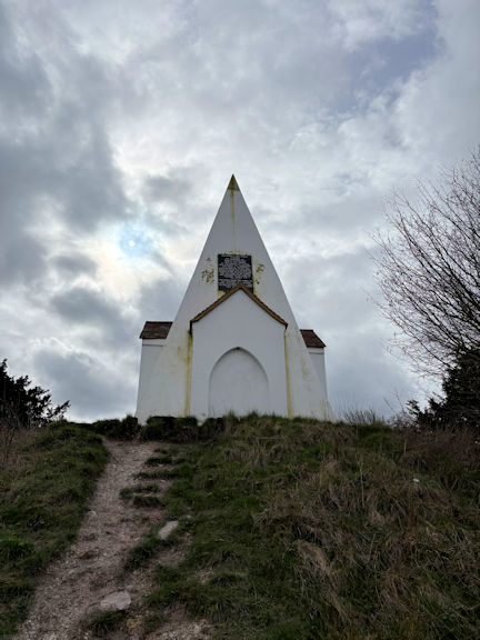
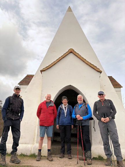
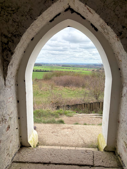
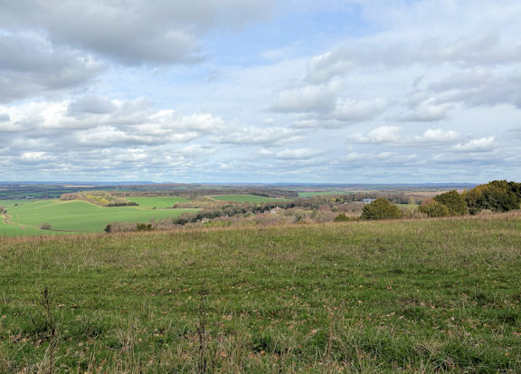
We stopped at the folly built to commemorate a noble’s horse which had unfortunately died after falling into a chalk pit. The views were extensive from this point.


group
looking across to Ashley manor

After lunch we traversed Beacon Hill ridge and dropped back down towards Hoplands Cottages following the course of a Roman Road.

The final section of our walk retraced our steps back across fields to Kings Sombourne and a quick refreshment in the Crown Inn.

After lunch we traversed Beacon Hill ridge and dropped back down towards Hoplands Cottages following the course of a Roman Road.

The final section of our walk retraced our steps back across fields to Kings Sombourne and a quick refreshment in the Crown Inn.

Many thanks to club members Mike Goodyer, Margaret Moore, Mike O'Dwyer, Steve Creasey for joining me on this 10.6 mile undulating walk in the Hampshire countryside.

Report by Paul Stock


This walk started from Stokenchurch, west of High Wycombe. We had changed the date to Thursday (as per the meets programme) and the venue, in order to make it more accessible to those who were available.

We met at Aston Rowant nature reserve in a small car park, as the main one was being renovated by people with several large diggers and masses of mud. From there we took a path down the field, under a bridge beneath the M40 and along the Swan’s Way track towards Watlington.

group
through the woods in the rain

After a coffee break in dry conditions, we decided to take the lower route beside Watlington Hill as it began to rain quite heavily for a while.

We continued through woodland in rain, but with a reasonably solid leafy path to pick up the Chiltern Way, where it stopped raining for a while.


group
group

Here we took photos by the statue at the edge of Wormsley park and found large swathes of snowdrops to cheer us into thinking the Spring is on its way.

We were further encouraged by seeing lambs as we crossed fields towards the next ridge, where we found a nice log to sit on for a lunch break.

group

The final section up to the M40, uphill in the next rain shower left us wanting to get home rather than exploring the pub in the village.

Fortunately we all had good, short journeys back and were glad we had made the effort to come out, meet each other and see the countryside.

Present: Margaret Moore, Mike Goodyer, Judy Renshaw


There are essentially two types of club meets. Firstly, those with a plan of activity and everything goes to plan. These meets are easy to record: We all arrived; we all went here or there; we all… Then there are the other kind where everyone is really busy doing different things and it all becomes a bit of a whirlwind. I enjoy them both, but the second kind receive little justice from a brief report by someone who only experienced a very small part. So it was with the dinner meet this year.

The weather had been magnificent: cold, crisp with even a little snow. But that all changed in the days leading up to the meet. There was still a little white stuff on the tops but the weather had an Atlantic focus. It wasn’t terribly wet but never really dry either. And the wind blew enthusiastically.

We had 36 members attend the dinner. Also two guests: our speaker, Dave Padgen and the president of the Alpine Club, Duncan Sperry. Eleven members stayed at the George Starkey Hut. The others were dispersed among hotels, bed & breakfasts and their own homes. This led to most of us only meeting up for the dinner itself on the Saturday night. We have decided to address this next year with a shared afternoon activity – probably tea and cake at the hut. It seemed such a waste of a rare opportunity to spend times with old friends.

The hut team started arriving on the Thursday night, allowing for walking time on the Friday without having to get back in time to make oneself respectable for the dinner. Once again, the White Lion Hotel provided excellent evening meals for those that preferred not to do their own cooking.

flags
table
flags
flags
Various outings were undertaken on the Friday and Saturday, mostly on the lower hills due to the weather.

One more ambitious team braved the shops of Ambleside and returned with new alpine boots and fell shoes.

For me, the most fun is had by getting out on the hill with members that I have not walked with before. In this way, I enjoyed Friday and Saturday walks greatly, even though they went nowhere particularly special.

The George Starkey Hut provided the usual comfy environment for catching up with old friends, but with some new improvements. The upgraded drying room really does do what it says on the door. It is still waiting for a coat of paint but having dry clothes each morning was lovely. The main luxury item was however the new multi-fuel stove. For now, it is being used only for smokeless briquettes as this is what is provided by the hut company, and to avoid people burning unsuitable sub-standard wood. Compared with the previous built-in stove, this freestanding one gives off a lot of heat. Its warmth was greatly appreciated.

On the Saturday evening, we assembled at the Inn on the Lake Hotel for the AGM and dinner. It was a pleasure to meet old friends in the bar before the proceedings. The meeting itself went smoothly with very good attendance. The elephant in the room – that we are all getting older without successors in place – was briefly mentioned and then ignored.

flags

The dinner was magnificent. Many thanks to the hotel staff who helped decorate the room with the Swiss Cantonal flags and other regalia and to our volunteers who arranged the seating plan with the care that only those who know our individual quirks could manage.
I heard only positive comments about the food and the service.

Many thanks to Don for compiling members memories of Ed Bramley and the annual pictorial account of 2025.

flags
table
table
table

Our after dinner speaker was Dave Padgen. Dave is remarkable for the expeditions he has taken part in, in spite of finding things hard, on account of his cerebral palsy. He was both inspiring and very entertaining. His little speech impediment served to make us listen carefully and become more engaged in the talk than is normal for most of us. It was also an honour to have last year’s speaker, our own Pamela Harris, join us – all the way from Switzerland.

table

Sunday dawned fine, as is the way. Most of us had to begin the trek home, but Judy managed a circuit taking in Bedafell and Angle Tarn.

Many thanks to all who contributed. Particularly to Julie Freemantle who has expertly organised the annual dinners for many years. This was her final year before passing the baton on.

Report by Daniel Albert


Archived reports from 2001 to 2025.